
Where Flight Simulation Enthusiasts Gather from Around the World!
AVSIM Library - Search Results

| Category: Flight Simulator 2004 - Scenery | |
| Mormon Range, Enterprise, Beryl (UT82), Utah, Photo-Scenery |

|
Images related to this file:
File Description:
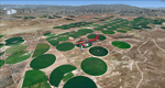
Mormon Range, Enterprise, Beryl (UT82), Utah, Photo-Scenery (FS9 & FSX)
This scenery covers the area of just north of St. George (KSGU) north along the Mormon Range and Enterprise to Beryl (UT82). It completes the southwestern corner of Utah and paves our way into Nevada. High resolution versions of this scenery for FS9 and FSX (much sharper, but larger and multiple downloads)are available at www.blueskyscenery.com/CNY_South2West6.html . The screenies are taken from the high-res versions, so expect this version to be slightly more blurry.
Thanks to Joop Mak for providing a custom AFCADs that correct airport layouts so that they align with the photo-textures! They are available at www.blueskyscenery.com/AFCADs.html . YourDonation@Work: Dedicated to Jean Pierre, Konrad and Juan.
| Filename: | Mormon_Range_Enterprise_Beryl_UT82_Utah_PhotoScene.zip |
| License: | Freeware, limited distribution |
| Added: | 27th March 2010, 11:38:48 |
| Downloads: | 1,371 |
| Author: | Gottfried Razek, blueskyscenery.com |
| Size: | 97.45 MB |
| Category: Flight Simulator 2004 - Scenery | |
| Quetta Airport |
|
File Description:
Quetta scenery for FS2004, requires RWY12 object libraries.
| Filename: | Quetta_Airport.zip |
| License: | Freeware, limited distribution |
| Added: | 30th March 2010, 20:09:26 |
| Downloads: | 392 |
| Author: | Abdul Haseeb Kamal (Virtual PIA WWW.VPIA.ORG) |
| Size: | 46.71 MB |
| Category: Flight Simulator 2004 - Scenery | |
| Emergency Services Incident # 2010-003 |
|
Images related to this file:
File Description:
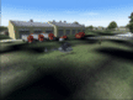
This is a series of missions called Emergency Services. All mission are flown using the Bell 206B Jet Ranger Helicopter. In this mission you will be flying for the Air Med out of Boone Hospital in Columbia MO . Your incident number is 2010-003.
| Filename: | Emergency_Services_Incident__2010003.zip |
| License: | Freeware |
| Added: | 1st April 2010, 02:17:25 |
| Downloads: | 213 |
| Author: | David J Crandall |
| Size: | 7 MB |
| Category: Flight Simulator 2004 - Scenery | |
| Torrey, Box-Death Hollow Wilderness, Aquarius Plateau, Utah, Photo-Scenery (FS9 & FSX) |
|
Images related to this file:
File Description:
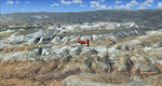
The southern part of this region covers the Box-Death Hollow Wilderness, with its vertical gray-orange walls of Navajo sandstone. Then comes the Aquarius Plateau which is the highest timbered plateau in North America with Boulder Mountain. In the north you'll find the little town of Torrey, which is just eight miles west of Capitol Reef National Park. Extends my Grand Staircase Escalante scenery to the north.
High resolution versions of this scenery for FS9 and FSX (much sharper, but larger and multiple downloads) are available at www.blueskyscenery.com/CNY_SouthWest3.html . The screenies are taken from the high-res versions, so expect this version to be slightly more blurry.
Thanks to Joop Mak for providing a custom AFCADs that correct airport layouts so that they align with the photo-textures! They are available here: www.blueskyscenery.com/AFCADs.html . YourDonation@Work: Dedicated to Ralf-Peter, Jon and Laurent.
| Filename: | Torrey_BoxDeath_Hollow_Wilderness_Aquarius_Plateau.zip |
| License: | Freeware, limited distribution |
| Added: | 3rd April 2010, 00:52:09 |
| Downloads: | 1,206 |
| Author: | Gottfried Razek - blueskyscenery.com |
| Size: | 93.79 MB |
| Category: Flight Simulator 2004 - Scenery | |
| Real NZ Auckland Airports (re-up) |
|
Images related to this file:
File Description:
Auckland city airports from Auckland 2005, reworked to fit into the "Real NZ Auckland City" scenery by Godzone Virtual Flight. The payware "Real NZ Auckland City" or freeware "Auckland 2005" is required. (This is a re-upload of the original file. No changes have been made.)
| Filename: | Real_NZ_Auckland_Airports_reup.zip |
| License: | Freeware, limited distribution |
| Added: | 3rd April 2010, 17:25:13 |
| Downloads: | 1,195 |
| Author: | Deane Baunton, Savern Reweti, Shayne Butler, Rob Diebold |
| Size: | 22.19 MB |
| Category: Flight Simulator 2004 - Scenery | |
| Ivanpah Valley Airport |
|
File Description:
FS2004 Scenery - Ivanpah Valley Airport is the planned relief airport for McCarran International Airport. Since there is only limited space left for expansion at McCarran, a new airport is the only alternative to increase capacity by a significant amount. The airport is planned to open in 2017. Created using Rwy12 and EZ Scenery objects. By Maurice Butz, with Jeff Hurd and John B. Loney, Jr.
| Filename: | Ivanpah_Valley_Airport.zip |
| License: | Freeware, limited distribution |
| Added: | 6th April 2010, 01:41:57 |
| Downloads: | 222 |
| Author: | Maurice Butz with Jeff Hurd and John B. Loney, Jr. |
| Size: | 3.05 MB |
| Category: Flight Simulator 2004 - Scenery | |
| EDDN Nurnberg two colored RWY and TWY |
|
Images related to this file:
File Description:
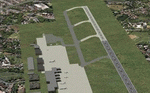
Only for the default scenery. Change the concrete RWY and TWY's to the mixed real one. Thanks to Steffen D and Lee Swordy. By HOUSE-RP, Switzerland
| Filename: | EDDN_Nurnberg_two_colored_RWY_and_TWY.zip |
| License: | Freeware, limited distribution |
| Added: | 6th April 2010, 21:13:41 |
| Downloads: | 772 |
| Author: | HOUSE-RP |
| Size: | 17.62 KB |
| Category: Flight Simulator 2004 - Scenery | |
| Comb Ridge, Rock Point (49AZ), Utah/Arizona, Photo-Scenery |
|
Images related to this file:
File Description:
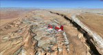
Comb Ridge, Rock Point (49AZ), Utah/Arizona, Photo-Scenery (FS9 & FSX)
This scenery extends my Monument Valley scenery to the east. It covers the area between the San Juan River in the north down to Rock Point, AZ (49AZ). Most of the scenery lies on the Navajo Nation Reservation. It completes the southeastern corner of Utah and paves our way into Colorado.
High resolution versions of this scenery for FS9 and FSX (much sharper, but larger and multiple downloads) are available at www.blueskyscenery.com/CNY_South3West6.html . The screenies are taken from the high-res versions, so expect this version to be slightly more blurry. Thanks to Joop Mak for providing custom AFCADs that correct airport layouts so that they align with the photo-textures! They are available at www.blueskyscenery.com/AFCADs.html . YourDonation@Work: Dedicated to Olivier, Kevin and Ruben.
| Filename: | Comb_Ridge_Rock_Point_49AZ_UtahArizona_PhotoScener.zip |
| License: | Freeware, limited distribution |
| Added: | 9th April 2010, 21:57:41 |
| Downloads: | 1,360 |
| Author: | Gottfried Razek, blueskyscenery.com |
| Size: | 90.99 MB |
| Category: Flight Simulator 2004 - Scenery | |
| KFTY Fulton County (Charlie Brown) Airport |
|
File Description:
Fulton County Airport at Charlie Brown Field is the nearest airport to Hartsfield-Jackson Atlanta International Airport (which is just south of Atlanta), and handles much of the general aviation traffic that would otherwise go there.
| Filename: | KFTY_Fulton_County_Charlie_Brown_Airport.zip |
| License: | Freeware |
| Added: | 11th April 2010, 08:20:18 |
| Downloads: | 866 |
| Author: | Tommy Harris |
| Size: | 8.74 MB |
| Category: Flight Simulator 2004 - Scenery | |
| Gatwick Xtreme |
|
Images related to this file:
File Description:
Extremely accurate scenery for Britains second main airport.Includes night
lighting, large amount of animation vehicles,replacement AFCAD2 file. All textures
made to the highest standard based on actual photographs. V1.02
DEMO FILE, fully funtional but has 'demo signs'
| Filename: | Gatwick_Xtreme.zip |
| License: | Commercial demo |
| Added: | 16th April 2010, 13:07:43 |
| Downloads: | 3,058 |
| Author: | UK2000 Scenery/Gary Summons |
| Size: | 46.92 MB |


© 2001-2026 AVSIM Online
All Rights Reserved
Privacy Policy |