
Where Flight Simulation Enthusiasts Gather from Around the World!
AVSIM Library - Search Results

| Category: Flight Simulator 2004 - Scenery | |
| Waskaganish CYKQ in James Bay, Quebec, Canada - Update |

|
Images related to this file:
File Description:
This update for Waskaganish CYKQ provides the AFCAD that was not included in the original post, and advises on a remedy for a possible village texture problem.
| Filename: | Waskaganish_CYKQ_in_James_Bay_Quebec_Canada__Updat.zip |
| License: | Freeware, limited distribution |
| Added: | 23rd October 2010, 21:40:19 |
| Downloads: | 352 |
| Author: | Roger Wensley |
| Size: | 180.14 KB |
| Category: Flight Simulator 2004 - Scenery | |
| Worland WY Airport (KWRL) |
|
Images related to this file:
File Description:
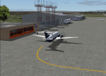
Worland Municipal Airport is located in Worland, WY. Worland is a town of 5000 located in the Big Horn Basin of Northwestern Wyoming. The Airport is served by Great Lakes Aviation which currently has 2 flights daily between Worland and Denver. Great Lakes is affiliated with both United and Frontier Airlines.
This is an fairly accurate representation of the present day Worland Wyoming Municipal Airport. It has the updated location for rwy 16/34 which was moved to the South in about 2006. It also shows the present Pepsi Hanger owned by Admiral Beverages with a door that opens (112.0 on nav2) revealing the company's Challenger Jet.
A special Thank You to David "Opa" Marshall who helped me when I had no idea how to do something. He is also responsible for making the General Aviation AI traffic that you see coming and going at the airport.
| Filename: | Worland_WY_Airport_KWRL.zip |
| License: | Freeware |
| Added: | 25th October 2010, 20:13:59 |
| Downloads: | 432 |
| Author: | Gary Wilson |
| Size: | 292.8 KB |
| Category: Flight Simulator 2004 - Scenery | |
| Puvirnituq CYPX in Hudson Bay, Quebec, Canada |
|
Images related to this file:
File Description:
Puvirnituq is a village of 1,300 or so inhabitants at N60 W77 on the east shore of Hudson Bay. It's name means "Putrid" in Inuit, and there are two different stories about how it got the name. The village does not feature in FS9, but is included in this scenery with approximately the right shape (the coast, even with UT, is not exactly right) so just think of it as a hand-made auto-generated village which gives the airfield a reason for being there. The runway is a very generous 6,300 feet of gravel 148 feet wide, which should be enough for almost anything. I also had to add the roads, delete the stock airfield background and add a new background, plus of course there is the scenery file and the AFCAD and AI.
| Filename: | Puvirnituq_CYPX_in_Hudson_Bay_Quebec_Canada.zip |
| License: | Freeware, limited distribution |
| Added: | 30th October 2010, 13:34:30 |
| Downloads: | 375 |
| Author: | Roger Wensley |
| Size: | 1.72 MB |
| Category: Flight Simulator 2004 - Scenery | |
| Ivujivik CYIK in Hudson Bay, Quebec, Canada |
|
Images related to this file:
File Description:
Ivujivik is a village of 350 or so inhabitants at N62 25 W78 on the northeastern corner of Hudson Bay. The village does not feature in FS9 but is included in this scenery with approximately the right shape (the coast, even with UT, is not exactly right) so just think of it as a hand-made auto-generated village which gives the airfield a reason. The runway is 3,500 feet of gravel 100 feet wide, which should be enough. I also added the roads, deleted the stock airfield background and added a new background, plus of course there is the scenery file and the AFCAD and AI. You may note that the terminal has the elevation written on the sign as 126', while on the winter photo it is written on the older & bigger sign as 130'. I thought this is because satellite radar has fixed the elevations of all airfields more accurately than before, as Rockcliffe too has gone from 192' to 188'; the alternative explanation is that global warming has raised sea level by 4'. Wow! That's a thought. I presume the new sign was made smaller as a cost saving.
| Filename: | Ivujivik_CYIK_in_Hudson_Bay_Quebec_Canada.zip |
| License: | Freeware, limited distribution |
| Added: | 31st October 2010, 07:41:20 |
| Downloads: | 458 |
| Author: | Roger Wensley |
| Size: | 2.07 MB |
| Category: Flight Simulator 2004 - Scenery | |
| Salluit CYZG in Hudson Strait, Quebec, Canada |
|
Images related to this file:
File Description:
Salluit is a village of 1,250 or so inhabitants at N 62 W 75 40 on the shore of Sugluk Inlet, which is off Hudson Strait. It's name means "Skinny Ones" in Inuit, and refers to a time when there was not enough to eat, which is a rather scary reminder of just how fragile Inuit survival used to be. The village does not feature in FS9 but is included in this scenery with approximately the right shape and with the roads that lead to the airfield and what I presume are quarries for building materials and roads. The airfield runway is 3,510 feet of gravel 100 feet wide and is some 740 feet higher than the village on the shoreline. I added the roads, the quarries, a new airfield background, plus of course there is the scenery file and the AFCAD and AI.
| Filename: | Salluit_CYZG_in_Hudson_Strait_Quebec_Canada.zip |
| License: | Freeware, limited distribution |
| Added: | 2nd November 2010, 01:18:55 |
| Downloads: | 374 |
| Author: | Roger Wensley |
| Size: | 1.96 MB |
| Category: Flight Simulator 2004 - Scenery | |
| St Marys Municipal KOYM |
|
Images related to this file:
File Description:
FS2004 Scenery - St. Marys Municipal Airport (IATA: STQ, ICAO: KOYM, FAA LID: OYM) is a city-owned public-use airport three miles (5 km) southeast of the central business district of St. Marys, a city in Elk County, Pennsylvania, United States..[1] This general aviation airport is located off South Michael Road in St. Marys. St. Marys Municipal Airport covers an area of 283 acres (115 ha) and contains one runway designated 10/28 with a 4,300 x 75 ft (1,311 x 23 m) asphalt pavement. For the 12-month period ending October 31, 2007, the airport had 6,730 aircraft operations, an average of 18 per day: 85% general aviation, 15% air taxi and
| Filename: | St_Marys_Municipal_KOYM.zip |
| License: | Freeware, limited distribution |
| Added: | 2nd November 2010, 01:35:14 |
| Downloads: | 311 |
| Author: | John B. Loney, Jr. |
| Size: | 947.83 KB |
| Category: Flight Simulator 2004 - Scenery | |
| Mehrabad Ver 1.0 (Tehran-Iran) |
|
Images related to this file:
File Description:

.::PERSIAN-SIM::. This package contains a simple scenery of Mehrabad Intl Airport OIII (Tehran-IRAN) and its buildings, aprons and hangars. The aprons contain all civil ,military and others. The AFCAD file of the airport is designed and updated exactly using the latest changes of Mehrabad which includes the following changes: 1.The complete change of Taxiway names and Taxiway signs; 2.Additional west parking space with 10 parking positions (APRON 4); 3.TWY 13 has been eliminated; 4.Apron names have been changed; 5.The position of Fire Fighting Station is changed (a new station is built); 6.All Parking positions are changed in names and headings. This version of Mehrabad is fully freeware and is available only from PERSIAN-SIM and AVSIM Library. The PROFESSIONAL version of Mehrabad (Payware), including the realistic scenery, buildings, static aircrafts, and realistic dynamic scenery, will be available soon on www.PERSIAN-SIM.com.
| Filename: | Mehrabad_Ver_10_TehranIran.zip |
| License: | Freeware, limited distribution |
| Added: | 3rd November 2010, 23:26:41 |
| Downloads: | 1,651 |
| Author: | PERSIAN-SIM ::: Behnam Zamani |
| Size: | 5.12 MB |
| Category: Flight Simulator 2004 - Scenery | |
| KBIS Bismarck North Dakota |
|
Images related to this file:
File Description:
Here is a redesign of Bismarck North Dakota, as of summer 2010.
| Filename: | KBIS_Bismarck_North_Dakota.zip |
| License: | Freeware |
| Added: | 4th November 2010, 02:30:16 |
| Downloads: | 1,209 |
| Author: | Eric Cagan |
| Size: | 13.08 MB |
| Category: Flight Simulator 2004 - Scenery | |
| Upgrade For Reggio Calabria Airport (LICR) V1.01 |
|
File Description:
Reposition and correct limit range for LOC 33 (18nm).
Correct limit range for RCA TVORDME and RCA NDB.
New Parking Position.
Correct Taxyway sign and rename taxyway.
Delete Start point Rwy 11.
Correct Helipad.
| Filename: | Upgrade_For_Reggio_Calabria_Airport_LICR_V101.zip |
| License: | Freeware |
| Added: | 9th November 2010, 20:09:04 |
| Downloads: | 569 |
| Author: | Fabio Iaria |
| Size: | 444.09 KB |
| Category: Flight Simulator 2004 - Scenery | |
| South African Cities |
|
File Description:
Includes Johannesburg, Cape Town, Durban and Sandton Buildings. The scenery is aligned to the South African Roads and Water feature packages done by Aeroworx authors which you can find here on Avsim. Dont install the scenery without the water feature package of Aeroworx otherwise the Durban buildings will float in the sea. This is also a re-upload because of the Avsim library problems. Nothing new has been added.
| Filename: | South_African_Cities.zip |
| License: | Freeware, limited distribution |
| Added: | 14th November 2010, 18:29:50 |
| Downloads: | 2,054 |
| Author: | Andre Potgieter |
| Size: | 3.15 MB |


© 2001-2026 AVSIM Online
All Rights Reserved
Privacy Policy |