
Where Flight Simulation Enthusiasts Gather from Around the World!
AVSIM Library - Search Results

| Category: Flight Simulator 2004 - Scenery | |
| Ilhas BR (Atol das Rocas, Sao Vicente, Sao Pedro) v3 |

|
Images related to this file:
File Description:

v3 ==> || Atol das Rocas (SNRC) | Sao Vicente & Sao Pedro (SNVP/SNPV) || FS2004 AFCAD and mesh files for three fictious airport-islands in Brazilian Atlantic Coast (the idea is not to represent nothing in real, but to provide a way for flight sim pilots to reach these islands). || Arquivos AFCAD e mesh para tres ilhas brasileiras, criando aeroportos ficticios para elas (a ideia nao eh representar nada real, mas apenas possibilitar que pilotos virtuais possam visitar essas ilhas). ==> v3 corrects MAG deviation at SNVP/SNPV reference VOR & adds news buildings to SNRC, SNVP and SNPV.
| Filename: | Ilhas_BR_Atol_das_Rocas_Sao_Vicente_Sao_Pedro_v3.zip |
| License: | Freeware |
| Added: | 13th December 2009, 03:34:41 |
| Downloads: | 708 |
| Author: | Rui Mesquita |
| Size: | 335.67 KB |
| Category: Flight Simulator 2004 - Scenery | |
| Kogd-Ogden,Utah |
|
Images related to this file:
File Description:
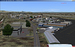
KOGD-Ogden,Ut Take your sailboat to the Great Salt Lake inland sea or hike the many mountains and enjoy the vistas offered atop the lofty peaks. Visit the quiet mountain valley town of Eden to the east of KOGD with its annual balloon festival and summer fun on Pineview dam or spend the day shopping the shops of Brigham City to the north or Salt Lake City to the south. Fly over the Great Salt Lake to the west. See the Ogden airport come alive with this must have add-on. With the help of Google Earth and FS Earth I have recreated the Ogden airport, with its new taxiway A (from a site visit), and the surrounding cities and towns to look as real as possible. Made with Ultimate Terrain, but the airport should be ok with default FS9. (No guarantee though ;-) The scenery enhancements were made with Ultimate Terrain in place. I modified the landclass to look more like the real thing. The airport is very close to a exact replica of KOGD! The crane by the tower was there when I took the pictures so I included it.
| Filename: | KogdOgdenUtah.zip |
| License: | Freeware |
| Added: | 15th December 2009, 00:45:07 |
| Downloads: | 725 |
| Author: | Alan C. Heiner |
| Size: | 15.59 MB |
| Category: Flight Simulator 2004 - Scenery | |
| WAPP Pattimura |
|
File Description:
scenery of Pattimura(WAPP)airport, Ambon Indonesia. FPS friendly and suitable for online flying.
| Filename: | WAPP_Pattimura.zip |
| License: | Freeware |
| Added: | 15th December 2009, 02:25:32 |
| Downloads: | 748 |
| Author: | Octavianus Vitalis |
| Size: | 2.03 MB |
| Category: Flight Simulator 2004 - Scenery | |
| Correctif_projet_Abitibi_2 |
|
File Description:
A scenery file was missing in Abitbi project_2 and Lac des Baies coordinates were wrong. English and french instructions in the read_me files.
| Filename: | Correctif_projet_Abitibi_2.zip |
| License: | Freeware |
| Added: | 20th December 2009, 17:01:03 |
| Downloads: | 99 |
| Author: | Pierre Fauteux |
| Size: | 26.46 KB |
| Category: Flight Simulator 2004 - Scenery | |
| Catania Fontanarossa 2009 |
|
File Description:
Il nuovo aeroporto Fontanarossa di Catania. Comprende tutte le taxi e in pi���¹ l'ILS pista 26 che sar��� attivo dal 2010
| Filename: | Catania_Fontanarossa_2009.zip |
| License: | Freeware |
| Added: | 22nd December 2009, 02:17:51 |
| Downloads: | 2,028 |
| Author: | Sorbello Luca Fabio |
| Size: | 10.4 MB |
| Category: Flight Simulator 2004 - Scenery | |
| WAPP ver1.01 Final release |
|
Images related to this file:
File Description:
WAPP scenery(Framerate friendly) suitable for online flying at many networks on the internet.changing in this final release
added some more buildings in the vicinity of the airport.
added start location at apron.
scenery repositioned at correct ground altitude.
| Filename: | WAPP_ver101_Final_release.zip |
| License: | Freeware |
| Added: | 26th December 2009, 02:13:22 |
| Downloads: | 1,647 |
| Author: | Octavianus Vitalis |
| Size: | 2.29 MB |
| Category: Flight Simulator 2004 - Scenery | |
| Boulder (KBDU) / Longmont / Loveland, Colorado, Photo-Scenery (FS9 & FSX) |
|
Images related to this file:
File Description:
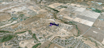
Boulder is situated where the Rocky Mountains meet the Great Plains. Just west of the city are imposing slabs of sedimentary stone tilted up on the foothills, known as Flatirons. Located at the base of the foothills is Boulder's main campus of the University of Colarado which is clearly visible from the sky. Longmont is home of the Denver ARTCC (Air Route Traffic Control Center) which controls all flights in the upper airspace of most of Colorado and parts of adjoining states. To explore the scenery depart from Boulder (KBDU) and head northeast. Extends my Rocky Mountain Park scenery to the east and my Denver scenery to the north. Provides another 3.500 sq km in 4.7m/pix quality. High resolution versions for FS9 and FSX (much sharper, but larger and multiple downloads) are available at www.blueskyscenery.com/GNB_East.html . The screenies are taken from the high-res versions, so expect this version to be slightly more blurry. YourDonation@Work: Dedicated to Senges and Eric.
| Filename: | Boulder_KBDU__Longmont__Loveland_Colorado_PhotoSce.zip |
| License: | Freeware, limited distribution |
| Added: | 28th December 2009, 20:14:09 |
| Downloads: | 2,389 |
| Author: | Gottfried Razek - blueskyscenery.com |
| Size: | 94.26 MB |
| Category: Flight Simulator 2004 - Scenery | |
| Canyonlands National Park South, Monticello (U43), Utah, Photo-Scenery (FSX too) |
|
Images related to this file:
File Description:
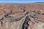
This scenery covers the southern part of Canyonlands National Park (Needles District) in Utah. The colorful layers of sand- and limestone that you can see today built over hundreds of millions years by advancing and retreating oceans as well as rivers that deposited huge amounts of sediment. About 15 million years ago these layers began to rise due to a colliding movement of plates in the earth's crust, forming what is today called the Colorado Plateau. As the land rose higher, erosion accelerated, resulting in countless canyons, mesas and buttes. The uplifting land caused the rivers to carve in even faster, resulting in the deep canyons of the Colorado and Green Rivers. The needles and fins in the Needles District have yet another story: First uplifts and later slides created a system of perpendicular cracks. Then he resulting crosshatched pattern of "joints" widened by erosion until only thin fins and needles of rock remained. The scenery extends my Arches National Park scenery to the south and brings you another 3.500 sq km in 4.7m/pix quality. To explore the scenery depart from Monticello (U43) and head north. YourDonation@Work: Dedicated to Nels, David and Michael. Thanks!
| Filename: | Canyonlands_National_Park_South_Monticello_U43_Uta.zip |
| License: | Freeware, limited distribution |
| Added: | 30th December 2009, 21:44:56 |
| Downloads: | 1,528 |
| Author: | Gottfried Razek - blueskyscenery.com |
| Size: | 95.76 MB |
| Category: Flight Simulator 2004 - Scenery | |
| CYSV Canada, New Foundland, Saglek |
|
Images related to this file:
File Description:
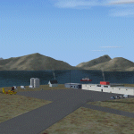
This scenery for FS-2004 as much as possible represents Saglek (CYSV), located at the north of New Foundland, Canada according to photographs found on the Web. This scenery is compatible with Mesh de M.Gilles Gauthier. Several originators took part in the design of this scenery: Regis Dassylva, Gerald Allaire, Gilles Gauthier and Jean-Pierre Fillion, all members of Concepteurs Virtual du Quebec.
| Filename: | CYSV_Canada_New_Foundland_Saglek.zip |
| License: | Freeware |
| Added: | 31st December 2009, 04:53:29 |
| Downloads: | 660 |
| Author: | Regis Dassylva |
| Size: | 2.33 MB |
| Category: Flight Simulator 2004 - Scenery | |
| Canyonlands National Park, The Maze-North, Utah, Photo-Scenery (FSX too) |
|
Images related to this file:
File Description:
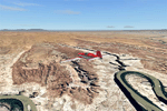
This is a re-upload of a package that was corrupted during the crash of the AVSIM library. The Maze is the wildest and least accessible district of Canyonlands National Park. It is a perplexing jumble of canyons that has been described as a '30 sq miles puzzle in sandstone'. The Maze covers the area west of the Green River and north of the Colorado River. Getting to most locations requires multiple hours of 4WD road driving. Hiking trails usually require multi day backpack trips.
Too strenous? Let's go flying! Checking out the area from an eagles perspective is certainly a stunning experience. The colors are awesome and the landforms are of breathtaking beauty. The scenery extends my Arches National Park scenery to the west and brings you another 3.500 sq km in 4.7m/pix quality. YourDonation@Work: Dedicated to Frans, Francois and James. Thanks!
| Filename: | Canyonlands_National_Park_The_MazeNorth_Utah_Photo.zip |
| License: | Freeware, limited distribution |
| Added: | 31st December 2009, 11:01:39 |
| Downloads: | 2,373 |
| Author: | Gottfried Razek - blueskyscenery.com |
| Size: | 92.88 MB |


© 2001-2026 AVSIM Online
All Rights Reserved
Privacy Policy |