
Where Flight Simulation Enthusiasts Gather from Around the World!
AVSIM Library - Search Results

| Category: Flight Simulator 2004 - Scenery | |
| ZWAT - Altay Airport - Xinjiang Uyghur Autonomous Region, China |

|
File Description:
Altay Airport (IATA: AAT, ICAO: ZWAT) is an airport serving Altay, a city in the Xinjiang Uyghur Autonomous Region in the People's Republic of China.
| Filename: | ZWAT__Altay_Airport___Xinjiang_Uyghur_Autonomous_R.zip |
| License: | Freeware, limited distribution |
| Added: | 1st January 2014, 14:05:07 |
| Downloads: | 361 |
| Author: | Billy Guo |
| Size: | 709.37 KB |
| Category: Flight Simulator 2004 - Scenery | |
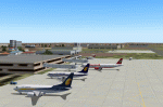
| Joplin Regional Airport |
|
Images related to this file:
File Description:
FS9 Scenery - Joplin Regional Airport (IATA: JLN, ICAO: KJLN) is a public airport located four miles (6 km) north of the central business district (CBD) of Joplin, a city in Jasper County, Missouri, USA. The airport covers 970 acres (393 ha) and has three runways. It offers commercial airline service subsidized by the Essential Air Service program. Joplin Regional Airport is owned by the City Of Joplin. The longest runway is a paved runway extending 6503 feet. The facility is at an elevation of 981 feet. This scenery was created using Instant Scenery by John B. Loney, Jr.
| Filename: | Joplin_Regional_Airport.zip |
| License: | Freeware, limited distribution |
| Added: | 30th December 2009, 21:53:28 |
| Downloads: | 618 |
| Author: | John B. Loney, Jr. |
| Size: | 1019.39 KB |
| Category: Flight Simulator 2004 - Scenery | |
| CYQR 2015 - Regina International Airport - Groome Field |
|
Images related to this file:
File Description:

Regina International Airport can trace its history back to 1919, when Regina airport became the first registered "air harbour" in Canada. This virtual model of CYQR represents the airport as it was in spring of 2015. CYQR airport is the gateway to southern Saskatchewan, Canada and is situated in Regina, which is the provincial capital. The airport is served by Air Canada, Air Canada Express, Westjet, Westjet Encore, West Wind Aviation, Express Air, Sunwing, Air Transat, Cargojet and Delta Airlines. The airport is named for Roland Groome, who was the first registered pilot in Canada.
This scenery was constructed with GMAX and includes detailed models of all buildings on the airport property. The scenery also includes the major landmark buildings of the City of Regina and those on the Runway approaches.
| Filename: | CYQR_2015__Regina_International_Airport__Groome_Fi.zip |
| License: | Freeware, limited distribution |
| Added: | 12th August 2015, 00:51:35 |
| Downloads: | 2,806 |
| Author: | Gregory Putz |
| Size: | 183.45 MB |
| Category: Flight Simulator 2004 - Scenery | |
| VFR of Lario - B2 Scenery REVISION 1 - Como Lake, Italy |
|
Images related to this file:
File Description:

Complete revision of Autogen objects, with adding of objects by library and Others; included train stations (Asso, Canzo) and a cycling race small scenery (muro di Sormano).
Check video available here: http://youtu.be/qoqw4SV89oo
| Filename: | VFR_of_Lario__B2_Scenery_REVISION_1__Como_Lake_Italy.zip |
| License: | Freeware |
| Added: | 13th December 2013, 15:41:57 |
| Downloads: | 599 |
| Author: | Aldo Della Vedova, Daniele Lanfranchi, Gian Mario Verga |
| Size: | 11 MB |
| Category: Flight Simulator 2004 - Scenery | |
| Tarrant Rushton Disused Airfield |
|
File Description:
This is a fairly basic representation of the disused Tarrant Rushton airfield about 18 miles northwest of Bournemouth/EGHH(50.51.00N/02.04.30W).This is sometimes used as a Visual Reporting Point by local traffic
Although the concrete runways were removed many years ago the outlines and the perimeter track are still plainly visible from the air. There are also some hangars remaining.
Made with FSSC by Derek Leung.
| Filename: | Tarrant_Rushton_Disused_Airfield.zip |
| License: | Freeware |
| Added: | 31st May 2004, 03:02:36 |
| Downloads: | 320 |
| Author: | Dave Fagan |
| Size: | 433.92 KB |
| Category: Flight Simulator 2004 - Scenery | |
| Night and Winter Textures |
|
File Description:
New, more realistic looking night textures for the whole of the FS2004 world plus modified winter textures for Europe to replace the drab beige brown colours of the default textures.
| Filename: | Night_and_Winter_Textures.zip |
| License: | Freeware |
| Added: | 3rd February 2004, 00:08:56 |
| Downloads: | 4,526 |
| Author: | Adam Mills |
| Size: | 12.66 MB |
| Category: Flight Simulator 2004 - Scenery | |
| Bangalore HAL VOBG Light |
|
Images related to this file:
File Description:
Bangalore HAL VOBG Light scenery FS9. Built with RWY12 objects. Because AI packages still use this old Bangalore Airport. Corrected position of RWY/TWY and parking according to Google Earth and Airports Authority of India Documents. By Gernot Zander 2010-02-07.
| Filename: | Bangalore_HAL_VOBG_Light.zip |
| License: | Freeware |
| Added: | 7th February 2010, 08:00:46 |
| Downloads: | 1,194 |
| Author: | Gernot Zander |
| Size: | 820.33 KB |
| Category: Flight Simulator 2004 - Scenery | |
| TimeZone 2.2/3.0 Update 2 |
|
File Description:
Europe200 and Russia West had strange time anomalies in FS9, specifically where timezone borders were at 30E, 45E, and 60E longitude. The borders have been shifted to the east by one full degree. Timezone coverage in these areas weren't affected.
Also changed is INDIA530, where Sri Lanka used to observe the same timezone with India, is now GMT+6.
This update replaces Update1, which is now obsolete.
| Filename: | TimeZone_2230_Update_2.zip |
| License: | Freeware, limited distribution |
| Added: | 13th April 2004, 03:17:18 |
| Downloads: | 3,436 |
| Author: | Dennis Thompson |
| Size: | 3.37 KB |
| Category: Flight Simulator 2004 - Scenery | |
| Time Zone Scenery ver. 1.0 (April 2022) |
|
Images related to this file:
File Description:
Time Zone Scenery is meant to completely replace the default time zone definitions as well as those coming from Dennis Thomson TZ3-TZ4.
Product characteristics:
-Each single squared mile of the earth surface is covered
-All standard time zones are correctly defined
-All non-standard time zones included: those with fraction-of-an-hour difference w.r.t UTC (eg. Iran, Afghanistan, India, Nepal, Myanmar, portions of Australia...)
-All Islands in the Pacific Ocean properly covered, including those in the +13, +14 hours regions or the few cases with fractional hours offset.
-Regions following DST are thoroughly modelled (requires FS Real Time)
-The scenery is updated to the world status as of April 2022
-The scenery is intended for FS9, but should also work on FSX and P3D
| Filename: | Time_Zone_Scenery_ver_10_April_2022.zip |
| License: | Freeware, limited distribution |
| Added: | 12th April 2022, 04:09:21 |
| Downloads: | 207 |
| Author: | Antonio Arreghini |
| Size: | 1.39 MB |
| Category: Flight Simulator 2004 - Scenery | |
| World's Highest Airfield @ 16600 feet - Daulat Beg Oldie |
|
File Description:
Located at an altitude of 16600 feet in North Eastern Ladakh near the strategic Karakoram Pass, DBO is an important Indian Army post which links with the ancient Silk Route to China. The Indian army maintains a helipad and an airstrip here, which is highest in the world. It is just 8 km south the Chinese border and 9 km northwest of the Aksai Chin & line of actual control between China and India. The scenery is truly fictional as no information is available on internet regarding the orientation of airstrip. Works best with Himalayan Peaks LOD10 Mesh, Volume 6 - Jammu and Kashmir avaiable at avsim: (fs_him_06.zip)
| Filename: | Worlds_Highest_Airfield__16600_feet__Daulat_Beg_Ol.zip |
| License: | Freeware |
| Added: | 26th June 2008, 10:57:26 |
| Downloads: | 964 |
| Author: | Deepak Blassi |
| Size: | 1.3 MB |
© 2001-2026 AVSIM Online
All Rights Reserved
Privacy Policy |