
Where Flight Simulation Enthusiasts Gather from Around the World!
AVSIM Library - Search Results

| Category: Flight Simulator 2004 - Scenery | |
| EGLC-V2.0 |

|
File Description:
Version two fixes major bugs and texturing problems. Stand alone version so previous version is not required. Recommended with enhanced traffic packs. Developed on gmax with custom hand drawn textures.
| Filename: | EGLCV20.zip |
| License: | Freeware |
| Added: | 29th March 2009, 02:56:21 |
| Downloads: | 1,864 |
| Author: | Rosario Resta |
| Size: | 7.11 MB |
| Category: Flight Simulator 2004 - Scenery | |
| Hamilton, New Zealand v2 |
|
File Description:
Version 2 of terminal scenery for Hamilton, NZ. This is an all inclusive package, so v1 is not required. Replaces the default boxes from MS with something more closely resembling the real thing. I have resized the buildings to a more realistic level and adjusted the AFCAD. Enjoy flying in the Waikato!
| Filename: | Hamilton_New_Zealand_v2.zip |
| License: | Freeware, limited distribution |
| Added: | 28th May 2006, 18:25:00 |
| Downloads: | 1,712 |
| Author: | Rob Diebold |
| Size: | 781.67 KB |
| Category: Flight Simulator 2004 - Scenery | |
| Sheldons Cabin |
|
File Description:
Don Sheldon was one of the great early bush pilots in Alaska. He was the founder of Talkeetna Air Service and the first person to routinely fly support (and rescue) for climbers on Mt. McKinley. In the early 1950's he built this cabin to serve as a base for these flights. The Sheldon family still own the cabin and it is rented out to climbers and others who just want to spend some time on the mountain.
| Filename: | Sheldons_Cabin.zip |
| License: | Freeware, limited distribution |
| Added: | 14th March 2004, 02:41:09 |
| Downloads: | 2,358 |
| Author: | Tom Fica |
| Size: | 326.76 KB |
| Category: Flight Simulator 2004 - Scenery | |
| Peawanuck CYPO / Winisk CYWN - Northern Ontario, Canada |
|
Images related to this file:
File Description:
Peawanuck is on the bank of the Winisk River, 23 miles upstream from where the river empties into the Hudson Bay just west of James Bay. It has a population of around 240, and was established in 1986 when the original settlement (Winisk) at the mouth of the river was destroyed by a flood. The airport is on a bluff in a corner of the river at 171 feet ASL, with a gravel runway just over 3,500 feet long and aligned 11-29. There is only basic runway lighting, with no ILS, VASI, or PAPI; there is also no apron lighting, or fuel. Service is provided by Air Creebec with connector flights to Moosonee and Timmins, and on to Montreal. A search of their timetable did not provide any information regarding timings but I made the AI flight from Timmins a daily one; it is probably only once or twice a week. There is also a daily private Cessna from Moosonee. Winisk, at the mouth of the river, has another gravel runway which is over 6,000 feet long. There is also a large hangar and to the north the remaining buildings and fuel tanks etc of a Radar Control site which was closed in 1965 after only 7 years of use.
| Filename: | Peawanuck_CYPO__Winisk_CYWN__Northern_Ontario_Cana.zip |
| License: | Freeware, limited distribution |
| Added: | 29th December 2012, 09:14:03 |
| Downloads: | 280 |
| Author: | Roger Wensley |
| Size: | 2.61 MB |
| Category: Flight Simulator 2004 - Scenery | |
| City of Huntsville, AL v1.1 |
|
File Description:
Hi, here is updated City of Huntsville package. Previous Huntsville package included Landclass file and i forgot to give install information for that file. But, now this package doesn't include that file anymore, it's not needed. That causes a memory leaks and fs9 will be unstable then.
| Filename: | City_of_Huntsville_AL_v11.zip |
| License: | Freeware |
| Added: | 22nd April 2008, 14:32:03 |
| Downloads: | 961 |
| Author: | Toni Hiltunen |
| Size: | 3.14 MB |
| Category: Flight Simulator 2004 - Scenery | |
| Hiline Lake/Alaska Cub Club |
|
File Description:
Hiline Lake is a fictional scenery located 51 miles WNW of Anchorage, Alaska. It's the home of a recreational facility owned by "The Alaska Piper Cub Owners Assn." (a fictional orginazation) and is known locally as "The Alaska Cub Club". The area has a 1300ft. dirt strip and a floatplane dock. The "Cub Club" is open to the public and you don't have to fly a "Cub" to visit. We hope you enjoy your stay!
| Filename: | Hiline_LakeAlaska_Cub_Club.zip |
| License: | Freeware, limited distribution |
| Added: | 29th March 2004, 14:19:20 |
| Downloads: | 1,573 |
| Author: | Tom Fica |
| Size: | 2.23 MB |
| Category: Flight Simulator 2004 - Scenery | |
| TKPN Vance Winkworth Amory International Airport |
|
Images related to this file:
File Description:
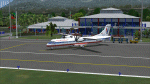
"TKPN_Vance Winkworth Amory" is the Scenery of the little Airport of NEVIS Island, located not far from St Kitt and Antigua islands in the Carribean.
| Filename: | TKPN_Vance_Winkworth_Amory_International_Airport.zip |
| License: | Freeware |
| Added: | 5th April 2013, 21:42:32 |
| Downloads: | 861 |
| Author: | Delblond Christian |
| Size: | 3.69 MB |
| Category: Flight Simulator 2004 - Scenery | |
| Vernon Regional Airport (CYVK) - Vernon, B.C.; Canada | Updated Version |
|
File Description:
Scenery add-on for Vernon Regional Airport (CYVK) - Vernon, B.C.; Canada. Vernon Regional boasts over 120,000 square feet of land and has become the center for aviation manufacturing and maintenance in the Pacific Northwest. This add-ons places the Vernon Flying Club building, plus a number of hangars on the airport grounds. Includes AFCAD file to add aircraft parking. Scenery was designed to reflect the current placement of buildings at CYVK within the limitations of the flight simulator terrain. Consideration was also given to system effects and framerates. This package requires the NovaSim Gold textures (Not included-directions provided in ReadMe file). This update fixes the missing BGL problem. Full Update- not a patched version.
| Filename: | Vernon_Regional_Airport_CYVK__Vernon_BC_Canada__Up.zip |
| License: | Freeware, limited distribution |
| Added: | 3rd January 2004, 20:41:03 |
| Downloads: | 1,682 |
| Author: | Jeff Shields |
| Size: | 48.75 KB |
| Category: Flight Simulator 2004 - Scenery | |
| Cape May-Lewes Ferry |
|
File Description:
FS2004 Scenery - Cape May-Lewes Ferry. This scenery consists of the ferry terminal at Cape May, New Jersey and the ferry terminal at Lewes, Delaware. The AI ferry, M.V. Cape May sails from The Cape May Ferry Terminal, just south of the Cape May County Airport(KWWD), to the Lewes Ferry Terminal in Lewes Delaware. AI ferryboat included. Compatible with default FS9 and Ultimate Terrain. By John B. Loney, Jr.
| Filename: | Cape_MayLewes_Ferry.zip |
| License: | Freeware, limited distribution |
| Added: | 30th January 2008, 03:12:46 |
| Downloads: | 876 |
| Author: | John B. Loney, Jr. |
| Size: | 648.42 KB |
| Category: Flight Simulator 2004 - Scenery | |
| Renfrew Airport |
|
File Description:
Renfrew Airport (1916 -1966)
Historical airport scenery for "Glasgow" Airport prior to its move to Abbotsinch in 1966.
| Filename: | Renfrew_Airport.zip |
| License: | Freeware |
| Added: | 1st July 2004, 14:56:59 |
| Downloads: | 779 |
| Author: | Geoff Smith |
| Size: | 2.05 MB |


© 2001-2026 AVSIM Online
All Rights Reserved
Privacy Policy |