
Where Flight Simulation Enthusiasts Gather from Around the World!
AVSIM Library - Search Results

| Category: Flight Simulator 2004 - Scenery | |
| Kugaaruk CYBB and DEW Pelly Bay CWPB in Nunavut, Canada |

|
Images related to this file:
File Description:
Kugaaruk is on the coast of northern mainland Canada on the Boothia Peninsula, 60 miles into a deep north-south fjord-like inlet called Pelly Bay. The name was changed from Pelly Bay in 1999, and the population is around 800. Gjoa Haven is 150 miles to the west, and Hall Beach just over 200 miles to the east. Six miles south of the village, and connected by a gravel road, there is a NWS station and what remains of a DEW Auxiliary Site; the DEW site was closed in 1992, a year after the NWS station became operational. There is also a 3,350 feet long gravel runway beside Barrow Lake 2 miles east of the site, Pelly Bay CWPB. Kugaaruk airfield is adjacent to the village and the 5,000 feet of 100 feet wide gravel runway is aligned 049T/229T where T stands for "true" as opposed to magnetic. There are flights by First Air and Canadian North and the AI includes a daily flight of each from Yellowknife via Gjoa Haven (as per real life) plus a cargo visit by Buffalo. Although the runway is long enough to accomodate a 737 it is not licensed for regular scheduled jet flights; the reason for this is that the approach lighting is "inadequate". Included here is a new .bgl for Gjoa Haven which will remove the small hold short line from the gravel; my mistake.
| Filename: | Kugaaruk_CYBB_and_DEW_Pelly_Bay_CWPB_in_Nunavut_Ca.zip |
| License: | Freeware, limited distribution |
| Added: | 25th November 2012, 00:43:07 |
| Downloads: | 430 |
| Author: | Roger Wensley |
| Size: | 6.1 MB |
| Category: Flight Simulator 2004 - Scenery | |
| Prudhoe Bay area on Alaska North Slope US |
|
Images related to this file:
File Description:
The Prudhoe Bay area of the Alaska north slope is dominated by all the equipment and machinery that is necessary for the extraction of oil and its transfer by the pipeline that reaches south to Valdez. Prudhoe Bay airport is now closed, and its replacement just to the south is Deadhorse PASC, with numerous storage, maintenance, and accomodation areas immediately to the north of the apron, and others adjacent to the road between the two. The runway is just under 6,500 feet with approach lights at both ends and ILS on 04 (true heading of 75 degrees). This scenery reflects the overall situation in 2011 and oil production facilities and buildings are included here. The airport buildings and those close to the airport are replicas of the real life buildings; while as distance increases the accuracy fades somewhat there are everywhere replica trucks and cross country vehicles that are true to life. Deadhorse handles around 7,000 passengers per month as staff are rotated in and out on Alaska Air and ERA flights and by oil company private flights. There are also freight flights to complement the trucking effort up the Dalton Highway. The Alaska Airlines terminal building and ERA (the red buildings nearby) are at one end of the apron, while at the other end is a very large and new green terminal, storage, hangar building built by the airport authority. All of the airport components, runways, taxiways, and aprons, are built up on a gravel base to raise them above the surrounding terrain that floods with melting snow, freezes, or dries out, according to the seasons. There are other new airstrips included here that serve the oil industry. Around 33 miles to the east is Badami PABP airport servicing a subsiduary oil producing area, with 5,000 feet of gravel runway. Some 28 miles to the west of Deadhorse is Ugnu-Kuparuk UBW with just over 6,000 feet of gravel (gravel in 2011, it is now asphalted) servicing oil production by Conoco Phillips, which uses 737's to fly staff in and out. A further 32 miles west is Alpine AK15 with 5,400 feet of gravel and also served by the Conoco Phillips 737's. To the south of Alpine and connected by road is the village of Nuiqsut. To the north of Alpine and reachable only by air in the delta of the Sagavanirktok River is CD-3, an oil collection and pump station area with another gravel runway of 3,000 feet. Other airstrips that were prviously posted are now updated, Nuiqsut and Oliktok. I experimented, but decided against trying to reproduce the several hundred miles of pipelines. The are new AI aircraft, and there are notes regarding downloading. There is a new "cement" texture (not its name, but used as that by SBuilder) for the built up gravel bases. It is slightly darker than the original but not so much that any previous use will be spoilt. You may wish to download my "Alaska Frozen Rivers and Lakes" which freezes lakes and the northern sea and makes them landable on wheels.
| Filename: | Prudhoe_Bay_area_on_Alaska_North_Slope_US.zip |
| License: | Freeware, limited distribution |
| Added: | 19th December 2017, 00:38:06 |
| Downloads: | 588 |
| Author: | Roger Wensley |
| Size: | 28.54 MB |
| Category: Flight Simulator 2004 - Scenery | |
| Big Creek U60 public use airfield in Idaho USA |
|
File Description:
This airfield is in the mountains of Idaho, 30 miles south of Dixie A05, which was the first in the series to be posted. Big Creek is now regularly used for picnic fly-ins and overnight camping, or for just a day of fishing in the creek; the creek does not appear in FS9 as it is not exactly huge, and within the Ultimate Terrain USA settings I have in fact turned streams off as in some cases they cross the grass or (in conjunction with the roads) left insufficient runway space. The U60 runway is at 5,743 feet ASl, 3,550 feet long, aligned 01-19, and in good condition. At the southern end there is the new replica of the old original Big Creek Lodge which was built in 1935. This burned down in 2008, and is now being rebuilt by a group of pilots, pilots having formed a large part of the early clientel courtesy of the grass strip. It is shown here as still under construction. There are also Forest Service buildings on the west side of the runway. All of this is located in the Frank Church Wilderness area and the Payette National Forest. The AI is increased at the weekends, reflecting reality, and also revised to use Boise as one of the starting places. Dixie is also reissued here with a revised positioning to fit with the roads. I had concluded that the roads were wrong, while in fact the position of the airstrip was at fault.
| Filename: | Big_Creek_U60_public_use_airfield_in_Idaho_USA.zip |
| License: | Freeware, limited distribution |
| Added: | 25th May 2017, 17:53:58 |
| Downloads: | 132 |
| Author: | Roger Wensley |
| Size: | 11.06 MB |
| Category: Flight Simulator 2004 - Scenery | |
| Gjoa Haven CYHK, on King William Island, Nunavut, Canada, |
|
Images related to this file:
File Description:
Gjoa Haven is a village of 1,200 or so inhabitants at N 68 38 W 95 51 on the southeast corner of King William Island, around 155 miles north of the Arctic Circle. It's Inuit name is Uqsuqtuuq; the Gjoa Haven name was given by the Norwegian explorer Roald Amundsen when he spent two years there from 1903 to 1905 during his exploration of the northwest passage from east to west. His boat was called Gjoa and the cove was named Gjoa Harbour, in Norwegian. The village has been added in this scenery with approximately the right shape; though the coastline with Ultimate Terrain does have the small cove that serves as a harbor the coast shape is wrong. The airfield runway is 4,400 feet of gravel 100 feet wide at 154 feet above sea level. There is no LL100 available, only JetA1, delivered once a year by ship along with all the other requirements of the town. There is also a nearby CAM-B remotely operated defence radar station with its three protective domes. The old terminal building is still there, albeit repainted and spruced up, along with the far larger and newer one alongside it.
One of the screen shots shows Gjoa Haven as it appears for at least 8 months of the year, with snow on the ground and sea ice all around. If you want the ice then download my recent post of All Canada frozen lakes, rivers, and the northern seas, reversible with an untick in the FS scenery library.
| Filename: | Gjoa_Haven_CYHK_on_King_William_Island_Nunavut_Can.zip |
| License: | Freeware, limited distribution |
| Added: | 19th February 2011, 15:42:51 |
| Downloads: | 551 |
| Author: | Roger Wensley |
| Size: | 2.68 MB |
| Category: Flight Simulator 2004 - Scenery | |
| Bethel: St Mary's area airfields in southwest Alaska close to the Yukon River |
|
Images related to this file:
File Description:
This presumes you have already installed Bethel PABE and Bethel Local Airfields. In the Yukon River area of Alaska to the north of Bethel there are small villages, served by flights from both Bethel and the nearer St Mary's PASM. St Mary's has a gravel runway like the other villages, but has a larger population and airport services including maintenance and fuel. This, plus the saving of an average one hundred miles of flying by a Cessna 205 when compared with flights from Bethel, means it acts as a distribution centre fed from Bethel by larger aircraft. Go to "http://vfrmap.com/" for free vfr maps of the area (see the attached). The ten village airfields included here are all to the north and west of St Mary's: Hooper Bay PAHP, Chevak VAK, Cape Romanzof PACZ (closed air force field servicing a radar station), Scammon Bay SCM, Sheldon Point SXP, Alakanuk AUK, Emmonak PAEM, Kotlik 2A9, Mountain Village MOU, and of course St Mary's PASM itself. With these airfields not everything is as it appears to be. For instance, Hooper Bay is not a new and modernised airfield, despite the asphalt runway and apron; the current version has dispensed with the aging asphalt and gone back to gravel. I have tended to go for the 2005 or so versions, which sometimes means a small runway amid or close to the housing; Kotlik was an early renewal for reasons of safety as much as anything else and has had (since 2003?) a new and longer runway located outside of the town. The second batch of airfields will be to the east of St Mary's.
| Filename: | Bethel_St_Marys_area_airfields_in_southwest_Alaska.zip |
| License: | Freeware, limited distribution |
| Added: | 29th April 2019, 17:07:24 |
| Downloads: | 226 |
| Author: | Roger Wensley |
| Size: | 11.53 MB |
| Category: Flight Simulator 2004 - Scenery | |
| Fort Smith CYSM in Northwest Territories, Canada Revised |
|
Images related to this file:
File Description:
This is an updated version to remove an incomplete static Beaver reported by Graeme (thanks Cobber) and to include other modifications that I made for my own version since posting the original; different taxiway lights, revised aprons, and in particular the revised AI that I mentioned in the original 2011 post. This is complete and can be installed as-is, or used to modify an existing post by changing the original folder contents. Fort Smith is just north of the border between Alberta and Northwestern Territories, midway between Lake Athabasca to the southeast and Great Slave Lake to the north west. You might stop there when flying between Yellowknife or Hay River to La Ronge or Saskatoon. It looks as if it is ex-military and these are the remains of what were once 10,000 feet of asphalt runways. The main runway is now 11/29 and 6,000 feet long, and the secondary one is 1,800 feet of mostly gravel. There is an airline based at the field, Northwestern Air, and fuel is available at a self service point. The town of Fort Smith is two miles east of the airfield, on the bank of the Slave River and where there are some rapids that require a portage to get around them. Before aviation came along the river was a major route to the north and all those furry animals, which was why the Hudson's Bay Company established an outpost there in 1872. Today it has a population of 2,400 and the main activities are government administration of much of the Northwest Territories, education, and tourism.
| Filename: | Fort_Smith_CYSM_in_Northwest_Territories_Canada_Re.zip |
| License: | Freeware, limited distribution |
| Added: | 23rd January 2019, 19:14:44 |
| Downloads: | 143 |
| Author: | Roger Wensley |
| Size: | 7.16 MB |
| Category: Flight Simulator 2004 - Scenery | |
| Sproat Lake CAA9 on Vancouver Island in British Columbia, Canada |
|
Images related to this file:
File Description:
Sproat Lake is in the middle of southern Vancouver Island, 6 miles west of the town of Port Alberni and 30 miles directly south of Comox Valley Airport. It is some 14 miles long and around the eastern shores has a large number of houses with docks and boats. Plus, in the offshoot called Upper Sproat Lake, it has the Sproat Lake Tankerbase CAA9, home to two rather large Martin Mars firefighting planes. Their history is interesting, and their capacity for carrying water for dousing forest fires during the summer months has kept them in use since their construction in the 1940's. They have finally been retired from fighting fires in 2013, having been first retired from military service in 1958. This scenery is made for use with Ultimate Terrain; there was another version made several years ago which either predated or ignored UT. This scenery is for the month when a Mars was being repainted before retiring to a museum as a military plane, date unkown but perhaps 2013? If it is a time when there were three in existance then it is sometime in the 1960's; take your pick. Because of hills adjacent to the lake the landing of the AI Mars may or may not take place, depending on wind direction and whether or not it flies into rock before landing. Take off and departure seem to be more reliable than landing on a daily basis. The Mars flies to Vancouver Harbour, but only in theory; it does not land and park as there is no parking available for such a large aircraft. The AI follows in the second post.
| Filename: | Sproat_Lake_CAA9_on_Vancouver_Island_in_British_Co.zip |
| License: | Freeware, limited distribution |
| Added: | 11th December 2016, 06:44:50 |
| Downloads: | 262 |
| Author: | Roger Wensley |
| Size: | 14.88 MB |
| Category: Flight Simulator 2004 - Scenery | |
| Chatrapatti Shivaji international Airport, Mumbai/ VABB |
|
Images related to this file:
File Description:
Mumbai is having frequent commissioning and decommissioning of various features especially aprons and stands and twy changing nomenclature. However the inf. and resources used while developing the scenery are as on Tue, 22 Jun 2010 13:14:00 UTC. Middle marker for rwy 27 has been permanently withdrawn so the missed approach point of the GP inop. procedure had been amended as 1D ILS/DME in place of middle marker(mm). Navaid BMB freq 396khz withdrawn from service.
New contents include - Commissioning of TWY L4 De-commissioning of portion of Taxi lane L beyond parking stand A1 Aircraft from parking stand A1 to A3 to push back facing west on the taxi lane L, to taxi out via TWY L4 on to TWY N.* Portion of taxi lane L beyond parking stand A1 shall be decommissioned w.e.f. 0430 UTC on 1st July 2010.1. Renaming portion of TWY P from RWY 14 to its junction with TWY E as E4 & TWY Y
as TWY S7
2. Commissioning of TWYs E7, E8, E9 & E10
3. Commissioning of one additional code C Parking Stand on Apron A named A1
4. Decommissioning of Parking Stands T4 & T5
5. Commissioning of Parking Stand G7and Decommissioning of Parking Stand G10 & G14
6. Renaming of Apron K(as apron J ) alongwith it's Parking Stands & Commissioning of
one additional code E Parking stand(J4).
7. Renaming of Apron M ( as apron K).layout chart included.
Scenery features includes - 3 different models of twy edge lights, holding point 3d lights at major intersection.check out pics. if you want extremely frame rate rate friendly update, look for file in library named as - Default mumbai.
| Filename: | Chatrapatti_Shivaji_international_Airport_Mumbai_V.zip |
| License: | Freeware |
| Added: | 22nd June 2010, 22:19:54 |
| Downloads: | 7,266 |
| Author: | Ashish Singh |
| Size: | 63.93 MB |
| Category: Flight Simulator 2004 - Scenery | |
| Airstrips of Scandinavia and the Baltic States |
|
Images related to this file:
File Description:
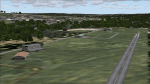
Effectively an extension of my "Airstrips of Western Europe" project for FS2004, around 140 sceneries of small airfields in Scandinavia and the Baltic states, each enhanced with buildings, taxiways, parking spaces and aprons as appropriate, to further facilitate the generation of lightweight AI traffic in the area, without overloading the more major airfields.
Given the available comprehensive coverage of both Norway and Finland by other authors, and much of Denmark by myself in my earlier "Airstrips of North-West Europe" upload, this selection comprises mostly small Swedish and Baltic State airfields.
Unfortunately, due to the very nature of much of the area, some of these airstrips are just that, a grass/dirt runway on a flattened/mown area in the landscape with just an associated building or two. Nevertheless, they do perform the required function of providing sources for AI traffic. The very existence of those airstrips not included in FS2004 is referred to in various on-line databases.
Again, there's no photo-realism here, just a selection of basic 'generic' buildings, more or less accurately sized and placed to reflect the airfield layout as seen on on-line satellite imagery and aerial photography. These buildings have minimal effect on frame-rates, so are ideal for this kind of job. The airfields are aligned as well as possible with the roads etc. in UT Europe (where applicable) and the Genesis Europe mesh, but should mostly be fine in a default installation or other configuration.
Please read the rest of this "blurb" in the included text file. There may be some details of note or interest.
| Filename: | Airstrips_of_Scandinavia_and_the_Baltic_States.zip |
| License: | Freeware |
| Added: | 11th November 2024, 17:25:16 |
| Downloads: | 112 |
| Author: | Chris Eve |
| Size: | 2.52 MB |
| Category: Flight Simulator 2004 - Scenery | |
| CYRL & CKS4 - Red Lake & Fishing Lodge Outposts - Ontario, Canada |
|
Images related to this file:
File Description:
Red Lake is in Ontario, 90 miles east of the Manitoba border & 120 miles north of the US border. The town is at what was the northern end of "the road" for many years, & this has led to it becoming a centre for floatplane flights north to fishing lodges etc. It has also become THE centre of Noorduyn Norseman floatplanes in Canada & there is a Norseman on display & an annual Norseman festival. Red Lake CYRL airport is 3 miles north of the town with 5,000 feet of asphalt runway aligned 08-26 with PAPI at both ends. The apron is in two parts; the western for the fire fighting planes & the eastern for the new terminal & the hangars for North Star, Superior, and Wasaya. There is also a scruffy hangar that is used for storage & to the south of the east apron some private hangars. The town & the float base (CKS4) are at the southern end of Howey Bay. Planes taxi north before going to full power for take off, & there are two main companies based at CKS4, Chimo & Green's, both of them using Norsemans (or Norsemen?) among other planes. Chimo service their fishing lodge & outposts in the Roderick Lake area, & Green's (who have a base on the west side of Howey Bay) service their own outposts on Trout Lake & Nungesser Lake in the AI. There are other Red Lake float operations using Norsemans from further north on the lake & they service fishing lodges in the AI on Peisk Lake and Uchi Lake. The AI also includes some GA float planes, & there are numerous GA & scheduled flights into CYRL.
| Filename: | CYRL__CKS4__Red_Lake__Fishing_Lodge_Outposts__Onta.zip |
| License: | Freeware, limited distribution |
| Added: | 15th November 2015, 14:29:42 |
| Downloads: | 502 |
| Author: | Roger Wensley |
| Size: | 32.92 MB |


© 2001-2026 AVSIM Online
All Rights Reserved
Privacy Policy |