
Where Flight Simulation Enthusiasts Gather from Around the World!
AVSIM Library - Search Results

| Category: Flight Simulator 2004 - Scenery | |
| Deline CYWJ - Northwest Territories, Canada |

|
Images related to this file:
File Description:
This is the third in a series of airfields that follow in a southward direction that early access route to the Canadian northern shore, the Mackenzie River. Deline is south of Tuktuk, Inuvik, Fort McPherson, and Fort Good Hope, all already posted. Deline is at 704 feet asl and around 50 miles east of the the Mackenzie, where the Great Bear River flows out of the western end of Great Bear Lake on its way to the Mackenzie. This lake is huge. The town of Deline has a population of around 500, and the first trading post (of the North West Company) was established there as early as 1799. The Hudson Bay Company opened an outpost in 1825 to support the Franklin Arctic Exploration expedition, and it was then called Fort Franklin. The name was changed to Deline in 1993. The airport is just over a mile north of the town, and has almost 4,000 feet of gravel runway. There is no fuel available. The original airfield is still visible just to the north of the town, from before it was rebuilt on higher ground (better drainage) and away from the houses. AI will follow with later posts.
| Filename: | Deline_CYWJ__Northwest_Territories_Canada.zip |
| License: | Freeware, limited distribution |
| Added: | 5th July 2014, 14:47:36 |
| Downloads: | 242 |
| Author: | Roger Wensley |
| Size: | 2.54 MB |
| Category: Flight Simulator 2004 - Scenery | |
| EPKK - Krakow Balice 2012 DEMO |
|
Images related to this file:
File Description:
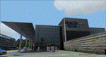
EPKK KRAKOW BALICE 2012 DEMO features an extremely detailed scenery of EPKK Krakow Balice airport and Krakow City, Poland, fully compatible with FS2004.
It's a fully functional DEMO version of the commercial payware product. It features same airport layout as in the full version but with limited 3D objects and low resolution textures. Using this free demo ensures no problems with online (VATSIM, IVAO, multiplayer etc.) flying in case some users use the payware scenery and some don't.
John Paul II International Airport Krakow-Balice (KRK / EPKK) is an international airport located near Krakow, in the village of Balice, 11 km (6.8 mi) west of the city centre, in southern Poland. The airport has one concrete runway, number 07/25, 2550x60m, which can handle such a large aircraft as Boeing 747-400.
It's equipped with an automatic installer, which means that the scenery will be automatically added to the Flight Simulator Scenery Library.
Please uninstall all previous versions of this airport you may have installed before. Please make also sure that no duplicated AFCAD files are installed. Enjoy your virtual flying with Drzewiecki Design!
| Filename: | EPKK__Krakow_Balice_2012_DEMO.zip |
| License: | Commercial demo |
| Added: | 2nd September 2015, 21:53:22 |
| Downloads: | 4,351 |
| Author: | Drzewiecki Design |
| Size: | 19.17 MB |
| Category: Flight Simulator 2004 - Scenery | |
| CYHD - Dryden Regional - Ontario, Canada * Updated v2 * |
|
Images related to this file:
File Description:
This greatly modifies my previous (2009) post of Dryden; this version has bespoke buildings and is stand-alone and does not require you to have the previous post. There will also be follow-up posts of Sioux Lookout and Geraldton. Dryden is in northern Ontario, 110 miles east of the Manitoba border, 40 miles west of Sioux Lookout, and with the US border 90 miles to the south. The town is on the northern shore of Wabigoon Lake and has a population of around 7,800. The main business is pulp and paper, along with agriculture, tourism, and mining. The airport is 5 miles northeast of the town.
Dryden Regional has 6,000' of asphalt which in FS9 is aligned 11-29. The second runway is compacted sand 2,000' long and aligned 05-23. There are two aprons, the western being for the terminal building and some ga parking, and the eastern larger and used in the summer for parking fire fighting planes, along with maintenance hangarage and accomodation etc. The Ontario Fire Service planes were included with my original Geraldton post and are included here again; they fly back and forth and keep Dryden busy along with several Bearskin Airlines and Perimeter Aviation flights.
| Filename: | CYHD__Dryden_Regional__Ontario_Canada___Updated_v2.zip |
| License: | Freeware, limited distribution |
| Added: | 16th March 2013, 09:59:52 |
| Downloads: | 595 |
| Author: | Roger Wensley |
| Size: | 26.99 MB |
| Category: Flight Simulator 2004 - Scenery | |
| Peawanuck CYPO / Winisk CYWN - Northern Ontario, Canada |
|
Images related to this file:
File Description:
Peawanuck is on the bank of the Winisk River, 23 miles upstream from where the river empties into the Hudson Bay just west of James Bay. It has a population of around 240, and was established in 1986 when the original settlement (Winisk) at the mouth of the river was destroyed by a flood. The airport is on a bluff in a corner of the river at 171 feet ASL, with a gravel runway just over 3,500 feet long and aligned 11-29. There is only basic runway lighting, with no ILS, VASI, or PAPI; there is also no apron lighting, or fuel. Service is provided by Air Creebec with connector flights to Moosonee and Timmins, and on to Montreal. A search of their timetable did not provide any information regarding timings but I made the AI flight from Timmins a daily one; it is probably only once or twice a week. There is also a daily private Cessna from Moosonee. Winisk, at the mouth of the river, has another gravel runway which is over 6,000 feet long. There is also a large hangar and to the north the remaining buildings and fuel tanks etc of a Radar Control site which was closed in 1965 after only 7 years of use.
| Filename: | Peawanuck_CYPO__Winisk_CYWN__Northern_Ontario_Cana.zip |
| License: | Freeware, limited distribution |
| Added: | 29th December 2012, 09:14:03 |
| Downloads: | 281 |
| Author: | Roger Wensley |
| Size: | 2.61 MB |
| Category: Flight Simulator 2004 - Scenery | |
| CYQU - Grande Prairie, Alberta, Canada |
|
Images related to this file:
File Description:
Grande Prairie is at 2,195 feet asl, 65 miles southeast of Dawsons Creek, 90 miles southwest of Peace River and around 60 miles east of the Rockies. The town has a population of 55,000 and growing. The airport is just to the west of the town and was originally a military base, built during WW2. The two runways are 07-25 and 11-29 and when one is the active runway then the other is used as a taxiway. AI in FS9 doesn't like this, and just stops at the first hold short without ever reaching the active runway. I have found a way to overcome this and AI will now use taxiway A and whichever runway is inactive to feed to and from both ends of the active runway. The vertical red tanks are for de-icing fluid; de-icing is carried out before take-off in the winter. The industrial area to the southeast is now larger than I have made it, but I kept it to this minimum size to keep frame rates down. All the buildings are modeled specifically for CYQU. The AI includes Westjet, Air Canada Jazz, and others as listed. The GA AI uses only FS9 standard aircraft.
| Filename: | CYQU__Grande_Prairie_Alberta_Canada.zip |
| License: | Freeware, limited distribution |
| Added: | 9th May 2014, 10:05:40 |
| Downloads: | 670 |
| Author: | Roger Wensley |
| Size: | 18.33 MB |
| Category: Flight Simulator 2004 - Scenery | |
| Helmericks 22AK on the North Slope, Alaska |
|
Images related to this file:
File Description:
Helmericks is on the northern coast of Alaska, 150 miles east of Barrow and 50 miles west of Prudhoe Bay. It is on the shore of Colville Island in the delta of the Colville River, and hasn't changed much from when Harmon Helmericks set up house there in the late 1950's. He lived there with his wife and two sons guiding hunting trips and running a fishing operation, and then in 1966 he was involved in the first north slope exploratory oil well drilling operation by Sinclair Oil, which was to lead to the opening up of the north slope in the 1970's. Read "The last of the Bush Pilots" if you want to know more about it. The dirt runway is around 2,400 feet long (long enough for the Wien DC3 to get in with supplies) and the house is still there along with storage sheds. To the southwest are the other houses (three of them) which make up the rest of Colville Village. If you want to have the frozen lakes and river and sea then look for my recent post which will freeze them until you get bored and want to put your floats back on.
| Filename: | Helmericks_22AK_on_the_North_Slope_Alaska.zip |
| License: | Freeware, limited distribution |
| Added: | 17th April 2010, 16:21:03 |
| Downloads: | 394 |
| Author: | Roger Wensley |
| Size: | 1.22 MB |
| Category: Flight Simulator 2004 - Scenery | |
| KQA Akutan, Alaska |
|
Images related to this file:
File Description:
This is Akutan, which comprises the water airport, the town, and the Trident crab and fish processing plant just to the west of the town. Akutan is in the Aleutians in an inlet on the island of the same name, around 35 miles ENE of Dutch Harbor, and is served by a Grumman Goose amphibian that flies from Dutch Harbor. The population is just over a thousand, though this can increase as more seasonal workers are employed at the plant. The church is not as big as it looks; the long part is a gymnasium. The Ai includes the Akutan end of a Grumman Goose flight from Dutch Harbour (the AI files are part of the Dutch Harbor scenery) which will take off from the Dutch Harbor runway and land on water at Akutan. It will then park at the bottom of the ramp up onto the apron, which is actually usable if you want to taxi up it. In reality it is a PenAir flight, here it is Reeve Aleutian for technical reasons. The Sea AI includes fishing boats from the Trident dock and a Coast Guard cutter from the town dock; the latter as explained in the updated version of Dutch Harbor, which you should already have installed.
| Filename: | KQA_Akutan_Alaska.zip |
| License: | Freeware, limited distribution |
| Added: | 10th August 2012, 16:54:02 |
| Downloads: | 492 |
| Author: | Roger Wensley + Sidney Schwartz |
| Size: | 3.17 MB |
| Category: Flight Simulator 2004 - Scenery | |
| PAHT - Amchitka - Aleutians, Alaska - USA |
|
Images related to this file:
File Description:
Amchitka is near the western end of the Aleutian chain of islands in Alaska, around 180 miles west of Adak, and was not included in FS9. There is no small town on Amchitka Island, which is why it was used for atom bomb testing after being closed down as an Air Force base. There are three runways from the 1940's, the largest of which is aligned 07-25 and just over 10,000 feet of overgrown asphalt 300 feet wide. The second runway is aligned 15-33 and 6,000 feet (also 300 feet wide) and the third is 05-23 and 5,000 feet. The whole eastern end of the island is crowded with old munitions storage areas and other military paraphernalia, including old quonset huts; some of those are included here. There are also some old buildings still standing but on their way to becoming piles of old wood or rust, and some of these are included. There is almost no visual information available about Amchitka; even Google Earth has snow obscuring what buildings still exist and where they are, so much of this is at best only approximate apart from the two large hangars. There are no markings, lights, signage, or a control tower.
| Filename: | PAHT__Amchitka__Aleutians_Alaska__USA.zip |
| License: | Freeware, limited distribution |
| Added: | 6th February 2015, 00:06:26 |
| Downloads: | 269 |
| Author: | Roger Wensley |
| Size: | 2.6 MB |
| Category: Flight Simulator 2004 - Scenery | |
| Memmingen Airbase (ETSM, South-Germany) including MilCom AI-Traffic |
|
File Description:
This airbase, located in the beautiful Allgaeu (Bavaria, South-Germany) about
55 NM in the west of Munich, was the homebase of the JaBoG34 riding the F104
1964 thru 1987 and then the Tornado PA200. After JaboG34 had been dissolved
in 2003, it was decided to use the airfield for commercial air traffic.
In memory of the JaBoG34 at the "Memminger Berg" and to keep the ATC people busy,
I created this airfield with combined military / commercial AI-Traffic.
The included AI-Package contains Lockheed F-104 GAF, Republik F-84F GAF,
Panavia-Tornado GAF, Airbus-A310 GAF, Lockheed-P3 Orion GNY, Boeing-727 with
UN paint, Boeing-737 Lauda, Bombardier CRJ-200 Lufthansa and aircraft.cfg for
MS: Beech-Baron 58, King-Air 350, and Learjet 45.
Several F104's and Tornados perform touch and goes in the local area, further an
UN-B727 leaves IFR to Decimomannu (LIED) and a GAF-A310 goes IFR to Cologne.
Some of the commercial airplanes perform touch and goes also, a CRJ-200 goes
IFR to Munich and a Lauda-737 goes IFR to Vienna per attached flightplan.
Lago's FSE is required in order to see most of the major buildings / objects.
Welcome to the party again.
| Filename: | Memmingen_Airbase_ETSM_SouthGermany_including_MilC.zip |
| License: | Freeware, limited distribution |
| Added: | 16th November 2005, 16:22:23 |
| Downloads: | 7,703 |
| Author: | Klaus Jone |
| Size: | 11.47 MB |
| Category: Flight Simulator 2004 - Scenery | |
| Cape Hooper CWFH and FOX-4 DEW Line Station in Nunavut, Canada |
|
Images related to this file:
File Description:
Cape Hooper is around 60 miles north of Kivitoo (FOX-D) and 140 miles south of Clyde River CYCY on the northeast-facing coast of Baffin Island. FOX-4 is still in use as a new and mostly-unmanned North Warning System site was established there in 1990 before the DEW line station was closed in 1991. Actually the DEW line station was not "closed" as such, they just stopped using it. The site of FOX-4 is on the top of a bump at the end of one of many long promontories that stick out into the Davis Strait between Baffin Island and Greenland, close to the far eastern end that is called Cape Hooper. There is a gravel runway to the west, down at 65' ASL; it is only just over 3,000' long and most material was delivered by sea to the beach at the southern end of the runway. The runway is signed as
"324T - 144T" as this is Northern Domestic Airspace where all runways are signed "true" and not "magnetic"; it is 013/193 magnetic with a huge magnetic variation of 48.9 degrees in this area where the magnetic field is mostly vertical, and so useless for navigation.
| Filename: | Cape_Hooper_CWFH_and_FOX4_DEW_Line_Station_in_Nuna.zip |
| License: | Freeware |
| Added: | 11th July 2011, 00:28:40 |
| Downloads: | 415 |
| Author: | Roger Wensley |
| Size: | 1.65 MB |


© 2001-2026 AVSIM Online
All Rights Reserved
Privacy Policy |