
Where Flight Simulation Enthusiasts Gather from Around the World!
AVSIM Library - Search Results

| Category: Flight Simulator 2004 - Scenery | |
| Nursery Corner Farm Field CF13 near Ottawa in Ontario, Canada |

|
Images related to this file:
File Description:
Nursery Corner is a tree nursery around 12 miles southwest of Rideau Valley Airpark CPL3 (which did not appear in FS9, probably because it was then mainly used by gliders, but is a post of mine and downloadable) and 6 miles south of Hicks Farm, a recent post. CPL3 is 15 miles south of Ottawa Airport, tucked into a right angle bend of the Rideau River. Ultimate Terrain puts the river into place and I am not sure how CPL3 works without UT as the river is close by. Fly west from CPL3 along the river and Hicks Farm will be on the south side; fly south parallel to the roads, cross a small river, and in an area which has place names like Hutchins Corners and Pattersons Corners will be the farm field with two grass runways at right angles among the nursery rows of trees. The runways are 36/18 1,700 feet and 27/09 2,000 feet. The single T hangar houses what looked like a Citabria.
| Filename: | Nursery_Corner_Farm_Field_CF13_near_Ottawa_in_Onta.zip |
| License: | Freeware, limited distribution |
| Added: | 11th February 2010, 00:53:28 |
| Downloads: | 247 |
| Author: | Roger Wensley |
| Size: | 14.1 MB |
| Category: Flight Simulator 2004 - Scenery | |
| Colorado Springs South (KCOS), Colorado, Photo-Scenery |
|
Images related to this file:
File Description:
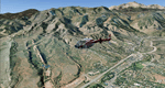
Colorado Springs South (KCOS), Colorado, Photo-Scenery (FS9 & FSX)
This region covers the area of Colorado Springs. Just west of the city you can fly around Pikes Peak. At 14.115ft it is the easternmost of Colorado's 54 fourteeners. Northwest of the city lies the Garden Of Gods with its many vertical rock formations. They are made of sedimentary beds red and white sandstones, conclomerates and limestone that were deposited horizontally but have been tilted vertically and faulted by the immense mountain building forces caused by the uplift of the Pikes Peak massiv. Deep within Chayenne Mountain is the North American Aerospace Defense Command's (NORAD) main technical facility which collects and evaluates data from a worldwide system of satellites, radars and other sensors.
High resolution versions of this scenery for FS9 and FSX (much sharper, but larger and multiple downloads) are available at www.blueskyscenery.com/GNB_South3East.html . The screenies are taken from the high-res versions, so expect this version to be slightly more blurry. YourDonation@Work: Dedicated to Veit and Hector.
| Filename: | Colorado_Springs_South_KCOS_Colorado_PhotoScenery.zip |
| License: | Freeware, limited distribution |
| Added: | 5th February 2010, 16:30:42 |
| Downloads: | 1,979 |
| Author: | Gottfried Razek, blueskyscenery.com |
| Size: | 95.63 MB |
| Category: Flight Simulator 2004 - Scenery | |
| Kremmling, Mc Elroy (20V), Colorado, Photo-Scenery |
|
Images related to this file:
File Description:

Kremmling, Mc Elroy (20V), Colorado, Photo-Scenery (FS9 & FSX)
Ever wanted to know how the scenery looks like around Kremmling VOR? Now you got the chance! This region covers the area around Kremmling and the northern part of the Gore Range. At Kremmling the Colorado River meets both the Blue River and the Muddy Creek. West of Kremmling you can see Gore Canyon. This rugged and steep canyon is almost 1000ft deep and was carved by the Colorado River on its way thru the Gore Range.
To explore the scenery depart from Mc Elroy Airfield (20V) in Kremmling and head north. High resolution versions of this scenery for FS9 and FSX (much sharper, but larger and multiple downloads) are available at www.blueskyscenery.com/GNB_West.html . The screenies are taken from the high-res versions, so expect this version to be slightly more blurry. Thanks to Joop Mak for providing custom AFCADs that correct airport layouts so that they align with the photo-textures! They are available at www.blueskyscenery.com/AFCADs.html . YourDonation@Work: Dedicated to Michael.
| Filename: | Kremmling_Mc_Elroy_20V_Colorado_PhotoScenery.zip |
| License: | Freeware, limited distribution |
| Added: | 21st April 2010, 17:39:09 |
| Downloads: | 1,138 |
| Author: | Gottfried Razek, blueskyscenery.com |
| Size: | 91.2 MB |
| Category: Flight Simulator 2004 - Scenery | |
| The Greater Toronto Area Part 1 |
|
File Description:
Part 1 of Flight Ontario's scenery for the Greater Toronto Area and Southern Ontario.
Over a year in the making, this scenery for Fs 2002 and Fs 2004 is bounded by Detroit in the west, Kingston in the east, Huntsville in the north and Buffalo in the south and features:
* all-season scenery
* custom water textures
* completely modelled Toronto Airports...CYTZ (Toronto Island) and CYZD
(Downsview-home to Bombardier Aerospace and the Canadair Regional Jet
and Dash-8, and the Toronto Aerospace Museum)
* custom autogen for the GTA
* Custom landclass for southern Ontario
* custom shorelines (western Lake Ontario, Kingston area, Lake
Couchiching...Severn River...Sparrow Lake area, and the Muskoka Lake
area)
* prominent features around Hamilton include the Burlington Skyway and
Lift Bridge and steel mills
* the Welland Canal is featured with lift bridges, bascule bridge and
fixed link bridge from Pt Weller to Pt Colborne
* the Niagara area includes the Minolta Tower, and 3 hydro generating
plants with reservoirs
* compatibility with SimFlyers CYYZ
This scenery is downloadable in two parts and both parts are essential
| Filename: | The_Greater_Toronto_Area__Part_1.zip |
| License: | Freeware |
| Added: | 9th April 2004, 12:40:02 |
| Downloads: | 37,176 |
| Author: | Flight Ontario |
| Size: | 62.09 MB |
| Category: Flight Simulator 2004 - Scenery | |
| Baker Lake CYBK in Nunavut, Canada |
|
Images related to this file:
File Description:
Baker Lake is the only Nunavut community that is not next to the sea. It is, as you might have guessed, on the shore of Baker Lake and 160 miles west and a bit north of Rankin Inlet on the shore of Hudson Bay (a recent post by Sid and Pete). The Hudson Bay Company opened a trading post there in 1916 and the town slowly developed, though as recently as 1946 the population was still only 32. These days the airfield is the support field for several nearby mines and there are now nearly 1,800 folks in Baker Lake using the stores, schools, churches, hospital, etc. The runway is almost 4,200' of 100' wide gravel and lighted; the alignment is 162T and 342T as this is in northern domestic airspace and bearings are given as 'true" and not "magnetic". Both JETA and 100LL fuel is available. The town is to the northeast of the airfield and is made up of a landclass without autogeneration, as this would mean a bunch of trees that would be, to say the least, unrealistic.
| Filename: | Baker_Lake_CYBK_in_Nunavut_Canada.zip |
| License: | Freeware, limited distribution |
| Added: | 23rd November 2011, 09:21:56 |
| Downloads: | 515 |
| Author: | Roger Wensley |
| Size: | 2.45 MB |
| Category: Flight Simulator 2004 - Scenery | |
| Sigonella AB - Sicily, Italy |
|
Images related to this file:
File Description:

Naval Air Station Sigonella, "The Hub of the Med", is a U.S. Navy installation at NATO Base Sigonella and an Italian Air Force base in Sicily, Italy. Although a tenant of the Italian Air Force, NAS Sigonella acts as landlord to more than 40 other U.S. commands and activities. It is located 15 km west and 11 km south of the city of Catania. Sigonella also serves as an Italian base for the 41º Stormo Antisom (41st Antisubmarine Warfare Wing). Among the aircraft that fly from this island base are U.S. Air Force C-130, C-17 and C-5 airlifters as well as KC refueling aircraft and a rotating squadron of forward-deployed U.S. Navy P-3 Orions. The Italian Air Force also fields the venerable Breguet Atlantic patrol aircraft. It is one of the most frequently used stops for U.S. airlift aircraft bound from the continental United States to Southwest Asia and the Indian Ocean. Scenery contains all new 3D models and AI aircraft. Package is stand-alone but additional downloads may be helpful (see docs for details).
| Filename: | Sigonella_AB__Sicily_Italy.zip |
| License: | Freeware, limited distribution |
| Added: | 3rd June 2014, 06:25:24 |
| Downloads: | 2,101 |
| Author: | John Stinstrom |
| Size: | 4 MB |
| Category: Flight Simulator 2004 - Scenery | |
| CYYD - Smithers Regional Airport - Smithers, British Columbia, Canada |
|
Images related to this file:
File Description:
Smithers is in northwest BC, 60 miles east and a bit north of Terrace (my previous post) and directly east of the southern border of Alaska, 430 miles north of Vancouver on the Yellowhead highway. The town has a population of 5,500 and is set in a north-south valley between mountains, the most impressive of which is Hudson Bay Mountain to the west. The airport is to the north of the town and has a single runway of 7,544 feet, aligned 33-15. The main user is Central Mountain Air, who are headquartered in Smithers and have a large maintenance hangar there next to the terminal building. The airport has scheduled flights by Central Mountain Air, Jazz, and Hawk Air, which are in the AI along with a Lockheed Electra of Conair (who are the largest operator of fire fighting planes in BC and have re-fill tanks in Smithers) and also a HS 748 of Air North, which is actually for an upcoming post of Old Crow CYOC.
| Filename: | CYYD__Smithers_Regional_Airport__Smithers_British_.zip |
| License: | Freeware, limited distribution |
| Added: | 30th November 2014, 13:53:46 |
| Downloads: | 716 |
| Author: | Roger Wensley |
| Size: | 8.06 MB |
| Category: Flight Simulator 2004 - Scenery | |
| Union Island TVSU in the Grenadines |
|
Images related to this file:
File Description:
Union Island is in the southern tail of the chain of islands known as St Vincent and the Grenadines, between Canouan and Carriacou. Union is another small island, 3.5 miles long and at its widest 1.5 miles wide; the resident population is around 3,000, mostly in the two towns Clifton and Ashton.
The airport is at the eastern end of the island, and has been extended into the sea on landfill. The runway is now around 2,480 feet long, aligned 08 (and with the southeast trade winds it is unlikely that you will find yourself using 26) and with a displaced threshold of 530 feet due to the hill to the west. The terminal is adjacent to a rather small apron; there is parking on the grass north of the taxiway. There are connecting flights by SVG to Barbados and the other islands and these are reflected in the AI. The airport has no lighting, and flights are obliged to land and depart in daylight hours only, outside of which the airport is closed.
| Filename: | Union_Island_TVSU_in_the_Grenadines.zip |
| License: | Freeware, limited distribution |
| Added: | 11th June 2013, 23:26:50 |
| Downloads: | 435 |
| Author: | Roger Wensley |
| Size: | 2.02 MB |
| Category: Flight Simulator 2004 - Scenery | |
| CYQR Regina (Regina International Airport and Roland Groome Field) Version 2 |
|
Images related to this file:
File Description:

Regina International Airport can trace its history back to 1919, when Regina airport became the first registered air harbour in Canada. This virtual model of CYQR represents the airport as it was in spring of 2007. CYQR airport is the gateway to southern Saskatchewan, Canada and is situationed in Regina, which is the provincial capital. The airport is served by Air Canada, Air Canada JAZZ, Westjet, West Wind, Express Air, Northwest Airlines and United Airlines. The airport is named for Roland Groome, who was the first registered pilot in Canada.
This scenery is a re-upload of version 2 of the scenery, which was lost in the AVSIM hack. Nothing has changed.
This scenery was constructed using GMAX and includes nearly every airport and commercial building on the airport property. Beyond the airport itself this scenery also includes, as an option, the major landmark buildings in the city of Regina proper and those on the runway approaches. Regina City buildings are meant to enhance the realism of virtual flying in the Regina area.
| Filename: | CYQR_Regina_Regina_International_Airport_and_Rolan.zip |
| License: | Freeware |
| Added: | 7th May 2010, 12:49:25 |
| Downloads: | 6,907 |
| Author: | Gregory Putz |
| Size: | 10.99 MB |
| Category: Flight Simulator 2004 - Scenery | |
| Health Bay CAD7 in British Columbia, Canada |
|
Images related to this file:
File Description:
This is the fourth in a series of new and renovated float bases in BC. Health Bay is a small village on the west coast of Gilford Island, just 13 miles northwest of Minstrel Island (the previous post in this series). There is no fuel or oil available. The AI is a further adaptation of the original CF36 AI and involves a Baxter Beaver flying from Port Hardy on a round trip in the area through Port McNeill, Health Bay, Echo Bay, and Sullivan Bay. At Health Bay the AI appears to work for both landing and takeoff, though landing will still depend on wind direction. I have played with circuit height and runway length at Minstrel Island and there are improvements, so there is a Minstrel Island replacement bgl. All of these float bases can be installed together in the same folders, with a saving in duplicate textures. So a series called BC Floats (or whatever you want to call it) or individually installed float bases; your choice. The next in the series will be Echo Bay, shown in an included screenshot.
| Filename: | Health_Bay_CAD7_in_British_Columbia_Canada.zip |
| License: | Freeware, limited distribution |
| Added: | 18th January 2017, 01:15:57 |
| Downloads: | 174 |
| Author: | Roger Wensley |
| Size: | 4.63 MB |


© 2001-2026 AVSIM Online
All Rights Reserved
Privacy Policy |