
Where Flight Simulation Enthusiasts Gather from Around the World!
AVSIM Library - Search Results

| Category: Flight Simulator 2004 - Scenery | |
| Inuvik CYXT in the Northwest Territories, Canada |

|
Images related to this file:
File Description:
Inuvik is a town of 3,500 or so inhabitants at N68 18 W133 29, which puts it 120 miles inside the Arctic Circle on the east side of the Mackenzie River delta and around 90 miles from where the Mackenzie meets the Beaufort Sea. There is a Canadian Forces base at the eastern end of the field, with shelters for six F18 fighters; the base in one form or another has been there for a while and is the reason for the generous length of asphalt runway.
Inuvik was established in the early 1960's as a replacement regional center for Aklavik which is 40 miles to the west across the delta and which flooded on a regular and inconvenient basis. This probably works without Ultimate Terrain but I haven't tested it. I also haven't tested it in FSX but I was told it works there too.
| Filename: | Inuvik_CYXT_in_the_Northwest_Territories_Canada.zip |
| License: | Freeware, limited distribution |
| Added: | 6th October 2010, 13:22:04 |
| Downloads: | 943 |
| Author: | Roger Wensley |
| Size: | 4.12 MB |
| Category: Flight Simulator 2004 - Scenery | |
| Arviat CYEK in Nunavut, Canada |
|
Images related to this file:
File Description:
Arviat is a small town on the west coast of Hudson Bay in Nunavut, around 90 miles south of Whale Cove, 130 miles south of Rankin Inlet, and 160 miles north of Churchill. The airfield is just south of the town, and the 4,000 feet of gravel runway is aligned 149T/329T; these are true bearings and not magnetic as Arviat is just inside the Northern Domestic Airspace zone. There is 100LL fuel available in drums, with 2 hours prior notice. The visiting AI airline is Calm Air, plus a cargo delivery by Buffalo Air. As a town of 2,200 people is too large to model I have used a landclass with autogeneration. The result includes some trees, which is not realistic, but there was no way out. There is a special note in the instructions regarding Flight Ontario replacement textures and "glowing" gravel aprons.
| Filename: | Arviat_CYEK_in_Nunavut_Canada.zip |
| License: | Freeware, limited distribution |
| Added: | 6th January 2012, 16:13:45 |
| Downloads: | 508 |
| Author: | Roger Wensley |
| Size: | 2.19 MB |
| Category: Flight Simulator 2004 - Scenery | |
| Kangiqsujuaq CYKF in northern Quebec, Canada |
|
Images related to this file:
File Description:
Kangiqsujuaq is on the north coast of Quebec, 85 miles west of Quaqtaq and 125 miles east of Salluit, while across the Hudson Strait and 100 miles away on Baffin Island is Kimmirut. The town grew around two trading posts, the first opened by Revillon Freres in 1910, and the second by the Hudson Bay Company in 1914. A school was opened in 1960, and a clinic in 1961. The town was known as Wakeham Bay until 1961, and now has a population of around 700. The airport is to the south of the town and up on the hill at 511 feet ASL (this has been remeasured since 2004 and is now known to be 501). The gravel runway is just over 3,500 feet long and aligned 15/33; there is no PAPI, but there is fuel available, both 100LL and JetA. There are flights by Air Inuit.
| Filename: | Kangiqsujuaq_CYKF_in_northern_Quebec_Canada.zip |
| License: | Freeware, limited distribution |
| Added: | 27th January 2013, 00:55:00 |
| Downloads: | 231 |
| Author: | Roger Wensley |
| Size: | 2.31 MB |
| Category: Flight Simulator 2004 - Scenery | |
| Torrey, Box-Death Hollow Wilderness, Aquarius Plateau, Utah, Photo-Scenery (FS9 & FSX) |
|
Images related to this file:
File Description:
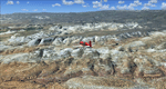
The southern part of this region covers the Box-Death Hollow Wilderness, with its vertical gray-orange walls of Navajo sandstone. Then comes the Aquarius Plateau which is the highest timbered plateau in North America with Boulder Mountain. In the north you'll find the little town of Torrey, which is just eight miles west of Capitol Reef National Park. Extends my Grand Staircase Escalante scenery to the north.
High resolution versions of this scenery for FS9 and FSX (much sharper, but larger and multiple downloads) are available at www.blueskyscenery.com/CNY_SouthWest3.html . The screenies are taken from the high-res versions, so expect this version to be slightly more blurry.
Thanks to Joop Mak for providing a custom AFCADs that correct airport layouts so that they align with the photo-textures! They are available here: www.blueskyscenery.com/AFCADs.html . YourDonation@Work: Dedicated to Ralf-Peter, Jon and Laurent.
| Filename: | Torrey_BoxDeath_Hollow_Wilderness_Aquarius_Plateau.zip |
| License: | Freeware, limited distribution |
| Added: | 3rd April 2010, 00:52:09 |
| Downloads: | 1,205 |
| Author: | Gottfried Razek - blueskyscenery.com |
| Size: | 93.79 MB |
| Category: Flight Simulator 2004 - Scenery | |
| Oberpfaffenhofen v2.2 |
|
Images related to this file:
File Description:
This factory airport is located in the west of Munich (lovely Bavaria, South-Germany).The simulated version of the airport I dedicated to Claude Dornier, one of the
very famous aviation pioneers in the last century. Civil and military aircraft are manufactured and/or serviced on this airport. Over the years the ownership has changed in 1996 from Dornier to Fairchild/Dornier and in December 2002 to RUAG (Swiss Company). The airport also is hosting the "DLR" (German Aerospace Center) at the south western part of the field.
Version 2.2 replaces version 1 and 2.1 completely. Several airport buildings have
been modified and all the scenery textures have been converted to the DXT1/DXT3 format.
All EZ-Scenery BGL's and Textures are on board, therefore no further library downloads
are required. Gentlemen, it's time to get the weather briefing.
Re-upload.
| Filename: | Oberpfaffenhofen_v22.zip |
| License: | Freeware |
| Added: | 8th April 2011, 11:44:36 |
| Downloads: | 2,556 |
| Author: | Klaus Jone |
| Size: | 32.76 MB |
| Category: Flight Simulator 2004 - Scenery | |
| Ontario Small Fields in Canada: #02 Harrow CGL2 |
|
Images related to this file:
File Description:
This is the second in a series of small airfields in southern Ontario, Canada. It is Harrow CGL2, a field near a small town of the same name close to Lake Erie. The airfield has a grass runway of 3,000 feet, with short displaced thresholds (400 feet) at each end; the south due to the trees and the north due to a road and fence. The electric cable strung along this road (unlike Leamington, with it's warning visibility spheres) is buried for a short stretch the width of the runway, but avoid the poles. The intention is that downloaders will add further posts to the earlier ones, which will avoid unnecessary texture duplication (for instance for parked cars or planes) and avoid adding yet another small field to the FS9 scenery library. The third airfield will probably be Essex CNE9, a grass field to the west of Harrow.
| Filename: | Ontario_Small_Fields_in_Canada_02_Harrow_CGL2.zip |
| License: | Freeware, limited distribution |
| Added: | 19th July 2015, 19:44:00 |
| Downloads: | 182 |
| Author: | Roger Wensley |
| Size: | 1.54 MB |
| Category: Flight Simulator 2004 - Scenery | |
| Honolulu International Airport PHNL |
|
File Description:
This scenery completely redoes the Honolulu Airport, which is the main stop over between the East and West, and the largest airport in the Central Pacific. Included here you will find the main terminal, the Inter-Island terminal, fuel storage tanks, 39 gates with jetways, plus numerous other parking spaces, three different hangar / cargo areas, parking structures and the park like landscaping on the front side of the airport, realistic ramp lights, ramp light parking textures, airport vehicles, the Aloha Tower, and the numerous Coconut Palms which welcome you at every turn at this airport. Due to it's large size, I have provided two scenery density settings, so you can eliminate all objects in front of the airport which are not seen from airside, and balance it between traffic and scenery density to get the best frame rates on your particular computer. This scenery should also be completely compatible with FS2002.
| Filename: | Honolulu_International_Airport_PHNL.zip |
| License: | Freeware |
| Added: | 10th December 2003, 04:56:16 |
| Downloads: | 42,317 |
| Author: | Bill Melichar |
| Size: | 4.91 MB |
| Category: Flight Simulator 2004 - Scenery | |
| Liverpool John Lennon (Speke) Airport (EGGP) Ver 4.0 |
|
File Description:
This all new version has been specifically created with the Default FS2004 scenery in mind. However, it is also aligned to the Visual Flight / getmapping VFR Scenery published by Just Flight. Files are also included to make the scenery FS2002 compatible.
Version 4.0 contains all new macros and textures including for the first time full night textures! Note however, the download no longer contains the additional landmark objects included with previous versions. These are still available however from the derbosoft website and from AVSIM.
This scenery forms part of the "UK2002 Scenery Project" co-ordinated by John Woodside - http://fsaviation.net/.
Thanks go to John Woodside and to Peter Leadbeater for the information they have supplied to me regarding the airport.
Special thanks also go to Dave Graham and the rest of the guys at North West Air News (www.nwan.co.uk) without whose photo's and information this new version just wouldn't exist!
| Filename: | Liverpool_John_Lennon_Speke_Airport_EGGP_Ver_40.zip |
| License: | Freeware |
| Added: | 27th June 2004, 05:09:39 |
| Downloads: | 22,322 |
| Author: | Paul Derbyshire |
| Size: | 6.14 MB |
| Category: Flight Simulator 2004 - Scenery | |
| EZ Scenery Cass Field (00CO) |
|
File Description:
FS2004 EZ Scenery CASS FIELD (00CO)
Briggsdale Colorado and surrounding parts of Eastern Co are well known for seeds. Seeds of almost any
kind imaginable like flowers, potatoes, bird seed and the list goes on and on. It is most always windy for there are no trees to slow the flow. Hot & windy in summer, cold and windy in winter and no natural enviromnent to harm plant growth. You can see the mountains to the west and more desolation to the east. A lonely place to drive through but rich in good people and seeds harvested for the world.
Area outside of airport's default flatten area require FS Global or Abasus extreme landscapes for elevation data. Download FREE library of RWY12 - EZ scenery objects (available on FlightSim.com or AVSIM) for objects. Ultimate Terrain USA for detailed landclass. FSX compatable.
Instructions inside.
jimmy R martin
| Filename: | EZ_Scenery_Cass_Field_00CO.zip |
| License: | Freeware |
| Added: | 6th June 2006, 01:54:47 |
| Downloads: | 619 |
| Author: | jimmy R martin |
| Size: | 255.55 KB |
| Category: Flight Simulator 2004 - Scenery | |
| Armstrong Ontario; one airfield and two float bases |
|
File Description:
Armstrong CYYW airfield is 70 miles northeast of Thunder Bay, and close to Lake Nipigon. There isn't much of interest at the airfield by way of buildings (as there aren't many buildings!) and the only plane I saw was a fire fighting Canadaair CL 415. A basic airfield with one runway with lights and one without, and no maintenance. There is fuel, but it is locked up and not for sale.
The two float bases are 5 miles west (CJF6) and 10 miles southwest (CKN6) of Armstrong airfield. Lake Mackenzie is home to two companies, Armstrong Outposts (two Beavers) and Huron Air & Outfitters (an Otter and a Beaver) who both run fishing and hunting lodges. Wilderness North are further south on Lake Waweig, and I think they fly two Otters and a Beaver to their outpost camps. You need Ultimate Terrain, or there won't be any lakes!
| Filename: | Armstrong_Ontario_one_airfield_and_two_float_bases.zip |
| License: | Freeware |
| Added: | 24th February 2009, 00:51:42 |
| Downloads: | 894 |
| Author: | Roger Wensley |
| Size: | 7.03 MB |


© 2001-2026 AVSIM Online
All Rights Reserved
Privacy Policy |