
Where Flight Simulation Enthusiasts Gather from Around the World!
AVSIM Library - Search Results

| Category: Flight Simulator 2004 - Scenery | |
| Eilat Scenery V2 .0 |

|
File Description:
A few word's about the new scenery "Eilat Scenery V2". What was changed from the previous version ("Eilat Airport and City Ver1.1" Downloads 6540 ) The terminal and all the airport all redone with Gmax. The Mall Building redone with Gmax. The Buildings of The West side of The airport redone with Gmax. 2 new Hotels Agamim, and Paradise look great. Improvement of the Night Vision of the Photoreal . Autogen of the city. you can see now a few object in Aqaba City: port cranes and buildings and much more and frame rate are much more friendly
| Filename: | Eilat_Scenery_V2_0.zip |
| License: | Freeware |
| Added: | 6th October 2005, 15:37:08 |
| Downloads: | 13,485 |
| Author: | David Rosenfeld |
| Size: | 23.53 MB |
| Category: Flight Simulator 2004 - Scenery | |
| CYGK (2008) - Kingston (Norman Rogers) Airport, Ontario, Canada |
|
Images related to this file:
File Description:
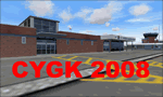
Kingston V2 (2008) - GMAX modeled scenery with custom ground textures. The airport was modeled in its 2008 state.
Kingston Airport or Kingston/Norman Rogers Airport (IATA: YGK, ICAO: CYGK) is located 4.3 nautical miles (7.96 km) west of the downtown of Kingston, Ontario, Canada. CYGK is now as the only airport (except CFB Trenton - restricted) between Toronto, Montreal, and Ottawa that has an ILS approach making it a preferred alternate airport to most aviators.
(This is a re-upload of the scenery to replace the original that was lost in the AVSIM hack. No changes have been made)
| Filename: | CYGK_2008__Kingston_Norman_Rogers_Airport_Ontario_.zip |
| License: | Freeware, limited distribution |
| Added: | 16th May 2010, 10:04:29 |
| Downloads: | 3,294 |
| Author: | Keith Murphy |
| Size: | 25.68 MB |
| Category: Flight Simulator 2004 - Scenery | |
| CWCY - Cape Young - Nunavut, Canada |
|
Images related to this file:
File Description:
Cape Young was a DEW line station on the nothern mainland coast 50 miles northwest of Kugluktuk, and 50 miles west of Lady Franklin Point. It closed in August 1993. Most of the buildings are still there, in various shades of decay. The runway is also still there and close to 5,000 feet of gravel in length, aligned and signed 110T/290T, though on the atc it will be called 07/25 as FS9 knows nothing about the Canadian Northern Domestic Airspace. There is no runway lighting, and don't be surprised if there are bushes growing amid the gravel.
| Filename: | CWCY__Cape_Young__Nunavut_Canada.zip |
| License: | Freeware, limited distribution |
| Added: | 11th November 2012, 01:23:51 |
| Downloads: | 224 |
| Author: | Roger Wensley |
| Size: | 1.53 MB |
| Category: Flight Simulator 2004 - Scenery | |
| Kaltag KAL in Alaska |
|
Images related to this file:
File Description:
Kaltag is a small village on the west bank of the Yukon River, around 65 miles east of the coast at Unalakleet and about 40 miles south of where the river turns from north-south to east-west, east being upstream towards the distant Fairbanks. The population is just under 200 and living from fishing and the land. The airfield is close by and has a gravel runway aligned 21-3 and just under 5,000 feet long. Apart from the airfield itself, and it's buildings, this scenery modifies the local land class, adds village buildings while reducing the village size to reality, and creates a new airfield background. Kaltag is located on the edge of three different airlines coverage areas, and is served by Bering Air from the northwest, ERA from the southwest, and also by Wright Air from Fairbanks in the east. These are included in the AI.
A note here about my scenery making. This is post number 507 and there will not be many more to follow this as I am almost at the end of the photos I either took or found for scenery purposes. There is a limit to what can be located online and I have already been making use of the little there is; eg Unalakleet. So, if you are near an airport (preferably Canadian or Alaskan) and have a camera..... Let me know.
| Filename: | Kaltag_KAL_in_Alaska.zip |
| License: | Freeware, limited distribution |
| Added: | 20th August 2019, 19:04:35 |
| Downloads: | 102 |
| Author: | Roger Wensley |
| Size: | 3.57 MB |
| Category: Flight Simulator 2004 - Scenery | |
| Aklavik CYKD in the Northwest Territories, Canada Revised |
|
Images related to this file:
File Description:
This version of Aklavik replaces the previous version so delete all previous installation elements. There is also for Inuvik replacement AI, additional texture, and replacement scenery bgl; this presumes you have already installed my revised post of Inuvik. There is also for Tuktoyuktak additional textures, and replacement scenery bgl's; this presumes you have already installed my 2012 post of Tuktoyakyuk.
Aklavik is a town of 650 or so inhabitants 120 miles inside the Arctic Circle and on the West Channel of the Mackenzie River delta. It is 40 miles west of Inuvik. There are two airlines serving the town on a regular basis and one is Aklak Air, operated by Kenn Borek. Aklavik village has not been changed since my previous post, but the airfield now has the correct terminal building.
The Inuvik replacement AI involves flights to Aklavik and Tuktoyaktuk and the texture and replacement bgl's are for gates that I forgot to include before.
The Tuktoyaktuk scenery now has a barge carrying the prefabricated new terminal for Grise Fiord, plus other items for the installation work. Northern terminals are prefabricated and delivered either complete or in flat-pack form to reduce construction time on site to a minimum. There is a note explaining why the terminal building is on a barge instead of being installed at its destination!
| Filename: | Aklavik_CYKD_in_the_Northwest_Territories_Canada_R.zip |
| License: | Freeware |
| Added: | 14th May 2012, 17:20:39 |
| Downloads: | 539 |
| Author: | Roger Wensley |
| Size: | 8.6 MB |
| Category: Flight Simulator 2004 - Scenery | |
| Z19O - Hamat Airbase - Batroun, Lebanon |
|
Images related to this file:
File Description:
Hamat is a village near the coast of Lebanon, around 25 miles north of Beirut. The airport runway was built during the civil war to the west of Hamat in the late 1970's, between Hamat and another village called Wuajh Al Hajar. The intention was have an alternative to Beirut airport, which could be (and often was) closed by shell fire from any or all of the sides involved in the civil war, or by bombing by those who were not directly part of the civil war but occasionally joined in. It has been used for drag racing, occasional freefall parachuting (this may continue) and is now an army base with mostly helicopter use. The runway is around 5,600 feet of asphalt, 90 feet wide and aligned 02/20. There is no lighting. The apron is set well back from the runway and has hangars at each end; one set is four hangars long, and at the other end of the apron there are three hangars. There are also the remains of some radar to the west of the apron, bombed (in 1982?). The runway has been repositioned and the surrounding landclass modified to reduce one village to it's approximate actual size and to create a second village which was missing entirely. An intrusive road has been deleted, and the airfield grass area also modified.
| Filename: | Z19O__Hamat_Airbase__Batroun_Lebanon.zip |
| License: | Freeware, limited distribution |
| Added: | 23rd May 2015, 10:03:10 |
| Downloads: | 224 |
| Author: | Roger Wensley |
| Size: | 8.53 MB |
| Category: Flight Simulator 2004 - Scenery | |
| Carp CYRP updated, near Ottawa in Ontario Canada |
|
Images related to this file:
File Description:
This version updates the post of 2006 with specifically modelled buildings for the east apron, plus a new AFCAD file. This is a stand-alone version and does not require you to have downloaded and installed the previous post. Carp airfield is fifteen miles west of Ottawa and two miles south of the town of Carp. There are two runways, 10/28 which is asphalt and almost 4,000 feet long and 100 feet wide, and 04/22 which is gravel and 2,000 feet long. The airfield has a fairly large polulation of general aviation residents and two years ago was expanding under new ownership, with a new terminal building and a large hangar opened and the "Touch'n Go" aviation warehouse that has opened more recently. The first version of Carp really included only the west apron, as that is where all (or almost all) the general aviation is located. I "represented" the east apron buildings without modelling any of them. This version corrects that, and the modeled east apron buildings are the HQ of Helicopter Transport Services Inc. and the adjacent Bell Helicopter service hangar, and the old First Air hangar and offices which are now under new ownership. The smaller hangars on the other side of the apron belong to chapter 245 of the Experimental Aircraft Association.
| Filename: | Carp_CYRP_updated_near_Ottawa_in_Ontario_Canada.zip |
| License: | Freeware, limited distribution |
| Added: | 16th February 2010, 03:18:39 |
| Downloads: | 563 |
| Author: | Roger Wensley |
| Size: | 6.03 MB |
| Category: Flight Simulator 2004 - Scenery | |
| Hazyview Airfield, Hazyview, South Africa |
|
Images related to this file:
File Description:
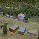
Hazyview is one of the gateway towns to the Kruger National Park and is located just to the West of Phabeni Gate, one of the main gates to use if you are travelling to Skukuza. The airfield in Hazyview is also called Numbi Airfield due to the location of the Numbi Hotel right next to the airfield.
Hazyview airfield is not included in the default scenery of FS2004. With this package, it has been faithfully produced in Gmax with photoreal textures on all the buildings and a photoreal ground as well. Even the Lowveld mall to the North of the airfield and right on the approach to Rwy 19 as well as the Building supplies store to the south and on approach to Rwy 01 is inlcuded with custom models and textures. Likewise, the buildings to the West of the runway (right at the edge of the runway) and the brickyard at the Northern end is modeled with custom models and textures. The two large cellphone antennas are also present in the airport scenery and custom made.
In real life, the runway is quite sloped and this was also recreated in the scenery under the limitations FS2004 presents with regards to non-flat airports.
The grass runway is aligned 01/19 and only 820m long. Take-off is on Rwy 01, with landings on Rwy 19.
| Filename: | Hazyview_Airfield_Hazyview_South_Africa.zip |
| License: | Freeware, limited distribution |
| Added: | 4th February 2022, 14:57:40 |
| Downloads: | 141 |
| Author: | Kobus van Wyk |
| Size: | 17.07 MB |
| Category: Flight Simulator 2004 - Scenery | |
| Old Lima, Ohio Municipal Airport (KLIA) |
|
Images related to this file:
File Description:
Opened; 1933. Closed; 1980. Built in 1933, it first consisted of 3 sod runways, with a single hangar located in the Northwest corner. It later (around 1960) sported a single paved east-west runway (9/27, 3,500 ft) and two sod strips, with one running parallel to the North of the paved runway. In addition, it had a small office/terminal, a main service hangar, and 3 long T-hangars. It's "golden years" were from 1953-63, when Lake Central Airlines ran DC-3 service connecting Lima to Columbus, Cincinnati, and Pittsburgh. To view the entire scenery, you'll need two Sidney Schwartz libraries - details in readme.
| Filename: | Old_Lima_Ohio_Municipal_Airport_KLIA.zip |
| License: | Freeware |
| Added: | 19th February 2011, 15:55:16 |
| Downloads: | 95 |
| Author: | Stephen Plumb |
| Size: | 5.9 KB |
| Category: Flight Simulator 2004 - Scenery | |
| Europe SRTM mesh Part 13: Western Spain & Portugal |
|
File Description:
Europe SRTM LOD9 mesh part 13 of 13: Covers Spain west of 4.5°W and Portugal.
This Europe SRTM project was optimized for the lowest HDD space use: Each part macthing exactly the boundaries of its neighbors, you'll have a complete corevage of Europe without gap or overlapping scenery. Based on SRTM Data v1 and v2 (3 arcsec, 90m) and sampled to LOD9 resolution (76m). Each SRTM tile was carefully checked and repaired with Blackart v4.02: water areas are now flattened (lighter mesh), and SRTM voids were treated taking advantage of Blackart's sophisticated interpolation algorithm. When required, biggest voids were patched with oversampled SRTM 30 arcsec data and/or manual input.
| Filename: | Europe_SRTM_mesh_Part_13_Western_Spain__Portugal.zip |
| License: | Freeware, limited distribution |
| Added: | 20th October 2005, 11:22:13 |
| Downloads: | 15,508 |
| Author: | Yohann Baptiste |
| Size: | 34.22 MB |


© 2001-2026 AVSIM Online
All Rights Reserved
Privacy Policy |