
Where Flight Simulation Enthusiasts Gather from Around the World!
AVSIM Library - Search Results

| Category: Flight Simulator 2004 - Scenery | |
| CYDF Deer Lake Regional Airport for Newfoundland & Labrador FS9 |

|
Images related to this file:
File Description:
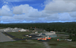
This scenery is a very accurate freeware version of Deer Lake Regional airport and sorounding area, on the west coast of the island of Newfoundland.
Designed to suit a variaty of computers, there is a setup for everyone.
There is something here for Heli, Bush, Low and slow right up to the IFR hight in the sky fliers.
Two solid years went into this scenery to try to capture as much detail as possible.
I really hope you enjoy it as much as Flight Ontario enjoyed working on it.
| Filename: | CYDF_Deer_Lake_Regional_Airport_for_Newfoundland__.zip |
| License: | Freeware |
| Added: | 2nd May 2010, 02:07:39 |
| Downloads: | 1,940 |
| Author: | Al Sibley Flight Ontario |
| Size: | 89.8 MB |
| Category: Flight Simulator 2004 - Scenery | |
| Telluride Regional Airport v3 ( KTEX ) |
|
File Description:
FS2004 Scenery - Telluride Regional Airport (IATA: TEX, ICAO: KTEX) is a public airport located 5 miles (8 km) west of Telluride, in San Miguel County, Colorado, USA. It is the highest commercial airport in North America, at an elevation of 9,078 feet (2767 m) above sea level. Located on a plateau, the airport's single runway literally dips slightly in the centre. This is version 3. Unlike versions 1 and 2, this scenery had the advantage of Google Earth's satellite image. Created using Instant Scenery by John B. Loney, Jr.
| Filename: | Telluride_Regional_Airport_v3__KTEX_.zip |
| License: | Freeware, limited distribution |
| Added: | 25th March 2008, 15:55:10 |
| Downloads: | 2,799 |
| Author: | John B. Loney, Jr. |
| Size: | 17.23 MB |
| Category: Flight Simulator 2004 - Scenery | |
| Landivisiau Air Base France |
|
Images related to this file:
File Description:

Serving as both operations and primary base for the French Navy's Rafale aircraft, Landivisiau airbase is located in the quiet hedgerow country of West Brittany. Here the pilots of the Aeronavale learn and practice those skills so necessary to carrier operations and the projection of sea power for the French nation. The airbase is equipped with a 2700m runway as well as a carrier practice deck for both pilot and handler training. This scenery is designed for use with the MAIW package 'French Rafales' but of course will work for any aircraft.
| Filename: | Landivisiau_Air_Base_France.zip |
| License: | Freeware, limited distribution |
| Added: | 17th December 2013, 19:04:52 |
| Downloads: | 2,024 |
| Author: | John Stinstrom |
| Size: | 7.05 MB |
| Category: Flight Simulator 2004 - Scenery | |
| NAS JRB New Orleans (KNBG) |
|
Images related to this file:
File Description:

Scenery for NAS JRB New Orleans (KNBG) and the surrounding area. Includes NAS New Orleans and Southern Seaplane (65LA). Also contains textures and flightplans for the NBAI F-15C/D model of the 159th FW LaANG. Requires MAIW Indonesian Hawks Package, MAIW West Coast ANG Package (with the Kingsly Field scenery activated), and MAIW Lemoore NAS or the MAIW Special Use Mentors Package for the objects to show, and can be found at www.militaryaiworks.com. AFCAD/Flightplans/Paints by Matthew Donica, IFOLS Marco by Marcel Ritzema, non-default scenery objects by the outstanding folks at MAIW.
| Filename: | NAS_JRB_New_Orleans_KNBG.zip |
| License: | Freeware, limited distribution |
| Added: | 10th May 2010, 07:33:53 |
| Downloads: | 1,627 |
| Author: | Matthew Donica |
| Size: | 11.71 MB |
| Category: Flight Simulator 2004 - Scenery | |
| Denver International Airport - KDEN V1 |
|
File Description:
Version 1 of Denver International Airport (KDEN) scenery. All new GMAX scenery. This version features more detailed buildings and jetways along with some animations. All animations are NAV2 frequency controlled. The new 16000' ft runway on the west end of the airport is also included with a very accurate AFCAD2 rendition of gate assignments to portray the airport in as realistic light as possible. All scenery has been optimized for best performance wherever possible. Quantity of jet ways is determined by scenery complexity settings. Previous FS2002 version had over 5000 downloads.
| Filename: | Denver_International_Airport__KDEN_V1.zip |
| License: | Freeware, limited distribution |
| Added: | 18th November 2003, 19:28:58 |
| Downloads: | 16,826 |
| Author: | Harald Krause |
| Size: | 2.17 MB |
| Category: Flight Simulator 2004 - Scenery | |
| Tengah Air Base Singapore (WSAT) |
|
File Description:
FS2004 Scenery — Tengah AB (WSAT), Singapore. Tengah Air Base is located on the tiny Island nation of Singapore and is home to two of its F-16 Fighting Falcons Squadrons, its E-2C Hawkeyes and a large number of UAVs. This scenery was created using RWY12 Objects. Users must have RWY12 object Libraries installed to see any objects. Included in this package are two photo-real AFCADS. The first, (WSAT) for the main base, and a second, (WSAU) for the Helicopter Base just to the west of the main runway.
| Filename: | Tengah_Air_Base_Singapore_WSAT.zip |
| License: | Freeware |
| Added: | 7th December 2008, 22:15:18 |
| Downloads: | 1,360 |
| Author: | Jacob Gibson |
| Size: | 333.18 KB |
| Category: Flight Simulator 2004 - Scenery | |
| Sembach Air Base 1990 |
|
Images related to this file:
File Description:
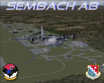
This scenery is a representation of Sembach Air Base in the former West Germany during 1990. At the time, Sembach was host to the 66th Electronic Combat Wing, which was responsible for the home-based EC-130H "Compass Call" aircraft of the 43rd Electronic Combat Squadron, and also had in-direct control of the 42nd Electronic Combat Squadron based at RAF Upper Heyford in the U.K. flying the Grumman EF-111A Raven.
The 66th ECW moved into Sembach during 1986, and spent the next six years flying from there. The role of the aircraft was electronic disruption of enemy radio and radar transmissions, to limit the enemies ability to co-ordinate their own forces and also the transmission of propaganda in an attempt to win hearts and minds.
Sembach was also known as Det.1 of the 81st Tactical Fighter Wing, based at the Twin Bases complex of RAF Woodbridge and RAF Bentwaters. The A-10A's of the six squadrons there would regularly deploy to Sembach and other Forward Operating Locations (FOLs) within West Germany, which was a part of their war-time role.
Included in this package are repaints of all six EC-130H's present at Sembach as of April 1990.
| Filename: | Sembach_Air_Base_1990.zip |
| License: | Freeware, limited distribution |
| Added: | 14th November 2012, 01:37:20 |
| Downloads: | 1,378 |
| Author: | Brian Clarke, Chris A. Brown, Daryl Payne, Stewart Pearson |
| Size: | 1.75 MB |
| Category: Flight Simulator 2004 - Scenery | |
| Watson Lake CYQH and CEJ9 in the Yukon Territories, Canada |
|
Images related to this file:
File Description:
Watson Lake is at 2,200 feet asl on the east side of the Rockies, in the Yukon Territories. The town is less than five miles north of the border with BC and is built around Wye Lake, just a few miles southeast of the much larger Watson Lake. Whitehorse is some 200 miles to the west, and Fort Nelson 220 miles to the east. The airport was built during WW2 and there remains one surviving original hangar, along with later additions. Unusually, the town of Watson Lake came into being because of the airport's existence, though with the closure of one mine that the airport used to serve and the serial closure of another (closed four times?) both the airport and the town (population 500) are in a downward spiral. The airport is 5 miles to the west of the town. There were two runways, but one is now closed and the remaining one is 08-26, 5,500 feet and 150 feet wide. There are two aprons, the northern one being half-used by CL 415 fire-fighting planes (included in the AI, along with Central Mountain Air). All the buildings for CYQH are modeled specifically, but the CJE9 shed is a guess.
| Filename: | Watson_Lake_CYQH_and_CEJ9_in_the_Yukon_Territories.zip |
| License: | Freeware, limited distribution |
| Added: | 14th July 2014, 21:38:57 |
| Downloads: | 443 |
| Author: | Roger Wensley |
| Size: | 17.6 MB |
| Category: Flight Simulator 2004 - Scenery | |
| PAAQ - Palmer Muni - Anchorage, Alaska - USA |
|
Images related to this file:
File Description:
Palmer PAAQ is in Alaska, some 40 miles northeast of Anchorage on the north side of Knik Arm and beside the west bank of the Matanuska River. It is for both GA and commercial aircraft. There are two apron areas, north and south, separated by the east-west runway. The north apron is for the Forestry Service planes and for resident GA tie-down places and hangars, along with maintenance facilities; the southern end of the north apron is for itinerant aircraft. The south apron is almost entirely for commercial companies and again maintenance. The main runway is just under 6,000 feet long, aligned L16-R34 and asphalted and lit, as is the parallel taxiway A. There is also a shorter and parallel runway that is grass and which receives no winter maintenance. The second main runway is 3,600 feet long and aligned 09-27, asphalt and lit and with a parallel taxiway B, also lit. The airport is undergoing a process of upgrading, which explains the varied colours (and age) of resurfaced taxiways. There are adjustment bgl's for two other neighbourhood airstrips, Toad Lake 24AK and Wolf Track 9AK8, which I just discovered buried in nearby holes in the ground; I also revised their runway surfaces.
| Filename: | PAAQ__Palmer_Muni__Anchorage_Alaska__USA.zip |
| License: | Freeware, limited distribution |
| Added: | 4th November 2014, 00:01:43 |
| Downloads: | 448 |
| Author: | Roger Wensley |
| Size: | 22.35 MB |
| Category: Flight Simulator 2004 - Scenery | |
| PAAT (ATU) - Attu - Alaska, USA |
|
Images related to this file:
File Description:
Attu is AT the western end of the Aleutian chain of islands in Alaska, around 40 miles west of Shemya. There was small village on Attu before the Japanese invasion in mid 1942, but the island is now uninhabited. The Coast Guard Loran navigation station remains in place, though it is no longer in operation and visitors to the island are now either tourists or wildlife experts conducting surveys of numbers of nesting birds, etc. The runway still usable is aligned 02-20 and 5,800 feet long; right hand circuits on 02 to stay away from rising ground to the west. The "terminal" building has lost its sign regarding the Horny Bird, removed in 2010 by one of the last of the station operators, but the building is still there, as are some sheds and shacks that lately were used for the uncomfortable accommodation of bird counters. FS9 has used an incorrect icao identification for Attu but correcting it now would make life complicated so ATU it is and shall remain. I have removed the default FS9 roads that came complete with streetlights and telephone poles and replaced and amended the layout with gravel roads to better resemble real life, though the island shape is at best approximate, as is usual in FS9.
| Filename: | PAAT_ATU__Attu__Alaska_USA.zip |
| License: | Freeware, limited distribution |
| Added: | 2nd March 2015, 20:58:09 |
| Downloads: | 281 |
| Author: | Roger Wensley |
| Size: | 3.27 MB |


© 2001-2026 AVSIM Online
All Rights Reserved
Privacy Policy |