
Where Flight Simulation Enthusiasts Gather from Around the World!
AVSIM Library - Search Results

| Category: Flight Simulator 2004 - Scenery | |
| LFBI - Poitiers-Biard Airport - Biard, France |

|
File Description:
Poitiers-Biard airport (LFBI) only for FS2004. Located west of the city of poitier this is as close as the Futuroscope airport.
http://www.poitiers.aeroport.fr/
This scenery is a freeware thank you to all those who provide assistance especially my F-BMPL for the permission to use the models of his FSX scenery for the creation of this scenery. It is not entirely realistic but allows you to use the Poitier platform in FS2004.
| Filename: | LFBI__PoitiersBiard_Airport__Biard_France.zip |
| License: | Freeware |
| Added: | 19th September 2014, 00:10:01 |
| Downloads: | 872 |
| Author: | Rambeau Philippe |
| Size: | 10.94 MB |
| Category: Flight Simulator 2004 - Scenery | |
| Male International Airport |
|
File Description:
Male is the capital city of the Republic of Maldives. Which is a country located in the Indian Ocean to the West of Sri Lanka and to the South of India. This country is made up of hundreds of small islands. This is a famous tourist destination in Asia.
Airport of Male is also an island (which is artificially expanded to make it suitable for the
airport.) which is at Northeast of the capital city Male (island).
| Filename: | Male_International_Airport.zip |
| License: | Freeware |
| Added: | 16th June 2004, 23:24:05 |
| Downloads: | 19,968 |
| Author: | Arjuna Chiththananda |
| Size: | 5.65 MB |
| Category: Flight Simulator 2004 - Scenery | |
| Gang Ranch CAY2 in British Columbia Canada |
|
Images related to this file:
File Description:
Gang Ranch is on the eastern side of the Coast Mountains of British Columbia, around 50 miles west of Green Lake and 5 miles west of the Fraser River that runs north-south at that latitude (51 degrees 30 minutes north, in round figures). The airfield is among some farm fields and difficult to spot (this will depend on your personal textures and settings) and the ranch buildings are scattered and a mile or two away, the nearest being the owner's house. The runway is gravel, only 1,800 feet long and aligned 08-26 at 2,150 feet above sea level. There is no lighting. I have posted it as Gang Ranch CAY2, but I suggest that you just add it to your previously created "BC airfields" (if you did that) and avoid the inevitable doubling up of common textures etc. Plus that way you will have just one FS9 library post to do and new airfields will not need yet another posting. Up to you. If you find a defect, email me.
| Filename: | Gang_Ranch_CAY2_in_British_Columbia_Canada.zip |
| License: | Freeware, limited distribution |
| Added: | 19th November 2020, 19:44:55 |
| Downloads: | 101 |
| Author: | Roger Wensley |
| Size: | 8.98 MB |
| Category: Flight Simulator 2004 - Scenery | |
| CYYH - Taloyoak - Nunavut, Canada |
|
Images related to this file:
File Description:
Taloyoak is on the coast of northern mainland Canada, on the west of the Boothia Peninsula, where it is at it's narrowest. Gjoa Haven is 80 miles southwest, and Hall Beach is 300 miles to the east. Taloyoak was established around a Hudson Bay trading post that was relocated from Fort Ross in 1948 because of poor ice conditions. There is now a clinic, school, church, recreation centre, two markets, two small hotels, and housing for the population of around 900. The airfield is to the west of the village on higher ground at 92 feet asl, and the 4,020 feet of 100 feet wide gravel runway is aligned 151T/331T where T stands for "true" as opposed to magnetic in the Northern Domestic Airspace. Only JETA-1 is available, unless there is some 100LL in drums. There are flights by First Air and Canadian North and the AI includes a daily flight of each, plus an afternoon cargo visit by a Buffalo C46; the closest large city is Yellowknife, 750 miles southwest.
| Filename: | CYYH__Taloyoak__Nunavut_Canada.zip |
| License: | Freeware, limited distribution |
| Added: | 18th November 2012, 09:23:20 |
| Downloads: | 377 |
| Author: | Roger Wensley |
| Size: | 3 MB |
| Category: Flight Simulator 2004 - Scenery | |
| Eagle County (KEGE), Glenwood Springs (KGWS), Colorado, Photo-Scenery (FS9 & FSX) |
|
Images related to this file:
File Description:
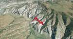
To explore this region depart from Eagle County Regional Airport (KEGE) which is a popular regional airport used in winter to transport skiers to nearby Vail. Northwest of the airport you can see the pit gypsum mine of American Gypsum which produces a variety of wallboard products. When you fly to the west and along the Eagle River, you soon pass its confluence with the Colorado River. Further west you can fly along Glennwood Canyon and finally reach Glennwood Springs where the Colorado meets the Roaring Fork River. Here you can turn south and fly direct Glenwood Springs Airport (KGWS) which lies south of the city. This scenery brings you another 3.500 sq km of beautiful Colorado in 4.7m/pix quality.
High resolution versions of this scenery for FS9 and FSX (much sharper, but larger and multiple downloads) are available at www.blueskyscenery.com/GNB_SouthWest2.html . The screenies are taken from the high-res versions, so expect this version to be slightly more blurry. YourDonation@Work: Dedicated to Alain and James.
| Filename: | Eagle_County_KEGE_Glenwood_Springs_KGWS_Colorado_P.zip |
| License: | Freeware, limited distribution |
| Added: | 30th January 2010, 17:01:49 |
| Downloads: | 2,710 |
| Author: | Gottfried Razek - blueskyscenery.com |
| Size: | 93.8 MB |
| Category: Flight Simulator 2004 - Scenery | |
| ETUO - RAF Gutersloh AB |
|
Images related to this file:
File Description:
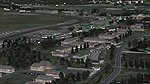
FS 2004 scenery - RAF Gutersloh AB (ICAO: ETUO)
The scenery represents the former airbase of RAF Gutersloh, one of the most populated military bases in West Germany during the Cold War, due to its location near the former East/West border. This scenery reflects the era at the end of the 1980s/beginning of the 90s, when the Harrier GR3 was in operation there, along with Chinook helicopters.
The airfield was built in 1935 and was used by the German Air Force during WW2, flying the Junkers JU-86 and Heinkel H-111. The first British squadrons were stationed there from 1947, with Mosquitos, Vampires and then Canberras.
The first Harrier arrived at Gutersloh in January 1977 and 3 and 4 Squadrons became resident until their farewell in 1993, after the cold war had ended. The airfield is currently used by the British army, but they will leave in 2014 to relinquish the area to the Government of Gutersloh for civil usage.
High detailed scenery by Manfred Schyma and Pete Beeby, supported by the Airfield Construction Group.
| Filename: | ETUO__RAF_Gutersloh_AB.zip |
| License: | Freeware |
| Added: | 10th October 2013, 20:30:01 |
| Downloads: | 1,926 |
| Author: | Manfred Schyma / Pete Beeby |
| Size: | 173.25 MB |
| Category: Flight Simulator 2004 - Scenery | |
| Kivitoo, Paulatuk, Qikiqtarjuak, Rowley Island, & West Baffin, adapted for FSGenesis 76m North Canada Terrain Mesh |
|
Images related to this file:
File Description:
These are replacement bgl's to convert five northern Canada fields for use with the FSGenesis 76m terrain mesh for northern Canada. The five are Kivitoo CWFK, Paulatuk CYPC, Qikiqtarjuak CYVM, Rowley Island CWFR, and West Baffin CWFW. These are not stand-alone, and the presumption is that you have already downloaded and installed the previously posted sceneries. This installation consists solely of replacing the existing scenery bgl's with the new. This is the last post of adapted northern airfields (unless more are discovered needing revision) and observations regarding and any further corrections that are required would be welcomed.
| Filename: | Kivitoo_Paulatuk_Qikiqtarjuak_Rowley_Island__West_.zip |
| License: | Freeware, limited distribution |
| Added: | 18th September 2017, 22:28:33 |
| Downloads: | 87 |
| Author: | Roger Wensley |
| Size: | 3.02 MB |
| Category: Flight Simulator 2004 - Scenery | |
| LTFD2008v1.3 - Edremit Korfez Airport |
|
File Description:
----What's new with v1.3 ?
*PAPI added in accordance with the current charts
*Electric poles added on both sides of the runway in accordance with the current charts
*Static GA aircraft grouped as north(kuzey),west(batý) and east(dogu)
*Extra parking space created in the apron
*Door signs have been updated with the real signs
*Security towers added in vicinity of the field
*Also improvements and corrections have been made on the models
*Airfield's landclass updated(Fatih Koz)
Have safe flights.
| Filename: | LTFD2008v13__Edremit_Korfez_Airport.zip |
| License: | Freeware |
| Added: | 28th April 2008, 22:45:39 |
| Downloads: | 1,756 |
| Author: | Gökhan Bayrakdar |
| Size: | 7.81 MB |
| Category: Flight Simulator 2004 - Scenery | |
| CYKY - Kindersley Regional Airport, Saskatchewan, Canada |
|
Images related to this file:
File Description:
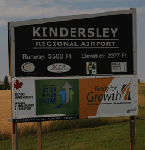
CYKY Kindersley Regional Airport is located in the west-central part of the province of Saskatchewan, Canada. The airport is located 4.6 km north of the town. The scenery consists of custom models of all the buildings at the airport, runway signs, runway and taxiway lighting, rotating beacon, static aircraft, vehicles, animated highway traffic and oil pump jacks, trees that properly change with the seasons, custom tarmac and runway textures, and seasonal ground textures for the airport and surrounding area.
| Filename: | CYKY__Kindersley_Regional_Airport_Saskatchewan_Can.zip |
| License: | Freeware |
| Added: | 14th June 2012, 13:44:10 |
| Downloads: | 1,289 |
| Author: | Gregory Putz |
| Size: | 84.58 MB |
| Category: Flight Simulator 2004 - Scenery | |
| Alexandra Airport , New Zealand. NZLX |
|
File Description:
Welcome to Alexandra,a small general aviation airport 2 nautical miles north-north-west of the small town of Alexandra.
The airport is home to the Central Otago Flying Club, and is also home to a number of GA aircraft and gliders.
Alexandra is located in the Central Otago region of the South island of New Zealand.
The scenery includes a GMAX photoreal Terminal/Flying Club building (textures included). Requires some EZ Scenery Object sets (see INSTALL instructions for details).
| Filename: | Alexandra_Airport__New_Zealand_NZLX.zip |
| License: | Freeware, limited distribution |
| Added: | 24th June 2008, 07:55:58 |
| Downloads: | 1,565 |
| Author: | Lawrie Roache / Jamie Marshall |
| Size: | 2.81 MB |


© 2001-2026 AVSIM Online
All Rights Reserved
Privacy Policy |