
Where Flight Simulation Enthusiasts Gather from Around the World!
AVSIM Library - Search Results

| Category: Flight Simulator 2004 - Scenery | |
| Grande Prairie CYQU in Alberta, Canada, Updated |

|
Images related to this file:
File Description:
This is a new version of the original post from March 2014, made in 2018. It was made mainly to provide some missing textures, but has been modified to also add parked trucks and floodlights to the de-icing area (the floodlights are inoperative as they will not be on when there is no de-icing in progress) and also street and car parking lighting, a few more parked planes, and some further objects on the terminal apron area. The runway approach lighting was also corrected; moving the airport so that the ILS on 29 did not coincide with the roads would have been nice, but meant too many complications at this stage. The scenery is complete in itself and can be installed as-is if you do not have the original post. Grande Prairie is at 2,195 feet asl, 65 miles southeast of Dawsons Creek, 90 miles southwest of Peace River and around 60 miles east of the Rockies. The town has a population of around 55,000 and growing. The name comes from the wide expanse of prairies all around the town, and there is also a large forested area to the southwest leading up to the Rockies which supplies raw material for industries in the town. The airport is just to the west of the town. It was originally a military base, built during WW2. The two runways are 07-25 and 11-29 and 6,200 and 6,500 feet respectively, both 200 feet wide; runway headings had changed by 2010 in real life but take this as it was in 2008. When one is the active runway then the other is used as a taxiway. Taxiway A is very wide with in real life a repaired central section marked out for use.
| Filename: | Grande_Prairie_CYQU_in_Alberta_Canada_Updated.zip |
| License: | Freeware, limited distribution |
| Added: | 13th December 2018, 04:12:11 |
| Downloads: | 209 |
| Author: | Roger Wensley |
| Size: | 34.97 MB |
| Category: Flight Simulator 2004 - Scenery | |
| Lismore Regional Airport (YLIS) |
|
File Description:
A very attractive small airport approximately 130 nautical miles from Coffs Harbour and a slightly shorter distance to Grafton and Ballina. This makes a good stopover for hopping down the east coast of Australia. The airport handles around 7 flight a day from Sydney and is also a busy GA aiport. A new terminal is a major feature of the airport with a very modern design. This terminal was opened on Dec 9 2000 and replaces an older style building to be found in the general aviation area. The terminal is at the northern end of the aiport and the GA area the furthest south.
The size of the airport has allowed me to put in that extra detail which makes the terminal and surrounds very much "as in real life". Photographic textures are used throughout for the buildings, trees and shrubs. Thanks to the cooperation of the airport manager and Lismore Council, the owners of the airport, a very accurate model of the airport has been produced from over 250 photographs taken on site. AFCAD and Traffic Tools files are included to add extra AI traffic. For that reason and because of limited apron space few static planes have been used. In addition a landclass is included to make the airport ground texture resemble the real thing and also to widen the river and show the lake to the east of the airport..
The scenery concentrates on adding a realistic terminal to the airport and hangars which are as close as possible to the real thing. Many other details have been added all authentically Lismore.
Some night lighting is included including some very distinctive airport lights in the car park.
| Filename: | Lismore_Regional_Airport_YLIS.zip |
| License: | Freeware |
| Added: | 11th April 2004, 06:31:42 |
| Downloads: | 3,677 |
| Author: | John Ross |
| Size: | 4.21 MB |
| Category: Flight Simulator 2004 - Scenery | |
| Bryce Canyon National Park (KBCE), Utah, Photo-Scenery |
|
Images related to this file:
File Description:
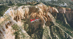
Bryce Canyon National Park (KBCE), Utah, Photo-Scenery (FS9 & FSX)
Despite its name, Bryce Canyon is not actually a canyon that was formed by a river, but rather a giant natural cliff shaped through erosion by wind, water, and ice. Bryce is distinctive due to its geological formations, delicate and colorful pinnacles called hoodoos that are up to 200ft high. The bizarre forms and red, orange and white colors of the rocks provide spectacular views. Unfortunately the hoodoos are too small for the elevation mesh in flight simulator. But you can enjoy the colors and shape of the cliffs. The cliffs in main region of the park, just south of the airport are partly covered
by snow. But on the southern and western part of the plateau you can enjoy them free of snow. Bryce Canyon is named after the Mormon pioneer Ebenezer Bryce who settled in this area in the 1850s. It was designated as a national park in 1928.
Bryce Canyon Airport (KBCE) just handles small aircraft on a daily basis. But is was actually built to handle larger aircraft in case of emergency. And so on Oct.6th 2000 an American Airlines MD-82 from Denver to Los Angeles made a successful emergency landing after reporting smoke in the cockpit and a loss of cabin pressure.
High resolution versions of this scenery for FS9 and FSX (much sharper, but larger and multiple downloads)are available at www.blueskyscenery.com/CNY_South2West4.html . The screenies are taken from the high-res versions, so expect this version to be slightly more blurry. Thanks to Joop Mak for providing a custom AFCADs that correct airport layouts so that they align with the photo-textures! They are available here: www.blueskyscenery.com/AFCADs.html . YourDonation@Work: Dedicated to Michael, Pat and Keith.
| Filename: | Bryce_Canyon_National_Park_KBCE_Utah_PhotoScenery.zip |
| License: | Freeware, limited distribution |
| Added: | 7th March 2010, 11:17:56 |
| Downloads: | 2,210 |
| Author: | Gottfried Razek, blueskyscenery.com |
| Size: | 96.35 MB |
| Category: Flight Simulator 2004 - Scenery | |
| Ballina, New South Wales, Australia (YBNA) |
|
File Description:
A very attractive small airport approximately 120 nautical miles from Coffs Harbour and a slightly shorter distance to Grafton and Lismore. This makes a good stopover for hopping down the east coast of Australia. The airport handles around 11 flight a day from Sydney and is also a busy GA aiport. Airlines REX and Qantas link fly into Ballina. The size of the airport has allowed me to put in that extra detail which makes to terminal and surrounds very much "as in real life". Photographic textures are used throughout for the buildings and even the trees and shrubs are hand made macros from photographs at the airport. Thanks to the cooperation of Northern Airline Services - Mr Bruce Beesley the MD and Graeme from Ballina Council the relative position of all of the buildings are exactly to scale as shown on scale drawings of the airport. AFCAD and Traffic Tools files are included to add extra AI traffic. For that reason and because of limited apron space no static planes have been used. In addition a landclass is included to make the airport ground texture resemble the real thing and also to widen the river behind runway 24. The scenery concentrates on adding a realistic terminal to the airport and hangars which are as close as possible to the real thing. Many other details have been added all authentically Ballina. The default runway detail remain unchanged with the exception of VASI placement. Other than that the airport merges into the default scenery without the usual "green oasis" effect. Full night lighting is included plus a rather dubious attempt to model the inside of the terminal (strictly not to be taken too seriously)
| Filename: | Ballina_New_South_Wales_Australia_YBNA.zip |
| License: | Freeware |
| Added: | 25th January 2004, 19:16:25 |
| Downloads: | 5,912 |
| Author: | John Ross |
| Size: | 6.8 MB |
| Category: Flight Simulator 2004 - Scenery | |
| KIAH - Houston Intercontinental Airport v3.0 |
|
File Description:
Flightlevel390 is proud to present to you KIAH-Houston's George Bush Intercontinental Airport version 3.0.This scenery was created using EZ-Scenery object placer & Flightones' Instant Scenery.This scenery WILL NOT work in FS X.This will work with Default FS9 terrain,although it is optimized for use with ultimate terrain...This will be the final project under the FL390 brandname,all projects hereafter will be with BSMP...
Includes the Main terminals,Continental Maintenence Base,FedEx cargo ramp,UPS cargo ramp,City cargo ramp,fuel farm by 15R,CFR building further down 15R,CFR Building along Rwy 9-27 taxiway,FBOs on both sides of the 33s,including the big Landmark Aviation FBO,static ground equipment & some custom made signs.Also includes full ramp night lighting,aircraft gate outline markings at each gate.
This version adds some more stuff and fixing some stuff that was noted in previous versions.This also fixes the blurries that some people had reported.
Features a very good and super accurate AFCAD file and decent rendition of the real airport layout.***
Most of the objects in this scenery are all default with some of our own custom made stuff and some objects from some 3rd party EZ Object Libraries and RWY12 Object Libraries.
***You will need to download the EZ-Scenery & RWY12 Object Libraries which can be had at avsim,flightsim.com and our own website available as single downloads instead of multiple seperate downloads.I also recomend that you install our recently released EZ-Object Library Installer which is available at flightsim.com and our own website in the downloads section.File name on flightsim.com is ( EZOLIv33.zip )....
Downloading the installer will ensure that you will have all of the fixed default textures from Sid Schwartz's default libraries....As always...Enjoy!!
| Filename: | KIAH__Houston_Intercontinental_Airport_v30.zip |
| License: | Freeware |
| Added: | 15th June 2008, 17:39:45 |
| Downloads: | 8,417 |
| Author: | Joe DeGregorio |
| Size: | 3.08 MB |
| Category: Flight Simulator 2004 - Scenery | |
| CYKF - Kitchener, Regional Muni of Waterloo - Ontario Canada |
|
Images related to this file:
File Description:
The town of Kitchener is in southern Ontario, 40 miles southwest of Toronto. The population is just over half a million, including the adjoining Cambridge and Waterloo which are known locally as the Tri Cities. The Kitchener name was adopted in 1916, replacing the former "City of Berlin".
The airport is on the northeastern side of the town, with the main runway aligned 08-26 and just over 7,000 feet of asphalt 150 feet wide, lit, with PAPI at both ends and approach lighting and ILS on 26. The second runway is aligned 14-32 and is 4,100 feet long, lit and with PAPI at both ends; right hand circuits for 32. The airport is being steadily enlarged and improved, with new hangars for rental, operators, and maintenance companies. The largest and most visible presence is the training operation located just off the southwest end of taxiway A, where there are 14 Cessna 172, 2 Cessna 152, 2 Piper Seminole, and others. These are represented in the AI. There are morning and evening scheduled flights by Westjet to Calgary and American Eagle to Chicago, also in the AI. To the southwest, past taxiway C, there is GA parking; request taxi to what is named here "southwest parking" where there are spaces on both grass and asphalt. To the southeast, along a taxiway off the southeast corner of the main apron, are mainly operators and maintenance facilities. This version of CYKF includes the new(ish) terminal, the first of the new central rental hangars alongside the new taxiway and access road, and the very new large hangar off taxiway C, but not the new airport services building (fire and snow clearance) that is off to the southeast of taxiway A, and not the new car park to the south of the airport access road. So an uncertain and possibly historically innacurate date, but with the correct taxiway lighting and signage, and building textures from photographs.
| Filename: | CYKF__Kitchener_Regional_Muni_of_Waterloo__Ontario.zip |
| License: | Freeware, limited distribution |
| Added: | 7th May 2016, 21:13:28 |
| Downloads: | 548 |
| Author: | Roger Wensley |
| Size: | 28.69 MB |
| Category: Flight Simulator 2004 - Scenery | |
| Port Hardy CAW5 in British Columbia, Canada |
|
Images related to this file:
File Description:
This is the sixth in a series of new and renovated float bases in BC. Port Hardy CAW5 is in a sheltered inlet on the northeast coast of Vancouver Island, close to the town and just 6 miles northwest of the Port Hardy airport. There is fuel (both JetA and 100LL) and also oil available, and the base acts as a refuelling centre for the other float bases in the neighbourhood. The dock is one-sided as the northern side borders a shallow area that is in fact exposed at low tide, as is most of the inlet to the south of BC Packers (adjacent to the float base, to the south). The parking along the dock is maximised by backing up each plane by hand so that it is close to the one behind it; this is not possible to replicate with AI in FS9 (watch the video). Watch out for the log boom on the other side of the inlet, it is there to protect fish farm "pools". The AI involves several Beavers and Otters, as listed in the AI folder. At Port Hardy all the AI works for both landing and takeoff for all of the planes, no matter what is the wind direction. There is a pic of the Supplement Port Hardy page, showing the two take-off and landing areas plus the third area that is to be used for take-off before 7am. All of these float bases can be installed together in the same folders, with a saving in duplicate textures. So a series called BC Floats (or whatever you want to call it) or individually installed float bases; your choice. The next in the series was suposed to be Sullivan Bay, another floating marina, but I digressed to Port Hardy and Port McNeill (next to be posted). The two hotels by the nearby marina are included. One of them gave me weird problems and I gave up on achieving the correct shape.
| Filename: | Port_Hardy_CAW5_in_British_Columbia_Canada.zip |
| License: | Freeware, limited distribution |
| Added: | 19th January 2017, 15:01:45 |
| Downloads: | 201 |
| Author: | Roger Wensley |
| Size: | 8.27 MB |
| Category: Flight Simulator 2004 - Scenery | |
| Airports Northern Coast Alaska (PALU, PPIZ, PAWI, AK03) |
|
Images related to this file:
File Description:
The town of Barrow is in the far north of Alaska, and these are coastal villages or radar installations to the west of Barrow, and there will be additions. Cape Lisburne is a gravel runway right next to the coast with radar gear and accomodation buildings close by, and what was called "Top Camp" at the end of a long and steep road to the top of a nearby hill, or mountain. The runway is lit, as are most of them in this area of long dark winter nights. Barrow is 270 miles to the northeast. Point Lay PPIZ used to have a radar installation as well as a village, but the old buildings have now been removed and the gravel runway 05-23 has been lengthened to 5,000 feet to serve the village throughout the year. The population is around 270, living mostly traditionally and with an annual beluga whale hunt. Barrow is 180 miles to the northeast.
Wainwright PAWI, some 80 miles southwest of Barrow and on the coast, has a population of around 570. The PAWI runway is just under 5,000 feet long and like PPIZ is aligned 05-23, lit, and with PAPI on each end. The original runway of some 2,000 feet is still visible next to the apron. Three miles to the southeast there is a third runway, at AK03, serving the Wainwright DEW station. It was decided in 2007 to close the station and to remove the buildings both there and at Point Lay because of subsidence, but everything at Wainwright was still in place in 2009 and beyond. The villages have been "sketched" as opposed to replicated exactly. The texture folder includes the missing car textures for Barrow PABR, and the AI is modified PABR to include passenger flights by Ravn and cargo flights by Northern Air Cargo, plus limited GA. There are no flattened grassed areas at these airfields; they are runways and taxiways and aprons on a bed of gravel on permafrost.
| Filename: | Airports_Northern_Coast_Alaska_PALU_PPIZ_PAWI_AK03.zip |
| License: | Freeware, limited distribution |
| Added: | 16th June 2016, 15:59:24 |
| Downloads: | 363 |
| Author: | Roger Wensley |
| Size: | 10.84 MB |
| Category: Flight Simulator 2004 - Scenery | |
| Bethel: Yukon Area |
|
Images related to this file:
File Description:
This presumes you have already installed Bethel PABE, Bethel Local Airfields, and Bethel St Mary's. In the Yukon River area of Alaska to the north of Bethel and to the south around the equally wide (but shorter) Kuskowim River there are small villages, served by flights from both Bethel PABE and St Mary's PASM. These villages are dependent upon fishing for survival, and in this flat and very wet terrain are equally dependent upon the gravel runways that link them to the outside world. There are no surfaced roads, and the rivers and their tributaries wind into the distance and are impractical delivery routes except from nearby places. In an area 300 miles by 200 miles most places cannot be described as "nearby". This post is of the small villages, including those previously posted; I had missed on picking up some terrain conflicts between nighttime grass and town textures. They are corrected here and included along with new airfields. Bethel and St Mary's are also reposted to include the further enlargement of parking for the increased number of small AI aircraft. These smaller airfields vary in quality; some have runway signage but most do not, and while some have two or even three hangars/garages/terminal buildings on the apron there are others who have none at all. The 39 small airfields included here are as listed:
Akiak AKI, Akiakchak Z13, Alakanuk AUK, Anvik PANV, Atmautluak 4A2, Cape Romanzof PACZ, Chefornak PACK, Chevak VAK, Eek EEK, Emmonak PAEM, Goodnews GNU, Grayling KGX, Holy Cross HCA, Hooper Bay PAHP, Kako 9AK2, Kalskag KLG, Kasigluk Z09, Kipnuk PAKI, Kongiganak PADY, Kotlik KOT, Kwethluk KWT, Kwigillingok A85, Marshall MLL, Mountain Village MOU, Napakiak WNA, Napaskiak PKA, Newtok PAEW, Nightmute IGT, Nunapichuk 16A, Pilot Station 0AK, Quinhagak PAQH, Russian Mission RSH, Scammon Bay SCM, Shageluk SHX, Sheldon Point SXP, Toksook Bay OOK, Tuluksak TLT, Tuntutuliak A61, Tununak 4KA.
I am currently going through the airfields again to check if further modifications are required, and I am also adding a few new ones. As I am going to be updating my computer I am posting now, complete or not, and I will post an update later of further additions.
| Filename: | Bethel_Yukon_Area.zip |
| License: | Freeware, limited distribution |
| Added: | 3rd May 2019, 17:20:53 |
| Downloads: | 170 |
| Author: | Roger Wensley |
| Size: | 6.3 MB |
| Category: Flight Simulator 2004 - Scenery | |
| CYCE - James T. Field Memorial at Centralia, Ontario, Canada V1 updated |
|
Images related to this file:
File Description:
This is an updated version of the original post, revising and adding to AI, parking, rear fences, paths from apron to hangar doors, etc. The Lockheed Constellation was downloaded from the web site California Classics, and with the knowledge and permission of Tom Gibson the modified plane is included here complete with its Air Alaska textures and a modified .cfg file so that it will imitate a lightly loaded plane and squeeze the landing run to suit the runway length of 10-28. The airfield is in southern Ontario, 55 miles west of Kitchener and 25 miles northwest of London, close to the shore of Lake Huron. The airfield is ex-military and was previously listed as Huron Airpark before being officially named the James T. Field Memorial; for me it will always be Huron Airpark. The field is owned by Goderich Aircraft Inc, a company that fits out aircraft with new interiors including instrumentation, seating, and paint schemes. Their main customers are business jet owners, which is why the AI here is oriented towards Lear etc. There are now two runways in use, the third being closed and marked as such (though still listed in the AI for you to select one to land on). The main runway is 10-28 and just over 5,000 feet. The second runway is 16-34 and 4,400 feet, with only identification numbers and centreline markings. There appear to be no apron lights, taxiway lights or runway signage currently installed. There is a small club hangar (and club room) adjacent to the main apron at the southern end, with GA parking, and there are two large hangars (one new) used by Goderich at the northern end. The remainder of the original large hangars are now in use as light industrial units unrelated to aviation, the most obvious of which is a garbage collection company with numerous parked garbage trucks. One of the hangars adjacent to the apron does incorporate what appears to be a new set of hangar doors (the red one) but it is unclear if this is actually in use for a plane. The control tower is no longer in use, and there is only limited snow clearance in the winter by Goderich; presumably they only clear it when they need to use it themselves.
| Filename: | CYCE__James_T_Field_Memorial_at_Centralia_Ontario_.zip |
| License: | Freeware, limited distribution |
| Added: | 24th November 2016, 22:20:37 |
| Downloads: | 325 |
| Author: | Roger Wensley |
| Size: | 13.92 MB |


© 2001-2026 AVSIM Online
All Rights Reserved
Privacy Policy |