
Where Flight Simulation Enthusiasts Gather from Around the World!
AVSIM Library - Search Results

| Category: Flight Simulator 2004 - Scenery | |
| Tofino CYAZ 2012 |

|
Images related to this file:
File Description:
I've always had a particular fondness for Tofino CYAZ, located on the west coast of Vancouver Island. I made my first Tofino scenery in 2005 using Lago's FSE, and an updated version in 2006 using EZ-Scenery. Neither of those included custom models. This final version is a complete, from-the-ground-up rebuild. Every building and many of the other scenery objects are custom made based on photos and using photo textures. (The images in the "Tour" folder will take you on a tour of the real and virtual airport.) In the time since the first two virtual versions were made, a new terminal building has been added to the east ramp at the real Tofino, along with some new hangers, and the scenery includes these changes. Tofino has an NDB instrument approach (CYAZ NDB A.pdf), but night operations are not allowed. For this reason the new terminal building has no night lighting. The golf clubhouse restaurant and pro shop are open after dark for your shopping and dining pleasure. This scenery represents many hours of work...I hope you enjoy it.
| Filename: | Tofino_CYAZ_2012.zip |
| License: | Freeware |
| Added: | 19th August 2012, 14:33:09 |
| Downloads: | 650 |
| Author: | Sidney Schwartz |
| Size: | 10.14 MB |
| Category: Flight Simulator 2004 - Scenery | |
| EPWA - Warsaw Chopin Airport - Warsaw, Poland ** UPDATED VERSION `` |
|
Images related to this file:
File Description:
EPWA WARSAW CHOPIN AIRPORT 2015 DEMO features an extremely detailed scenery of EPWA Chopin airport in Warsaw, Poland, fully compatible with FS2004.
This product is a fully functional DEMO version of the commercial payware product. It features same airport layout as in the full version but with limited 3D objects and low resolution textures. Using this free demo ensures no problems with online (VATSIM, IVAO, multiplayer etc.) flying in case some users use the payware scenery and some don't.
Warsaw Chopin Airport (WAW / EPWA) is is an international airport located in Warsaw, Poland's capital, which handles just under 40% of the country's air passenger traffic. There are two crossing runways (2800m and 3690m), a number of hangars, a cargo terminal and a passenger terminal, completely rebuilt in 2008-2015.
The product is equipped with an automatic installer, which means that the scenery will be automatically added to the Flight Simulator Scenery Library. Please uninstall all previous versions of this airport you may have installed before. Please make also sure that no duplicated AFCAD files are installed.
Enjoy your virtual flying with Drzewiecki Design!
| Filename: | EPWA__Warsaw_Chopin_Airport__Warsaw_Poland___UPDAT.zip |
| License: | Freeware, limited distribution |
| Added: | 4th March 2016, 15:54:50 |
| Downloads: | 1,038 |
| Author: | Drzewiecki Design |
| Size: | 15.67 MB |
| Category: Flight Simulator 2004 - Scenery | |
| Health Bay CAD7 in British Columbia, Canada |
|
Images related to this file:
File Description:
This is the fourth in a series of new and renovated float bases in BC. Health Bay is a small village on the west coast of Gilford Island, just 13 miles northwest of Minstrel Island (the previous post in this series). There is no fuel or oil available. The AI is a further adaptation of the original CF36 AI and involves a Baxter Beaver flying from Port Hardy on a round trip in the area through Port McNeill, Health Bay, Echo Bay, and Sullivan Bay. At Health Bay the AI appears to work for both landing and takeoff, though landing will still depend on wind direction. I have played with circuit height and runway length at Minstrel Island and there are improvements, so there is a Minstrel Island replacement bgl. All of these float bases can be installed together in the same folders, with a saving in duplicate textures. So a series called BC Floats (or whatever you want to call it) or individually installed float bases; your choice. The next in the series will be Echo Bay, shown in an included screenshot.
| Filename: | Health_Bay_CAD7_in_British_Columbia_Canada.zip |
| License: | Freeware, limited distribution |
| Added: | 18th January 2017, 01:15:57 |
| Downloads: | 175 |
| Author: | Roger Wensley |
| Size: | 4.63 MB |
| Category: Flight Simulator 2004 - Scenery | |
| Kona at Keahole International Airport PHKO |
|
File Description:
This is a completely new Kona, which is now more correctly laid out and very detailed. This is one of the most unique and beautiful airports in the world. It resembles a Hawaiian Village and Botanic garden combined, and is completey open air. The airport is built on old lava flows, and the terminal area is full of lava rock walls, which was probably mined while constructing the taxiways, tarmacs, and terminal itself. This scenery redoes the entire airport, and includes details like baggage carrousels, benches at the gate areas, check-in counters, parking lot shelters, and some purple baggage carts to go with the Island atmosphere. Since this airport has no jetways, I have created some new lower impact air stairs, and have positioned them around the two main gate areas. There is also a large air stair at each gate area to accommodate heavy jetliners. The unique ramp lights found at this airport are also included as well as some interesting night lit ramp textures. It has not been tested in FS2002.
| Filename: | Kona_at_Keahole_International_Airport______PHKO.zip |
| License: | Freeware |
| Added: | 16th January 2004, 14:14:35 |
| Downloads: | 6,781 |
| Author: | Bill Melichar |
| Size: | 5.52 MB |
| Category: Flight Simulator 2004 - Scenery | |
| Grafton District Airport - NSW Australia |
|
File Description:
A delighful small airport approximately 80 nautical miles from Coffs Harbour and a slightly shorter distance to Ballina and Lismore. This makes a good stopover for hopping down the east coast of Australia.
The size of the airport has allowed me to put in that extra detail which makes to terminal and surrounds very much "as in real life". Photographic textures are used throughout for the buildings and even the trees are hand made macros from photographs at the airport.
AFCAD and Traffic Tools files are included to add extra AI traffic. For that reason and because of limited apron space no static planes have been used.
The scenery concentrates on adding a realistic terminal to the airport whilst leaving much of the default runway detail unchanged. Changes which have been made to the runway include tidying up the taxi way fillets so the markings do not appear to be on the grass and the windsocks have been replaced with macros designed to resemble the Grafton windsocks. Other than that the airport merges into the default scenery without the usual "green oasis" effect.
| Filename: | Grafton_District_Airport__NSW_Australia.zip |
| License: | Freeware, limited distribution |
| Added: | 5th December 2003, 04:29:01 |
| Downloads: | 2,547 |
| Author: | John Ross |
| Size: | 2.1 MB |
| Category: Flight Simulator 2004 - Scenery | |
| Kremmling, Mc Elroy (20V), Colorado, Photo-Scenery |
|
Images related to this file:
File Description:

Kremmling, Mc Elroy (20V), Colorado, Photo-Scenery (FS9 & FSX)
Ever wanted to know how the scenery looks like around Kremmling VOR? Now you got the chance! This region covers the area around Kremmling and the northern part of the Gore Range. At Kremmling the Colorado River meets both the Blue River and the Muddy Creek. West of Kremmling you can see Gore Canyon. This rugged and steep canyon is almost 1000ft deep and was carved by the Colorado River on its way thru the Gore Range.
To explore the scenery depart from Mc Elroy Airfield (20V) in Kremmling and head north. High resolution versions of this scenery for FS9 and FSX (much sharper, but larger and multiple downloads) are available at www.blueskyscenery.com/GNB_West.html . The screenies are taken from the high-res versions, so expect this version to be slightly more blurry. Thanks to Joop Mak for providing custom AFCADs that correct airport layouts so that they align with the photo-textures! They are available at www.blueskyscenery.com/AFCADs.html . YourDonation@Work: Dedicated to Michael.
| Filename: | Kremmling_Mc_Elroy_20V_Colorado_PhotoScenery.zip |
| License: | Freeware, limited distribution |
| Added: | 21st April 2010, 17:39:09 |
| Downloads: | 1,141 |
| Author: | Gottfried Razek, blueskyscenery.com |
| Size: | 91.2 MB |
| Category: Flight Simulator 2004 - Scenery | |
| Zion National Park South, Hurricane (1L8), Colorado City (KAZC), Utah/Arizona, Photo-Scenery (FS9 & FSX) |
|
Images related to this file:
File Description:
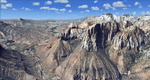
Covers the southern part of Zion National Park extends south along the cities of Hurricane and Colorado City. Zion National Park is another place where erosion of the Colorado Plateau formed the most beautiful colorful stone formations of unique and wonderful shapes. There are nine different layers of stone visible in the park. Most of them consist of sandstone. But there is also limestone, gypsum, siltstone, shale, clay and mudstone. The Virgin River cut a spectacular and famous canyon thru Zion Park that is as narrow as 20ft and up to 2000ft tall.
High resolution versions of this scenery for FS9 and FSX (much sharper, but larger and multiple downloads)
are available at www.blueskyscenery.com/CNY_South3West5.html . The screenies are taken from the high-res versions,
so expect this version to be slightly more blurry. Thanks to Joop Mak for providing custom AFCADs that
correct airport layouts so that they align with the photo-textures! They are available at www.blueskyscenery.com/AFCADs.html . YourDonation@Work: Dedicated to Jerry, Ralph J. and Lance.
| Filename: | Zion_National_Park_South_Hurricane_1L8_Colorado_Ci.zip |
| License: | Freeware, limited distribution |
| Added: | 20th March 2010, 23:26:42 |
| Downloads: | 1,787 |
| Author: | Gottfried Razek - blueskyscenery.com |
| Size: | 95.39 MB |
| Category: Flight Simulator 2004 - Scenery | |
| Bornholm Island 2011 DEMO |
|
Images related to this file:
File Description:

BORNHOLM ISLAND 2011 DEMO features an extremely detailed scenery of Bornholm Island and EKRN Ronne airport in Denmark, fully compatible with FS2004.
It's a fully functional DEMO version of the commercial payware product. It features same airport layout as in the full version but with limited 3D objects and low resolution textures. Using this free demo ensures no problems with online (VATSIM, IVAO, multiplayer etc.) flying in case some users use the payware scenery and some don't.
Bornholm is an island located in the Baltic Sea 37 km south of Sweden and the north of Poland. Bornholm Airport (RNN / EKRN) is a Danish airport located 2.7 nautical miles (5 km) southeast of Ronne.
It's equipped with an automatic installer, which means that the scenery will be automatically added to the Flight Simulator Scenery Library.
Please uninstall all previous versions of this airport you may have installed before. Please make also sure that no duplicated AFCAD files are installed.
Enjoy your virtual flying with Drzewiecki Design!
| Filename: | Bornholm_Island_2011_DEMO.zip |
| License: | Commercial demo |
| Added: | 5th September 2015, 01:09:19 |
| Downloads: | 3,607 |
| Author: | Drzewiecki Design |
| Size: | 12.75 MB |
| Category: Flight Simulator 2004 - Scenery | |
| Airports of Iran V1.1 |
|
Images related to this file:
File Description:

This package creates a simple basic scenery of airports of Iran and it is purposed to have the maximum technical match with the reality, not necessarily the exact scenery textures. The most of Iranian airports in FS2004 have a very poor, out of date and incomplete design, some are only a runway and some do not even exist! No model design has been performed using for this package and all the scenery objects are the available free-ware objects on the online libraries. The main purpose of PERSIAN-SIM | Airports of Iran is to create a maximum match of the airports technical elements with the reality, e.g. the size and location of the buildings, dimensions and distances of runways, taxiways, aprons, stands, gates etc. and also airports lighting systems and NAVAIDs. The technical information including Comm. Frequencies, navigation systems, NAVAIDs, TWYs and RWYs characteristics and dimensions are designed and updated using Iran AIP and other valid up-to-date aviation resources. Special thanks to John Stinstrom and Sidney Schwartz for their permission and helps.
| Filename: | Airports_of_Iran_V11.zip |
| License: | Freeware, limited distribution |
| Added: | 15th January 2013, 17:27:17 |
| Downloads: | 2,616 |
| Author: | Behnam Zamani / PERSIAN-SIM |
| Size: | 25.88 MB |
| Category: Flight Simulator 2004 - Scenery | |
| The Greater Toronto Area Part 1 |
|
File Description:
Part 1 of Flight Ontario's scenery for the Greater Toronto Area and Southern Ontario.
Over a year in the making, this scenery for Fs 2002 and Fs 2004 is bounded by Detroit in the west, Kingston in the east, Huntsville in the north and Buffalo in the south and features:
* all-season scenery
* custom water textures
* completely modelled Toronto Airports...CYTZ (Toronto Island) and CYZD
(Downsview-home to Bombardier Aerospace and the Canadair Regional Jet
and Dash-8, and the Toronto Aerospace Museum)
* custom autogen for the GTA
* Custom landclass for southern Ontario
* custom shorelines (western Lake Ontario, Kingston area, Lake
Couchiching...Severn River...Sparrow Lake area, and the Muskoka Lake
area)
* prominent features around Hamilton include the Burlington Skyway and
Lift Bridge and steel mills
* the Welland Canal is featured with lift bridges, bascule bridge and
fixed link bridge from Pt Weller to Pt Colborne
* the Niagara area includes the Minolta Tower, and 3 hydro generating
plants with reservoirs
* compatibility with SimFlyers CYYZ
This scenery is downloadable in two parts and both parts are essential
| Filename: | The_Greater_Toronto_Area__Part_1.zip |
| License: | Freeware |
| Added: | 9th April 2004, 12:40:02 |
| Downloads: | 37,181 |
| Author: | Flight Ontario |
| Size: | 62.09 MB |


© 2001-2026 AVSIM Online
All Rights Reserved
Privacy Policy |