
Where Flight Simulation Enthusiasts Gather from Around the World!
AVSIM Library - Search Results

| Category: Flight Simulator 2004 - Scenery | |
| Arviat CYEK in Nunavut, Canada |

|
Images related to this file:
File Description:
Arviat is a small town on the west coast of Hudson Bay in Nunavut, around 90 miles south of Whale Cove, 130 miles south of Rankin Inlet, and 160 miles north of Churchill. The airfield is just south of the town, and the 4,000 feet of gravel runway is aligned 149T/329T; these are true bearings and not magnetic as Arviat is just inside the Northern Domestic Airspace zone. There is 100LL fuel available in drums, with 2 hours prior notice. The visiting AI airline is Calm Air, plus a cargo delivery by Buffalo Air. As a town of 2,200 people is too large to model I have used a landclass with autogeneration. The result includes some trees, which is not realistic, but there was no way out. There is a special note in the instructions regarding Flight Ontario replacement textures and "glowing" gravel aprons.
| Filename: | Arviat_CYEK_in_Nunavut_Canada.zip |
| License: | Freeware, limited distribution |
| Added: | 6th January 2012, 16:13:45 |
| Downloads: | 508 |
| Author: | Roger Wensley |
| Size: | 2.19 MB |
| Category: Flight Simulator 2004 - Scenery | |
| Torrey, Box-Death Hollow Wilderness, Aquarius Plateau, Utah, Photo-Scenery (FS9 & FSX) |
|
Images related to this file:
File Description:
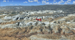
The southern part of this region covers the Box-Death Hollow Wilderness, with its vertical gray-orange walls of Navajo sandstone. Then comes the Aquarius Plateau which is the highest timbered plateau in North America with Boulder Mountain. In the north you'll find the little town of Torrey, which is just eight miles west of Capitol Reef National Park. Extends my Grand Staircase Escalante scenery to the north.
High resolution versions of this scenery for FS9 and FSX (much sharper, but larger and multiple downloads) are available at www.blueskyscenery.com/CNY_SouthWest3.html . The screenies are taken from the high-res versions, so expect this version to be slightly more blurry.
Thanks to Joop Mak for providing a custom AFCADs that correct airport layouts so that they align with the photo-textures! They are available here: www.blueskyscenery.com/AFCADs.html . YourDonation@Work: Dedicated to Ralf-Peter, Jon and Laurent.
| Filename: | Torrey_BoxDeath_Hollow_Wilderness_Aquarius_Plateau.zip |
| License: | Freeware, limited distribution |
| Added: | 3rd April 2010, 00:52:09 |
| Downloads: | 1,205 |
| Author: | Gottfried Razek - blueskyscenery.com |
| Size: | 93.79 MB |
| Category: Flight Simulator 2004 - Scenery | |
| Omni Aviation School and PhilipinesAirlines Flight Trianning Center AFCAD and Scenery |
|
File Description:
Manny Aquino for the acacia and acacia tree textures
OMNI AVIATION- www.omni-aviation.com
Tonet, Mike B and Pecorino for identifying the trees in front of the omni barracks and for identifying a missing taxiway. :-)
My cousin Spike Acenas for taking pictures of the airport.
Ina Patrimonio for taking some of the PFSGers up in an aerial tour around Clark last Feb 17 2002. :-)
Dennis T. for more OMNI pics.
Capt's: Ina Patrimonio, Joy Roa, Jessica Horne & Rene Mapua.
Installation:
Copy the OMNI folder to your FS2002/scenery/ folder and activate the scenery in FS2002.
Happy flying!
Clark Intl Airport AFCAD with Omni Aviation School and Philipines Airlines Flight Trianning Center.They also use Clark Tower to make Communication when their Aircraft wanna take off and landing. Its Pattern is on Right Hand Side at 700ft and their Parking Ramps are just for Cessna,Piper or Beech Craft!
| Filename: | Omni_Aviation_School_and_PhilipinesAirlines_Flight.zip |
| License: | Freeware |
| Added: | 15th November 2003, 05:28:34 |
| Downloads: | 962 |
| Author: | Peter Binamira(Scenery) and Cadmus Lee( AFCAD ) |
| Size: | 1.14 MB |
| Category: Flight Simulator 2004 - Scenery | |
| Kerkira Airport Enhancement |
|
File Description:
This is old scenery which has been updated for FS2004 and enhances the visual environment of Ionian sea island airport of Kerkira, also known as Corfu. Its part of my “Greek Airfields” package that currently is not fully compatible with FS2004 since MS decided to move the airports in Greece and elsewhere to adjacent positions and ASD, which I use for placing these objects, is not compatible with FS2004. Here you will find airport & terrain enhancements for Hellenic airport of Kerkira LGKR that make it look closer to the real one; hotels, runway turning bay, perimeter fences, windsocks, radio antennae, new approach radar antenna to the southwest and most importantly, an exclusion of autogen scenery that is wrongfully generated on each side of the runway. A big difference is attributed to Babis Peribolas’s Kerkira mesh terrain that is included in this scenery. Scenery includes the necessary ASD 2.1 textures.
| Filename: | Kerkira_Airport_Enhancement.zip |
| License: | Freeware, limited distribution |
| Added: | 4th September 2003, 02:23:06 |
| Downloads: | 12,182 |
| Author: | Kyprianos Biris |
| Size: | 1.94 MB |
| Category: Flight Simulator 2004 - Scenery | |
| EDCP Military Airfield Peenemunde (New Version) |
|
Images related to this file:
File Description:
The airfield Peenemunede is the one field of a row of military airfield sceneries of the former NVA. In the scenery are included the airfield and the technical supplies.
The airfield was put into operation in 1961 in duty of the NVA (National People's Army). It accommodated the 9th fighter wing with Mig-21 and MiG-23 aircraft.
New Version News: new seasonal textures, 2 new military bases (Navy, airforce), reworked ground layout, reworked airfield layout, new 3D objects (old powerplant etc.), new night lighting, static MiG-23, reworked isles of Ruden and Oi.
Peenemünde Airfield (IATA: PEF, ICAO: EDCP) is an airfield along the Baltic Sea north of Peenemünde, Germany. Today round trips in light aircraft take place from here and bus tours are also available. Because of its long runway the airfield is also a popular location for flight schools.
| Filename: | EDCP_Military_Airfield_Peenemunde_New_Version.zip |
| License: | Freeware |
| Added: | 4th May 2012, 15:38:21 |
| Downloads: | 1,794 |
| Author: | Volker Loew, Frithjof Koch |
| Size: | 10.77 MB |
| Category: Flight Simulator 2004 - Scenery | |
| FinneyGround_Fences |
|
File Description:
This collection features the Gmax fencing objects and textures by Robert "Lt.Finney" Finnegan, and the Gmax Crosshairs_Plus created by myself, Gary "Gman" Mills.
In Gmax, I added 10m sections of 3 types of Rob's fencing to my Crosshairs_Plus to make it easier to see the centering point and the edge of the fence in their exact positions.
I call the results the Crosshairs_Plus_Fence ( CH+F ).
The fence sections for the Rwy12 sets were cloned from the fence sections of the CH+F in GMax, and moved in a computer aided perfect straight line to the right, from a perfectly centered CH+F.
They are as accurate as I can get them, the rest is in your calibration of your joystick.
With a little patience and a lot of joystick calibration, the set works pretty good.
They are not perfect, but they will do until something better comes along!
Enjoy!
| Filename: | FinneyGround_Fences.zip |
| License: | Freeware, limited distribution |
| Added: | 25th September 2005, 14:21:01 |
| Downloads: | 5,247 |
| Author: | Robert Finnegan Gary Mills |
| Size: | 3.26 MB |
| Category: Flight Simulator 2004 - Scenery | |
| Honolulu International Airport PHNL |
|
File Description:
This scenery completely redoes the Honolulu Airport, which is the main stop over between the East and West, and the largest airport in the Central Pacific. Included here you will find the main terminal, the Inter-Island terminal, fuel storage tanks, 39 gates with jetways, plus numerous other parking spaces, three different hangar / cargo areas, parking structures and the park like landscaping on the front side of the airport, realistic ramp lights, ramp light parking textures, airport vehicles, the Aloha Tower, and the numerous Coconut Palms which welcome you at every turn at this airport. Due to it's large size, I have provided two scenery density settings, so you can eliminate all objects in front of the airport which are not seen from airside, and balance it between traffic and scenery density to get the best frame rates on your particular computer. This scenery should also be completely compatible with FS2002.
| Filename: | Honolulu_International_Airport_PHNL.zip |
| License: | Freeware |
| Added: | 10th December 2003, 04:56:16 |
| Downloads: | 42,319 |
| Author: | Bill Melichar |
| Size: | 4.91 MB |
| Category: Flight Simulator 2004 - Scenery | |
| Mielec EPML 2009 |
|
Images related to this file:
File Description:
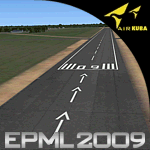
This is third version of EPML airport scenery. Main features of the scenery are: Airport ground high resolution textures - (four seasons + night textures); Highly detailed 3D objects, all photo textured; Detailed autogen and photorealistic trees. For more details please look at the README file attached to the scenery file.
EPML is home base of PZL-Mielec (Polskie Zaklady Lotnicze - Polish Aviation Works), formerly WSK-Mielec and WSK "PZL-Mielec" is the Polish aerospace manufacturer, based inMielec. It has been the biggest Polish post-war aerospace manufacturer. In 2007 it was acquired by Sikorsky Aircraft Corporation, retaining the brand.Starting from 1950, the factory developed much and became the biggest Polish aircraft producer. It was a licensed producer of the Soviet jet fighters MiG-15 (produced as Lim-1), MiG-15bis (Lim-2), MiG-17 (Lim-5) and its Polish attack variant, Lim-6. The first Lim-1s were manufactured of Soviet parts in 1952, a full-scale production started in 1953. About 1500 Lims were built by 1964. In 1957-1960 there were also produced 250 Polish-designed piston trainers TS-8 Bies. From 1963 there was produced Polish-designed jet trainer TS-11 Iskra, being a basic trainer in the Polish military aviation. Its successor, designed with a part of PZL-Mielec, the PZL I-22 Iryda, appeared however a failure for different reasons, mostly lack of proper funding, and only a small series was built.
The most numerous plane built in Mielec was the licensed Soviet Antonov An-2 utility biplane, produced from 1960 in different variants. Over 13,000 of these aircraft were manufactured by 1991, mostly on the Soviet order, but also used in Poland and exported to other countries. From 1984 PZL-Mielec manufactured Soviet STOL transport planes Antonov An-28, as its only producer in the world. The plane was subsequently developed in Mielec and in a modernized variant PZL M-28 Skytruck/Bryza is offered for the Polish Army, Polish Navy and services abroad, with some success.
| Filename: | Mielec_EPML_2009.zip |
| License: | Freeware |
| Added: | 15th May 2010, 09:47:41 |
| Downloads: | 3,780 |
| Author: | Marcin Bobro, Kuba Paczek |
| Size: | 56.33 MB |
| Category: Flight Simulator 2004 - Scenery | |
| EPGO Goraszka 2010 - The Airshow Challenge |
|
Images related to this file:
File Description:
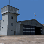
EPGO Goraszka 2010 - The Airshow Challenge is a freeware, extremely detailed scenery of a general aviation airport located 12nm (20km) south-east of Warsaw downtown and Warsaw Frederic Chopin International Airport, Poland. EPGO Goraszka airfield was built in 1994 and currently belongs to a General Aviation company, which offers aero-taxi flights, air transport and special flights (air photo, patrol) and airport services. The airport has a 800m-long runway and a lightened helipad, which can be used by helicopters of up to 5700kg weight. General Aviation's fleet includes Antonov AN-2, PZL-104 Wilga 80, Bell 407 and 427. Since 1996 the International Air Picnic Goraszka is organized every year by the "Polish Eagles" foundation created on initiative of Zbigniew Niemczycki.
The scenery is equipped with an automatic installer. Currently we support a safe, manual way of adding new sceneries to the Scenery Library in Flight Simulator. This is just one thing users need to do for themselves. Detailed instructions will be given during the installation process.
Scenery features:
-Compatible with FS2004 only
-Highest level of accuracy in geographic positioning, modeling and texturing
-Incredibly high quality photoreal textures of all airport buildings. Textures are based on over 300 real world -photographs made for this project.
-Hundreds of 3D objects like tents, exhibitions, airport buildings and surrounding buildings
-Life in the airport: people and cars will enhance your feelings
-AI traffic, animations and effects, designed specifically for FS2004
-Some buildings include interior (control tower)
-High quality aerial photos of the airport surroundings (5 seasons + night) with autogen and water mask
-Ultra high quality aerial photos of the airport (with seasons)
-Plain airport scenery with no airshow objects available too (details in the manual)
-Product includes manual and airport charts in PDF format
EPGO Goraszka 2010 - The Airshow Challenge scenery is compatible with almost every payware add-on, including Ultimate Terrain Eastern Europe and Warsaw Photo Scenery by Simdesign.
Scenery by Drzewiecki Design - www.drzewiecki-design.net
| Filename: | EPGO_Goraszka_2010__The_Airshow_Challenge.zip |
| License: | Freeware |
| Added: | 14th July 2010, 09:49:07 |
| Downloads: | 3,756 |
| Author: | Drzewiecki Design - Stanislaw Drzewiecki, Jakub Paczek |
| Size: | 132.03 MB |
| Category: Flight Simulator 2004 - Scenery | |
| Cache Creek CAZ5 in British Columbia Canada |
|
Images related to this file:
File Description:
Cache Creek is a small village of around 1,000 folks on the eastern side of the Coast Mountains of British Columbia, around 70 miles northeast of Pemberton and 40 miles west of Kamloops. The village is in a valley bottom and recently suffered from severe flooding due to the overflow of the river. The airfield is high above the town, with a runway aligned 15-33 and 3,280 feet of asphalt, without runway or taxiway lighting; hence "airfield" as opposed to "airport". I have posted it as Cache Creek CAZ5, but I suggest that you revise the name to perhaps "BC airfields" and just load my future airfield posts into the same scenery and texture folders to avoid the inevitable doubling up of common textures etc. Plus that way you will have just one FS9 library post to do and new airfields will not need yet another posting. Up to you. If you find a defect, email me.
| Filename: | Cache_Creek_CAZ5_in_British_Columbia_Canada.zip |
| License: | Freeware, limited distribution |
| Added: | 18th November 2020, 01:21:22 |
| Downloads: | 96 |
| Author: | Roger Wensley |
| Size: | 9.27 MB |


© 2001-2026 AVSIM Online
All Rights Reserved
Privacy Policy |