
Where Flight Simulation Enthusiasts Gather from Around the World!
AVSIM Library - Search Results

| Category: Flight Simulator 2004 - Scenery | |
| San Jose Costa Rica Intl. Airport |

|
File Description:
FS2004 Scenery of San Jose Costa Rica.(MROC)
Juan Santamaria Intl. Airport. The main
airport in Costa Rica.
This is the fourth release for this scenery. It has many improvements; The new rotating radar,
Cargo Terminals, photoreal local ground vehicules,Animated frequency controlled gates, dynamic
ground vehicules,Night Lighting, Completely reworked photorealistic textures, signs,
new taxiways, hangars. It is aligned with the default scenery to avoid conflict with online flying. AFCAD file included. Frame rate friendly
| Filename: | San_Jose_Costa_Rica_Intl_Airport.zip |
| License: | Freeware, limited distribution |
| Added: | 3rd May 2004, 02:09:28 |
| Downloads: | 21,655 |
| Author: | Rodrigo Gonzalez |
| Size: | 6.35 MB |
| Category: Flight Simulator 2004 - Scenery | |
| Pirate's Cove Caribbean Hideaway |
|
File Description:
Welcome to Pirate's Cove, a small tourist hideaway located on the island of St. Kitts in the Caribbean. A fun, laid back place to spend the day and home to the Treasure Chest Bar and grill, a party spot wellknown by the locals, springbreakers and elite tourists. With plenty of dock space for boats, and a lighted runway servicing mid to small props with connections to St Kitts main airport. Features custom objects, textures and nightlighting.
| Filename: | Pirates_Cove_Caribbean_Hideaway.zip |
| License: | Freeware |
| Added: | 11th September 2003, 04:32:37 |
| Downloads: | 10,229 |
| Author: | Michael Carr - MCDesigns 2003 |
| Size: | 5.19 MB |
| Category: Flight Simulator 2004 - Scenery | |
| Hutchinson Municipal KHUT |
|
Images related to this file:
File Description:
FS2004 Scenery-Hutchinson Municipal Airport (KHUT), Ks serves Hutchinson and Reno County and is owned by the City Of Hutchinson. The airport has more than one runway. The longest is a paved runway extending 7001 feet. The facility is at an elevation of 1542 feet at a distance of about 3 miles from Hutchinson. Scenery Created with FSDS3, Lago's FSE, EZ Scenery and Rwy12. FSDS3 textures included. Must download EZ Scenery and Rwy12 libraries. AFCAD2 and Traffic Tools flight plans included.
| Filename: | Hutchinson_Municipal_KHUT.zip |
| License: | Freeware |
| Added: | 24th April 2006, 02:54:20 |
| Downloads: | 666 |
| Author: | John B. Loney, Jr. |
| Size: | 909.15 KB |
| Category: Flight Simulator 2004 - Scenery | |
| Princeton 2005 |
|
Images related to this file:
File Description:
FS2004 Scenery-A completely reworked Princeton Airport with FSDS2, Rwy12 and Lago's FSE. Princeton Airport(39N) serves Princeton/Rocky Hill and Somerset County NJ and is owned by Princeton Aero Corp. The paved runway extends for 3099 feet. The facility is at an elevation of 125 feet at a distance of about 3 miles from Princeton/Rocky Hill/. Requires AFCAD2, Traffic Tools v2.0, and Nova and Nova Gold textures. Rwy12 and FSE recommended for full effect. By John B. Loney, Jr
| Filename: | Princeton_2005.zip |
| License: | Freeware, limited distribution |
| Added: | 17th May 2010, 22:04:49 |
| Downloads: | 903 |
| Author: | John B. Loney, Jr. |
| Size: | 1.38 MB |
| Category: Flight Simulator 2004 - Scenery | |
| Quonset State Airport KOQU |
|
Images related to this file:
File Description:
Re-upload. FS2004 Scenery-Quonset State Airport (KOQU) serves North Kingstown and Washington County and is owned by Rhode Island Airport Corp. The airport has more than one runway. The longest is a paved runway extending 7998 feet. The facility is at an elevation of 19 feet at a distance of about 3 miles from North Kingstown. Standard and custom textures included. Must have AFCAD2, Traffic Tools, Rwy12 and Lago's FSE for full effect. Main creation with FSDS2. By John B. Loney, Jr.
| Filename: | Quonset_State_Airport_KOQU.zip |
| License: | Freeware, limited distribution |
| Added: | 7th June 2010, 08:28:26 |
| Downloads: | 1,079 |
| Author: | John B. Loney, Jr. |
| Size: | 1.2 MB |
| Category: Flight Simulator 2004 - Scenery | |
| Pearly Beach Airfield, South Africa |
|
Images related to this file:
File Description:
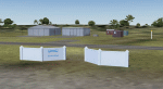
A Gmax representation of Pearly Beach Airfield, Western Cape, South Africa with photoreal textures. Pearly Beach airfield is a small privately owned airfield between the towns of Pearly Beach and Gansbaai in South Africa. Bearly Beach and Gansbaai are both very well known tourist spots for whale watching and even shark-cage diving with Great Whites which are regularly seen just of the coast. The runway is aligned 30/12 and measures 838m x 9m. Even the animated windpump is included.
| Filename: | Pearly_Beach_Airfield_South_Africa.zip |
| License: | Freeware, limited distribution |
| Added: | 24th February 2017, 19:46:06 |
| Downloads: | 246 |
| Author: | Kobus van Wyk, Aeroworx |
| Size: | 1.55 MB |
| Category: Flight Simulator 2004 - Scenery | |
| University of Illinois Willard Champaign |
|
File Description:
FS2004 Scenery-Willard Airport is one of only a handful of commercial airports in the country owned and operated by an educational institution. Willard Airport, often referred to by its FAA designation "CMI," was named for former University of Illinois president Arthur Cutts Willard. Formal dedication of the airport took place on October 26, 1945 with the first scheduled airline service in 1954. This scenery was created with FSDS2, Rwy12 and Lago's FSE. Textures, Modified AFCAD2 file and AI traffic file included.
| Filename: | University_of_Illinois_Willard_Champaign.zip |
| License: | Freeware |
| Added: | 12th August 2005, 19:50:35 |
| Downloads: | 1,353 |
| Author: | John B. Loney, Jr. |
| Size: | 1.97 MB |
| Category: Flight Simulator 2004 - Scenery | |
| Flying Cloud Airport KFCM |
|
File Description:
FS2004 Scenery-Flying Cloud Airport (KFCM) serves Minneapolis and Hennepin County and is owned by Metropolitan Airport Cmsn. The airport has more than one runway. The longest is a paved runway extending 3909 feet. The facility is at an elevation of 906 feet at a distance of about 11 miles from Minneapolis. This scenery was created using FSDS3, EZ Scenery, Rwy12, Lago's FSE and AFCAD2 and Traffic Tools.Objects placed with slightly different method. Please read readme file. Some textures included.
| Filename: | Flying_Cloud_Airport_KFCM.zip |
| License: | Freeware |
| Added: | 7th January 2006, 20:59:06 |
| Downloads: | 1,203 |
| Author: | John B. Loney, Jr. |
| Size: | 2.17 MB |
| Category: Flight Simulator 2004 - Scenery | |
| KDYS - Dyess AFB - Abilene, Texas |
|
Images related to this file:
File Description:

Dyess Air Force Base is located approximately 7 miles (11km) southwest of Abilene, Texas. It is home to the 7th Bomb Wing, which consists of four groups of which two squadrons, the 9th and 28th, fly the B-1B. In addition, the 28th Bomb Squadron is the Air Force schoolhouse for all B-1B aircrew members. Scenery contains photo-real all-season ground textures as well as custom objects. Scenery is stand-alone but additional downloads may be useful (see readme.doc for details).
| Filename: | KDYS__Dyess_AFB__Abilene_Texas.zip |
| License: | Freeware, limited distribution |
| Added: | 25th January 2015, 07:13:19 |
| Downloads: | 1,407 |
| Author: | John Stinstrom |
| Size: | 6.82 MB |
| Category: Flight Simulator 2004 - Scenery | |
| FAPF - Piet Retief Airfield - Mpumalanga, South Africa |
|
Images related to this file:
File Description:
A Gmax representation of Piet Retief Airfield, Mpumalanga, South Africa with photoreal textures.
Piet Retief airfield is a small airfield with a grass/dirt runway measuring 1 371m. The airfield is situated between the trees of the lush Sappi forests between the town of Piet Retief and the Swaziland border at an elevation of 4 420ft. There is an NDB for a "Breakcloud" procedure onto rwy 15. An animated water-truck will also raom around the area in case of forest fires.
| Filename: | FAPF__Piet_Retief_Airfield__Mpumalanga_South_Afric.zip |
| License: | Freeware, limited distribution |
| Added: | 1st August 2014, 10:56:40 |
| Downloads: | 423 |
| Author: | Kobus van Wyk, Aeroworx |
| Size: | 3.67 MB |


© 2001-2026 AVSIM Online
All Rights Reserved
Privacy Policy |