
Where Flight Simulation Enthusiasts Gather from Around the World!
AVSIM Library - Search Results

| Category: Flight Simulator 2004 - Scenery | |
| Attawapiskat CYAT in northern Ontario, Canada |

|
Images related to this file:
File Description:
Attawapiskat is on the north bank of the river of the same name, around 7 miles upstream from where the river meets the west shore of James Bay at its mid point. The top end of the Bay is around 140 miles north, Moosonee is around the same to the south, and the east shore 140 miles to the east. The town has a population of around 1,600, although this varies with the seasons as hunting and the traditional way of life on the land is still important to the Cree-speaking inhabitants. The airport is just to the north of the town with a gravel runway almost 3,500 feet long, and I have included the recently installed PAPI. The Canada Flight Supplement does not say anything about fuel being available so I presume the tanks beside the apron are no longer in use. There is also no apron lighting, unless it has been installed recently. There are flights by Air Creebec and by several other smaller airlines and I have included both Air Creebec and Wasaya; their textures are available for download and the planes are as listed in the AI folder.
| Filename: | Attawapiskat_CYAT_in_northern_Ontario_Canada.zip |
| License: | Freeware, limited distribution |
| Added: | 3rd January 2013, 01:37:50 |
| Downloads: | 376 |
| Author: | Roger Wensley |
| Size: | 3.54 MB |
| Category: Flight Simulator 2004 - Scenery | |
| Tampa General Aviation Airports |
|
File Description:
Tampa General Aviation Airports for FS9
Tampa has three General Aviation Airports: Tampa Executive Airport, Peter O. Knight Airport and Plant City Municipal Airport. They are operated by the Hillsborough Aviation Authority, in addition to Tampa International Airport.
All three airports are represented in this package. The airports were made using Aircraft Design Editor. This program was produced by Scruffyduck Software. I also wish to thank John B. Loney who has kindly consented to allow me to use the buildings and textures from his original release of Peter O. Knight Airport in 2005. This is the first version of KPCM designed over and above the original FS9 stock airport.
Here is a list of the scenery objects used in Tampa Executive and Plant City Muni:
DB Parkinglots
ez-extra-objects
ga hangars ss vol vol 2 v1
ga hangars ss v3
large hangars ss v2
loney's buildings
loney's hangars and buildings
loney's hangars and buildings2
warehouse airport vehicles
You must have these objects installed in a folder in your FS9 Addon Scenery folder
You may download these from AVSIM and Flightsim.com
John Loney's Objects may be downloaded from www.lfssd.net
| Filename: | Tampa_General_Aviation_Airports.zip |
| License: | Freeware, limited distribution |
| Added: | 11th August 2013, 22:56:15 |
| Downloads: | 370 |
| Author: | Michael Verlin /John B. Loney |
| Size: | 1021.15 KB |
| Category: Flight Simulator 2004 - Scenery | |
| CEN5 - Cold Lake Regional & revised CYOD - Cold Lake, Alberta, Canada |
|
Images related to this file:
File Description:
CYOD was made by John Stinstrom and you should download and install it first; there is also a "fix" for the apron lights textures. I am posting a modified AFCAD for CYOD with John's knowledge; this changes gates and atc identifications for the gates, so that with my version of the CYOD AI there are pairs of F18s taking off every 20 minutes or so. This means that the nearby Cold Lake Regional CEN5 works within the busy environment of flights to and from the nearby base. There is also a Hawker Hunter that drops in, and transport planes. The planes are listed so that you will know which are required to be downloaded. CEN5 may have "Regional" attached to its name, but there are now no scheduled flights and it is a peaceful and relaxed little airfield. There is fuel, and a little clubhouse building, and some hangars. There is ai for it here, using original FS9 planes so no downloads are required. Right hand circuits for runway 25 to stay as far away as possible from CYOD, and it is the CYOD tower that controls all flights in the area.
| Filename: | CEN5__Cold_Lake_Regional___revised_CYOD__Cold_Lake.zip |
| License: | Freeware, limited distribution |
| Added: | 11th May 2014, 13:41:51 |
| Downloads: | 489 |
| Author: | Roger Wensley |
| Size: | 12.25 MB |
| Category: Flight Simulator 2004 - Scenery | |
| Port McNeill CAM8 float base in British Columbia, Canada |
|
Images related to this file:
File Description:
This is the seventh in a series of new and renovated float bases in BC. Port McNeill is a float base in a sheltered inlet on the northeast coast of Vancouver Island, close to the town and just under 20 miles east of the Port Hardy float base. There is no fuel available as the Port Hardy floatbase (already posted) acts as a refuelling centre for this and other float bases in the neighbourhood. The dock is to the west of the marina and east of the log raft area. The AI is a further adaptation of the CF36 AI and involves Beavers as listed in the AI folder. At Port McNeill all the AI works for both landing and takeoff for all of the planes, no matter what the wind direction is. All of these float bases can be installed together in the same folders, with a saving in duplicate textures. So a series called BC Floats (or whatever you want to call it) or individually installed float bases; your choice. The next in the series was suposed to be Sullivan Bay, another floating marina, but I digressed to Port Hardy and Port McNeill.
| Filename: | Port_McNeill_CAM8_float_base_in_British_Columbia_C.zip |
| License: | Freeware, limited distribution |
| Added: | 21st January 2017, 19:11:03 |
| Downloads: | 171 |
| Author: | Roger Wensley |
| Size: | 5.07 MB |
| Category: Flight Simulator 2004 - Scenery | |
| FSE Scenery, W29, Bay Bridge |
|
File Description:
Scenery for W29, Bay Bridge, Kent, Maryland for use with FS2004 and Lagos new FLight Simulator Enhancer (FSE). I've made this far nicer than the place really is but I wanted a test bed to get reaquainted with the FSE interface and a place to try out some of the new features of FSE. It looked too nice to sit on the shelf tho so I thought I would share and make this number one in the PAMDVA series for FS2004. Here you'll find beautiful full seasonal sound which varies as you move about the airport. You'll also find 4 dynamic scenery tracks (two birds gliding overhead, a car that drives about the airport, and a cruising motorboat that plies the waves off the end of the runway. Some seasonal textures are used as well so that it looks correct in all 4 seasons. Many many details but EXTREMELY frame rate friendly. In fact, on my AMD 2600+ with 512 MB ram, and FX5900 I saw no loss at all. Lagos FSE for 2004 required. FSGenesis US Landclass highly recommended (freeware or payware versions.) Enjoy!
| Filename: | FSE_Scenery_W29_Bay_Bridge.zip |
| License: | Check within download |
| Added: | 28th December 2003, 18:35:43 |
| Downloads: | 1,650 |
| Author: | Lauren Robison |
| Size: | 784.39 KB |
| Category: Flight Simulator 2004 - Scenery | |
| New Alternate Roads for FlightOne "USRoads" |
|
File Description:
USA Roads" is a software add-on for MS Flight Simulator 2004 (FS9) marketed by Flight One Software, Inc. and Scenery Solutions. It replaces the default roads and highways which are sparse and only approximate in location, with correctly placed roads, down to the street level.
It has been said by some that "US Roads" look unrealistic, like looking at a Road-Map, because the roads are too bright and clean. In real life the roads are darker and partially concealed by vegetation. I have spent hours looking at aerial photos on the net, and was surprised at how "US Roads" looks very realistic, especially when comparing FS "top-down" views with map-type color photos. The light color roads are very prominent in the pictures, as are the clean lines. In my new "Alternate US Roads", I have modified the various roads using different methods, including actual road photographs, changes in road color and brightness, and the use of irregular transparency to soften the lines and give the illusion of vegetation partially obscuring the roadse. Most textures use images adapted from "US Roads" by kind permission of the author. Extract to a temporary file, and follow the ReadMe!
| Filename: | New_Alternate_Roads_for_FlightOne_USRoads.zip |
| License: | Freeware |
| Added: | 14th July 2004, 10:50:27 |
| Downloads: | 4,263 |
| Author: | Frank Bergson |
| Size: | 1.69 MB |
| Category: Flight Simulator 2004 - Scenery | |
| Hewanorra TLPL on Saint Lucia in the eastern Caribbean |
|
Images related to this file:
File Description:
St Lucia island is to the north of the Grenadines, between Martinique and Saint Vincent. St Lucia is nearly 30 miles long and has a population of 175,000, with two airports. Hewanorra International is at the southern end of the island, the end furthest from the capital, Castries. The reason for this is that at the southern end it was possible to build a runway almost 9,000 feet long, while the airport in the north (Vigie) could not be extended further to accomodate the largest jets. The airport was originally a USAAF base, converted to commercial use.
All buildings are made with photographic textures and include the new terminal and a new control tower. The apron has been extended so that 747's etc can be accommodated, and there are regular international flights by Virgin, BA, Air Canada, Air France, etc and local connecting flights by LIAT; the AI includes both major international airlines and LIAT. The towns around the airport (Vieux Fort etc) are included here: the scenery is based on the "Lesser Antilles Mesh" which is required and can be downloaded for free.
| Filename: | Hewanorra_TLPL_on_Saint_Lucia_in_the_eastern_Carib.zip |
| License: | Freeware, limited distribution |
| Added: | 11th June 2013, 16:23:49 |
| Downloads: | 836 |
| Author: | Roger Wensley |
| Size: | 4.25 MB |
| Category: Flight Simulator 2004 - Scenery | |
| PADL - Dillingham - Alaska, USA |
|
Images related to this file:
File Description:
Dillingham is a town with a population of around 2,300 at the southeast corner of the Bering Sea in Bristol Bay, 70 miles west of King Salmon. The town's economical well being is based on the commercial price of salmon and the numerous surrounding sport fishing lodges. FS9 shows the town as way more extensive than it is; the landclass textures correct this. The airport is a mile west of the town and has a single runway 6,400 feet long and orientated 01-19. There are scheduled passenger flights by Alaska Air (numerous in summer and non-existant in winter) and PenAir (year around) plus cargo flights by Everts and Northern Air Transport, and local scheduled flights by Grant Air; the AI includes these, plus GA. The GA gravel apron is behind the main apron and across a road, which is unusual. The parking on the asphalt apron is marked; in actuality there are no markings but landing at a field in FS9 that doesn't have a control tower leaves one wondering where to go; the six spots at the far northern end are unused by AI and free for visitors.
| Filename: | PADL__Dillingham__Alaska_USA.zip |
| License: | Freeware, limited distribution |
| Added: | 14th May 2015, 17:35:29 |
| Downloads: | 397 |
| Author: | Roger Wensley |
| Size: | 10.39 MB |
| Category: Flight Simulator 2004 - Scenery | |
| Indian Creek Farm Field CF07 near Ottawa in Ontario, Canada |
|
Images related to this file:
File Description:
Indian Creek farm field (Re-upload WITH THE MISSING TEXTURES!) is in Ontario and southeast of Ottawa, less than two miles east of two other real-life farm fields I have already posted (Russell Farm, and Russellette Strip). The creek is just north of the runway in the trees, though it doesn't show in FS with or without Ultimate Terrain.
There is a grass runway 08/26 that is 2,100 feet long and has lights; the grass could be better (I mean there could be more of it) but the drainage is good. There is a large hangar that is right by the house and is heated (wow!); this is for the owner. There are also eight other hangars which are slightly basic and without doors, which means boxes over the wheels so the tires don't get chewed by the wild life and canvas hangar fronts for the winter. All the hangar buildings are modeled specifically for this scenery. The runway has been there for 22 years, and before that (though with a large gap between) there was a military grass strip as a relief field for nearby Pendleton .
| Filename: | Indian_Creek_Farm_Field_CF07_near_Ottawa_in_Ontari.zip |
| License: | Freeware, limited distribution |
| Added: | 8th February 2010, 09:45:16 |
| Downloads: | 443 |
| Author: | Roger Wensley |
| Size: | 11.35 MB |
| Category: Flight Simulator 2004 - Scenery | |
| EPKK - Krakow Balice 2012 DEMO |
|
Images related to this file:
File Description:
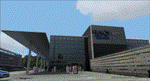
EPKK KRAKOW BALICE 2012 DEMO features an extremely detailed scenery of EPKK Krakow Balice airport and Krakow City, Poland, fully compatible with FS2004.
It's a fully functional DEMO version of the commercial payware product. It features same airport layout as in the full version but with limited 3D objects and low resolution textures. Using this free demo ensures no problems with online (VATSIM, IVAO, multiplayer etc.) flying in case some users use the payware scenery and some don't.
John Paul II International Airport Krakow-Balice (KRK / EPKK) is an international airport located near Krakow, in the village of Balice, 11 km (6.8 mi) west of the city centre, in southern Poland. The airport has one concrete runway, number 07/25, 2550x60m, which can handle such a large aircraft as Boeing 747-400.
It's equipped with an automatic installer, which means that the scenery will be automatically added to the Flight Simulator Scenery Library.
Please uninstall all previous versions of this airport you may have installed before. Please make also sure that no duplicated AFCAD files are installed. Enjoy your virtual flying with Drzewiecki Design!
| Filename: | EPKK__Krakow_Balice_2012_DEMO.zip |
| License: | Commercial demo |
| Added: | 2nd September 2015, 21:53:22 |
| Downloads: | 4,351 |
| Author: | Drzewiecki Design |
| Size: | 19.17 MB |


© 2001-2026 AVSIM Online
All Rights Reserved
Privacy Policy |