
Where Flight Simulation Enthusiasts Gather from Around the World!
AVSIM Library - Search Results

| Category: Flight Simulator 2004 - Scenery | |
| Pellston Regional Airport |

|
Images related to this file:
File Description:
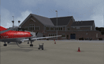
Highly realistic rendition of Pellston Regional Airport in Northern Michigan. This scenery features full seasonal textures, night lighting, animated road traffic and comes complete with a landclass-scenery for the entire northern tip of the Lower Michigan peninsula. It is optimized for high frame rates through extensive use of libraries containing custom objects made in Gmax.
Re-upload due to Avsim hack. This file already incorporates the patch released in May 2007.
| Filename: | Pellston_Regional_Airport.zip |
| License: | Freeware, limited distribution |
| Added: | 8th February 2010, 17:33:04 |
| Downloads: | 8,672 |
| Author: | Matthias Rauh |
| Size: | 36.01 MB |
| Category: Flight Simulator 2004 - Scenery | |
| Castle Teck |
|
File Description:
Castle Teck in southern Germany near Stuttgart is an important landmark of the region and a quite nice one. It was founded 1150 and is now a ruin with some new buildings in medieval style. It is in the vicinty of Hahnweide Airfield famous for model- and sailplane championships and an vintage aircraft meeting. The scenery features seasonal textures, a smoking chimney (Oct.to March), ridge lift and flying buzzards as dynamic scenery. Happy flying!
| Filename: | Castle_Teck.zip |
| License: | Freeware |
| Added: | 29th February 2004, 23:43:41 |
| Downloads: | 5,222 |
| Author: | Dietrich Steffens |
| Size: | 5.22 MB |
| Category: Flight Simulator 2004 - Scenery | |
| Gander CYQX in Newfoundland Canada |
|
Images related to this file:
File Description:
Gandeer is on the east coast of Canada and is the closest North American airport to Europe on the great circle route. In the early days of transatlantic flight, and in fact into the 1960's, this made it very important as a refueling stop either before the ocean hop or just after. Since then it's importance as an airport has faded somewhat as planes now fly directly to the larger city destinations. It is still an active air force base for ocean patrol and search and rescue planes, and military flights are around half of the total flights into and out of the airport. The main attractions of the airport now are the long runways and the cheaper landing fees, and there are some cargo flights and cheap charter passenger flights. This version of Gander is based upon a forgotten-about video taken in October 2010. By then the two longer runways, 13-31 at 8,900 feet and 03-21 at 10,200 feet (though in FS9 this is still designated 04-22, as it had been in 2003) had been closed (one at a time) and totally resurfaced. The third runway 09-27 (3,500 feet in 2003) was closed and starting the process of being broken up, along with associated aprons. This was part of a long process of demolition of some of the older buildings, aprons, and taxiways as they became unused with the fall in the number of daily flights. I have made it clear which of the 2010 taxiways and aprons were still in use by showing them as asphalt, while those in the process of decaying disuse or removal are in the darker tarmac texture; this is somewhat realistic as when asphalt aprons are "ploughed" for removal the darker underside becomes visible. In the renovation process of taxiway repairs only the centre strip of the taxiways was repaired and this is marked by new and closer edge lines. One end of the closed runway was still being used in 2010 for access and parking. There is a warning note in the April 2010 edition of the NAV CANADA Flight Supplement that states "surface rut on Gander Flight Training's private taxiway" (written with extremely shortened words). The Gander layout page is included here, showing that in the Spring of 2010 a much-shortened version (1,875 feet) of the 09-27 runway was still in use; my version is for late 2010 and after that runway was closed. The older buildings (and some of them are now 70 years old or more) are built in concrete and flat roofed with bitumen water proofing; hence the almost black roofs. The terminal building is one of these, though it has been enlarged by the inclusion of a hangar that is now used as the main terminal space. Almost all of the buildings are correctly replicated here. The main GA parking area is to the east of 03-21 where there are two large hangar buildings. One of them is for maintenance and the other is for a large FBO called Gander Aviation. There are other FBO's on the airport, closer to the terminal. These are Irving and Woodward, both to the west, and Allied to the south. There is a further FBO at the eastern end of the apron, name unknown. Shell, who only did refueling, were next to Woodward in 2010 but left, I believe, in 2012. The large red building behind Woodward and Shell is for the maintenance of all airport equipment (from luggage trolleys, snow clearers, de-icing trucks etc to air conditioning, radar, and radios). Most of the remaining buildings are for the air force base, though there are some private companies (such as Universal Helicopters) and even a small private cottage.
| Filename: | Gander_CYQX_in_Newfoundland_Canada.zip |
| License: | Freeware, limited distribution |
| Added: | 29th April 2020, 19:15:01 |
| Downloads: | 680 |
| Author: | Roger Wensley |
| Size: | 29.37 MB |
| Category: Flight Simulator 2004 - Scenery | |
| Gang Ranch CAY2 in British Columbia Canada |
|
Images related to this file:
File Description:
Gang Ranch is on the eastern side of the Coast Mountains of British Columbia, around 50 miles west of Green Lake and 5 miles west of the Fraser River that runs north-south at that latitude (51 degrees 30 minutes north, in round figures). The airfield is among some farm fields and difficult to spot (this will depend on your personal textures and settings) and the ranch buildings are scattered and a mile or two away, the nearest being the owner's house. The runway is gravel, only 1,800 feet long and aligned 08-26 at 2,150 feet above sea level. There is no lighting. I have posted it as Gang Ranch CAY2, but I suggest that you just add it to your previously created "BC airfields" (if you did that) and avoid the inevitable doubling up of common textures etc. Plus that way you will have just one FS9 library post to do and new airfields will not need yet another posting. Up to you. If you find a defect, email me.
| Filename: | Gang_Ranch_CAY2_in_British_Columbia_Canada.zip |
| License: | Freeware, limited distribution |
| Added: | 19th November 2020, 19:44:55 |
| Downloads: | 101 |
| Author: | Roger Wensley |
| Size: | 8.98 MB |
| Category: Flight Simulator 2004 - Scenery | |
| Terrace CYXT in BC Canada Updated |
|
Images related to this file:
File Description:
This version of Terrace has night textures that work, good news for the 319 downloaders who did not tell the author that the ones already posted did not work. Why? Terrace is fifteen miles east and inland from Prince Rupert, which is 500 miles north of Vancouver up the BC coast. It is at the point in the mountains where two fjords meet, one coming from Prince Rupert and the other from Kitimat. There are two runways, the main one is a recently-extended 7,500 feet long and lighted 33/15 and the second is 5,373 feet of unlit 03/21. The apron has been enlarged to be able to accomodate a Boeing 737; though I don't think there is an airline using a 737 for flights to Terrace I have parked an Air Canada jet and the pics show the planes that do fly to Terrace, Air Canada and Hawk Air Dash 8-300's. The aircraft and the textures are down-loadable and and can be used for AI.
| Filename: | Terrace_CYXT_in_BC_Canada_Updated.zip |
| License: | Freeware, limited distribution |
| Added: | 3rd July 2010, 03:28:31 |
| Downloads: | 1,066 |
| Author: | Roger Wensley |
| Size: | 3.72 MB |
| Category: Flight Simulator 2004 - Scenery | |
| KLXD - Ultimate Concept, Luna International - Los Angeles, California |
|
Images related to this file:
File Description:

Luna International is our master concept for FS9. this airport is located in east Los Angeles and is our first piece of High-Def scenery, all textures are custom made. We have been working on this for many weeks and hope that everyone will enjoy the outcome of the effort.
Advice: this is a very complex airport and it contains a lot of separate elements therefore it may not be suitable for use on slower/older computers.
| Filename: | KLXD__Ultimate_Concept_Luna_International__Los_Ang.zip |
| License: | Freeware, limited distribution |
| Added: | 23rd September 2013, 16:57:05 |
| Downloads: | 1,041 |
| Author: | Mark Piccolo - Soarfly Concepts |
| Size: | 30.46 MB |
| Category: Flight Simulator 2004 - Scenery | |
| Millard Municipal Airport, NE |
|
File Description:
FS2004 Scenery-Millard Airport (KMLE) serves Omaha and Douglas County and is owned by Omaha Arpt Authority. The paved runway extends for 3800 feet. The facility is at an elevation of 1050 feet at a distance of about 7 miles from Omaha. Dynamic scenery via Lago's FSE. Rwy12 and EZ Scenery along with FSDS3 also used. Textures for FSDS3 included in download. Modified AFCAD2 file and AI traffic via Traffic Tools. By John B. Loney, Jr.
| Filename: | Millard_Municipal_Airport_NE.zip |
| License: | Freeware |
| Added: | 14th March 2006, 04:04:43 |
| Downloads: | 600 |
| Author: | John B. Loney, Jr. |
| Size: | 858.51 KB |
| Category: Flight Simulator 2004 - Scenery | |
| Pirate's Cove Caribbean Hideaway |
|
File Description:
Welcome to Pirate's Cove, a small tourist hideaway located on the island of St. Kitts in the Caribbean. A fun, laid back place to spend the day and home to the Treasure Chest Bar and grill, a party spot wellknown by the locals, springbreakers and elite tourists. With plenty of dock space for boats, and a lighted runway servicing mid to small props with connections to St Kitts main airport. Features custom objects, textures and nightlighting.
| Filename: | Pirates_Cove_Caribbean_Hideaway.zip |
| License: | Freeware |
| Added: | 11th September 2003, 04:32:37 |
| Downloads: | 10,227 |
| Author: | Michael Carr - MCDesigns 2003 |
| Size: | 5.19 MB |
| Category: Flight Simulator 2004 - Scenery | |
| OSLK-Latakia-AB for FS9 v2a update |
|
File Description:
FS2004 Scenery-OSLK-Latakia-Assad Intl and Hmeymin AB update v2a.
Small update for AFCAD file and Flightplan from Base, because from OSLK are flying now as well
two MiG-31K. You will need previous released OSLK scenery v2 to work with this update. Please
exchange files and add textures to your AI MiG-31 installation from SBAI.
Please see Install notes for necessary Add-Ons, you need to buy these models; download links are
included in notes. Enjoy.
| Filename: | OSLKLatakiaAB_for_FS9_v2a_update.zip |
| License: | Freeware |
| Added: | 29th June 2021, 00:16:35 |
| Downloads: | 104 |
| Author: | Bernd Barsch |
| Size: | 837.4 KB |
| Category: Flight Simulator 2004 - Scenery | |
| San Jose Costa Rica Intl. Airport |
|
File Description:
FS2004 Scenery of San Jose Costa Rica.(MROC)
Juan Santamaria Intl. Airport. The main
airport in Costa Rica.
This is the fourth release for this scenery. It has many improvements; The new rotating radar,
Cargo Terminals, photoreal local ground vehicules,Animated frequency controlled gates, dynamic
ground vehicules,Night Lighting, Completely reworked photorealistic textures, signs,
new taxiways, hangars. It is aligned with the default scenery to avoid conflict with online flying. AFCAD file included. Frame rate friendly
| Filename: | San_Jose_Costa_Rica_Intl_Airport.zip |
| License: | Freeware, limited distribution |
| Added: | 3rd May 2004, 02:09:28 |
| Downloads: | 21,649 |
| Author: | Rodrigo Gonzalez |
| Size: | 6.35 MB |


© 2001-2026 AVSIM Online
All Rights Reserved
Privacy Policy |