
Where Flight Simulation Enthusiasts Gather from Around the World!
AVSIM Library - Search Results

| Category: Flight Simulator 2004 - Scenery | |
| Namibia, Southwestern Africa Mesh Part 2 Of 5 |

|
File Description:
Add-on mesh for the entire country of Namibia (S17-29 E11-21), including the Caprivi Strip east to the Victoria Falls (Zambia/Zimbabwe). The source data are 3-arcsec (~90-m) Shuttle Radar (SRTM) files, compiled at LOD9 (76-m) resolution. Processing with John Childs' Blackart (v3.74) and Peter Guth's MicroDEM (v7.02). Includes a LOD7 buffer mesh to prevent blue slivers in the mid to far distance. Part 2 of 5.
| Filename: | Namibia_Southwestern_Africa_Mesh_Part_2_Of_5.zip |
| License: | Freeware, limited distribution |
| Added: | 5th April 2004, 00:18:13 |
| Downloads: | 5,098 |
| Author: | Holger Sandmann |
| Size: | 21.39 MB |
| Category: Flight Simulator 2004 - Scenery | |
| Area around and including Orcas Island (Washington State) |
|
Images related to this file:
File Description:
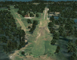
Big area to fly North of Washington State, between Victoria, Vancouver and Seatle. Orcas, Sucia, Central, Decatur, San Juan, Blakely, Waldron, Crane,... All those islands are photoreal, with seasonal textures and autogen. 9 airfields, 4 in high definition, with buildings (as near as possible from the reality). With a lot of details to give life!
You will need some EZ and RWY12 libraries. All instructions included. Please read them carefully.
| Filename: | Area_around_and_including_Orcas_Island_Washington_.zip |
| License: | Freeware |
| Added: | 27th July 2010, 20:52:56 |
| Downloads: | 2,141 |
| Author: | Daniel Gauthier |
| Size: | 79.53 MB |
| Category: Flight Simulator 2004 - Scenery | |
| Sturt Point CWSP in Nunavut, Canada |
|
Images related to this file:
File Description:
Sturt Point was a DEW line I Station on the south coast of Victoria Island, 50 miles east of Cambridge Bay. It was closed in 1963 but remains in place, though a 5 man I Station has such a small impact on its surroundings that it is hardly visible. The runway is 3,420 feet of gravel aligned 117T/297T, and there are no lights, signage, or windsock, but there are ruts in the gravel. A North Warning System station was built 15 miles inland and closer to Cambridge Bay, operating from 1991 onwards. This has a short (1,280'?) gravel runway aligned 138T/318T (and named CWSX here). No ruts in the gravel, but also still no lights, signage, or windsock.
| Filename: | Sturt_Point_CWSP_in_Nunavut_Canada.zip |
| License: | Freeware, limited distribution |
| Added: | 11th November 2012, 21:07:18 |
| Downloads: | 206 |
| Author: | Roger Wensley |
| Size: | 1.35 MB |
| Category: Flight Simulator 2004 - Scenery | |
| Jenny Lind Island CWJL in Nunavut, Canada |
|
Images related to this file:
File Description:
This was a DEW line Auxiliary Station on Jenny Lind Island; the island is about 14 miles by 12 miles and off the southeast corner of Victoria Island, 85 miles east of Cambridge Bay. The station was closed in 1992 but is still there as "closed" meant "shut the door and walk away". There has been some later removal of diesel tanks and other polluting items but the buildings are still intact, and the runway is 4,470 feet of gravel 150' wide. At the western end there is an apron and a large hangar. There are of course no lights, signage, or windsock. A North Warning System station was built in 1990, 6 miles inland to the northwest of the runway. This has a shorter (1,400'?) gravel runway (and named CWJX here).
| Filename: | Jenny_Lind_Island_CWJL_in_Nunavut_Canada.zip |
| License: | Freeware, limited distribution |
| Added: | 15th November 2012, 13:55:29 |
| Downloads: | 190 |
| Author: | Roger Wensley |
| Size: | 1.65 MB |
| Category: Flight Simulator 2004 - Scenery | |
| Lady Franklin Point CWLF in Nunavut, Canada |
|
Images related to this file:
File Description:
Lady Franklin Point was a DEW line station on the southwest corner of Victoria Island, and then a North Warning System station until January 2000 when there was a fire. As a result there are now no NWS buildings, and no central long DEW line station building, only the outlying and already unused buildings from the DEW line site. However, the runway is still there and over 5,000 feet of gravel in length, aligned and signed 90T/270T, though on the atc it will be called 55/235 as FS9 knows nothing about the Canadian Northern Domestic Airspace. There is no runway lighting. Kugluktuk is around 80 miles to the southwest, on the mainland.
I should have mentioned a long time ago that to see the apron lights working (on my fields that HAVE apron lights) requires you to have the "lights_ss_v2" by Sidney Schwartz installed.
| Filename: | Lady_Franklin_Point_CWLF_in_Nunavut_Canada.zip |
| License: | Freeware, limited distribution |
| Added: | 10th November 2012, 04:04:06 |
| Downloads: | 259 |
| Author: | Roger Wensley |
| Size: | 1.81 MB |
| Category: Flight Simulator 2004 - Scenery | |
| Ulukhaktok (Holman) CYHI in the Northwest Territories, Canada |
|
Images related to this file:
File Description:
Ulukhaktok (Holman) is an airfield on the west side of Victoria Island, off the northern coast of Canada. It is 320 miles west of Cambridge Bay (and you should download and install the recent post of CYCB by Sid and Pete, as I use it for the AI included in this post) and around 400 miles east of Inuvik (my post of a few months ago). It has been officially called Ulukhaktok since 2006, and before that it's name was Holman.
The village of Ulukhaktok has been placed around the bay and is approximately the right shape; it houses some 460 people who used to rely solely on hunting and fishing. The village is close to 71 degrees north, and there are only four months of the year when the average high is above zero centigrade. The photograph with snow (and of course a frozen sea) is typical; for the frozen sea download my Frozen Rivers & Lakes post which will provide this. The buildings on the field have been modelled specifically for this scenery, and as in real life there is only JetA available. The AI visiting aircraft are an Aklak Air DC3 (based in Inuvik and operated by Kenn Borek Air) and a Canadian North Dash 8-100. Note that the runways are signed as "true" headings instead of magnetic; in the Canadian Northern Domestic Airspace all headings are given as true. Unfortunately FS9 doesn't accommodate this in ATC.
| Filename: | Ulukhaktok_Holman_CYHI_in_the_Northwest_Territorie.zip |
| License: | Freeware, limited distribution |
| Added: | 24th May 2011, 20:05:47 |
| Downloads: | 452 |
| Author: | Roger Wensley |
| Size: | 2.3 MB |
© 2001-2026 AVSIM Online
All Rights Reserved
Privacy Policy |