
Where Flight Simulation Enthusiasts Gather from Around the World!
AVSIM Library - Search Results

| Category: Flight Simulator 2004 - Scenery | |
| Backcountry airfields for 19m terrain mesh in Idaho USA |

|
Images related to this file:
File Description:
These four backcountry fields are for use with the FSGenesis 19m mesh of Idaho, and are Big Creek, Johnson Creek, Dixie, and Sulphur Creek Ranch. They have been revised to fit and almost certainly do not work without the 19m mesh; a quick comparison with Big Creek before and after demonstrates the difference. I also have Ultimate Terrain installed. The three ingredients of terrain mesh, UT main roads, and UT streams, along with their individual margins of error, very often create conficts of space that make a grass runway impossible to site with it's correct length. Given the choice of turning off roads or streams (the terrain mesh cannot be turned off, obviously) I chose streams; the roads are less obviously incorrect, plus it matters not if roads go uphill while a climbing stream is to be avoided. On that basis the original series is reissued here for use with the 19m terrain mesh, on the presumption that you have already downloaded the original series. There are no textures or AI included as they remain the same as the originals, and the new scenery bgl's replace the originals to get the runways and grass etc in the right positions. There will be follow-on fields that are new, and all of the new ones will be only for the 19m mesh.
| Filename: | Backcountry_airfields_for_19m_terrain_mesh_in_Idah.zip |
| License: | Freeware, limited distribution |
| Added: | 29th May 2017, 04:19:43 |
| Downloads: | 125 |
| Author: | Roger Wensley |
| Size: | 2.22 MB |
| Category: Flight Simulator 2004 - Scenery | |
| LFRD2004 Dinard/St-Malo VFR Scenery |
|
Images related to this file:
File Description:
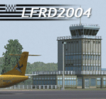
LFRD is a regional airport in Brittany, France. This scenery was created entirely with GMax and the latest Microsoft compilers. Everything was made to ensure maximum framerate while giving maximum visual impact, even on humbler machines. This scenery will run just as fast as the default one (which is very bare) with your current settings, even though there are literally thousands of houses, buildings, trees and a detailed airport.
This is a complete package:
-SRTM local mesh with custom coast trimming
-Custom phototexture (200sq km), with seamless blending into FS9 standard landclass
-Full autogen with custom local texture
-Custom landclass and waterclass
-AFCAD2 file with parking codes
-Custom Hi-res photographic textures at airport.
-Gmax buildings and xml librairy objects.
It was made by a real life pilot and is totally aimed at recreating the feeling of being there, not so much on the ground (after all, this is a FLIGHT simulator), but at circuit altitudes. This is not about recreating an airport in all its glorious details at the cost of framerate, but instead an exercise in balancing visual cues and details as viewed from up there to make it 'as real as it gets' within the limits of FS9. Scenery made by Vauchez (http://mapage.noos.fr/euro_vauchez/)
| Filename: | LFRD2004_DinardStMalo_VFR_Scenery.zip |
| License: | Freeware, limited distribution |
| Added: | 28th April 2010, 18:06:05 |
| Downloads: | 46,564 |
| Author: | Etienne Vauchez |
| Size: | 10.55 MB |
| Category: Flight Simulator 2004 - Scenery | |
| Bethel PABE in southwest Alaska |
|
Images related to this file:
File Description:
There are four main northwestern Alaska towns which have good airports and are serviced by Alaska Airlines. From these airports local flights connect to nearby villages, "nearby" in Alaska meaning up to 200 miles away. The northernmost is Barrow. Southwest of Barrow is Kotzebue, then Nome, and the furthest south is this one, Bethel. The town of Bethel has a population of just over 6,000 and is 50 miles from the sea on the Kuskowim River, that splits and forks into many tributaries. Bethel Airport is close to the town and provides the only contact with the rest of Alaska, as there is no connecting highway system. There are scheduled flights by Alaska Airlines, ERA (now called Ravn) and Grant Aviation, plus others such as Ryan Air. There are cargo flights by Everts, Northern, and Lynden, and redistribution onwards to nearby villages by the smaller locally-based planes; all of these are included in the AI. There are two main runways, one just under 6,400 feet and another just under 3,900 feet, both of them aligned 19-1. The third runway is around 1,800 feet and mainly gravel, aligned 11-29. Parking at PABE is on three aprons, the northern for smaller commercial planes of Grant, ERA, Ryan etc, the central for larger planes of Alaska, Northern, Everts, and Lynden, and the southern for a large collection of GA; each apron has further hangars for maintenance companies and smaller operators. There is also another separate apron for the local military and Coastguard. There is not much photographic information available for PABE, and I have never been there; as a result it was impossible to make detailed photographic textures for some of the buildings. However, for most hangars I have made textures of at least the right colour etc based on the information I assembled and if it is green with white trim and side windows then that is how it now appears here. The exceptions are the Alaska Airlines terminal building which has complicated curved elements, and the two military hangars and workshops where I had to settle for an Alaska terminal building from another airport and the same for the military. There are numerous small villages in the vicinity of Bethel, all of them being beside either a river tributary or the coast. There are two Google Earth screenshots to show the villages that are served by the flights from Bethel and that are (mostly) included in the AI. Some of these airfields were not included in FS9 but AI will still operate in and out of Bethel. The smaller area screenshot shows the villages that are close to Bethel, and of these eight I have so far made six and they are included in this post: Napaskiak PKA, Napakiak WNA, Kwethluk KWT, Atmautluak 4A2, Nunapitchuk 16A, and Kasigluk Z09. I will work my way through the rest of the area.
| Filename: | Bethel_PABE_in_southwest_Alaska.zip |
| License: | Freeware, limited distribution |
| Added: | 8th March 2019, 00:37:58 |
| Downloads: | 309 |
| Author: | Roger Wensley |
| Size: | 32.02 MB |
| Category: Flight Simulator 2004 - Scenery | |
| Mesa Verde National Park, Cortez (KCEZ), Colorado, Photo-Scenery (FS9 & FSX) |
|
Images related to this file:
File Description:
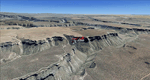
Mesa Verde National Park is famed for its numerous ruins of cliff dwellings built in the 12th century by ancient Pueblo people called Anasazi. Cliff dwellings are highly defensible stone villages situated under alcoves (rock overhangs) along the canyon walls. The largest cliff dwelling in the park is Cliff Palace, which is the largest cliff dwelling in North America. Cliff Palace contained 150 rooms and housed approximately 100 people. Unfortunately you won't see the cliff dwellings from the air, because they are under the cliffs but you will see everything else like all roads, trails and facilities. Very little is known about the Anasazis and the reason for their sudden departure at the end of the 13th century remains a mystery. Theories range from crop failures due to droughts to an intrusion of foreign tribes from the North. The name "Mesa Verde" stems from Spanish explorers seeking for a route from Sante Fe to California. They named the region Mesa Verde (spanish for green table) because of its high, tree-covered plateaus. High resolution versions of this scenery for FS9 and FSX (much sharper, but larger and multiple downloads)
are available at www.blueskyscenery.com/GNB_West2.html . The screenies are taken from the high-res versions, so expect this version to be slightly more blurry. Thanks to Joop Mak for providing custom AFCADs that correct airport layouts so that they align with the photo-textures! They are available at www.blueskyscenery.com/AFCADs.html . YourDonation@Work: Dedicated to David.
| Filename: | Mesa_Verde_National_Park_Cortez_KCEZ_Colorado_Phot.zip |
| License: | Freeware, limited distribution |
| Added: | 1st May 2010, 03:55:31 |
| Downloads: | 1,469 |
| Author: | Gottfried Razek - blueskyscenery.com |
| Size: | 92.87 MB |
| Category: Flight Simulator 2004 - Scenery | |
| St. George (KSGU) / Mesquite (67L), Utah/Nevada, Photo-Scenery (FS9 & FSX) |
|
Images related to this file:
File Description:
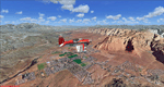
Covers the area between St. George, Utah and Mesquite, Nevada. To the north of St. George
the Pine Valley Mountains with their foothills of scenic red sandstone loom over the city.
St. George Municipal Airport (KSGU) is mostly used for general aviation but is also served by SkyWest Airlines
on behalf of Delta Connection. Because of it's location on a mesa this airport can't be expanded and so a new
airport is currently being built southeast of the city at the site of an abandoned airfield. The opening
is expected in 2011. To the south of the city make sure, you don't miss the Virgin River Gorge where the
Virgin River winds thru a long winding canyon in the transition zone between the red rocks of southern Utahs
Colorado Plateau and Nevadas Mojave Desert. Shortly afterwards you reach Mesquite which is situated just
west of the Arizona stateline. Like nearly all Nevada cities near the stateline Mesquite is home to several
Casinos. Mesquite Airport (67L) lies just north of the city.
High resolution versions of this scenery for FS9 and FSX (much sharper, but larger and multiple downloads)
are available at www.blueskyscenery.com/CNY_South3West6.html . The screenies are taken from the high-res versions,
so expect this version to be slightly more blurry. Thanks to Joop Mak for providing custom AFCADs that
correct airport layouts so that they align with the photo-textures! They are available at www.blueskyscenery.com/AFCADs.html .
YourDonation@Work: Dedicated to Werner, Ralf-Peter and Nels.
| Filename: | St_George_KSGU__Mesquite_67L_UtahNevada_PhotoScene.zip |
| License: | Freeware, limited distribution |
| Added: | 24th March 2010, 19:41:43 |
| Downloads: | 1,656 |
| Author: | Gottfried Razek - blueskyscenery.com |
| Size: | 95.58 MB |
| Category: Flight Simulator 2004 - Scenery | |
| Bear Creek Winery & Lodging (v2.0.9) - "Diamond Edition" |
|
Images related to this file:
File Description:

Bear Creek Winery & Lodging Enhanced v2.0.9 "Diamond Edition".
An all new Flight Simulator experience awaits you at Bear Creek. This is a completely re-vamped "Extreme Make Over" of the previous Bear Creek Winery & Lodging. Some additions include: Scenery Changer Utility, Custom Textures, Festive Events (Christmas, Balloon Festival Etc.) Also added enhanced AI Traffic to the whole of Bear Creek. If you are a previous user of the original Bear Creek scenery this one that awaits you will indeed replace the original!!
No need to keep the previous version 1.0 that you may have downloaded this 2.0 version is a whole new interface that utilizes different install criteria.
Some of the Extra additions that are used with the new 2.0 version are: Runway12 3 Part Library, the Abacus Scenery Creator default libraries, Lago FSE, AI Schweizer 300C Helicopter, Gerrish Grey Tree Library Version 3. The direct links to these downloads are provided to you to download to display the scenery in its entirety. Not all of the above mentioned are required, like Lago, as it is a payware addition. All others mentioned are freely distributed at various download sites.
Please unzip (using folders option) to a temporary location and follow the installation instructions very carefully. Do not attempt to install this scenery with a "scenery manager" - for proper installation please use the built in installation routine.
Enjoy the newest edition: Airport Code: BCWL near Homer, Alaska.
| Filename: | Bear_Creek_Winery__Lodging_v209__Diamond_Edition.zip |
| License: | Freeware |
| Added: | 2nd February 2010, 10:50:06 |
| Downloads: | 4,949 |
| Author: | Mike Woolsey & David "Opa" Marshall |
| Size: | 58.49 MB |
| Category: Flight Simulator 2004 - Scenery | |
| Lanseria International Airport (FALA), Johannesburg, South Africa |
|
Images related to this file:
File Description:
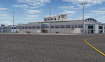
Lanseria international airport is Johannesburg's second international airport and mostly cater to private jets, low cost airlines and many private general aviation and flightschool aircraft. It is a privately owned airport and can accomodate aircraft up to the size of a Boeing 757-300. This airport has seen John Travolta use it with his Boeing 707, the Hilton family with a private Boeing 757 and even the USAF have landed their C-17 Globemasters at the airport when Air Force one came here in the past with the latter landing at AFB Waterkloof.
This package started out as a conversion of the wonderfull FSX scenery of the airport by Lee Hall and converted with permission from the original author. It quickly expanded however to a project that now additionally includes photoreal ground textures that changes with seasons, many added fences and gates around the airport, inclusion of the shaded parking areas with parked cars, static airplanes (RWY12 and EZ scenery libraries needed to see this) as well as numerous objects around the airport and apron made by myself in Gmax to give the airport some FS9 life.
Also included is the wonderfull "apron light splashes" by Hans Günther Schnell who kindly gave me permission to use it for the night times.
I have also included a local mesh for the area for users of FSGlobal 2010 to eliminate the extreme elevation anomoly around the airport.
| Filename: | Lanseria_International_Airport_FALA_Johannesburg_S.zip |
| License: | Freeware, limited distribution |
| Added: | 11th August 2023, 16:03:37 |
| Downloads: | 284 |
| Author: | Kobus van Wyk, Lee Hall |
| Size: | 37.64 MB |
| Category: Flight Simulator 2004 - Scenery | |
| Thompson CYTH in northern Manitoba, Canada |
|
Images related to this file:
File Description:
Thompson is a city with around 13,000 inhabitants, located in northern Manitoba beside the Burntwood River. It serves as the administration centre for a large area of Manitoba and has industrial activities centred around mining and the processing of mined products. The version of the airport upon which this modification is based is the original posting in 2004 by CanUK Scenery. I would have made new buildings and a totally new scenery but I have the same problem as Sid and Pete in their later Thompson scenery: almost no photos!?! The update modifies the short end of the mainly gravel runway to asphalt (it was upgraded because it is regularly used as a taxiway) and also adds a later (2010?) gravel taxiway. The other ground modifications add allocated parking spots for fire fighting CL415 planes that are in the new AI, plus a lot more ga parking. You should already have some AI that includes Calm Air to see CYTH as it really is, the HQ of Calm Air. There are other additions including car parks and the usual sundry bits and pieces that inhabit every airfield. The CL415's with Manitoba textures are adaptations of what were originally Ontario planes and included with my post of Geraldton, not the most recent post in 2013, the one in 2007. If you don't have the planes get them from my Geraldton post. The AI version was made from the original piloted version which was by Massimo Taccoli. The AI helicopter was included in my post of Alma CYTF.
| Filename: | Thompson_CYTH_in_northern_Manitoba_Canada.zip |
| License: | Freeware, limited distribution |
| Added: | 23rd September 2018, 15:24:22 |
| Downloads: | 225 |
| Author: | Roger Wensley |
| Size: | 6.4 MB |
| Category: Flight Simulator 2004 - Scenery | |
| Zion National Park North, Cedar Breaks National Monument, Cedar City (KCDC), Utah, Photo-Scenery (FS9 & FSX) |
|
Images related to this file:
File Description:
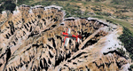
Cedar Breaks National Monument is a large amphitheater cliff in bright colors of red, orange and purple.
It lies east of Cedar City in the northern region of the scenery. The cliff was formed by erosion thru wind,
water and ice. Today erosion continues with a pace of about 2 inches every 5 years. Although it is called
Cedar Breaks, there are no cedars growing there but juniper trees. For a scenic flight to Cedar Breaks
National Monument best depart from Cedar City Regional Airport (KCDC) and head east. The scenery extends
south to Zion National Park and covers a large part of Zion Canyon and the Kolob Canyons area.
Zion National Park is another place where erosion of the Colorado Plateau formed the most beautiful colorful
stone formations of unique and wonderful shapes. There are nine different layers of stone visible in the park.
Most of them consist of sandstone. But there is also limestone, gypsum, siltstone, shale, clay and mudstone.
The Virgin River cut a spectacular and famous canyon thru Zion Park that is as narrow as 20ft and up to 2000ft tall.
High resolution versions of this scenery for FS9 and FSX (much sharper, but larger and multiple downloads)
are available at www.blueskyscenery.com/CNY_South2West5.html . The screenies are taken from the high-res versions,
so expect this version to be slightly more blurry.
Thanks to Joop Mak for providing a custom AFCADs that correct airport layouts so that they align with the photo-textures!
They are available here: www.blueskyscenery.com/AFCADs.html . YourDonation@Work: Dedicated to Richard, P.J. and Felix.
| Filename: | Zion_National_Park_North_Cedar_Breaks_National_Mon.zip |
| License: | Freeware, limited distribution |
| Added: | 14th March 2010, 00:30:28 |
| Downloads: | 1,566 |
| Author: | Gottfried Razek - blueskyscenery.com |
| Size: | 97.13 MB |
| Category: Flight Simulator 2004 - Scenery | |
| Allakaket 6A8 Runway and Taxiway Lighting in Alaska |
|
Images related to this file:
File Description:
Allakaket is on the Koyukuk River in Alaska, 40 miles southwest of Bettles. This posting adds proper runway and taxiway lighting to the scenery, as shown in the screenshots. There will be lights on top of traffic cones visible during the day, just as there are at Allakaket in real life so that pilots can still see them after a snowfall. At night there will be lit lights that properly illuminate the runway for landing, and at a lower level of brightness the taxiway. Put the bgl's into the existing scenery folder of your Allakaket 6A8 installation and say yes to replace the existing bgl's that have the same names. Add the texture bmp's to the texture folder. That's all, and in fact you could try it without the textures in the Allakaket 6A8 texture folder, but read on. Instal the Library objects once and for all by placing the CONTENTS of the Lighting Library scenery folder in your static objects scenery folder and the CONTENTS of the texture folder in the static objects texture folder (which is how I install scenery objects libraries). Alternatively, put them in the scenery and texture folders of your Add on scenery folder, or even in the main scenery and texture folders. They just have to be in related scenery and texture folders that are always active when FS9 is running. There will be further retro upgrades to other recent scenery that was posted with temporary lighting. Say thank you to Greg Putz for making the lighting.
| Filename: | Allakaket_6A8_Runway_and_Taxiway_Lighting_in_Alask.zip |
| License: | Freeware, limited distribution |
| Added: | 23rd November 2019, 20:30:02 |
| Downloads: | 117 |
| Author: | Roger Wensley |
| Size: | 711.35 KB |


© 2001-2026 AVSIM Online
All Rights Reserved
Privacy Policy |