
Where Flight Simulation Enthusiasts Gather from Around the World!
AVSIM Library - Search Results

| Category: Flight Simulator 2004 - Scenery | |
| OryxSim Salalah International Airport, Dhofar, Oman - Version 1.0 |

|
Images related to this file:
File Description:

OryxSim welcomes you to Salalah International Airport, situated on less than 2 hours flying from major gulf destinations such as Dubai, Abu Dhabi, Bahrain, Doha and Muscat. Salalah is one of the very few cities in the Middle East that experience a Monsoon season. This scenery includes custom ground textures, 3d ground lighting as well extensive night lighting. This is the FS2004 version, a FSX version should be available within two after this release.
| Filename: | OryxSim_Salalah_International_Airport_Dhofar_Oman_.zip |
| License: | Freeware |
| Added: | 10th April 2010, 00:04:33 |
| Downloads: | 2,961 |
| Author: | OryxSim |
| Size: | 8.28 MB |
| Category: Flight Simulator 2004 - Scenery | |
| Reading Regional Airport/MAAM Scenery |
|
File Description:
This package includes fully detailed scenery of the Reading Regional Airport (KRDG) in Reading, Pennsylvania, USA including the grounds of the Mid Atlantic Air Museum. All objects were constructed in Gmax and feature photo-realistic textures that bring them very close in appearance with their real-world counterparts. Scenery features include radio frequency-controlled hangar door animations, realistic AI GA and Commercial traffic and even the inclusion of an important local VFR landmark.
| Filename: | Reading_Regional_AirportMAAM_Scenery.zip |
| License: | Freeware, limited distribution |
| Added: | 24th December 2003, 20:02:01 |
| Downloads: | 15,792 |
| Author: | Bill Womack, Kenneth Weik, Charles Dayhuff and Tony Fosler |
| Size: | 10.6 MB |
| Category: Flight Simulator 2004 - Scenery | |
| Barrow PABR update |
|
Images related to this file:
File Description:
This is a small addition to Barrow PABR, namely the ground runway signage on each taxiway. I just plain forgot it. Plus the "installation" bgl of the static Piper Supercubs, which is required for them to show up. I didn't forget that, I just didn't know it was required. Just add the three .bgl's to your Barrow installation and say yes to replace for two of them. You already have the required textures.
| Filename: | Barrow_PABR_update.zip |
| License: | Freeware, limited distribution |
| Added: | 8th December 2016, 20:21:58 |
| Downloads: | 500 |
| Author: | Roger Wensley |
| Size: | 3.9 MB |
| Category: Flight Simulator 2004 - Scenery | |
| Central Appalachia Land Class |
|
Images related to this file:
File Description:
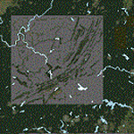
I've used default textures (tiles) for villages MS left out of the sim. I didn't place all of the missing villages on the project sheet, though. I did not need to make custom tiles, neither. Most highways are connected the default villages now. I was satisfied with the default tiles MS uses. Most highways are connected the default villages now. Mountain ridge lines better contrast with valleys now. But, I did get it all...
| Filename: | Central_Appalachia_Land_Class.zip |
| License: | Freeware |
| Added: | 9th July 2015, 01:47:21 |
| Downloads: | 148 |
| Author: | Rick Connolly |
| Size: | 1.31 MB |
| Category: Flight Simulator 2004 - Scenery | |
| LEST Santiago de Compostela 2018 |
|
File Description:
FS2004 Scenery--LEST Santiago De Compostela, Spain. FULL PACKAGE
1. Airport Scenery with new buildings, parkings, lights positions, taxilines and night textures
2. Photoreal scenery
This scenery was built from the official maps for the runway and taxiways with Google Maps as a background image as support. The different signs were positioned without any documentation or references. Only use with IVAO or VATSIM; no AI possible.
By Serge Libon (airport) and Diego Varela Rodriguez (photoreal)
| Filename: | LEST_Santiago_de_Compostela_2018.zip |
| License: | Freeware |
| Added: | 13th March 2018, 23:02:34 |
| Downloads: | 1,721 |
| Author: | Serge Libon (airport) and Diego Varela Rodriguez (photoreal) |
| Size: | 167.97 MB |
| Category: Flight Simulator 2004 - Scenery | |
| KDAY Cox-Dayton Intl Airport |
|
File Description:
A complete rework of KDAY for FS2004. Jetways have been added as well as correct gate placement and airline parking codes. The default terminal has been reworked and modified to show the new bagroom near the B Concourse. Apron has been resized. Multiple vehicles have been added to give a more real terminal feel. New Tower location added. Most building objects are generic textures. Recommend AEU7.zip for best texture appearance. by Brian Good
| Filename: | KDAY_CoxDayton_Intl_Airport.zip |
| License: | Freeware |
| Added: | 26th March 2012, 10:54:27 |
| Downloads: | 540 |
| Author: | Brian Good |
| Size: | 10.53 MB |
| Category: Flight Simulator 2004 - Scenery | |
| Terrace CYXT in BC Canada Updated |
|
Images related to this file:
File Description:
This version of Terrace has night textures that work, good news for the 319 downloaders who did not tell the author that the ones already posted did not work. Why? Terrace is fifteen miles east and inland from Prince Rupert, which is 500 miles north of Vancouver up the BC coast. It is at the point in the mountains where two fjords meet, one coming from Prince Rupert and the other from Kitimat. There are two runways, the main one is a recently-extended 7,500 feet long and lighted 33/15 and the second is 5,373 feet of unlit 03/21. The apron has been enlarged to be able to accomodate a Boeing 737; though I don't think there is an airline using a 737 for flights to Terrace I have parked an Air Canada jet and the pics show the planes that do fly to Terrace, Air Canada and Hawk Air Dash 8-300's. The aircraft and the textures are down-loadable and and can be used for AI.
| Filename: | Terrace_CYXT_in_BC_Canada_Updated.zip |
| License: | Freeware, limited distribution |
| Added: | 3rd July 2010, 03:28:31 |
| Downloads: | 1,068 |
| Author: | Roger Wensley |
| Size: | 3.72 MB |
| Category: Flight Simulator 2004 - Scenery | |
| Gang Ranch CAY2 in British Columbia Canada |
|
Images related to this file:
File Description:
Gang Ranch is on the eastern side of the Coast Mountains of British Columbia, around 50 miles west of Green Lake and 5 miles west of the Fraser River that runs north-south at that latitude (51 degrees 30 minutes north, in round figures). The airfield is among some farm fields and difficult to spot (this will depend on your personal textures and settings) and the ranch buildings are scattered and a mile or two away, the nearest being the owner's house. The runway is gravel, only 1,800 feet long and aligned 08-26 at 2,150 feet above sea level. There is no lighting. I have posted it as Gang Ranch CAY2, but I suggest that you just add it to your previously created "BC airfields" (if you did that) and avoid the inevitable doubling up of common textures etc. Plus that way you will have just one FS9 library post to do and new airfields will not need yet another posting. Up to you. If you find a defect, email me.
| Filename: | Gang_Ranch_CAY2_in_British_Columbia_Canada.zip |
| License: | Freeware, limited distribution |
| Added: | 19th November 2020, 19:44:55 |
| Downloads: | 101 |
| Author: | Roger Wensley |
| Size: | 8.98 MB |
| Category: Flight Simulator 2004 - Scenery | |
| Howick Airfield (FAHC), South Africa |
|
Images related to this file:
File Description:
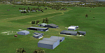
This package will add a custom (Gmax) made Howick Airfield (FAHC), KwaZulu Natal, South Africa with photoreal textures and seasonal ground textures.
Howick is a small town in the KwaZulu Natal Midlands just off the N3 freeway which connects Johannesburg and Durban and home to the famous Howick waterfall. The Umgeni river falls 95m (311 ft) over the cliffs on the way to the Indian Ocean. The town is also home to the Midmar dam. This dam is very well known as being the location of the annual Midmar Mile swimming event which, in 2009, was recognized by the Guinness Book of World Records as the world's largest open water swimming event with 13 755 competitors taking part.
The sloped grass runway is aligned 16/34 and 825m long and sits at an elevation of 3 615ft. Both runways have obstacles on the approach, with powerlines 730m from the threshold of runway 16, while runway 34's approach have hills around 900m before the threshold. The sloped runway has been created in FS2004 within the limits of the simulator itself.
| Filename: | Howick_Airfield_FAHC_South_Africa.zip |
| License: | Freeware, limited distribution |
| Added: | 15th January 2021, 20:25:51 |
| Downloads: | 205 |
| Author: | Kobus van Wyk |
| Size: | 7.67 MB |
| Category: Flight Simulator 2004 - Scenery | |
| Millard Municipal Airport, NE |
|
File Description:
FS2004 Scenery-Millard Airport (KMLE) serves Omaha and Douglas County and is owned by Omaha Arpt Authority. The paved runway extends for 3800 feet. The facility is at an elevation of 1050 feet at a distance of about 7 miles from Omaha. Dynamic scenery via Lago's FSE. Rwy12 and EZ Scenery along with FSDS3 also used. Textures for FSDS3 included in download. Modified AFCAD2 file and AI traffic via Traffic Tools. By John B. Loney, Jr.
| Filename: | Millard_Municipal_Airport_NE.zip |
| License: | Freeware |
| Added: | 14th March 2006, 04:04:43 |
| Downloads: | 601 |
| Author: | John B. Loney, Jr. |
| Size: | 858.51 KB |


© 2001-2026 AVSIM Online
All Rights Reserved
Privacy Policy |