
Where Flight Simulation Enthusiasts Gather from Around the World!
AVSIM Library - Search Results

| Category: Flight Simulator 2004 - Scenery | |
| Indianapolis Executive KTYQ |

|
Images related to this file:
File Description:
FS2004 Scenery - Indianapolis Executive Airport (Formally known as Indianapolis Terry Airport) KTYQ, serves Indianapolis and Boone County and is owned by R. Vansickle. The paved runway extends for 5500 feet. The facility is at an elevation of 922 feet at a distance of about 14 miles from Indianapolis. Created with FSDS2, Rwy12 and Lago's FSE. AFCAD2 and Traffic Tools required. By John B. Loney, Jr.
| Filename: | Indianapolis_Executive_KTYQ.zip |
| License: | Freeware, limited distribution |
| Added: | 17th May 2010, 22:30:47 |
| Downloads: | 788 |
| Author: | John B. Loney, Jr. |
| Size: | 984.06 KB |
| Category: Flight Simulator 2004 - Scenery | |
| RAF Fairford 2007 |
|
File Description:
RAF Fairford 2007. Add-on scenery for the default FS2004 scenery - not tested with UK2000 or VFR scenery. This isn't photorealistic by any means but provides an accurate as possible representation of RAF Fairford, the home of the Royal International Air Tattoo. Zip file c6MB. Readme file contains instructions and recommended addon files.Readme recommends users download RWY12 package, Novagold textures and 4 other freeware object libraries.
| Filename: | RAF_Fairford_2007.zip |
| License: | Freeware, limited distribution |
| Added: | 6th September 2007, 23:34:12 |
| Downloads: | 2,571 |
| Author: | Dave Morgan |
| Size: | 6.05 MB |
| Category: Flight Simulator 2004 - Scenery | |
| Kigali International Airport (HRYR) V1 |
|
Images related to this file:
File Description:
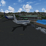
This is Kigali International Airport (HRYR) V1. This is the Largest Airport in the Republic of Rwanda. The Airport scenery was built from Sketchup, SBUILDER and ADE v1.78 utilizing Google Earth for correct positions. Runway lights by AFL Lights. This is version 1, it includes Main Terminal, VIP terminal/Control tower, Fire Station, hangars Afcad. Needs RWY12 Object library. See Readme file for Install instructions. Cheers!
| Filename: | Kigali_International_Airport_HRYR_V1.zip |
| License: | Freeware |
| Added: | 31st May 2020, 20:55:15 |
| Downloads: | 529 |
| Author: | Emmanuel Mwandosya |
| Size: | 11.52 MB |
| Category: Flight Simulator 2004 - Scenery | |
| Petaluma , California (O69) Scenery |
|
File Description:
This is a scenery upgrade for Petaluma Airport, California (O69). This is part Five of a series of small airstrip and minor airfield scenery enhancements which are based on real world data from Google Earth.
This is a more complex scenery than previous ones. You can see from the Google earth image that a golf course runs alongside the airport (appropriately called the Rabbit Run!). I have tried to include this with a golf course landclass polygon, also the airfield base seems mainly a red soil and this is reflected in the airbase poly. Built using EZ_Scenery, Lee Swordy's AFCAD and SBuilder. You must have rwy12 and EZ scenery libraries installed for the buildings to show. Both libraries of objects are free;
EZ Library is available from this URL http://www.abacuspub.com/pub/AbacusEZLibraries.exe
rwy12 from Avsim and additional EZ Custom libraries from Avsim. Search under Scenery design.
| Filename: | Petaluma__California_O69_Scenery.zip |
| License: | Freeware |
| Added: | 23rd March 2006, 23:09:07 |
| Downloads: | 719 |
| Author: | Kim Gowney |
| Size: | 629.87 KB |
| Category: Flight Simulator 2004 - Scenery | |
| Caballococha, Peru |
|
File Description:
Caballococha, Peru - Actually I have found only one photo of the town along the Amazon River and it was only of the Plaza. This is a total impressionistic file. Creates the town, riverside features (Piers, Ferry landing) and a few features to the default airport.
New AFCAD created offering parking and a taxiway, plus two water start locations. Again totally fictious. BUT enjoy.
One thing about Caballococha is that it is along a highly navagatable portion of the Amazon and with the fantastic array of Watercraft available offers, I believe, unlimited simming possibilities.
I included the .XML file for rwy12, if you are into enhancing your own scenery...please do feel free to modify or add as desired. This scenery DOES require both LAGO FSE (Payware) and RWY12 available here at avsim) to work.
questions or comments PLEASE do e-mail me ... I will respond as rapidly as possible.
[email protected]
| Filename: | Caballococha_Peru.zip |
| License: | Freeware |
| Added: | 9th April 2006, 04:19:26 |
| Downloads: | 715 |
| Author: | Dale Caruso |
| Size: | 225.37 KB |
| Category: Flight Simulator 2004 - Scenery | |
| University-Oxford Airport |
|
File Description:
FS2004 Scenery-University-Oxford Airport (KUOX) serves Oxford and Lafayette County and is owned by University Of Mississippi. The paved runway extends for 4700 feet. The facility is at an elevation of 451 feet at a distance of about 2 miles from Oxford. Created with FSDS3, EZ Scenery, Rwy12 and Lago's FSE. Modified AFCAD2 file and Traffic Tools employed. Choice of two scenery variants. Read readme for details.
| Filename: | UniversityOxford_Airport.zip |
| License: | Freeware |
| Added: | 15th January 2006, 00:58:35 |
| Downloads: | 783 |
| Author: | John B. Loney, Jr. |
| Size: | 765 KB |
| Category: Flight Simulator 2004 - Scenery | |
| Morrisville-Stowe State, Vermont (KMVL) |
|
File Description:
FS204 Scenery-Morrisville-Stowe State Airport, Vt. (KMVL) serves Morrisville and Lamoille County and is owned by the State Of Vermont. The paved runway extends 3,701 feet. The facility is at an elevation of 732 feet and is about two miles from Morrisville. Scenery requires EZ Scenery and Rwy12 libraries,(Please read the readme file) AFCAD2, Traffic Tools and Nova texture sets. Lago's FSE is optional. By John B. Loney, Jr.
| Filename: | MorrisvilleStowe_State_Vermont_KMVL.zip |
| License: | Freeware |
| Added: | 21st May 2006, 18:51:01 |
| Downloads: | 717 |
| Author: | John B. Loney, Jr. |
| Size: | 938.42 KB |
| Category: Flight Simulator 2004 - Scenery | |
| Amposta Airfield - LEAO |
|
File Description:
FS2004 Scenery-Amposta Airfield (LEAO) is a fictional airfield located in the Amposta area of Spain. Though there is currently no airport there, there may be one built in the future. The runway is 4000 ft long and the airport is controlled. Created entirely with EZ Scenery, the scenery requires the EZ Scenery and Rwy12 libraries. AFCAD2 and Traffic Tools are also required. By John B. Loney, Jr.
| Filename: | Amposta_Airfield__LEAO.zip |
| License: | Freeware |
| Added: | 22nd July 2006, 04:54:17 |
| Downloads: | 771 |
| Author: | John B. Loney, Jr. |
| Size: | 540.29 KB |
| Category: Flight Simulator 2004 - Scenery | |
| KBTP_1Update |
|
File Description:
This file is a fix file for the previous KBTP scenery I created. This file fixes a issue with the taxi way concrete, Parking lot, and removes the MD-80.
For FS2004
If you are a first time user of this file you do not need to do anything but use this file only.
You must have RWY12 and LAGO FSE installed to get the full detail of my work.
| Filename: | KBTP_1Update.zip |
| License: | Freeware |
| Added: | 26th August 2008, 02:40:42 |
| Downloads: | 181 |
| Author: | Rob Touchtone |
| Size: | 684.06 KB |
| Category: Flight Simulator 2004 - Scenery | |
| FYAR Arandis, Namibia |
|
File Description:
Based on googleEarth and fotos. Ez-scenery and rwy12 objects included. Includes the airport, as well as landclass for the town of Arandis and a textured area to represent the uranium mine east-south-east of the airport. Roads in the vicinity have been added and adjusted. Compatible with Holger Sandmann's Namibia LOD9 Terrain mesh (namibia_ne.zip, namibia_nw.zip, namibia_se.zip, namibia_sw.zip, namibia_cp.zip) as well as his namibia_scenery_updates.zip, all found at avsim.com.
| Filename: | FYAR_Arandis_Namibia.zip |
| License: | Freeware |
| Added: | 4th January 2009, 12:17:39 |
| Downloads: | 879 |
| Author: | Detlev J. Rohmer |
| Size: | 7.41 MB |


© 2001-2026 AVSIM Online
All Rights Reserved
Privacy Policy |