
Where Flight Simulation Enthusiasts Gather from Around the World!
AVSIM Library - Search Results

| Category: Flight Simulator 2004 - Scenery | |
| St Jovite CSZ3 in Quebec Canada |

|
Images related to this file:
File Description:
St Jovite is a grass strip in Quebec near the town of St Jovite and the Mont Tremblant tourist area. This updated version has specifically modeled buildings etc. The unlighted runway is 3,300 feet long, aligned 02/20, and there is now fuel available, so that's a change for the better. However, there is also a landing fee and charges for overnight parking, though the fee is waived if you buy fuel. Based upon my experience of St Jovite there is no AI required for added realism; you will be the only plane visiting and that will be totally realistic. There must be a busy time, but I have never seen it. The aerial picture shows St Jovite from the south, with Lac Ouimet and Mont Tremblant beyond.
| Filename: | st_jovite.zip |
| License: | Freeware, limited distribution |
| Added: | 25th November 2011, 17:29:25 |
| Downloads: | 306 |
| Author: | Roger Wensley |
| Size: | 2.58 MB |
| Category: Flight Simulator 2004 - Scenery | |
| Umiujaq CYMU in Northern Quebec, Canada |
|
Images related to this file:
File Description:
Umiujaq is a small village on the east coast of Hudson Bay, in Quebec, around 140 miles south of Inukjuak and 100 miles north of Kuujjuarapik; the latter is where some 500 inhabitants moved from in 1986 to avoid the effects of a hydroelectric dam project and founded Umiujaq. The airfield is a mile and a half inland and southeast of the village, and the 3,520 feet of gravel runway is aligned 03/21, and these are magnetic bearings as Inukjuak is not in the Northern Domestic Airspace zone. There is no fuel available, unless there is some 100LL in drums. The visiting AI airline is Air Inuit from Montreal.
| Filename: | umiujaq.zip |
| License: | Freeware, limited distribution |
| Added: | 22nd December 2011, 01:00:20 |
| Downloads: | 621 |
| Author: | Roger Wensley |
| Size: | 2.03 MB |
| Category: Flight Simulator 2004 - Scenery | |
| CTH3 Canada, Quebec, Les Grandes-Bergeronnes |
|
Images related to this file:
File Description:
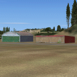
This is the scenery Les Grandes Bergeronnes (CTH3), which represents the reality. Les Grandes Bergeronnes is a small village located on Northern bank of the St-Laurent river of Quebec at Canada. This scenery is designed with FSDS and it accepts Mesh of Gilles Gauthier. This scenery functions for both FS-2004 and FS-X.
| Filename: | cth3_bergeronnes.zip |
| License: | Freeware |
| Added: | 2nd January 2010, 19:29:43 |
| Downloads: | 372 |
| Author: | Regis Dassylva |
| Size: | 2.34 MB |
| Category: Flight Simulator 2004 - Scenery | |
| Pontiac Airpark CPC7 in Quebec Canada |
|
Images related to this file:
File Description:
Pontiac Airpark is in Quebec on the north bank of the Ottawa River, some 20 miles northwest of Ottawa in Canada. It is a new airfield and in fact is still under construction, though the east-west runway has been in use since late last year. This east-west runway is 3,400 feet long and gravel, though it will later be lighted, and then asphalted. The second runway will be just under 2,000 feet and unlighted gravel, and at its southern end there are docks for float planes. The float base is already in use; CPC7 is the ICAO code for the float base. There are lots for sale, and the idea is to build your house right on the airfield so there is no driving necessary between house and plane, thus leaving more time for what is important. There will be updates as things progress.
| Filename: | pontiac_airpark.zip |
| License: | Freeware, limited distribution |
| Added: | 1st May 2010, 00:33:40 |
| Downloads: | 337 |
| Author: | Roger Wensley |
| Size: | 7.07 MB |
| Category: Flight Simulator 2004 - Scenery | |
| Factory Field CF40 in Quebec Canada |
|
Images related to this file:
File Description:
Factory Field (my name for it) is in Quebec on highway 321 a few miles north of St Andre Avellin, and 40 miles ENE of Ottawa. The runway is 3,500 feet long and asphalt and went out of regular use in the early 1990's when the airfield was closed. It was sold in 1995 to a company (ELP) that has built up a factory for manufacturing and fitting snow ploughs and other pneumatically operated equipment to trucks, and who now use the runway for testing their snow ploughs. In between times, as it is not marked closed with an "X", it is also occasionally used by customers who fly in, usually to get the drivers there to take delivery of completed trucks. The surface is good and there are no obstructions but also no markings, though with 3,500 feet of 100 feet wide asphalt there is plenty of space and it doesn't much matter.
| Filename: | factoryfieldelp.zip |
| License: | Freeware, limited distribution |
| Added: | 13th May 2010, 22:11:41 |
| Downloads: | 344 |
| Author: | Roger Wensley |
| Size: | 1.3 MB |
| Category: Flight Simulator 2004 - Scenery | |
| Akulivik CYKO in northern Quebec Canada |
|
Images related to this file:
File Description:
This is another of the many airfields that are all around the coast of Hudson Bay, this one being on the eastern, Quebec side. Akulivik is around 110 miles south of Ivujivik, which is on the northeastern corner of the Bay, and some 60 miles north of Puvirnituq. The population is 630 or so and the village grew from a move back to the area by one family in 1973, followed by others in the following years; the closure of the Hudson Bay trading post post in 1952 had pushed all residents to move south to Puvirnituq. The village is unusual in that it has a built harbour instead of the usual beached storage of boats. The village is built on the central prong of a three pronged spear of headlands (from which the village name is derived) while the airfield is a mile or so further inland. I have no information regarding what I think may be a new terminal building, so this includes only the old original one. The runway is just under 3,500 feet of gravel aligned 09-27, and the ai includes the scheduled flight by an Air Inuit Dash 8-300, plus GA.
| Filename: | akulivik.zip |
| License: | Freeware, limited distribution |
| Added: | 9th September 2018, 03:43:25 |
| Downloads: | 156 |
| Author: | Roger Wensley |
| Size: | 4.84 MB |
| Category: Flight Simulator 2004 - Scenery | |
| Aupaluk CYLA in northern Quebec Canada |
|
Images related to this file:
File Description:
This is a very small village in northern Quebec, on the eastern shore of Nunavik in Ungava Bay. The population is only around 200. The name refers to the redness of the iron bearing soil. Kuujuaq, the regional centre, is 90 miles to the south, and there are regularly scheduled flights by an Air Inuit Twin Otter. The runway is 3,400 feet of gravel aligned 05-23. The ai was included with the posting of Akulivik but is included again here.
| Filename: | aupaluk.zip |
| License: | Freeware, limited distribution |
| Added: | 18th September 2018, 04:22:22 |
| Downloads: | 124 |
| Author: | Roger Wensley |
| Size: | 2.46 MB |
| Category: Flight Simulator 2004 - Scenery | |
| Kangiqsujuaq CYKF in northern Quebec, Canada |
|
Images related to this file:
File Description:
Kangiqsujuaq is on the north coast of Quebec, 85 miles west of Quaqtaq and 125 miles east of Salluit, while across the Hudson Strait and 100 miles away on Baffin Island is Kimmirut. The town grew around two trading posts, the first opened by Revillon Freres in 1910, and the second by the Hudson Bay Company in 1914. A school was opened in 1960, and a clinic in 1961. The town was known as Wakeham Bay until 1961, and now has a population of around 700. The airport is to the south of the town and up on the hill at 511 feet ASL (this has been remeasured since 2004 and is now known to be 501). The gravel runway is just over 3,500 feet long and aligned 15/33; there is no PAPI, but there is fuel available, both 100LL and JetA. There are flights by Air Inuit.
| Filename: | kangiqsujuaq.zip |
| License: | Freeware, limited distribution |
| Added: | 27th January 2013, 00:55:00 |
| Downloads: | 228 |
| Author: | Roger Wensley |
| Size: | 2.39 MB |
| Category: Flight Simulator 2004 - Scenery | |
| Kangiqsualujjuaq CYLU in northern Quebec, Canada |
|
Images related to this file:
File Description:
Kangiqsualujjuaq is in northern Quebec on the east side of Ungava Bay, which is to the east of Hudson Bay and around 150 miles wide and 120 miles deep. Kuujjuaq, the administrative capital of northern Quebec, is 100 miles to the southwest. The town is on the bank of the George River, and has also been known as Fort George River, George River, etc. There was a Hudson Bay trading post at the town's location as early as 1838, though it was closed and reopened more than once and the town did not grow because of the trading post; the Inuit lived on the coast during the summer but moved 30 miles inland in winter for trapping. A cooperative was formed in 1959 to market fish, and this was the creative force that brought about establishment of the town; a school was built in 1963.
The airport is to the north of the town in a valley between the surrounding hills at 215 feet ASL. The gravel runway is just over 3,500 feet long and aligned 16/34; there is no PAPI, but there is fuel available, both 100LL and JetA. There are flights by Air Inuit and a warning of caribou on the runway during October and November.
| Filename: | kangiqsualujjuaq.zip |
| License: | Freeware, limited distribution |
| Added: | 1st February 2013, 21:24:55 |
| Downloads: | 274 |
| Author: | Roger Wensley |
| Size: | 2.88 MB |
| Category: Flight Simulator 2004 - Scenery | |
| Chisasibi CSU2 in northern Quebec, Canada |
|
Images related to this file:
File Description:
Chisasibi is in northern Quebec on the east shore of James Bay, 60 miles from the corner of James Bay and Hudson Bay. Originally called Fort George and founded at the mouth of La Grande Riviere around the Hudson Bay trading post that was established in 1803, the town had to move 5 miles upstream in 1981 when the Quebec hydro project increased the flow rate of the river. The name was changed to Chisasibi at the time of the move (Chisasibi = Great River in Cree) and the population (750 as early as 1940) has now grown to around 2,000. There is a paved road east to Radisson that connects to the north-south James Bay road, which was built at the time of the hydro project work. The original Fort George airport runway is still visible but not usable, just south of the original town site. Chisasibi airport is to the west of the new town, and the gravel runway is 3,792 feet long and aligned 14/32, which is approximately parallel to the river. There is officially no fuel available, but there is JetA on site for Air Creebec in a tank protected by used fuel drums (filled with sand?). The terminal and the garage building are both relatively new; the terminal dates from 2002 and has unusual touches. There are two AI flights by Air Creebec each day plus other private planes.
| Filename: | chisasibi.zip |
| License: | Freeware, limited distribution |
| Added: | 27th February 2013, 21:24:47 |
| Downloads: | 282 |
| Author: | Roger Wensley |
| Size: | 2.9 MB |
© 2001-2025 AVSIM Online
All Rights Reserved