
Where Flight Simulation Enthusiasts Gather from Around the World!
AVSIM Library - Search Results

| Category: Flight Simulator 2004 - Scenery | |
| Cape Dorset CYTE, Baffin Island, Nunavut, Canada |

|
Images related to this file:
File Description:
Cape Dorset is a village of 1,300 or so inhabitants at N 64 13 W 76 31 on Dorset Island, off the southwest corner of Baffin Island. It's Inuit name is Kinngait, which means "High Mountains"; watch out if you fly there in low clouds. The village (again) does not feature in FS9 but is included in this scenery with approximately the right shape, or shapes as there are separate parts. The airfield runway is just under 4,000 feet of gravel 100 feet wide at 158 feet above sea level. There is a double gradient to it, but unfortunately this cannot be replicated in FS.
Cape Dorset had a Hudson Bay Company store as long ago as 1913, and is now known as a centre for Inuit art. I added the roads, a new airfield background, a pond between apron and runway, plus of course there is the scenery file and the AFCAD and AI, which has two planes visiting, a First Air HS748 and a Canadian North Dash 8-100, as per real life.
| Filename: | Cape_Dorset_CYTE_Baffin_Island_Nunavut_Canada.zip |
| License: | Freeware, limited distribution |
| Added: | 9th December 2010, 18:45:06 |
| Downloads: | 1,016 |
| Author: | Roger Wensley |
| Size: | 2.75 MB |
| Category: Flight Simulator 2004 - Scenery | |
| Groom Lake / Area 51 Scenery - KXTA |
|
File Description:
This package will add the missing Area 51 airport (credited as KXTA according to some sources) to Flight Simulator 2004: A Century of Flight. It will add the following items, but YOU CONTROL IF THEY ARE ACTIVE IN FS2004 via the scenery library (directions are included in the manual):
* KXTA in the proper location with assocated scenery including airport buildings, antenna arrays on Bald Mountain and Papoose Mountain, even an SUV in the general location of "Freedom Ridge"; the one time favortie observation point for civilians wanting to keep an eye on what our "Uncle" is up to out there in the desert.
* New KLAS, KLSV, and KINS to add appropriate parking (Again you don't HAVE to use them, so if you already have a MOD for one of these, you can simply elect not to activate mine)
* New skin for the default 737-400 in EG&G Janet colors.
* AI F-22 Raptor
* AI Flight plans for the F22s and Janet 737s (Janet flights based on real world schedules as found at www.dreamlandresort.com)
| Filename: | Groom_Lake__Area_51_Scenery__KXTA.zip |
| License: | Freeware |
| Added: | 2nd March 2008, 02:07:17 |
| Downloads: | 4,625 |
| Author: | Ted Thompson |
| Size: | 5.26 MB |
| Category: Flight Simulator 2004 - Scenery | |
| PANC / ANC Ted Stevens Anchorage International Airport, Alaska - Version 6.0 |
|
Images related to this file:
File Description:

This is a major rebuild of Ted Stevens International airport. All terminals have been heavily upgraded from the default form. Terminals A & B have been resized and relocated to be more accurately placed. Terminal C, the newest terminal, has been rebuilt from scratch, and the cargo ramps received special treatment as well. As usual, there is plenty of eye candy placed around the airport including plenty of static general aviation aircraft. The included AFCAD has been extensively reworked, and all gates are laid out per the ANC website and sat photos.
Update: Version 6 contains various changes to the scenery which make it more accurate. There are jetway updates, afcad changes, and various structure changes. Airline parking assignments have also been updated as well as a missing taxiway. The connecting walkway between the international terminal and terminal C has been added. The cargo ramps near terminal C have been expanded and made more accurate to real life. The jetways on terminal A have been removed, and the jetways on Terminal C have also been modified for accuracy.
| Filename: | PANC__ANC_Ted_Stevens_Anchorage_International_Airp.zip |
| License: | Freeware |
| Added: | 29th December 2012, 20:34:30 |
| Downloads: | 18,412 |
| Author: | FRFStudio.net, William Morgan |
| Size: | 6.13 MB |
| Category: Flight Simulator 2004 - Scenery | |
| Santorini LGSR Big Scenery 2012 (airport and full island scenery) |
|
Images related to this file:
File Description:
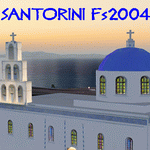
This FS2004 project is about the greek Santorini island (located in the Aegean Sea 200 km southeast from Greece's mainland) and contain two main scenery parts:
1) the "Santorini (Thira) International Airport" (Iata: JTR, Icao: LGSR) where you'll find all buldings (airport and close sourroundings buildings), hundred of custom made detailed objects, static and animated vehicles, animated scenery parts and various effects.
2)the Santorini island scenery where you'll find real hand-made landmarks (churches, factories, windmills,harbors and more), boats/ferries, completely redesigned landclasses with custom (seasonal+night) ground textures, coastlines, roads, main towns with custom greek textures, extreme autogen density and a lot of objects.
Every scenery part (frame-rate friendly thanks to the low poly design) has photoreal textures and everything is placed in the right position (wich was found at spring 2012) and in according to the satellite image.English extendet handbook is included. Watch the screenshot and the demo video on the Albysim youtube chanel and enjoy all scenery features (in this free/demo edition some features are limited).
| Filename: | Santorini_LGSR_Big_Scenery_2012_airport_and_full_i.zip |
| License: | Check within download |
| Added: | 4th November 2012, 13:13:55 |
| Downloads: | 4,724 |
| Author: | Albysim Scenery Design (Alberto Di Bolzano) |
| Size: | 35.43 MB |
| Category: Flight Simulator 2004 - Scenery | |
| CYYN Swift Current Municipal Airport |
|
File Description:
Swift Current Municipal airport is situated approximately 8 km east of the City of Swift Current. It is one of those tiny airports where the default flightsim scenery has no resemblance to the real world airport. CYYN was constructed using GMAX and represents the airport as it was in the Summer of 2007. It includes nearly all the buildings at the airport, runway signs, the addition of fencing, and a rotating beacon. CYYN also includes a landclass file to better represent the terrain around the airport, at least as far as the limits of the default landscape will allow. The airport has a long history, being built in 1937, as one of the hundred-mile airports on the Trans Canada airway. It was greatly expanded as an RCAF / RAF station during world war II. Many of the wartime structures still exist but many are in poor shape. Two of the original three runways remain in service. The airfield is often used by 15 Wing aircraft of CFB Moose Jaw to practice approaches.
| Filename: | CYYN_Swift_Current_Municipal_Airport.zip |
| License: | Freeware |
| Added: | 30th August 2008, 03:25:36 |
| Downloads: | 1,346 |
| Author: | Gregory Putz |
| Size: | 5.28 MB |
| Category: Flight Simulator 2004 - Scenery | |
| FHSH - St. Helena Island & Airport - St. Helena, South Atlantic |
|
Images related to this file:
File Description:
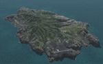
This project is a port of my FSX release of the the new airport (FHSH) on St. Helena Island. This scenery provides more accurate coastlines and roads, as well as corrected landclass based on the latest available satellite imagery. Flight plans are provided for the proposed commercial service to St. Helena, and some additional GA and military flights to the island are added as well.
The FS2004 St. Helena (FHSH) airport was created by aligning master plans for the airport with current satellite data and by studying many of the pictures that have been posted as the airport has taken shape. The official opening of the real airport on May 21, 2016, has been pushed back for more field tests due to challenging crosswinds. Updates were created or rebuilt in a manner which carefully aligns airport data with current satellite imagery. Scenery was created using Airport Design Editor 9 v1.67.5684 and SBuilder. Scenery objects were added and modified from stock FS9 scenery to resemble as closely as possible the actual airports.
| Filename: | FHSH__St_Helena_Island__Airport__St_Helena_South_A.zip |
| License: | Freeware |
| Added: | 5th May 2016, 07:44:38 |
| Downloads: | 2,236 |
| Author: | Carlyle Sharpe |
| Size: | 1.62 MB |
| Category: Flight Simulator 2004 - Scenery | |
| Mielec EPML 2009 |
|
Images related to this file:
File Description:
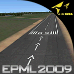
This is third version of EPML airport scenery. Main features of the scenery are: Airport ground high resolution textures - (four seasons + night textures); Highly detailed 3D objects, all photo textured; Detailed autogen and photorealistic trees. For more details please look at the README file attached to the scenery file.
EPML is home base of PZL-Mielec (Polskie Zaklady Lotnicze - Polish Aviation Works), formerly WSK-Mielec and WSK "PZL-Mielec" is the Polish aerospace manufacturer, based inMielec. It has been the biggest Polish post-war aerospace manufacturer. In 2007 it was acquired by Sikorsky Aircraft Corporation, retaining the brand.Starting from 1950, the factory developed much and became the biggest Polish aircraft producer. It was a licensed producer of the Soviet jet fighters MiG-15 (produced as Lim-1), MiG-15bis (Lim-2), MiG-17 (Lim-5) and its Polish attack variant, Lim-6. The first Lim-1s were manufactured of Soviet parts in 1952, a full-scale production started in 1953. About 1500 Lims were built by 1964. In 1957-1960 there were also produced 250 Polish-designed piston trainers TS-8 Bies. From 1963 there was produced Polish-designed jet trainer TS-11 Iskra, being a basic trainer in the Polish military aviation. Its successor, designed with a part of PZL-Mielec, the PZL I-22 Iryda, appeared however a failure for different reasons, mostly lack of proper funding, and only a small series was built.
The most numerous plane built in Mielec was the licensed Soviet Antonov An-2 utility biplane, produced from 1960 in different variants. Over 13,000 of these aircraft were manufactured by 1991, mostly on the Soviet order, but also used in Poland and exported to other countries. From 1984 PZL-Mielec manufactured Soviet STOL transport planes Antonov An-28, as its only producer in the world. The plane was subsequently developed in Mielec and in a modernized variant PZL M-28 Skytruck/Bryza is offered for the Polish Army, Polish Navy and services abroad, with some success.
| Filename: | Mielec_EPML_2009.zip |
| License: | Freeware |
| Added: | 15th May 2010, 09:47:41 |
| Downloads: | 3,780 |
| Author: | Marcin Bobro, Kuba Paczek |
| Size: | 56.33 MB |
| Category: Flight Simulator 2004 - Scenery | |
| Airstrips of North-East Germany |
|
Images related to this file:
File Description:
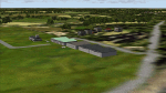
Moving towards completing my Airstrips of Western Europe project, herewith 50+ sceneries for smaller airfields in NE Germany, that I haven't included in my previous uploads, each enhanced with taxiways, parking spaces, buildings etc. and aprons as appropriate, to further facilitate the generation of lightweight AI traffic in the area, without overloading the more major airfields. If you have my "German Airstrips" folder from my previous uploads, these are in addition to that and the folders can be merged. Any apparent duplicates will be (minor) updates and can be over-written.
Again, there's no photo-realism here, just a selection of basic 'generic' buildings, more or less accurately sized and placed to reflect the airfield layout as seen on on-line satellite imagery and aerial photography. These buildings have minimal effect on frame-rates, so are ideal for this kind of job. The airfields are aligned as well as possible with the roads etc. in UT Europe and the Genesis Europe mesh, but should mostly be fine in a default installation or other configuration.
As before, the files for each airfield can be easily identified by the ICAO code, even if the airfield names vary slightly, so you can pick and choose and mix and match to suit any sceneries you already have, should you so wish. There is no requirement for any other download. Each airfield will exist as a stand-alone entity should you only want a few of them.
Very few basic library objects are used ... you can add "eye-candy" to suit your own taste should you wish, or just leave them as vague shapes in the scenery that can put a few more small aircraft into the air. As with other airfields in this series, now these are "ai-activated" you can expect to see the occasional little aircraft turn up at some of them if you've got any third-party traffic installed.
Please read the rest of this "blurb" in the enclosed text file ... there may be some details of interest.
| Filename: | Airstrips_of_NorthEast_Germany.zip |
| License: | Freeware |
| Added: | 14th April 2025, 19:55:20 |
| Downloads: | 82 |
| Author: | Chris Eve |
| Size: | 2.11 MB |
| Category: Flight Simulator 2004 - Scenery | |
| Toronto Downtown Airport CYTZ, Ontario Canada, for Toronto2 |
|
Images related to this file:
File Description:
CYTZ is on an island in Lake Ontario and immediately adjacent to downtown Toronto, and this is the version for use with Flight Ontario's Toronto2 scenery for the Greater Toronto Area. There have been major changes after Porter Airlines purchase of the airport. The obvious and main new item is the terminal, made with photo textures, and with ten gates sized to meet the requirements of the Dash 8-400 they currently use. The terminal has a passenger entrance and a vehicle setdown point as part of the link to the ferry terminal that wraps around the west side of the original and preserved terminal building. The ferry terminal is included here, along with a ferry. Also new are the car parking, road routing, gate and taxi markings, taxiways, taxiway signage, taxiway lighting, runway lighting, aprons, apron lighting (from Sid, and you will need to install his "lights_ss_v2"), fences, fuel tanks, tanker trucks, access roads to navigation equipment, ai parking, static parked planes, parked cars, apron equipment, and the useable floatplane ramp. The AI includes Porter, Jazz, several GA aircraft, and a helicopter; only 3 of these require downloads. The Lake Ontario AI includes three large ships, typical of the traffic to be seen on all the Great Lakes. CYTZ has three runways and there is an airport diagram included. 08-26 has ILS and is the only runway long enough for Porter to use; FS9 atc will ignore this. There is fuel available and it is dispensed from a truck. The longer projection from the front of the terminal building is a covered ramp that leads up from the terminal basement level, used by towed luggage trolleys. The gates are not powered in any way except for the weather cover that protects passengers as they cross the small area of asphalt between plane and gate. I did not try to reproduce this in FS9.
| Filename: | Toronto_Downtown_Airport_CYTZ_Ontario_Canada_for_T.zip |
| License: | Freeware, limited distribution |
| Added: | 23rd October 2012, 12:52:29 |
| Downloads: | 1,531 |
| Author: | Roger Wensley + Flight Ontario |
| Size: | 12.71 MB |
| Category: Flight Simulator 2004 - Scenery | |
| St Michael Island in Alaska-St Michael 5S8 and Stebbins WBB |
|
Images related to this file:
File Description:
St Michael Island is 50 miles southwest of Unalakleet, an island that in fact appears to be a cape and a firmly attached piece of the mainland. On the island there are two villages, St Michael on the northeast corner and Stebbins on the northwest. St Michael has a new airfield that is west of the village by around a mile or so, with a gravel runway 4,000 feet long. The old and now closed airport was known as SMK, and is now readily identifiable by the new red-roofed school building that occupies the centre of the runway. The new airfield now has an icao code of PAMK, but FS9 does not readily accept icao code changes so we are stuck with the original code it was given, 5S8. The SMK icao of the old airport will still show on your gps as if I deleted it the runway would also have to be deleted, and a substitute and unsatisfactory gravel apron made to impersonate a runway. Stebbins is 5 miles west of St Michael and next to the shore, a smaller village than St Michael with around 250 inhabitants. The airfield is at the southern end of the village and has a gravel runway that is 3,000 feet long. The icao code is WBB. There is no AI included here as it was already included in the post of Shaktoolik. There is a correction here for Shaktoolik, which I now find should have had a blue garage, not a red one; I wrongly named a photo. A note here about my scenery making. This is post number 501 and there will not be many more to follow this as I am almost at the end of the photos I took or found for scenery purposes. There is a limit to what can be located online and I have already been making use of the little there is; eg Unalakleet. So, if you are near an airfield (preferably Canadian or Alaskan) and have a camera..... Let me know.
| Filename: | St_Michael_Island_in_AlaskaSt_Michael_5S8_and_Steb.zip |
| License: | Freeware, limited distribution |
| Added: | 1st August 2019, 16:45:58 |
| Downloads: | 96 |
| Author: | Roger Wensley |
| Size: | 3.88 MB |


© 2001-2026 AVSIM Online
All Rights Reserved
Privacy Policy |