
Where Flight Simulation Enthusiasts Gather from Around the World!
AVSIM Library - Search Results

| Category: Flight Simulator 2004 - Scenery | |
| Canlaon Volcano Eruption Scenery |

|
File Description:
Canlaon Volcano is located at the center of Negros Island,Philippines.The twin-peaked massif of Canlaon Volcano (aka Mt. Kanlaon) rises 2,465 meters above the island of Negros just 40-km southwest of the capital Bacolod.This file will add the crater to Canlaon Volcano and will enhance the Landclass surrounding the crater.The crater is real with water.This also adds Visual Effects such as steam,volcanic ashes and lava that will erupt every now and then.Ash falls will fall in the vulnerable surrounding villages of Pula, Malaiba, and Lumanao.The last volcanic activity of Canlaon Volcano recorded by Phivolcs was on June 1-18,2003.
Fly from Bacolod City(RPVB)to Tagbilaran City(RPVT)or Mactan(RPVM) and pass through the highest point of the Island of Negros and behold the beauty of the Canlaon Volcano eruption.
Special steam,ash,and lava effects are visible at daytime and at nighttime.The new Philippine Mesh by Jacques Marie is recommended for achieving realistic topography.You may find it here at avsim,too.
| Filename: | Canlaon_Volcano_Eruption_Scenery.zip |
| License: | Freeware |
| Added: | 10th December 2003, 22:41:38 |
| Downloads: | 3,877 |
| Author: | Ver Walter L. Gulfan |
| Size: | 5.04 KB |
| Category: Flight Simulator 2004 - Scenery | |
| Paul Farm Field CF16 in Ontario, Canada |
|
Images related to this file:
File Description:
Paul Field is on the south side of Highway 174, four miles east of Hawkesbury Windover Field and five miles west of the town of Hawkesbury; the town is on the south bank of the Ottawa River approximately midway between Ottawa and Montreal. I first saw the field when I was on the way to Windover a few years ago. I asked some old timers at Windover who the grass strip belonged to and they said "Paul". It may not be what Paul calls it, but it's the only name I know it by. Probably Paul doesn't call it anything, it's just the field where he keeps his plane. There is a grass runway approximately north-south and 2,000 feet long, and two hangars which look to be an old one and a new one. In real life the runway isn't so north-south as it lines up with the farm fields alignment which is of course in FS is auto-generated and not actuality-accurate.
| Filename: | Paul_Farm_Field_CF16_in_Ontario_Canada.zip |
| License: | Freeware, limited distribution |
| Added: | 6th February 2010, 02:36:49 |
| Downloads: | 291 |
| Author: | Roger Wensley |
| Size: | 997.17 KB |
| Category: Flight Simulator 2004 - Scenery | |
| NTGK Kaukura, French Polynesia |
|
File Description:
Googly scenery for NTGK Kaukura, a small airport on Motu Panao island of Kaukura
atoll, part of the Tuamotu group in French Polynesia. The airport, opened in 1994,
is served just a couple of times per week by ATR turboprop aircraft of Air Tahiti.
Flight Simulator 2004 has only provided a runway at this airport and this scenery
seeks to redress the situation so that you and your "AI" traffic can use the
airport.
The scenery does not purport to be ultra-accurate. Based on high quality
satellite imagery from Google Earth, the layout is proportionally correct but the
added airport features, such as buildings, are built from default Microsoft objects
and add-on libraries so will not look exactly like the real thing.
You are not obliged to download and install any additional scenery libraries,
but to enjoy this scenery in its entirety, you may wish to. It will work fine,
with or without.
| Filename: | NTGK_Kaukura_French_Polynesia.zip |
| License: | Freeware |
| Added: | 19th April 2008, 20:34:24 |
| Downloads: | 1,573 |
| Author: | John Hinson |
| Size: | 70.52 KB |
| Category: Flight Simulator 2004 - Scenery | |
| Calcinate del Pesce, Italy |
|
Images related to this file:
File Description:
Calcinate del Pesce is a small gliders airport placed on Varese lake, approx 25 miles north-west Milan Italy, closed to the Prealpi hills. North of the hills around you can find towers and observer of Campo dei Fiori meteo station. The airport is also base of Elilombarda, helicopter-rescue. Contents: Grass runway placed approx on the real coordinates, with ILS and taxi ways; five different hangars and fast food on the entrance; 10 gliders parked on the ground, several glider boxes all around the airport; a lot of trees around the scenery and lights on parking, gliders and road areas; wind sign, static Cessna, fuel station, people and cars; bird storm floating in the air; complete fences on all the airport perimeter with opening gate; two helicopters on ground and a Coca Cola balloon; small pier in the lake with dinghy; Varese open footbal stadium, close sport building and cathedral (fiction); Campo dei Fiori fantasy scenery with observe and comunication towers
| Filename: | Calcinate_del_Pesce_Italy.zip |
| License: | Freeware |
| Added: | 16th February 2011, 15:34:22 |
| Downloads: | 768 |
| Author: | Aldo Della Vedova |
| Size: | 12.28 MB |
| Category: Flight Simulator 2004 - Scenery | |
| VAUD Udaipur/Dabok, India |
|
Images related to this file:
File Description:
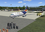
Googly scenery for VAUD Udaipur/Dabok, (also sometimes referred to as VAID) a small domestic airport in
India served by about six flights a day by jets and propeller aircraft from
airlines such as Alliance Air, Jagson Airlines and Jet Airways. These
scenery files improve/add aprons, taxiways, buildings and other airport
features to Flight Simulator's basic representation.
The scenery does not purport to be ultra-accurate. Based on high-detail satellite
imagery from Google Earth, the layout is proportionally correct but the added
[File re-uploaded at request of AVSIM]
airport features, such as buildings, are built from default Microsoft objects
and add-on libraries so will not look exactly like the real thing.
You are not obliged to download and install any additional scenery libraries,
but to enjoy this scenery in its entirety, you may wish to. It will work fine,
with or without.
[File re-uploaded at request of AVSIM]
| Filename: | VAUD__UdaipurDabok_India.zip |
| License: | Freeware |
| Added: | 23rd May 2010, 01:22:29 |
| Downloads: | 1,425 |
| Author: | John Hinson |
| Size: | 67.47 KB |
| Category: Flight Simulator 2004 - Scenery | |
| Redcliffe & Caboolture Airports, Queensland |
|
File Description:
THese are my latest versions of these two great little General Aviation airports for FS9 (FS2004)
Redcliffe is the next biggest general aviation airport in the Brisbane region after Archerfield.This version is a fairly close representation of the real thing which is the home of 2 flying schools. Many ga and also sport aircraft are hangered here. Watch out for the swamp at either end of the runway.... quite a few aircraft over the years have landed there by accident! Redcliffe is also notorious for crosswinds which can make takeoffs and landings interesting at this airport.Caboolture is a wonderful little grass strip about 10 minutes flying north of Redcliffe. The airstrip dates back to WWII and is the home of a strong warbird/vintage aircraft restoration industry, 3 flying schools, a glider club and also a large ultralight fraternity. Caboolture can be a busy little airport on the weekends and a Vintage GA aircraft spotters paradise!
| Filename: | Redcliffe__Caboolture_Airports_Queensland.zip |
| License: | Freeware |
| Added: | 24th September 2003, 00:56:27 |
| Downloads: | 1,430 |
| Author: | Steve James, Mal Lloyd |
| Size: | 2.74 MB |
| Category: Flight Simulator 2004 - Scenery | |
| EBAW2004 Deurne, Antwerpen (Belgium) |
|
File Description:
The airport:
FS2002/2004. Is situated on the western edge of the city of Antwerp and is the home base of VLM Airlines (Vlaamse Luchtvaart Maatschappij). On one side, the airport is enclosed by a residential area, on the other side by an old fort (which is a protected area) an a major district road. All these factors make that the runway is pretty short and a challenge to land on with a larger jet, like a 737 for example. Extra info about this airport can be found on the net : http://www.antwerpairport.be/
Members of FSCB (Flight Simulator Club Belgium), together with the airport authorities made it possible for me to have a guided tour on the airport so I got the opportunity to make pictures of each and every building. This together with other information that people sent to me, I had all the ingredients to make a scenery to what it has become : an exact replica of the real Antwerp airport.
| Filename: | EBAW2004_Deurne_Antwerpen_Belgium.zip |
| License: | Freeware, limited distribution |
| Added: | 27th December 2003, 19:52:39 |
| Downloads: | 7,999 |
| Author: | Robert Buysen |
| Size: | 8.39 MB |
| Category: Flight Simulator 2004 - Scenery | |
| Bumba Airport (FZFU/BMB) |
|
File Description:
Scenery for Bumba airport (FZFU/BMB), namely a small airport located in the North part of the Democratic Republic of Congo (DRC), Mondala Province, serving the small town of Bumba located near the Congo river. Bumba is an ideal reference point for VFR flights along the Congo river in that region, as well as around that part of the DRC forest. The scenery contains two parts: the landclass, that defines the terrain at and around the airport, and the airport scenery, which contains the runway, the aprons, and the 3D objects. In comparison with the default FS2004 scenery, this contains brand new runway and aprons, drawn using custom textures that should give a more realistic feeling of the airstrip, and the landclass has been modified in order to represent faithfully the real landscape around the airport. The Static Object Library of RWY12 is necessary in order to properly display the 3D objects: it can be found easily in the AVSIM library.
| Filename: | Bumba_Airport_FZFUBMB.zip |
| License: | Freeware |
| Added: | 30th April 2020, 18:31:15 |
| Downloads: | 161 |
| Author: | Marco Ruggieri |
| Size: | 7.52 MB |
| Category: Flight Simulator 2004 - Scenery | |
| SWUY Coari/Urucu, Brazil |
|
File Description:
Googly scenery for SWUY Coari/Urucu, Brazil, a small domestic airport
located near Brazil's largest inshore gas source and serving the city
of Coari (some distance away), one of the largest cities in the Amazonas
state. The airport is served about four times daily by ATR aircraft of
Total Linhas Aereas on domestic flights, plus general aviation traffic.
Flight Simulator 2004 has made no provision for traffic with only a runway
provided and this scenery seeks to redress the situation.
The scenery does not purport to be ultra-accurate. Based on high quality
satellite imagery from Google Earth, the layout is proportionally correct but the
added airport features, such as buildings, are built from default Microsoft objects
and add-on libraries so will not look exactly like the real thing.
You are not obliged to download and install any additional scenery libraries,
but to enjoy this scenery in its entirety, you may wish to. It will work fine,
with or without.
| Filename: | SWUY_CoariUrucu_Brazil.zip |
| License: | Freeware |
| Added: | 16th April 2008, 19:26:04 |
| Downloads: | 1,208 |
| Author: | John Hinson |
| Size: | 61.58 KB |
| Category: Flight Simulator 2004 - Scenery | |
| LTBM Isparta, Turkey |
|
Images related to this file:
File Description:
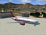
Googly scenery for LTBM Isparta, Turkey - a small airport for which nothing more than a runway has been provided in Flight Simulator 2004. These scenery files add the apron, taxiways, buildings and other airport features so that you and your "AI" traffic can land, taxi, park and take off in a realistic manner.
The airport appears to used mainly for occasional tourism flights, particularly traffic to and from Iran.
The scenery does not purport to be ultra-accurate. Based on high-detail satellite imagery from Google Earth, the layout is proportionally correct but the added airport features, such as buildings, are built from default Microsoft objects and add-on libraries so will not look like the real thing.
You are not obliged to download and install any additional scenery libraries, but to enjoy this scenery in its entirety, you may wish to. It will work fine, with or without.
[File re-uploaded at request of AVSIM]
| Filename: | LTBM_Isparta_Turkey.zip |
| License: | Freeware |
| Added: | 26th June 2010, 13:53:59 |
| Downloads: | 1,559 |
| Author: | John Hinson |
| Size: | 88.64 KB |


© 2001-2026 AVSIM Online
All Rights Reserved
Privacy Policy |