
Where Flight Simulation Enthusiasts Gather from Around the World!
AVSIM Library - Search Results

| Category: Flight Simulator 2004 - Scenery | |
| ENRY - Rygge Airport, Oslo |

|
Images related to this file:
File Description:

This is my first attempt at making a scenery, so do not expect much! It's only an enhancement of the default scenery to make it look a little bit more realistic than the plain stock airport. I have added jetways to gates 3, 4 and 5, as per real life, a couple of hangars, and static aircraft, as well as some de-icing trucks in the de-icing area. I have also redone the taxiway signs my own way, and also equipped the runway with ILS at both ends. Gates are numbered and some have assignments for Ryanair, which is the chief airline serving this airport.
You MUST have the Runway 12 library objects installed to make this scenery work properly. Details of where to find them are included in the readme. Enjoy!
| Filename: | ENRY__Rygge_Airport_Oslo.zip |
| License: | Freeware |
| Added: | 31st July 2011, 17:25:13 |
| Downloads: | 1,606 |
| Author: | Chris Horsfield |
| Size: | 128.91 KB |
| Category: Flight Simulator 2004 - Scenery | |
| Modified SRTM Relief 76 m for Czech Republic |
|
File Description:
This Czech Republic terrain mesh 76 m (LOD9) is made from the 3arc-sec SRTM. Small voids in the source data were filled by the interpolation. Both the primary processing of the 3arc-sec data and the rendering of the terrain in the FS cause flattening and simplifying of the real shape of the terrain. This phenomenon was partially compensated by the sharpening of the source data. Made by the programs Surfer (Golden Software) and MS Terrain SDK 2000 and 2002. The relief covers the area N51.1523 E011.9531 to N48.5156 E018.9844 in the boundaries of the LOD9 quadrants. This scenery contains only the elevation data. The other elements of the basic terrain as the landclass, locally used airborne photos, vector roads, rivers and lakes are available in different sceneries by other authors and they are continuously developed.
| Filename: | Modified_SRTM_Relief_76_m_for_Czech_Republic.zip |
| License: | Freeware |
| Added: | 22nd December 2003, 21:25:07 |
| Downloads: | 6,723 |
| Author: | Vladimir Stoje |
| Size: | 20.81 MB |
| Category: Flight Simulator 2004 - Scenery | |
| "Caiolo" Sondrio Airport, Valtellina, North Italy |
|
Images related to this file:
File Description:
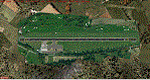
In this airport reside AvioValtellina and VolaValtellina, as well as the operational base of the Health Service 118 and Mountain Rescue. It also base of the Aeroclub Sondrio with its Flight School VDS. Site at the beginning of the Valtellina, in Caiolo municipality (N46 09.0 E09 48.0), has an asphalt runway from 1050x23 mts, ground communication frequency 129.50; ICAO code: LILO. It is also enclosed the base of INAER Aviation, located in Colico-Piantedo (N46 08.18 E09 24.19 - code LIEI), that operates in Medical Emergency, rescue operations in the mountains and off-shore. Scenery realized on the real cooordinates of the airport (except for elevation) including the scenery of the heliport INAER Colico. Requires the use of the libraries' dva51 "and the system of vegetations "TreePlanter".
Enjoy!
A presentation video is available here.
| Filename: | Caiolo_Sondrio_Airport_Valtellina_North_Italy.zip |
| License: | Freeware |
| Added: | 25th October 2014, 11:52:25 |
| Downloads: | 860 |
| Author: | Aldo Della Vedova |
| Size: | 29.5 MB |
| Category: Flight Simulator 2004 - Scenery | |
| Modified SRTM relief 76 m for Slovakia |
|
File Description:
This Slovak terrain mesh 76 m (LOD9) is made from the 3arc-sec SRTM. The voids in the source data were filled by the interpolation. Both the primary processing of the 3arc-sec data and the rendering of the terrain in the FS cause flattening and simplifying of the real shape of the terrain. This phenomenon was partially compensated by the sharpening of the source data.
Made by the programs Surfer (Golden Software) and MS Terrain SDK 2000 and 2002. The relief covers the area N49.9219 E016.1719 to N47.4609 E022.9687 in the boundaries of the LOD9 quadrants. This scenery contains only the elevation data. The other elements of the basic terrain as the landclass, locally used airborne photos, vector roads, rivers and lakes are available in different sceneries by other authors and they are continuously developed.
| Filename: | Modified_SRTM_relief_76_m_for_Slovakia.zip |
| License: | Freeware, limited distribution |
| Added: | 28th May 2010, 19:40:13 |
| Downloads: | 4,610 |
| Author: | Vladimir Stoje |
| Size: | 19.36 MB |
| Category: Flight Simulator 2004 - Scenery | |
| LOWS 2006, Designator Patch |
|
File Description:
Since the deployment of the freeware "W.A. Mozart Airport in Salzburg/Austria" (LOWS 2006) by Johannes Kimla the magnetic deviation has changed significantly. Thus, in the real world, it was decided to change the designators for the runways accordingly. Since a few weeks the runways have been renamed: the former RW34 is now named "RW33", and corresponding to this the former RW16 is named "RW15" now.
For those flight simulation enthusiasts who want to fly in a simulated world close to reality we are offering a small patch which take account of these changes: the new designators are now visible on the runways, the taxiway signs should lead to the correct runways. In addition a small file is included which controls the proper approaches on RW15. Please note that this patch is only working with Microsoft Flight Simulator 2004!!!
| Filename: | LOWS_2006_Designator_Patch.zip |
| License: | Freeware |
| Added: | 30th September 2012, 21:33:41 |
| Downloads: | 4,305 |
| Author: | Johannes Kimla |
| Size: | 143.2 KB |
| Category: Flight Simulator 2004 - Scenery | |
| Mogadishu Aden Adde International Airport, HCMM/MGQ |
|
Images related to this file:
File Description:
Mogadishu Aden Adde International Airport scenery for FS9. The scenery comes with a landclass, that defines the terrain at and around the airport, and the airport scenery, which contains the runway, the aprons, and the 3D objects. I have modified a bit the landclass of the default FS2004 scenery to improve the experience of visual landing at HCMM on both runways and of flying VFR around the airport area.
The scenery comes with proper runway, taxiways and aprons: these have been drawn by Gmax using photoreal textures of concrete and asphalt whenever it was possible, trying to reproduce the structure of the concrete and asphalt surfaces of the real airport.
In order to visualize some of the objects of the scenery, the Static Objects Library (also known as RWY12) is necessary: it can be downloaded on AVSIM.
| Filename: | Mogadishu_Aden_Adde_International_Airport_HCMMMGQ.zip |
| License: | Freeware |
| Added: | 27th May 2020, 18:12:59 |
| Downloads: | 331 |
| Author: | Marco Ruggieri |
| Size: | 44.55 MB |
| Category: Flight Simulator 2004 - Scenery | |
| PIK2004 |
|
File Description:
FS2004 - (Glasgow)Prestwick International Airport.
This whole package is intended to compliment the comprehensive scenery for Scotland provided by the Scotflight Commercial Product, whilst at the same time being fully compatible with default scenery also.
This Fs2004 only compatible scenery gives highly detailed scenery for Prestwick Airport and it's immediate surrounds.
Prestwick Airport is a hub for the low-cost carrier Ryanair providing flights to many European destinations. Other holiday charter flights operate from the airport and there is a busy cargo terminal. Also adjacent to the airfield is the BAE Systems factory ( formerly Scottish Aviation) and extensive detailed scenery for this site is included.
The ground elements of the scenery are drawn with Lee Swordy's excellent Afcad program. The same file also adds AI traffic and accurately placed gates and parking spots. Included is the recently added FlightCentre, with AI traffic movements, the new Ryanair Service Hangar and new Business Park.
All added buildings are custom made, many with photo-texturing. The scenery has taxiway signs, active wigwags and full night lighting and a few static aircraft, discreetly placed.
A stretch of redrawn accurate coastline is included allowing the addition of the sandy beaches on the approach to Runway 13.
The two renowned championship golf courses of Royal Troon and Old Prestwick also feature on the seaward approach plus further golf courses in the towns of Prestwick and Ayr.
A local replacement road system covering the airport surrounds and the towns of Prestwick and Ayr is also included and this together with the replacement coastline should be compatible with any of the new Coastline and Roads products now available.
| Filename: | PIK2004.zip |
| License: | Freeware, limited distribution |
| Added: | 27th August 2005, 19:32:32 |
| Downloads: | 24,612 |
| Author: | Iain Gallacher-Scotflight Scenery |
| Size: | 8.07 MB |
| Category: Flight Simulator 2004 - Scenery | |
| Airstrips of Scandinavia and the Baltic States |
|
Images related to this file:
File Description:
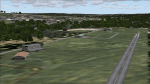
Effectively an extension of my "Airstrips of Western Europe" project for FS2004, around 140 sceneries of small airfields in Scandinavia and the Baltic states, each enhanced with buildings, taxiways, parking spaces and aprons as appropriate, to further facilitate the generation of lightweight AI traffic in the area, without overloading the more major airfields.
Given the available comprehensive coverage of both Norway and Finland by other authors, and much of Denmark by myself in my earlier "Airstrips of North-West Europe" upload, this selection comprises mostly small Swedish and Baltic State airfields.
Unfortunately, due to the very nature of much of the area, some of these airstrips are just that, a grass/dirt runway on a flattened/mown area in the landscape with just an associated building or two. Nevertheless, they do perform the required function of providing sources for AI traffic. The very existence of those airstrips not included in FS2004 is referred to in various on-line databases.
Again, there's no photo-realism here, just a selection of basic 'generic' buildings, more or less accurately sized and placed to reflect the airfield layout as seen on on-line satellite imagery and aerial photography. These buildings have minimal effect on frame-rates, so are ideal for this kind of job. The airfields are aligned as well as possible with the roads etc. in UT Europe (where applicable) and the Genesis Europe mesh, but should mostly be fine in a default installation or other configuration.
Please read the rest of this "blurb" in the included text file. There may be some details of note or interest.
| Filename: | Airstrips_of_Scandinavia_and_the_Baltic_States.zip |
| License: | Freeware |
| Added: | 11th November 2024, 17:25:16 |
| Downloads: | 117 |
| Author: | Chris Eve |
| Size: | 2.52 MB |
| Category: Flight Simulator 2004 - Scenery | |
| Petaluma , California (O69) Scenery |
|
File Description:
This is a scenery upgrade for Petaluma Airport, California (O69). This is part Five of a series of small airstrip and minor airfield scenery enhancements which are based on real world data from Google Earth.
This is a more complex scenery than previous ones. You can see from the Google earth image that a golf course runs alongside the airport (appropriately called the Rabbit Run!). I have tried to include this with a golf course landclass polygon, also the airfield base seems mainly a red soil and this is reflected in the airbase poly. Built using EZ_Scenery, Lee Swordy's AFCAD and SBuilder. You must have rwy12 and EZ scenery libraries installed for the buildings to show. Both libraries of objects are free;
EZ Library is available from this URL http://www.abacuspub.com/pub/AbacusEZLibraries.exe
rwy12 from Avsim and additional EZ Custom libraries from Avsim. Search under Scenery design.
| Filename: | Petaluma__California_O69_Scenery.zip |
| License: | Freeware |
| Added: | 23rd March 2006, 23:09:07 |
| Downloads: | 719 |
| Author: | Kim Gowney |
| Size: | 629.87 KB |
| Category: Flight Simulator 2004 - Scenery | |
| OIBJ Jam/Tohid, Iran |
|
File Description:
Googly scenery for OIBJ Jam/Tohid - a small Iranian domestic airport for which
nothing more than a runway is provided in Flight Simulator 2004. These scenery
files add taxiways, aprons, buildings and other airport features so that you
and your "AI" traffic can land, taxi, park and take off in a realistic manner.
The airport is served about twice per week by Fokker jets of Iran Air.
The scenery does not purport to be ultra-accurate. Based on high-detail satellite
imagery from Google Earth, the layout is proportionally correct but the added
airport features, such as buildings, are built from default Microsoft objects
and add-on libraries so will not look like the real thing.
You are not obliged to download and install any additional scenery libraries,
but to enjoy this scenery in its entirety, you may wish to. It will work fine,
with or without.
| Filename: | OIBJ_JamTohid_Iran.zip |
| License: | Freeware |
| Added: | 8th July 2007, 21:19:39 |
| Downloads: | 1,020 |
| Author: | John Hinson |
| Size: | 80.11 KB |


© 2001-2026 AVSIM Online
All Rights Reserved
Privacy Policy |