
Where Flight Simulation Enthusiasts Gather from Around the World!
AVSIM Library - Search Results

| Category: Flight Simulator 2004 - Scenery | |
| Airstrips of Central Germany |

|
Images related to this file:
File Description:

Another selection in my Airstrips of Western Europe project, herewith 80+ small airfields in central Germany, each enhanced with taxiways, parking spaces, buildings etc. and aprons as appropriate, to further facilitate the generation of lightweight AI traffic in the area, without overloading the more major airfields.
Again, there's no photo-realism here, just a selection of basic 'generic' buildings, more or less accurately sized and placed to reflect the airfield layout as seen on on-line satellite imagery and aerial photography. These buildings have minimal effect on frame-rates, so are ideal for this kind of job. The airfields are aligned as well as possible with the roads etc. in UT Europe and the Genesis Europe mesh, but should mostly be fine in a default installation or other configuration.
As before, the files for each airfield can be easily identified by the ICAO code, even if the airfield names vary slightly, so you can pick and choose and mix and match to suit any sceneries you already have, should you so wish. There is no requirement for any other download. Each airfield will exist as a stand-alone entity should you only want a few of them.
Please read the rest of this "blurb" in the included text file. There may be some details of note or interest.
| Filename: | Airstrips_of_Central_Germany.zip |
| License: | Freeware |
| Added: | 26th February 2025, 19:22:06 |
| Downloads: | 113 |
| Author: | Chris Eve |
| Size: | 1.14 MB |
| Category: Flight Simulator 2004 - Scenery | |
| LPVZ_Viseu Municipal airfield v2.0 |
|
File Description:
LPVZ_Viseu Municipal airfield (Goncalves Lobato Airfield) Version 2.0.
This freeware scenery was created using digital pictures taken at the airfield, as well as real measures by Google Earth and official information at http://www.nav.pt/ais/VFRs/VISEU.pdf (it is supposed you download the file and read it carefully); there are obstacles as well as visual references... and I placed them in this scenery, see README doc included. This scenery have dawn, dusk and night effects; Static firefighter helicopter added and some terrain changes by Leonardo Santos
This scenery is to be used EXCLUSIVELLY with Portugal Terrain from PTSIM (http://www.ptsim.com)
Freeware. For Microsoft FS2004.NOT tested for FSX. By Joao A. Graca Ferreira
| Filename: | LPVZ_Viseu_Municipal_airfield_v20.zip |
| License: | Freeware |
| Added: | 18th May 2018, 01:18:51 |
| Downloads: | 236 |
| Author: | Joao A. Graca Ferreira |
| Size: | 13.99 MB |
| Category: Flight Simulator 2004 - Scenery | |
| Working TACAN Beacons in the UK |
|
Images related to this file:
File Description:

Working TACAN Beacons in the UK: In real-life TACAN beacons require a TACAN receiver to receive the course (OBS) information of the beacon. With a civil VOR/DME receiver you only receive the distance (DME) to the beacon. The problem in FS is that there are no dedicated TACAN gauges, so it's not possible to perform TACAN approaches, because this requires course information of the beacon. To overcome this problem i've modified the TACAN beacons in the UK so you can fully use them with civil receivers. And so are able to fly TACAN approaches. For charts how to fly the TACAN approaches see (procedure section) http://www.cenor.org/ (reupload) by Marcel Ritzema
| Filename: | Working_TACAN_Beacons_in_the_UK.zip |
| License: | Freeware, limited distribution |
| Added: | 13th May 2010, 21:06:04 |
| Downloads: | 1,020 |
| Author: | Marcel Ritzema |
| Size: | 492.34 KB |
| Category: Flight Simulator 2004 - Scenery | |
| Quinta do Alqueidao ULM Airfield v1 |
|
Images related to this file:
File Description:

This very old farm was reworked in order to became an ULM airfield, very crowded during weekends; it's also a rural tourism farm with a small but very nice restaurant (I suggest you visit Pelicano site and see the pictures). This scenery is ONLY compatible with Portugal Terrain from PTSIM (http://www.ptsim.com) and is based on digital pictures taken at the place, accurate real measures by Aerodromos de Portugal (http://www.pelicano.com.pt/zmapa.html). Although certified for ULM, this airfield have no ICAO so I gave it the fake LPQA.
This scenery is still under construction, so a second version will be published with several improvements and reworked objects. Freeware. For Microsoft FS2004. NOT tested for FSX
| Filename: | Quinta_do_Alqueidao_ULM_Airfield_v1.zip |
| License: | Freeware |
| Added: | 20th September 2011, 23:38:52 |
| Downloads: | 372 |
| Author: | Joao A. Graca Ferreira |
| Size: | 4.01 MB |
| Category: Flight Simulator 2004 - Scenery | |
| Franz Josef Aerodrome - NZFJ |
|
File Description:
Franz Josef Aerodrome on New Zealand's South Island is the ideal place from which to explore the Southern Alps and the Franz Josef Glacier.
Real-world charts have been used to ensure correct placement and dimensions of the Aerodrome although some artistic license has been taken to make this scenery 'user friendly' for FS2004!
The scenery was created using Lee Swordy's AFCAD and the magnificent RWY12 Object Placer software (you will require the RWY12 Static Object Library for this scenery to be properly displayed).
This is my first ever scenery and, whilst it has been tested, problems may still arise. Please feel free to contact me with any suggestions or queries.
Enjoy!
| Filename: | Franz_Josef_Aerodrome__NZFJ.zip |
| License: | Freeware |
| Added: | 11th March 2006, 20:42:24 |
| Downloads: | 516 |
| Author: | Mike Walters |
| Size: | 755.23 KB |
| Category: Flight Simulator 2004 - Scenery | |
| Placerville Airport (KPVF) California |
|
File Description:
This is a scenery upgrade for Placerville Airport, California (KPVF). This is part Four of a series of small airstrip and minor airfield scenery enhancements which are based on real world data from Google Earth (Not this one though, Google earth did not have a detailed image of KPVF so I had to use what was available on the net, which was not much!). Built using EZ_Scenery, Lee Swordy's AFCAD and SBuilder. You must have rwy12 and EZ scenery libraries installed for the buildings to show. Both libraries of objects are free. EZ Library is available from this URL http://www.abacuspub.com/pub/AbacusEZLibraries.exe. Rwy12 from Avsim and additional EZ Custom libraries from Avsim also. Search under Scenery design.
| Filename: | Placerville_Airport__KPVF_California.zip |
| License: | Freeware |
| Added: | 21st March 2006, 23:26:12 |
| Downloads: | 642 |
| Author: | Kim Gowney |
| Size: | 242.76 KB |
| Category: Flight Simulator 2004 - Scenery | |
| Alaska/BC Bush Scenery: Edgecombe Lodge, Johnny Mountain Mine, & Bob Quinn Lake |
|
File Description:
My fourth bush scenery in Alaska/British Columbia. This package includes three airstrips: the first runway at Edgecombe Lodge has an unusual inclined profile, located precariously across a ridgeline on Annette Island near Ketchikan. I've also put together a tailor-made NDB Instrument Approach plate for it. The other two, Johnny Mountain Mine and Bob Quinn Lake, are hazardous real-life airstrips along the Iskut River in BC (about 50 miles north of Ketchikan). Includes AFCAD files for FS2004 and FS2002. Although I have modified the terrain to create the runways, Eddie Denney's FS2002 mesh of Alaska is still required as a foundation for this scenery to work. Also requires Gerrish Gray's Tree Library (release 3).
| Filename: | AlaskaBC_Bush_Scenery_Edgecombe_Lodge_Johnny_Mount.zip |
| License: | Freeware, limited distribution |
| Added: | 26th January 2004, 15:42:49 |
| Downloads: | 4,434 |
| Author: | James Belk |
| Size: | 5.64 MB |
| Category: Flight Simulator 2004 - Scenery | |
| Mingaladon Airport 2006, Yangon, Myanmar (VYYY) |
|
Images related to this file:
File Description:
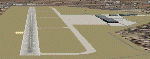
Yangon International Airport "MINGALADON" will be able to accommodate bigger aircrafts and handle more passengers when work on extending its runway and upgrading its facilities is completed in July 2006. The completion of the runway extension will enable Boeing 747 and Airbus 380 airplanes to use the airport. The work on extending the runway from 8100 feet to 11,200 feet began October 2004. The length of the two-storey building will be increased from 340 feet to 800 feet, its width from 140 feet to 200 feet. This scenery buildings and parking areas maybe are different from the real one, but the runway is exact 11228 feet long. The ILS-Correction is already contained here. Re-upload
| Filename: | Mingaladon_Airport_2006_Yangon_Myanmar_VYYY.zip |
| License: | Freeware, limited distribution |
| Added: | 8th June 2010, 01:00:57 |
| Downloads: | 1,367 |
| Author: | HOUSE-RP |
| Size: | 16.95 KB |
| Category: Flight Simulator 2004 - Scenery | |
| OMSJ Sharjah Minor Update for FS2004 March 2019 |
|
File Description:
This is a basic 2019 rework of the Sharjah Airport by Matthew Ministry made in 2010. I have only updated the Airport Layout as it shows to this day. The old runway 12/30 is now Taxiway B as per the real charts. PLEASE note, the parking spaces are a bit off but the main focus of this was to updated the Airport layout with the updates taxiways. See readme for details. But it does the job for FS9 pilots to fly and enjoy some Air Arabia hops out of the UAE. Happy flying FS9 users!
This works fully with Flytampa OMDB, only prioritize in your library order to show the scenery properly!
| Filename: | OMSJ_Sharjah_Minor_Update_for_FS2004_March_2019.zip |
| License: | Freeware, limited distribution |
| Added: | 23rd March 2019, 16:26:39 |
| Downloads: | 912 |
| Author: | Nadeem Zabaneh |
| Size: | 4.19 MB |
| Category: Flight Simulator 2004 - Scenery | |
| Milano Linate Refresh 2017 |
|
Images related to this file:
File Description:

Hello guys, I proceed with my work retexturizzazione the legendary scenery isd Milan Linate done by ISD.
Basically I worked to make it less "cartoon" the old texture of the airport making it much more plausible real photos the colors of the airport.
To install it is sufficient to copy the texture folder of your Linate isd new textures. (I recommend making back up first).
To complete the work I recommend to install in addition to the original scenario, even my "Linate area" 2013 always available on AVSIM.
It goes without saying that I recommend for the best performance to have autogen to massimo.Ps (not a job of AFCAD but only graphic)
VIVA FS2004! VIVA ITALY
| Filename: | Milano_Linate_Refresh_2017.zip |
| License: | Freeware |
| Added: | 9th March 2017, 04:49:28 |
| Downloads: | 1,957 |
| Author: | fabio ferrari |
| Size: | 7.89 MB |


© 2001-2026 AVSIM Online
All Rights Reserved
Privacy Policy |