
Where Flight Simulation Enthusiasts Gather from Around the World!
AVSIM Library - Search Results

| Category: Flight Simulator 2004 - Scenery | |
| Maine Lobster Festival |

|
File Description:
This scenery was first introduced for FS2002 and was well liked so I made an adapted version better suited for FS2004. Take-off from KBHB and follow the road sign till you get to Tom's Lobster House. On the way, you will see lots of candies. You can fly that Cub or Jenny real slow and it will be perfect. You can land on the beach or use the float plane dock. Or, for the first time, driving there is fun also. Read the instructions and view the pictures.
| Filename: | Maine_Lobster_Festival.zip |
| License: | Freeware |
| Added: | 6th November 2003, 03:57:38 |
| Downloads: | 1,261 |
| Author: | Leon Louis |
| Size: | 3.08 MB |
| Category: Flight Simulator 2004 - Scenery | |
| Csákvár (Abandoned Airport) |
|
File Description:
Csákvár, Hungary abandoned military airport. This is my first scenery design, so sorry for poorness. Made from real aviation maps. I'm making many airports in Hungary,so those how miss the airports will get those soon. About 55 aiports will be made. I hope I can finish them within a month or two. I upload another scenery: Békéscsaba. I will put all the aiportst in one pack. Made with FS Scenery Creator. Macros used from the internet. If you have any questions, please write me at: [email protected] Thanks!
| Filename: | Cskvr_Abandoned_Airport.zip |
| License: | Freeware |
| Added: | 17th May 2004, 22:40:46 |
| Downloads: | 761 |
| Author: | Kornél Várhelyi |
| Size: | 214.46 KB |
| Category: Flight Simulator 2004 - Scenery | |
| CYZF Yellowknife, Northwest Territories |
|
File Description:
Created using EZ-Scenery by Abacus. I could find only a few photos of Yellowknife, so there was a certain amount of guesswork involved in making this scenery. The general layout should be reasonably accurate and it's hopefully an improvement over the default scenery. The terminal and tower at the real Yellowknife are really cool. I'm sorry I couldn't do a better job at representing them. Also includes a file to add some additional GA traffic. Have fun flying in the beautiful Northwest Territories. (Previous version had 616 downloads)
| Filename: | CYZF_Yellowknife_Northwest_Territories.zip |
| License: | Freeware |
| Added: | 12th March 2006, 04:03:36 |
| Downloads: | 3,243 |
| Author: | Sidney Schwartz |
| Size: | 2.91 MB |
| Category: Flight Simulator 2004 - Scenery | |
| Mustang Airport, (2CL9) Galt, California |
|
File Description:
This is a scenery upgrade for Mustang Airport, Galt, California (2CL9) Part Eleven of a series of small airstrip and minor airfield scenery enhancements which are based on real world data from Google Earth.
Again just a small Hanger and some other building seem to make up the airstrips buildings but the strip itself (which is a remarkable 4000ft long!) is surrounded by a very regular group of fields divided by dirt roads, this is visible both from google and the airnav shot, consequently I have made the scenery to try and match this.
| Filename: | Mustang_Airport_2CL9_Galt_California.zip |
| License: | Freeware |
| Added: | 6th April 2006, 05:00:33 |
| Downloads: | 476 |
| Author: | Kim Gowney |
| Size: | 127.02 KB |
| Category: Flight Simulator 2004 - Scenery | |
| Tetlin Lake |
|
File Description:
Welcome to Tetlin Lake! Great scenery and fantastic fishing are found throughout the entire area. Tetlin Lake sits in an outdoorsman's paradise. One may fly in and land at the airport or use the floatplane facility at the lake. This is a great vacation spot, and is about as comfortable a place as one may find in the vast expanse of Alaska. Bigger airports such as Delta Junction, Tok Junction and Northway, are not too far from Tetlin Lake. While Tetlin Lake is truly a real-world lake, this scenery is fictitious. Please enjoy!
| Filename: | Tetlin_Lake.zip |
| License: | Freeware, limited distribution |
| Added: | 21st October 2005, 20:00:07 |
| Downloads: | 1,828 |
| Author: | Don Moser |
| Size: | 1012.12 KB |
| Category: Flight Simulator 2004 - Scenery | |
| Photorealisitic Grass Textures |
|
Images related to this file:
File Description:
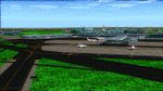
Are you tired of having Default Grass Textures within your FS2004?
Are you fed up with paying loads & loads of money for expensive Payware Addons?
Lost track of all the look-a-like 'amazing' textures and everytime you get dissapointed?
Looking for FREEWARE Photorealisitic Grass Textures that give you the "As Real As It Gets"-feeling?
Don't Search Any Longer... 'Cause Now you HAVE THEM RIGHT HERE!
20 Amazing Textures that will GREATLY enhance your FS2004, At the airports and around the Globe!
Fly with FREEWARE Photorealisitic Grass Textures TODAY!
| Filename: | Photorealisitic_Grass_Textures.zip |
| License: | Freeware |
| Added: | 20th May 2012, 06:15:51 |
| Downloads: | 1,012 |
| Author: | Diego Varela Rodriguez |
| Size: | 24.64 MB |
| Category: Flight Simulator 2004 - Scenery | |
| Tripoli Internaional Airport 2010 V.1 For FS2004 / FSX |
|
Images related to this file:
File Description:
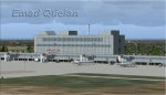
FS2004 /FSX Tripoli International (HLLT) Scenery. A large effort has been made in designing
this airport to make it look as real as the original, lots of objects desigined by me and
another were also use to speed up the process of designing of the airport as it took me almost
6 month to complete, in FSX you may notice that few textures or objects do not show correctly
a lot more work needs to be done, but my schedule is full, hopfully there is going to be updates
in the future.
| Filename: | Tripoli_Internaional_Airport_2010_V1_For_FS2004__F.zip |
| License: | Freeware, limited distribution |
| Added: | 5th May 2010, 22:13:20 |
| Downloads: | 14,139 |
| Author: | Emad Qtiefan |
| Size: | 21.52 MB |
| Category: Flight Simulator 2004 - Scenery | |
| Ferndale 53U in Montana US |
|
Images related to this file:
File Description:
I have made this because I downloaded and tried the Glacier Park photo land-class scenery by Blue Sky Scenery and then rediscovered that the airfield runways are not correctly positioned or aligned in FS9. So I corrected the Ferndale runway and while I was there also added 33 hangars and some parked planes. Of course, as all I know about the hangars is the colour of the roof this isn't up to total realism. It is, however, better than nothing and as I have a large stock of hangars from other sceneries not much effort was involved.
Ferndale is an "airpark" type of airfield where folks build their houses and hangers around the field, plus it also has a bunch of hangars; it is the "bunch" that I have replicated, as I have no idea at all what the houses look like. The field is 20 miles southeast of Glacier Park International at 3,060 feet ASL and around 55 miles south of the Canadian border. There are no large towns close by; the nearest would be Missoula, which is some 70 miles further south.
| Filename: | Ferndale_53U_in_Montana_US.zip |
| License: | Freeware, limited distribution |
| Added: | 29th May 2010, 17:54:14 |
| Downloads: | 291 |
| Author: | Roger Wensley |
| Size: | 2.26 MB |
| Category: Flight Simulator 2004 - Scenery | |
| Ivujivik CYIK in Hudson Bay, Quebec, Canada |
|
Images related to this file:
File Description:
Ivujivik is a village of 350 or so inhabitants at N62 25 W78 on the northeastern corner of Hudson Bay. The village does not feature in FS9 but is included in this scenery with approximately the right shape (the coast, even with UT, is not exactly right) so just think of it as a hand-made auto-generated village which gives the airfield a reason. The runway is 3,500 feet of gravel 100 feet wide, which should be enough. I also added the roads, deleted the stock airfield background and added a new background, plus of course there is the scenery file and the AFCAD and AI. You may note that the terminal has the elevation written on the sign as 126', while on the winter photo it is written on the older & bigger sign as 130'. I thought this is because satellite radar has fixed the elevations of all airfields more accurately than before, as Rockcliffe too has gone from 192' to 188'; the alternative explanation is that global warming has raised sea level by 4'. Wow! That's a thought. I presume the new sign was made smaller as a cost saving.
| Filename: | Ivujivik_CYIK_in_Hudson_Bay_Quebec_Canada.zip |
| License: | Freeware, limited distribution |
| Added: | 31st October 2010, 07:41:20 |
| Downloads: | 458 |
| Author: | Roger Wensley |
| Size: | 2.07 MB |
| Category: Flight Simulator 2004 - Scenery | |
| Colorado Lakes Project II |
|
File Description:
This project features the Blue Mesa Reservoir and the Black Canyon of the Gunnison and adds over 300 highly detailed lakes to the central portion of western Colorado. Three reservoirs, named for corresponding dams on the Gunnison River, form the heart of Curecanti National Recreation Area. Panoramic mesas, fjord-like reservoirs, and deep, steep and narrow canyons abound. Blue Mesa Reservoir is Colorado's largest body of water, and is the largest Kokanee Salmon fishery in the United States. Morrow Point Reservoir is the beginning of the Black Canyon of the Gunnison and below it is Crystal Reservoir.
These lakes are specifically designed to show off their photo realistic detail when used in combination with "FSGenesis-The Rockies 38.2m Terrain Mesh-Colorado" available as "fsg_dem38m_usrk_co.zip" at avsim.com, or comparable mesh. The free FSGenesis US National Landclass Project Beta 6 also adds beautifully to the landscape. These lakes work equally as well with the default mesh.
All lake information was projected from satellite imagery and compiled with a beta version of Jim Keir's "Slartibartfast" utility. Much thanks to Holger Sandmann and Jim Keir for their help and advice on interpreting the satellite data properly.
| Filename: | Colorado_Lakes_Project_II.zip |
| License: | Freeware |
| Added: | 1st June 2004, 02:34:42 |
| Downloads: | 6,057 |
| Author: | Carlyle Sharpe |
| Size: | 332.25 KB |


© 2001-2026 AVSIM Online
All Rights Reserved
Privacy Policy |