
Where Flight Simulation Enthusiasts Gather from Around the World!
AVSIM Library - Search Results

| Category: Flight Simulator 2004 - Scenery | |
| VEAT Argatala, India |

|
Images related to this file:
File Description:
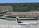
Googly scenery for VEAT Argatala, India - one of the airports that Microsoft seem to have, um, "forgotten" in FS2004. In the real world it is regularly served by Boeings and Airbii of Alliance Air, Indian Airlines, Jet Airways and Kingfisher Airlines (and smaller aircraft), using the 6000 foot runway with little room for manoevre. These scenery files add aprons, taxiways, buildings and other airport features to Flight Simulator's bland representation and allow you, and "AI" traffic, to land, taxi, park and take off realistically. The scenery does not purport to be ultra-accurate. Based on high-detail satellite imagery from Google Earth, the layout is proportianally correct but the added airport features, such as buildings, are built from default Microsoft objects and add-on libraries so will not look like the real thing. You are not obliged to download and install any additional scenery libraries, but to enjoy this scenery in its entirety, you may wish to. It will work fine, with or without. Details of optional additional scenery library downloads are provided within.
[File re-uploaded at request of AVSIM]
| Filename: | VEAT_Argatala_India.zip |
| License: | Freeware |
| Added: | 14th May 2010, 04:49:05 |
| Downloads: | 1,658 |
| Author: | John Hinson |
| Size: | 65.16 KB |
| Category: Flight Simulator 2004 - Scenery | |
| WIOO Pontianak/Supadio, Kalimantan, Indonesia |
|
Images related to this file:
File Description:
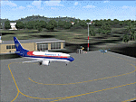
Googly scenery for WIOO Pontianak/Supadio, Kalimantan, Indonesia. In Flight Simulator
2004 only a general aviation parking is provided at this important Indonesian domestic
airport, but in the real world it is served over fifteen times
a day by jets and smaller aircraft of Adam Air, Airfast Service, Batavia Air, Deraya
Air Taxi, Indonesia Air Transport, Sriwijaya Air and Tri-MG Intra Asia Airlines. These
scenery files add aprons, taxiways, buildings and other airport features to Flight
Simulator's limited representation and allow "AI" traffic to land, taxi, park and
take off in a realistic manner.
The scenery does not purport to be ultra-accurate. Based on high-detail satellite
imagery from Google Earth, the layout is proportionally correct but the added
airport features, such as buildings, are built from default Microsoft objects
and add-on libraries so will not look like the real thing.
You are not obliged to download and install any additional scenery libraries,
but to enjoy this scenery in its entirety, you may wish to. It will work fine,
with or without.
[File re-uploaded at request of AVSIM]
| Filename: | WIOO_PontianakSupadio_Kalimantan_Indonesia.zip |
| License: | Freeware |
| Added: | 15th May 2010, 01:10:01 |
| Downloads: | 1,963 |
| Author: | John Hinson |
| Size: | 64.96 KB |
| Category: Flight Simulator 2004 - Scenery | |
| WAML Palu/Mutiara, Indonesia |
|
Images related to this file:
File Description:
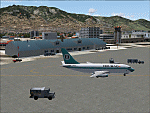
Googly scenery for WAML Palu/Mutiara, Indonesia. In Flight Simulator 2004 little
is provided other than a runway at this small domestic airport, although in the
real world it sees regular jet flights from airlines such as Batavia Air, Bouraq
Indonesia Airlines, Garuda Citylink, Lion Airlines and Merpati Nusentara and
smaller aircraft from operators like Airfast Service and Indonesia Air Transport.
These scenery files add aprons, taxiways, buildings and other airport features
to Flight Simulator's limited representation and allow "AI" traffic to land,
taxi, park and take off in a realistic manner.
The scenery does not purport to be ultra-accurate. Based on high-detail satellite
imagery from Google Earth, the layout is proportionally correct but the added
airport features, such as buildings, are built from default Microsoft objects
and add-on libraries so will not look exactly like the real thing.
You are not obliged to download and install any additional scenery libraries,
but to enjoy this scenery in its entirety, you may wish to. It will work fine,
with or without.
| Filename: | WAML_PaluMutiara_Indonesia.zip |
| License: | Freeware |
| Added: | 15th May 2010, 01:11:30 |
| Downloads: | 1,771 |
| Author: | John Hinson |
| Size: | 140.88 KB |
| Category: Flight Simulator 2004 - Scenery | |
| VEPT Patna, India |
|
Images related to this file:
File Description:
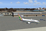
Googly scenery for VEPT Patna, India. In Flight Simulator 2004, the airport is
depicted at a pretty waterside location but only a small ramp for general aviation
aircraft is provided. In the real world it is served around six times a day by
Boeing jets on domestic flights by Alliance Air, Indian Airlines, Jet Airways, and
Sahara Airlines. These scenery files add aprons, taxiways, buildings and other
airport features to Flight Simulator's bland representation and allow "AI" traffic,
to land, taxi, park and take off in a realistic manner.
The scenery does not purport to be ultra-accurate. Based on high-detail satellite
imagery from Google Earth, the layout is proportionally correct but the added
airport features, such as buildings, are built from default Microsoft objects
and add-on libraries so will not look like the real thing.
You are not obliged to download and install any additional scenery libraries,
but to enjoy this scenery in its entirety, you may wish to. It will work fine,
with or without.
[File re-uploaded at request of AVSIM]
| Filename: | VEPT_Patna_India.zip |
| License: | Freeware |
| Added: | 7th May 2010, 11:02:44 |
| Downloads: | 1,705 |
| Author: | John Hinson |
| Size: | 65.91 KB |
| Category: Flight Simulator 2004 - Scenery | |
| HSSS Khartoum, Sudan |
|
File Description:
Googly scenery for HSSS Khartoum, Sudan. For Sudan's main international airport,
the Flight Simulator depiction is somewhat simplified, depicting just a few
buildings which are badly located. These scenery files attempt to reproduce
the real atmosphere of the airport - from the huge clutter of small hangars
and workshops and large quantities of inactive planes through to the aircraft
dump at the north end of the airport.
The scenery does not purport to be ultra-accurate. Based on high-detail satellite
imagery from Google Earth, the layout is proportionally correct but the added
airport features, such as buildings, are built from default Microsoft objects
and third-party object libraries so will not look like the real thing.
You are not obliged to download and install any additional scenery libraries,
but to enjoy this scenery in its entirety, you may wish to. It will work fine,
with or without. These files complement the Sudan Airways AI Fleet Pack by Billy Rutherford &
John Hinson, updating the scenery files contained therein, but the two are not
inter-dependent.
| Filename: | HSSS_Khartoum_Sudan.zip |
| License: | Freeware |
| Added: | 9th March 2007, 17:29:13 |
| Downloads: | 4,418 |
| Author: | John Hinson |
| Size: | 38.74 KB |
| Category: Flight Simulator 2004 - Scenery | |
| Cameri and Turbigo sceneries (rev. 3) - north Italy |
|
Images related to this file:
File Description:
The following files are required by this file:
http://library.avsim.net/esearch.php?DLID=163723&UploadID=&Name=&FileName=&Author=&CatID=root
http://library.avsim.net/esearch.php?DLID=186350&UploadID=&Name=&FileName=&Author=&CatID=root
This scenery includes a global review of the previous Sceneries of Cameri Military airport (rev.2 Oct 2011), Cameri Museum (rev. 2 Oct 2011), Cameri Babini (rev. 2 oct 2011), Turbigo power station (rev. 2 Sep 2011 and update rev. 2.1 Oct 2014). All the above ARE NOW INCLUDED in this new unique scenery. Contents: Terrain in new version photo-realistic multi-seasons/night; adapted to Western Europe special elevation meshes; cover area of over 120 sqkm from Bellinzago-Oleggio (NW) to Magnago-Bienate (NE), from Novara (SW) to Cuggiono-Inveruno (SE); all the terrain has been restorated with 3D buildings, either through autogen that with specific dedicated objects (by GMax) and with significant addition of library objects ("dva51" and other existings). This scenery (located on the final approach to the Milan Malpensa international airport) includes the Cameri's Mil Airport with the Babini closed Army area and the planes of the Historical Museum of the airport; it is also included the thermoelectric power station of Turbigo. All the buildings are placed to recreate cities and villages covered in the photo-realistic terrain, including Bellinzago, Bienate, Buscate, Caltignaga, Cameri, Castano Primo, Castelletto Ticino, Cuggiono, Galliate, Inveruno, Magnago, Malvaglio, Nibbia, Novara, Oleggio, Pernate, Robecchetto, Romentino, Sant'Anna, San Pietro Mosezzo, Turbigo , Vanzaghello, and the covered Turin-Milan highway.
Details of the new buildings for the care and maintenance to F35 completely recreated, as obtainable from the current satellite view.
It REQUIRES the use of the following, to be downloaded separately :
- the libraries dva51 - the system of vegetations TreePlanter - the West Europe Meshes of Daniele Lanfranchi. See the Readme file. Enjoy!
Videos available here:
https://dl.dropboxusercontent.com/u/38829151/FS9/Cameri_Turbigo_v3%20shots.WMV
http://youtu.be/yVI2KeJKS5o
http://youtu.be/oKa0e_5kxIk
| Filename: | Cameri_and_Turbigo_sceneries_rev_3__north_Italy.zip |
| License: | Freeware |
| Added: | 21st January 2015, 21:32:36 |
| Downloads: | 996 |
| Author: | Aldo Della Vedova, Daniele Lanfranchi and Gian Mario Verga |
| Size: | 103.7 MB |
| Category: Flight Simulator 2004 - Scenery | |
| Airstrips of Eastern France |
|
Images related to this file:
File Description:
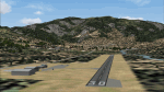
Next in my ongoing "Airstrips of Western Europe" project for FS2004, herewith about 100 sceneries of small, mostly default airfields in the eastern section of France, each enhanced with taxiways, parking spaces and aprons as appropriate, to further facilitate the generation of lightweight AI traffic in the area without overloading the more major airfields. When combined with the French airstrips from my previous uploads, the majority of the default small French airstrips in FS2004 will be able to generate AI traffic, should you so wish, as well as putting a little basic detail into the countryside.
Again, there's no photo-realism here, just a selection of basic 'generic' buildings, more or less accurately sized and placed to reflect the airfield layout as seen on on-line satellite imagery and aerial photography. These buildings have minimal effect on frame-rates, so are ideal for this kind of job. The airfields are aligned as well as possible with the roads etc. in UT Europe and the Genesis Europe mesh, but should mostly be fine in a default installation or other configuration.
| Filename: | Airstrips_of_Eastern_France.zip |
| License: | Freeware |
| Added: | 25th September 2024, 13:37:50 |
| Downloads: | 153 |
| Author: | Chris Eve |
| Size: | 2.83 MB |
| Category: Flight Simulator 2004 - Scenery | |
| LPMO Morargil Airfield, Portugal |
|
Images related to this file:
File Description:
LPMO Morargil Airfield.
This is a certified airfield in the neighbourhood of Mora Village (North Alentejo) in the middle south of Portugal, about 4.5 miles SSE from Montargil dam. The house painting respects the traditional Alentejo houses.
This scenery is only compatible with Portugal Terrain from PTSIM (http://www.ptsim.com) and is based on digital pictures taken at the place, accurate real measures by Aerodromos de Portugal (http://www.pelicano.com.pt/zmapa.html) and Google Earth. Freeware. For Microsoft FS2004.NOT tested for FSX
| Filename: | LPMO_Morargil_Airfield_Portugal.zip |
| License: | Freeware |
| Added: | 1st March 2013, 22:39:29 |
| Downloads: | 376 |
| Author: | Joao A. Graca Ferreira |
| Size: | 8.67 MB |
| Category: Flight Simulator 2004 - Scenery | |
| USMC Camp Leatherneck, Afghanistan |
|
File Description:
Flight Simming for ten year now, I wanted to give a little something back. A fan of the military side of Flight simming i have always been disappointed in the complete lack of military Camps/Bases in FS9. Camp Leatherneck is a 1,600 acre United States Marine Corps base located in Helmand Province, Afghanistan. This Scenery is completely Fictional the only aspect that is accurate (To a degree) is the location of this scenery in actuality to the real camp.
Have fun
| Filename: | USMC_Camp_Leatherneck_Afghanistan.zip |
| License: | Freeware |
| Added: | 13th May 2011, 00:25:10 |
| Downloads: | 2,383 |
| Author: | Scott Stanford |
| Size: | 7.48 KB |
| Category: Flight Simulator 2004 - Scenery | |
| FS RELIEF 2 1.- Relief Textures For Autogen And Airports |
|
File Description:
This is the SECOND version of my prior relief textures for the autogen and airport buildings. The level of detail and depth in the relief has been improved, and you can see now that the windows, doors, columns, and all the forms that would have the real structure show different degrees of illumination and shadows. All the little surfaces, like the spaces between windows and doors, the roofs, etc have a certain degree of roughness that wasn’t visible in the first version.
| Filename: | FS_RELIEF_2_____1_Relief_Textures_For_Autogen_And_.zip |
| License: | Freeware |
| Added: | 4th December 2003, 05:42:27 |
| Downloads: | 6,625 |
| Author: | Carlos Lorenz Benlloch |
| Size: | 5.59 MB |


© 2001-2026 AVSIM Online
All Rights Reserved
Privacy Policy |