
Where Flight Simulation Enthusiasts Gather from Around the World!
AVSIM Library - Search Results

| Category: Flight Simulator 2004 - Scenery | |
| Hana Heli-Playground v1.0 |

|
Images related to this file:
File Description:
Hana Airport is a regional airport of the State of Hawaii on the east shore of the island of Maui, 3 NM northwest of the unincorporated town of Hana. The airport covers 119 acres and has one runway. It is primarily a commuter facility used by unscheduled air taxis and general aviation. This scenery is intended as a single/multiplayer helicopter obstacle course where heli pilots can meet to compete, show off, and share their helo skills. Since birdseye (Timm Turner) already did a neat scenery called Hana_Scenery_PHHN (search for "hana" in the HoverControl Downloads), we decided to convert PHHN to a full helicopter training area. Makes a great place for helo pilots to gather to practice and perfect their skills, and challenge other pilots! And keep an eye-out for that Hot Air Balloon, cruising around an altitude of 3000 feet (don't forget to wave at them!).
Another unique thing about this scenery is the neighboring islands (Honolulu Intl/Hickam AFB, Bellows AFB, Lanai City, Kahului, Molokai, etc). If you get frustrated during your heli obstacle course training, just take a heading of 275°, and relax at one of the neighboring islands.
| Filename: | Hana_HeliPlayground_v10.zip |
| License: | Freeware |
| Added: | 9th May 2010, 11:29:39 |
| Downloads: | 524 |
| Author: | Bob Ferguson |
| Size: | 27.79 MB |
| Category: Flight Simulator 2004 - Scenery | |
| Camarillo, CA - (KCMA) - Update |
|
File Description:
Camarillo, CA Airport (KCMA) - UPDATE. This update adds AI Ultra-lite aircraft to the beautifully detailed airport by John B. Loney Jr. The excellent Sky Seeker Ultra-lite (included in this package) by Fern Marques has been repainted by John Burford in 5 colorful textures and is used with permission from the author. Use the Zip-Dive option to see more screenshots. A proper installation of KCMA is required (kcma_v1.zip.zip - available here). This update package also includes two minor visual corrections to the Camarillo airport property. Please unzip to a temporary folder and follow the easy installation instructions. Project compiled for your flying enjoyment by David "Opa" Marshall.
| Filename: | Camarillo_CA__KCMA__Update.zip |
| License: | Freeware |
| Added: | 29th May 2007, 14:46:15 |
| Downloads: | 1,298 |
| Author: | David "Opa" Marshall and John B. Loney Jr. |
| Size: | 3.35 MB |
| Category: Flight Simulator 2004 - Scenery | |
| LFBT Tarbes/Lourdes-Pyrenees, France |
|
Images related to this file:
File Description:
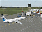
Googly scenery for LFBT Tarbes - a normally quiet airport that just sees a few
domestic flights a day but bursts into life for those of the the Catholic faith to
participate in the pilgrimage to Lourdes. At these times it is served by a
regular stream of charter flights and the airport can handle aircraft as large
as the Boeing 747. The only scheduled flights are between here and Paris, normally operated by Canadair CRJ700 craft worked by Brittany Air International on behalf of Air France, but a huge range of charter operators - mostly from Italy, Ireland, Belgium, the
United Kingdom and Germany - may be seen here at times and although seasonal this
traffic represents 80% of the airport's entire annual activity.
The scenery does not purport to be ultra-accurate. Based on less-than-perfect
satellite imagery from Google Earth, the layout is proportionally correct but the
added airport features, such as buildings, are built from default Microsoft objects
and add-on libraries so will not look exactly like the real thing. You are not obliged to download and install any additional scenery libraries, but to enjoy this scenery in its entirety, you may wish to. It will work fine, with or without.
[File re-uploaded at the request of AVSIM]
| Filename: | LFBT_TarbesLourdesPyrenees_France.zip |
| License: | Freeware |
| Added: | 4th May 2010, 15:02:30 |
| Downloads: | 7,819 |
| Author: | John Hinson |
| Size: | 73 KB |
| Category: Flight Simulator 2004 - Scenery | |
| Weaver MT54 Montana USA |
|
Images related to this file:
File Description:
I made this because I downloaded and tried the Glacier Park scenery by Blue Sky Scenery and then discovered that the airfield runways are not always correctly positioned or aligned. So I moved the Weaver runway over and added a couple of buildings. That's it, almost the same as I did for Whitefish. If I find some more airfields in this area with similar problems then I'll do more of the same. Weaver is a private field 4 miles south of Glacier Park International at 2,929 feet ASL and around 45 miles south of the Canadian border. There are no large towns close by; the nearest would be Missoula, which is some 90 miles further south.
| Filename: | Weaver_MT54__Montana_USA.zip |
| License: | Freeware, limited distribution |
| Added: | 26th May 2010, 03:18:46 |
| Downloads: | 203 |
| Author: | Roger Wensley |
| Size: | 14.23 MB |
| Category: Flight Simulator 2004 - Scenery | |
| Dillingham Airfield, HI |
|
File Description:
FS2004 Scenery-Dillingham Airfield, Oahu, HI (PHDH) is a general aviation joint-use facility on the north shore of Oahu near the community of Waialua. The airfield has one 5,000' by 75' runway, a State-operated UNICOM (air traffic advisory) facility, several hangars, and a tie down area for recreation aircraft, but no other facilities. Air traffic is limited to daytime operations by small single-engine and light twin-engine aircraft, sailplanes, ultra-lights aircraft, and helicopters. Traditionally, the airfield has been used mainly for recreation, such as glider soaring, hang-gliding, parachuting, and sky jumping. A taxiway extension will be built in 2005. Created with EZ Scenery. PLEASE READ THE README FILE!
| Filename: | Dillingham_Airfield_HI.zip |
| License: | Freeware, limited distribution |
| Added: | 29th May 2007, 04:02:32 |
| Downloads: | 2,024 |
| Author: | John B. Loney, Jr. |
| Size: | 802.31 KB |
| Category: Flight Simulator 2004 - Scenery | |
| MRAO Turtuguero, Costa Rica |
|
Images related to this file:
File Description:
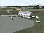
Googly scenery for MRAO Turtuguero, Costa Rica - another one that Microsoft
forgot in FS2004. It is a small domestic airport located on a long spit of
land that almost seems like an island. Turtuguero is just a village but the
airport also serves the lush Tortuguero National Park (rain falls all the
year round here) which draws thousands of visitors each year. The airport
is served daily by DHC-6 Twin Otters of Nature Air.
These scenery files create the airport and add taxiways, aprons, buildings and other airport features, so that you and your "AI" traffic can land, taxi, park and take
off in a realistic manner.The scenery does not purport to be ultra-accurate. Based on less-than-perfect satellite imagery from Google Earth, the layout is as good as I can get it, but some imagination has been used as I cannot tell what buildings exist. The
buildings and other features I have provided are built from default Microsoft
objects and add-on libraries so will not look exactly like the real thing.
You are not obliged to download and install any additional scenery libraries,
but to enjoy this scenery in its entirety, you may wish to. It will work fine,
with or without. [File re-uploaded at request of AVSIM]
| Filename: | MRAO_Turtuguero_Costa_Rica.zip |
| License: | Freeware |
| Added: | 28th May 2010, 20:40:00 |
| Downloads: | 1,174 |
| Author: | John Hinson |
| Size: | 65.12 KB |
| Category: Flight Simulator 2004 - Scenery | |
| Dhulia Airport, India |
|
Images related to this file:
File Description:
its always interesting and enjoyable to taxi an aircraft thru tight areas,and especially when a taxiway is
surrounded by trees like Eucalyptus,capable of attaining a height that can range anywhere between 6fts to 300fts! after a short evening
flight from Mumbai you've just landed at small airport at Dhulia(India) and vacated the runway, AND you've just spotted a
hanger, good! that's were you want to be, but hey! it's already occupied. now what?.Well..good news! there is another hanger,
but were? can't even see were taxiway is leading to because of dense trees. Can you find the Hanger? surely you don't
want to leave your cessna under open sky for whole night long or do you?
| Filename: | Dhulia_Airport_India.zip |
| License: | Freeware, limited distribution |
| Added: | 10th May 2011, 03:56:06 |
| Downloads: | 527 |
| Author: | Ashish Singh |
| Size: | 17.93 MB |
| Category: Flight Simulator 2004 - Scenery | |
| Whitefish 58S in Montana US |
|
Images related to this file:
File Description:
I have made this because I downloaded and tried the Glacier Park scenery by Blue Sky Scenery and then discovered that the runway for Whitefish was wrongly aligned and headed off across the adjacent railroad tracks. This would be inconvenient if you had to wait for a train to pass before landing so I fixed that and added a couple of buildings. That's it, nothing more complicated than that. If I find some more airfields in this area with similar problems then I'll do more of the same. Whitefish is 3 or so miles north of Glacier Park International at 3,066 feet ASL and around 35 miles south of the Canadian border. There are no large towns close by; the nearest would be Missoula, which is 90 miles further south.
| Filename: | Whitefish_58S_in_Montana_US.zip |
| License: | Freeware, limited distribution |
| Added: | 23rd May 2010, 02:05:52 |
| Downloads: | 194 |
| Author: | Roger Wensley |
| Size: | 826.52 KB |
| Category: Flight Simulator 2004 - Scenery | |
| Phoenix Deer Valley Airport |
|
File Description:
FS2004 Scenery-Phoenix Deer Valley Municipal Airport (KDVT) serves Phoenix and Maricopa County and is owned by the City Of Phoenix. The airport has more than one runway. The longest is a paved runway extending 8200 feet. The facility is at an elevation of 1476 feet at a distance of about 15 miles from Phoenix. Phoenix Deer Valley Airport is a general aviation reliever airport for Phoenix Sky Harbor International Airport. The airport is home to more than 1,350 based aircraft and had more than 340,000 takeoffs and landings in 2004. A vital component of the City of Phoenix airport system, Deer Valley is the second busiest general aviation airport in the nation. Scenery created with FSDS2, Rwy12, Lago's FSE, with AFCAD2 and Traffic Tools. Contains 438 parking spaces.
| Filename: | Phoenix_Deer_Valley_Airport.zip |
| License: | Freeware |
| Added: | 23rd September 2005, 20:33:47 |
| Downloads: | 2,011 |
| Author: | John B. Loney, Jr. |
| Size: | 1.46 MB |
| Category: Flight Simulator 2004 - Scenery | |
| New! CLUBE CEU - Flight Sports Club - SIAN (Aeródromo Armando Nogueira) |
|
Images related to this file:
File Description:
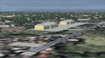
I bring you a scenery made by me with the help of AFCAD and ADE165, of the new CLUBE CEU airfield at its new address near Santa Cruz, Rio de Janeiro.
This scenery is quite simple and this airfield is also used by the CEU Squadron, an aerial demonstration group formed by civilian pilots and former officers of the Brazilian Air Force (FAB). The squadron conducts aerobatic training flights and performances at events throughout Brazil, using primarily sports aircraft.
In addition to serving as a meeting point and hangars for private pilots, the site houses civil aviation schools (such as Sky Training) focused on training civil pilots (Private, Commercial, Instructor and CPA/Ultraleve). The club annually promotes integrated flyovers and sporting events such as FlyCEU.
| Filename: | CLUBE_CEU__Flight_Sports_Club__SIAN_Aerdromo_Arman.zip |
| License: | Freeware |
| Added: | 30th October 2026, 01:29:17 |
| Downloads: | 15 |
| Author: | CLAUDIO LUIZ |
| Size: | 5.37 MB |


© 2001-2026 AVSIM Online
All Rights Reserved
Privacy Policy |