
Where Flight Simulation Enthusiasts Gather from Around the World!
AVSIM Library - Search Results

| Category: Flight Simulator 2004 - Scenery | |
| BLUFF PORT & AREA |

|
Images related to this file:
File Description:
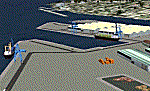
Includes the Ocean Beach Heliport, (NZOB), airstrips on nearby Dog Island and Raratoka Island and some detail around Bluff Port. Made to fit Christian Stock's awesome 20m-mesh and topo for New Zealand. Not compatible with Invercargill City, (which is part of the Invercargill Photoreal Scenery by Murray Hall and Ian Warren. If you have this scenery and wish to use my Bluff Port scenery, simply delete the 'City" entry from the FS9 Scenery Library.
| Filename: | BLUFF_PORT__AREA.zip |
| License: | Freeware |
| Added: | 28th July 2010, 14:54:59 |
| Downloads: | 443 |
| Author: | Godfrey Tier |
| Size: | 3.22 MB |
| Category: Flight Simulator 2004 - Scenery | |
| LEST Santiago de Compostela 2018 |
|
File Description:
FS2004 Scenery--LEST Santiago De Compostela, Spain. FULL PACKAGE
1. Airport Scenery with new buildings, parkings, lights positions, taxilines and night textures
2. Photoreal scenery
This scenery was built from the official maps for the runway and taxiways with Google Maps as a background image as support. The different signs were positioned without any documentation or references. Only use with IVAO or VATSIM; no AI possible.
By Serge Libon (airport) and Diego Varela Rodriguez (photoreal)
| Filename: | LEST_Santiago_de_Compostela_2018.zip |
| License: | Freeware |
| Added: | 13th March 2018, 23:02:34 |
| Downloads: | 1,695 |
| Author: | Serge Libon (airport) and Diego Varela Rodriguez (photoreal) |
| Size: | 167.97 MB |
| Category: Flight Simulator 2004 - Scenery | |
| Whangarei Airport (NZWR) |
|
File Description:
Whangarei Airport Scenery (NZWR) for FS2004.
The scenery is detailed, and all airport buildings, runways, taxiways, aprons, signage, trees, surrounding roads etc. etc. are represented.
Photo textures have been used extensively.
The use of NZ150 metre mesh, and landclass (.bgl) files are highly recommended.
Taxiing around, will give the visitor an accurate impression of this busy provincial airport, set in the scenic beauty of Northland, New Zealand.
Nav: NDB 326, DME 117.3
| Filename: | Whangarei_Airport_NZWR.zip |
| License: | Freeware |
| Added: | 25th May 2005, 04:31:43 |
| Downloads: | 3,030 |
| Author: | David Quirey |
| Size: | 3.94 MB |
| Category: Flight Simulator 2004 - Scenery | |
| Thompson CYTH in northern Manitoba, Canada |
|
Images related to this file:
File Description:
Thompson is a city with around 13,000 inhabitants, located in northern Manitoba beside the Burntwood River. It serves as the administration centre for a large area of Manitoba and has industrial activities centred around mining and the processing of mined products. The version of the airport upon which this modification is based is the original posting in 2004 by CanUK Scenery. I would have made new buildings and a totally new scenery but I have the same problem as Sid and Pete in their later Thompson scenery: almost no photos!?! The update modifies the short end of the mainly gravel runway to asphalt (it was upgraded because it is regularly used as a taxiway) and also adds a later (2010?) gravel taxiway. The other ground modifications add allocated parking spots for fire fighting CL415 planes that are in the new AI, plus a lot more ga parking. You should already have some AI that includes Calm Air to see CYTH as it really is, the HQ of Calm Air. There are other additions including car parks and the usual sundry bits and pieces that inhabit every airfield. The CL415's with Manitoba textures are adaptations of what were originally Ontario planes and included with my post of Geraldton, not the most recent post in 2013, the one in 2007. If you don't have the planes get them from my Geraldton post. The AI version was made from the original piloted version which was by Massimo Taccoli. The AI helicopter was included in my post of Alma CYTF.
| Filename: | Thompson_CYTH_in_northern_Manitoba_Canada.zip |
| License: | Freeware, limited distribution |
| Added: | 23rd September 2018, 15:24:22 |
| Downloads: | 223 |
| Author: | Roger Wensley |
| Size: | 6.4 MB |
| Category: Flight Simulator 2004 - Scenery | |
| Victoria, Canada area scenery |
|
File Description:
This is a complete upgrade of vicenh05, Victoria, Canada area scenery for FS9. New in this version: automated installer and configurator from Ken Peters; several detailed models including the Empress Hotel, the Legislature, the Regent Hotel and the Johnson St. Bridge; greatly enhanced Inner Harbour; many generic buildings representing buildings throughout the area; 7 new small airfields with sloping runways; seven new floatplane bases (owners of Vancouver+ get extensive floatplane traffic in local liveries); 7 new heliports (Vancouver+ users get additional heli AI traffic) and a myriad of minor fixes and improvements. Included from previous versions are revised shorelines, landclass and 19m mesh and buffer meshes for South-Eastern Vancouver Island; boat docks with static boats, seaplane docks and terminal buildings for Harbour Air, Kenmore Air and West Coast Air; piers, buildings, breakwater and other components of the Ogden Point Terminal; dock, service building and pilot boats of the Pacific Pilotage Authority; Odgen Point Cafe and Dive Shop; marine navigational lights for Victoria Harbour and area, including Esquimalt harbour and Oak Bay; antennae location corrections for the area; AFCADs included: Land based (CML2), Floatplane (CAB3, CAP5, CAP8, CAV8, CAW7, CAX6, CMAP, CYWH), Heli (CAL7, CBF5, CBF7, CBK8, CBW7, CBW9, CBZ7, CMBH); AI craft models and repaints (Cruise ships are repaints of Asuka model by Mitsuya Hamaguchi: MS Amsterdam of the Holland America Line travelling from Victoria to Vancouver, MS Summit of the Celebrity Cruise Line travelling from Seattle to Victoria); S-61 Sea-King helicopter in Helijet colours; Pacific Pilot custom vessel working from the Pilot dock; 22, 30 and 40 foot vessels plying the harbour and nearby Straight of Juan de Fuca. Effects included for lights, water, smoke effects. Many flights are offered, including two flights for owners of the Aerosoft Beaver (not required). Ultimate Terrain compatible (not required). Users of Misty Fjords will also get additional cruise ship traffic: the Island Princess and the Volendam alternating with the Amsterdam and Summit. Fully compatible with Don Grovestine's excellent CYYJ 2007. Replaces viflat.zip, ve4_tr1.zip, vicenh02.zip, vicenh03.zip, vicenh04.zip and vicenh05.zip. Detailed documentation included. By Jon Patch and Holger Sandmann.
| Filename: | Victoria_Canada_area_scenery.zip |
| License: | Check within download |
| Added: | 29th January 2010, 21:22:09 |
| Downloads: | 5,313 |
| Author: | Jon Patch and Holger Sandmann |
| Size: | 24.28 MB |
| Category: Flight Simulator 2004 - Scenery | |
| Cyprus: Airfields plus landmarks and land class for all of Cyprus and AI |
|
Images related to this file:
File Description:
Cyprus, an island in the eastern Mediterranean. Without the benefit of Ultimate Terrain, which does not exist for Cyprus, the land class provided by FS9 stands out as hopelessly inadequate. I have added the extensive farmland and the larger towns and villages, plus the major roads. Four completely new airfields are included here, three in the north and one in the south. Ercan LCEN is in the north and functions as the airport for all of the north. It was recently closed for two years while a new terminal was built and the runway updated and an apron extended etc, and during that time Gecitkale LCGK functioned (barely) as the airport for the north. Gecitkale is now hardly used at all. The third northern airfield is Ilker Karter LCIK and this functions as the HQ base of the Turkish Army Corp in northern Cyprus. The last of the new airfields is Kingsfield LCRE, which is in the Sovereign Base area to the east of Larnaca and is now used for recreational purposes. Ercan is now undergoing further expansion with a new runway and a new terminal building and apron, so this scenery is for the period between 2010 to 2015. My set up of Cyprus already included a payware Larnaca by Aerosoft (now only 12 euros) plus a freeware Paphos, Nicosia, and Akrotiri; that was my starting point. Larnaca has been the major airport for Cyprus since the mid 1970's, with a huge tourist trade that peaks in the summer but which is year long (almost a million Brits visit every year, let alone the other nationalities). I have adapted this (gate sizes etc) to allow parking by a multitude of B737's and others. Nicosia is freeware (posted in 2010) and I have included modifications to reflect its now total disuse. Paphos is at the far western end of the island and freeware, and I have modified this to allow larger and military ai aircraft to function properly; the poster improved his first version to better cater for ai but I was unaware of this and I have stayed with my modifications. Akrotiri is freeware and includes a lot of library object input from MAIW. I have modified the parking somewhat and added further residential areas and munitions storage. The AI is based upon recorded take offs and landings in April, with some further additions in later months. At Ercan the visible gate numbers on the apron are as per real life, but the numbers within FS9 reflect the fact that planes are directed to gates at the centre of the terminal building and not at the far ends. Follow the pink line and obey ATC when it says taxi to gate number 2 even if it is visibly numbered 4.
| Filename: | Cyprus_Airfields_plus_landmarks_and_land_class_for.zip |
| License: | Freeware, limited distribution |
| Added: | 13th August 2017, 21:21:46 |
| Downloads: | 940 |
| Author: | Roger Wensley |
| Size: | 29.61 MB |
| Category: Flight Simulator 2004 - Scenery | |
| Dalnegorsk, Russia - Dalnegorsk airport - UHWD *UPDATE* |
|
File Description:
The airport was uploaded last April 20, 2020 in avsim filename is "eastern_russia_arpts.zip". I sent the airport code was DHG. Someone emailed me that advised me the airport code should be UHWD. I tried to find it but no luck. Someone knows Russian. The airport code is UHWD now I updated and changed it. Please remove DHG files if you installed them before. Replacement of a new file UHWD. Make sure you change flight plans if you have them.
| Filename: | Dalnegorsk_Russia__Dalnegorsk_airport__UHWD__UPDAT.zip |
| License: | Freeware |
| Added: | 25th May 2021, 22:46:24 |
| Downloads: | 82 |
| Author: | Stuart John Gilbert II |
| Size: | 6.9 KB |
| Category: Flight Simulator 2004 - Scenery | |
| CYWG Winnipeg 2020 - Building Night Lighting Fix |
|
Images related to this file:
File Description:
CYWG Winnipeg 2020 Scenery Fix -- The Kelly Western FBO and Nav Canada building models were compiled without night lighting. Consequently the buildings are dark from dusk to dawn. This omission went unnoticed through the beta testing phase of development. The night textures for these buildings was included in the original release of the scenery so no new textures are required. This is a simple fix that adds the light map to the existing models. See readme for installation instructions.
| Filename: | CYWG_Winnipeg_2020__Building_Night_Lighting_Fix.zip |
| License: | Freeware, limited distribution |
| Added: | 27th October 2023, 12:08:33 |
| Downloads: | 274 |
| Author: | Gregory Putz |
| Size: | 334.24 KB |
| Category: Flight Simulator 2004 - Scenery | |
| Terrain Mesh (LOD08) for Nunavut, Canada (File 2 of 4) |
|
File Description:
FS2002 and FS2004. The files in this package contain a new 153m (LOD08) terrain mesh for Nunavut, Canada ( and northern part of Northwest Territories) to use with FS2002 and FS2004. The source data is GeoBase (CDED – 1 : 250 000). All data were compiled and edited in MicroDEM 7.01 alpha and resampled to LOD08 (Level of Details), or 152.88 meters horizontal resolution, with the Microsoft Terrain Software Developer's Kit (SDK) utilities.
(Nunavut8a.zip, Nunavut8b.zip Nunavut8c.zip Nunavut8d.zip - 4 Parts).
| Filename: | Terrain_Mesh_LOD08_for_Nunavut_Canada_File_2_of_4.zip |
| License: | Freeware, limited distribution |
| Added: | 30th December 2003, 23:42:23 |
| Downloads: | 3,892 |
| Author: | Gilles Gauthier |
| Size: | 22.71 MB |
| Category: Flight Simulator 2004 - Scenery | |
| Ohio Lakes (Wizarddz Neighborhood) v.1 |
|
File Description:
Default scenery modifications for FS2004 including 11 new and redrawn default lakes and reservoirs in north-central Ohio. Some landclass changes are included. An optional fictitious grass airstrip is provided near Wizardd's home on Apple Valley Lake east of Mount Vernon, Ohio. Coordinates for the lakes are provided in the included text file. This scenery is best viewed using USARoads. No modifications were made to
the default road system and some roads will cross lakes, etc.
| Filename: | Ohio_Lakes_Wizarddz_Neighborhood_v1.zip |
| License: | Freeware, limited distribution |
| Added: | 7th June 2006, 03:31:09 |
| Downloads: | 468 |
| Author: | Wil Husted |
| Size: | 341.16 KB |
© 2001-2026 AVSIM Online
All Rights Reserved
Privacy Policy |