
Where Flight Simulation Enthusiasts Gather from Around the World!
AVSIM Library - Search Results

| Category: Flight Simulator 2004 - Scenery | |
| South West Islands, Japan and Taiwan Ver.3.0 |

|
Images related to this file:
File Description:
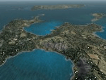
FS2004 Scenery SWIJT2004 Ver 3.0 (South West Islands, Japan and Taiwan)
These files improve specific scenerys (South West Islands of Japan and Taiwan, Asia) of FS2004. Included islands: Ohsumi Islands, Tokara Islands, Amami Islands, Okinawa lands, Kerama-Kume Islands, Miyako Islands, Yaeyama Islands and Taiwan Island.
In this scenery design, the coastline was reproduced as exactly as possible, following the specification of FS2004. Moreover, 90m mesh geographical data is reproduced by
using SRTM 3arc/sec. Correction of missing holes is perfect.
==NOTAM== I exhibited "SWIJ2k4.zip" on August 26, 2004.
However, it became clear that some of files of "SWIJ2k4" are infringing on the opyright of Microsoft. Then, I stopped public presentation of "SWIJ2k4". I apologize for having
made you trouble to those who already downloaded "SWIJ2k4.zip". New "SWIJT2k4.zip" is vast scenery which covered South West Islands, Japan and Taiwan Island. Please install new "SWIJT2k4".
By Kazuo Kawamura
| Filename: | South_West_Islands_Japan_and_Taiwan_Ver30.zip |
| License: | Freeware, limited distribution |
| Added: | 4th December 2011, 00:05:05 |
| Downloads: | 7,739 |
| Author: | Kazuo Kawamura |
| Size: | 20.5 MB |
| Category: Flight Simulator 2004 - Scenery | |
| RAF Upper Heyford EGUA 1955-1962 |
|
File Description:
EGUA RAF Upper Heyford 1955-1962
The airfield was originally built in 1918 by the Royal Air Force on land owned by New College Oxford, closed briefly after the end of the First World War and then re-opened in the 1920s. During the Second World War it was used by units of RAF Bomber Command but these were training rather than operational forces, even if aircraft of the 16th OTU (Operational Training Unit) may sometimes have taken part in bombing operations against the Third Reich. New runways were laid in 1942. During the Cold War Upper Heyford was chosen as one of the airfields used to operate bomber aircraft belonging to the US Strategic Air Command, and in 1950 the main runway was extended while new hardstandings were constructed for the bombers concerned. However, units were not stationed there permanently, but did Temporary Duty Assignments from their bases in the US. They included the 93rd Bomb Wing, 97th Air Refueling Squadron, 509th Air Refueling Squadron, 301st Bomb Wing, 8th Air Sea Rescue Squadron, 2nd Bomb Wing, 5th Bomb Wing Detachment, and the 22nd Bomb Wing. Aircraft included the B-50 Superfortress, (briefly) the B-36 Peacemaker, the B-47 and from 1960 the B-52. There were further significant developments after 1962 which fall outside the remit of this scenery, Upper Heyford being finally returned to the British Ministry of Defence in 1994 after the end of the Cold War.
| Filename: | RAF_Upper_Heyford_EGUA_19551962.zip |
| License: | Freeware |
| Added: | 7th October 2022, 03:40:20 |
| Downloads: | 152 |
| Author: | Al Von Pingel, Ken Lawson |
| Size: | 42.75 MB |
| Category: Flight Simulator 2004 - Scenery | |
| Bear Creek Winery & Lodging (v2.0.9) - "Diamond Edition" |
|
Images related to this file:
File Description:

Bear Creek Winery & Lodging Enhanced v2.0.9 "Diamond Edition".
An all new Flight Simulator experience awaits you at Bear Creek. This is a completely re-vamped "Extreme Make Over" of the previous Bear Creek Winery & Lodging. Some additions include: Scenery Changer Utility, Custom Textures, Festive Events (Christmas, Balloon Festival Etc.) Also added enhanced AI Traffic to the whole of Bear Creek. If you are a previous user of the original Bear Creek scenery this one that awaits you will indeed replace the original!!
No need to keep the previous version 1.0 that you may have downloaded this 2.0 version is a whole new interface that utilizes different install criteria.
Some of the Extra additions that are used with the new 2.0 version are: Runway12 3 Part Library, the Abacus Scenery Creator default libraries, Lago FSE, AI Schweizer 300C Helicopter, Gerrish Grey Tree Library Version 3. The direct links to these downloads are provided to you to download to display the scenery in its entirety. Not all of the above mentioned are required, like Lago, as it is a payware addition. All others mentioned are freely distributed at various download sites.
Please unzip (using folders option) to a temporary location and follow the installation instructions very carefully. Do not attempt to install this scenery with a "scenery manager" - for proper installation please use the built in installation routine.
Enjoy the newest edition: Airport Code: BCWL near Homer, Alaska.
| Filename: | Bear_Creek_Winery__Lodging_v209__Diamond_Edition.zip |
| License: | Freeware |
| Added: | 2nd February 2010, 10:50:06 |
| Downloads: | 4,946 |
| Author: | Mike Woolsey & David "Opa" Marshall |
| Size: | 58.49 MB |
| Category: Flight Simulator 2004 - Scenery | |
| Guadalupe Mountains National Park (Version 2) SRTM30_1ArcSec Terrain Mesh |
|
File Description:
This 38m terrain mesh is centered in the 'Panhandle' region of Western Texas.
Coverage area: From West 104.5° to West 105° and North 31.7° to North 32.2°.
It includes Guadalupe Mountains National Park and the surrounding mountains
of Lincoln National Forest. Version 2 replaces my former release of 'Guadalupe_Mountains_SRTM30.zip' which covered a too large area and had some scenery anomalies (craters). The new version now fixes these errors.
| Filename: | Guadalupe_Mountains_National_Park_Version_2_SRTM30.zip |
| License: | Freeware, limited distribution |
| Added: | 28th December 2003, 18:33:52 |
| Downloads: | 2,062 |
| Author: | Andreas Trawny |
| Size: | 1.27 MB |
| Category: Flight Simulator 2004 - Scenery | |
| Murfreesboro Municipal - KMBT |
|
Images related to this file:
File Description:
FS2004 Scenery-Murfreesboro Municipal Airport (KMBT) serves Murfreesboro and Rutherford County and is owned by the City Of Murfreesboro. The paved runway extends for 3898 feet. The facility is at an elevation of 615 feet at a distance of about 2 miles from Murfreesboro. Created entirely with EZ Scenery. EZ Scenery library objects required. New AFCAD file and AI traffic from Traffic Tools included. By John B. Loney, Jr.
| Filename: | Murfreesboro_Municipal__KMBT.zip |
| License: | Freeware, limited distribution |
| Added: | 3rd June 2010, 00:43:34 |
| Downloads: | 817 |
| Author: | John B. Loney, Jr. |
| Size: | 1.09 MB |
| Category: Flight Simulator 2004 - Scenery | |
| Neumuenster (EDHN) SG2 Update |
|
File Description:
FS2004 Scenery EDHN_SG2 (Neumuenster/N-Germany)Update Only! This is a second time modified version for the VFR-"Scenery Germany 2" as there has been a wrong mesh height disturbing the AI Traffic. Sorry for the inconvenience caused. You have to exchange the whole scenery-folder! Will also work with the default scenery, but you need the texture folder or download the whole new scenery EDHN_2006 on this server
| Filename: | Neumuenster_EDHN_SG2_Update.zip |
| License: | Freeware |
| Added: | 18th April 2006, 22:19:10 |
| Downloads: | 976 |
| Author: | Uwe Schweitzer |
| Size: | 487.74 KB |
| Category: Flight Simulator 2004 - Scenery | |
| Cape May-Lewes Ferry |
|
File Description:
FS2004 Scenery - Cape May-Lewes Ferry. This scenery consists of the ferry terminal at Cape May, New Jersey and the ferry terminal at Lewes, Delaware. The AI ferry, M.V. Cape May sails from The Cape May Ferry Terminal, just south of the Cape May County Airport(KWWD), to the Lewes Ferry Terminal in Lewes Delaware. AI ferryboat included. Compatible with default FS9 and Ultimate Terrain. By John B. Loney, Jr.
| Filename: | Cape_MayLewes_Ferry.zip |
| License: | Freeware, limited distribution |
| Added: | 30th January 2008, 03:12:46 |
| Downloads: | 876 |
| Author: | John B. Loney, Jr. |
| Size: | 648.42 KB |
| Category: Flight Simulator 2004 - Scenery | |
| Columbia Metropolitan Airport (KCAE) |
|
File Description:
This file replaces the inaccurate and drab rendition of the KCAE terminal with a more realistic version of the new terminal and parking deck. AFCAD2 file included for proper placement and assignment of gates and for addition of the airport roads. LAGO FSE file also included for some 'extras' such as UPS planes at the UPS hub and others.
Scenery will work in FS2002, but AFCAD2 and LAGO files will not.
| Filename: | Columbia_Metropolitan_Airport_KCAE.zip |
| License: | Freeware |
| Added: | 27th February 2004, 21:48:52 |
| Downloads: | 1,773 |
| Author: | Todd Lucas |
| Size: | 1.69 MB |
| Category: Flight Simulator 2004 - Scenery | |
| Optional 32-bit textures for my Harare and Victoria Falls sceneries. |
|
File Description:
This archive contains only the 32-bit format replacement textures for use with my sceneries for Harare and Victoria Falls that are also hosted on Avsim. This archive has been made separate because people using dial-up access shouldn't be forced to upload gargantuan texture files simply to enjoy a new airport or two. Note that the textures were worked on as 24-bit images and saved as 32-bit.
| Filename: | Optional_32bit_textures_for_my_Harare_and_Victoria.zip |
| License: | Freeware, limited distribution |
| Added: | 28th November 2005, 13:51:54 |
| Downloads: | 1,950 |
| Author: | Matthew Ministry |
| Size: | 8.95 MB |
| Category: Flight Simulator 2004 - Scenery | |
| Scenery-Loney's Alaska Vol 3 |
|
File Description:
FS2004 Scenery-Loney's Alaska vol3. This download comprises of 6 more Alaskan airports enhanced using Rwy12 and EZ Scenery. The airports include Calhoun Memorial (PATA), Minchumina Airport (PAMH), New Allakaket Airport (6A8), Nenana Muinicipal Airport (PANN), Ruby Airport (PARY) and Rampart Airport (RMP). There are some challenging approaches again. Watch out for the trees. Includes AI traffic through Traffic Tools with modified AFCAD files. Rwy12 and EZ Scenery libraries required.
| Filename: | SceneryLoneys_Alaska_Vol_3.zip |
| License: | Freeware |
| Added: | 9th May 2006, 03:51:52 |
| Downloads: | 1,306 |
| Author: | John B. Loney, Jr. |
| Size: | 790.92 KB |
© 2001-2026 AVSIM Online
All Rights Reserved
Privacy Policy |