
Where Flight Simulation Enthusiasts Gather from Around the World!
AVSIM Library - Search Results

| Category: Flight Simulator 2004 - Scenery | |
| Bethel: Yukon Area |

|
Images related to this file:
File Description:
This presumes you have already installed Bethel PABE, Bethel Local Airfields, and Bethel St Mary's. In the Yukon River area of Alaska to the north of Bethel and to the south around the equally wide (but shorter) Kuskowim River there are small villages, served by flights from both Bethel PABE and St Mary's PASM. These villages are dependent upon fishing for survival, and in this flat and very wet terrain are equally dependent upon the gravel runways that link them to the outside world. There are no surfaced roads, and the rivers and their tributaries wind into the distance and are impractical delivery routes except from nearby places. In an area 300 miles by 200 miles most places cannot be described as "nearby". This post is of the small villages, including those previously posted; I had missed on picking up some terrain conflicts between nighttime grass and town textures. They are corrected here and included along with new airfields. Bethel and St Mary's are also reposted to include the further enlargement of parking for the increased number of small AI aircraft. These smaller airfields vary in quality; some have runway signage but most do not, and while some have two or even three hangars/garages/terminal buildings on the apron there are others who have none at all. The 39 small airfields included here are as listed:
Akiak AKI, Akiakchak Z13, Alakanuk AUK, Anvik PANV, Atmautluak 4A2, Cape Romanzof PACZ, Chefornak PACK, Chevak VAK, Eek EEK, Emmonak PAEM, Goodnews GNU, Grayling KGX, Holy Cross HCA, Hooper Bay PAHP, Kako 9AK2, Kalskag KLG, Kasigluk Z09, Kipnuk PAKI, Kongiganak PADY, Kotlik KOT, Kwethluk KWT, Kwigillingok A85, Marshall MLL, Mountain Village MOU, Napakiak WNA, Napaskiak PKA, Newtok PAEW, Nightmute IGT, Nunapichuk 16A, Pilot Station 0AK, Quinhagak PAQH, Russian Mission RSH, Scammon Bay SCM, Shageluk SHX, Sheldon Point SXP, Toksook Bay OOK, Tuluksak TLT, Tuntutuliak A61, Tununak 4KA.
I am currently going through the airfields again to check if further modifications are required, and I am also adding a few new ones. As I am going to be updating my computer I am posting now, complete or not, and I will post an update later of further additions.
| Filename: | Bethel_Yukon_Area.zip |
| License: | Freeware, limited distribution |
| Added: | 3rd May 2019, 17:20:53 |
| Downloads: | 169 |
| Author: | Roger Wensley |
| Size: | 6.3 MB |
| Category: Flight Simulator 2004 - Scenery | |
| Koyuk PAKK in Alaska |
|
Images related to this file:
File Description:
Koyuk is a coastal village around 125 miles east of Nome at the mouth of the Koyuk River, with a population just under 400 living from fishing and the land. The airfield is close by and has a gravel runway aligned 18-36, 3,300 feet long with VASI at both ends. Apart from the airfield itself, and it's buildings, this scenery modifies the local land class, adds village buildings while reducing the village size to reality, and creates a new airfield background. Bering Air and ERA both fly into Deering and are included in the AI. A note here about my scenery making. This is post number 506 and there will not be many more to follow this as I am almost at the end of the photos I either took or found for scenery purposes. There is a limit to what can be located online and I have already been making use of the little there is; eg Unalakleet. So, if you are near an airport (preferably Canadian or Alaskan) and have a camera..... Let me know.
| Filename: | Koyuk_PAKK_in_Alaska.zip |
| License: | Freeware, limited distribution |
| Added: | 15th August 2019, 17:56:50 |
| Downloads: | 140 |
| Author: | Roger Wensley |
| Size: | 3.88 MB |
| Category: Flight Simulator 2004 - Scenery | |
| AI Water "aircraft" for Lake Okanagan, BC. |
|
Images related to this file:
File Description:
AI Water "aircraft" for Lake Okanagan, BC. This package features an AI Sternwheeler ship, an AI Waco Bi-wing plane and AI Cabin Cruisers set on Lake Okanagan, near Penticton and Kelowna, BC, Canada. Offerred as an interesting scenery enhancement, it also demonstrates the use of the "forward departure" (no push-back) technique as applied to water based aircraft. A few EZ objects have also been used to decorate the dock areas where the AI "craft" will be seen. This enhancement has been tested with the default FS2004 scenery only and may not work with other enhancements (such as UT-Canada) which alter the shorelines of Lake Okanagan. Other downloads may be required or are recommended. Complete details about these will be found in the instructions. Please unzip to a temporary folder and follow the easy installation instructions. Compiled for your flying enjoyment by David "Opa" Marshall.
-
NOTE: This package replaces the one which is missing due to the May hack on Avsim. Nothing new has been added.
| Filename: | AI_Water_aircraft_for_Lake_Okanagan_BC.zip |
| License: | Freeware |
| Added: | 29th January 2010, 21:28:38 |
| Downloads: | 1,464 |
| Author: | David "Opa" Marshall |
| Size: | 1.8 MB |
| Category: Flight Simulator 2004 - Scenery | |
| WLP-HQ |
|
File Description:
WLP HQ is a basic simple scenery. It's a fictous bush-airport and camp in northern Tanzania, just west of the famous Lake Natron.
WLP stands for "Wild Life Protection". WLP is a fictous project and is refering to J.T. Chance's latest adventure novel. Max Stein, a bushpilot and adventurer, is hunting down smuggling and illegal hunting gangs. This project stands for a complete new approach by making the reader a part of the story ... kind like interactiv action if you will say so. The book invites you to fly it's hero adventures in your flightsim, therefore you got maps, flightplans and so on with the book. (No need for a specific flightsim version.)
WLP HQ is the main base of these operations. You'll take over from there and you follow the storyline on your own yoke. There is no need to download any further files to do so. This scenery is freeware of course, the adventure may be purchased (inexpensive paper-back or even cheaper PDF download) on lulu.com
| Filename: | WLPHQ.zip |
| License: | Freeware |
| Added: | 19th January 2007, 01:32:36 |
| Downloads: | 455 |
| Author: | J.T. Chance |
| Size: | 3.37 MB |
| Category: Flight Simulator 2004 - Scenery | |
| Baton Rouge,La. ( KBTR v2 ) |
|
File Description:
FS2004 KBTR Baton Rouge,La. v2.0
This is an updated version from my old EZ Mega KBTR version 1.0
This Scenery is optimized for use with Ultimate Terrain USA,but should work OK with default land scenery.
This package features a lot of objects around the city of Baton Rouge, such as an accurate rendition of the 473foot tall State capital Building, Cortana mall,Seigen Village Mall,strip malls,banks,restaurants,gas stations,Chemical plants,River Barge Traffic,USS Kidd Destroyer,the two casino boats,the Marriott Hotel off College drive,Louisiana State Police headquarters with its own AFCAD and Helo pads and lots of other stuff.This version does not feature my custom built terminal and hangers,that will come in version 3.
The Airport AFCAD has been once again reworked as well to reflect the newly lengthened Rwy 22R-4L and other stuff.
This has been my test bed for the upcoming version 3 release which will be released by Christmas hopefully.
In the meantime,enjoy this new version equipped with familiar landmarks.
As Always...Enjoy!!!
| Filename: | Baton_RougeLa__KBTR_v2_.zip |
| License: | Freeware |
| Added: | 11th October 2008, 02:15:38 |
| Downloads: | 2,866 |
| Author: | Joe DeGregorio |
| Size: | 13.04 MB |
| Category: Flight Simulator 2004 - Scenery | |
| FHSH - St. Helena Island & Airport - St. Helena, South Atlantic |
|
Images related to this file:
File Description:
This project is a port of my FSX release of the the new airport (FHSH) on St. Helena Island. This scenery provides more accurate coastlines and roads, as well as corrected landclass based on the latest available satellite imagery. Flight plans are provided for the proposed commercial service to St. Helena, and some additional GA and military flights to the island are added as well.
The FS2004 St. Helena (FHSH) airport was created by aligning master plans for the airport with current satellite data and by studying many of the pictures that have been posted as the airport has taken shape. The official opening of the real airport on May 21, 2016, has been pushed back for more field tests due to challenging crosswinds. Updates were created or rebuilt in a manner which carefully aligns airport data with current satellite imagery. Scenery was created using Airport Design Editor 9 v1.67.5684 and SBuilder. Scenery objects were added and modified from stock FS9 scenery to resemble as closely as possible the actual airports.
| Filename: | FHSH__St_Helena_Island__Airport__St_Helena_South_A.zip |
| License: | Freeware |
| Added: | 5th May 2016, 07:44:38 |
| Downloads: | 2,229 |
| Author: | Carlyle Sharpe |
| Size: | 1.62 MB |
| Category: Flight Simulator 2004 - Scenery | |
| Milano Malpensa Area (ISD) 2013 |
|
Images related to this file:
File Description:
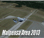
Dear Friends simmer, as always taking advantage of the beautiful objects bgl Gianluca Giovannini, I tried to improve with a symmetric pairing of autogen trees / towns / industrial buildings, the urban area near the international airport of Milano Malpensa, in the best ever scenery by the ISD project.
With the current integration I have created the village of Casenuove, Cardano al Campo, Cascina Costa, Femo, part of the small towns near the attached industrial buildings and new parking in 3D for both terminals. I paid particular attention to the impact of the approach in view of the Ticino Park with a significant density of trees near the runway. Inside you will also find the file on the grass in 3D previously published by me, so if you have already installed, you can deactivate maintaining this.
Warning Very Important: the scenery "is not complete" and to get the best result, you must install ISD LIMC 2009 (limc2009v1.1.zip) - available HERE.
| Filename: | Milano_Malpensa_Area_ISD_2013.zip |
| License: | Freeware |
| Added: | 22nd February 2013, 17:15:22 |
| Downloads: | 4,749 |
| Author: | Fabio Ferrari "fafo air" |
| Size: | 4.51 MB |
| Category: Flight Simulator 2004 - Scenery | |
| Gang Ranch CAY2 in British Columbia Canada |
|
Images related to this file:
File Description:
Gang Ranch is on the eastern side of the Coast Mountains of British Columbia, around 50 miles west of Green Lake and 5 miles west of the Fraser River that runs north-south at that latitude (51 degrees 30 minutes north, in round figures). The airfield is among some farm fields and difficult to spot (this will depend on your personal textures and settings) and the ranch buildings are scattered and a mile or two away, the nearest being the owner's house. The runway is gravel, only 1,800 feet long and aligned 08-26 at 2,150 feet above sea level. There is no lighting. I have posted it as Gang Ranch CAY2, but I suggest that you just add it to your previously created "BC airfields" (if you did that) and avoid the inevitable doubling up of common textures etc. Plus that way you will have just one FS9 library post to do and new airfields will not need yet another posting. Up to you. If you find a defect, email me.
| Filename: | Gang_Ranch_CAY2_in_British_Columbia_Canada.zip |
| License: | Freeware, limited distribution |
| Added: | 19th November 2020, 19:44:55 |
| Downloads: | 99 |
| Author: | Roger Wensley |
| Size: | 8.98 MB |
| Category: Flight Simulator 2004 - Scenery | |
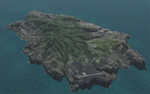
| Cape Dorset CYTE, Baffin Island, Nunavut, Canada |
|
Images related to this file:
File Description:
Cape Dorset is a village of 1,300 or so inhabitants at N 64 13 W 76 31 on Dorset Island, off the southwest corner of Baffin Island. It's Inuit name is Kinngait, which means "High Mountains"; watch out if you fly there in low clouds. The village (again) does not feature in FS9 but is included in this scenery with approximately the right shape, or shapes as there are separate parts. The airfield runway is just under 4,000 feet of gravel 100 feet wide at 158 feet above sea level. There is a double gradient to it, but unfortunately this cannot be replicated in FS.
Cape Dorset had a Hudson Bay Company store as long ago as 1913, and is now known as a centre for Inuit art. I added the roads, a new airfield background, a pond between apron and runway, plus of course there is the scenery file and the AFCAD and AI, which has two planes visiting, a First Air HS748 and a Canadian North Dash 8-100, as per real life.
| Filename: | Cape_Dorset_CYTE_Baffin_Island_Nunavut_Canada.zip |
| License: | Freeware, limited distribution |
| Added: | 9th December 2010, 18:45:06 |
| Downloads: | 1,014 |
| Author: | Roger Wensley |
| Size: | 2.75 MB |
| Category: Flight Simulator 2004 - Scenery | |
| Kimmirut CYLC on Baffin Island in Nunavut, Canada |
|
Images related to this file:
File Description:
Kimmirut is a village of some 400 folks at the southern end of the southwest-facing coast of Baffin Island, 75 miles southwest of Iqaluit. It is on the northern side of the Hudson Strait between Baffin Island and Quebec, opposite Kangiqsujuaq on the Quebec shore. The airfield is served by two flights per week, one on Monday and another on Friday, only half fueled to be able to use the 1,899' of gravel 75' wide runway. The terminal building is small and there is a garage building for airport maintenance vehicles (snow clearing). There are some nearby buildings that I have included. The village is "represented" (not "modeled") with approximately the right shape and road layout. Take enough fuel so that you can leave again, as fuel is no longer for sale here. The Cape Dyer bgls are to make a small correction, it is explained in the text. I will not be posting new sceneries in the future and this is the last one for Avsim; it completes Baffin Island.
| Filename: | Kimmirut_CYLC_on_Baffin_Island_in_Nunavut_Canada.zip |
| License: | Freeware, limited distribution |
| Added: | 25th July 2011, 17:36:57 |
| Downloads: | 534 |
| Author: | Roger Wensley |
| Size: | 2.53 MB |
© 2001-2026 AVSIM Online
All Rights Reserved
Privacy Policy |