
Where Flight Simulation Enthusiasts Gather from Around the World!
AVSIM Library - Search Results

| Category: Flight Simulator 2004 - Scenery | |
| Yangon International Airport, Yangon, Myanmar (VYYY) V2.0 |

|
File Description:
Yangon International Airport "MINGALADON" in Burma (Myanmar) will be able to accommodate bigger aircrafts and handle more passengers when work on extending its runway and upgrading its facilities is completed. The completion of the runway extension will enable Boeing 747 and Airbus 380 airplanes to use the airport. The work on extending the runway from 8100 feet to 11,200 feet began October 2004.
Version 2.0 with northward corrected and extended runway, taxiways and new taxisign. With Myanmar Air Force area, Helipads and even more parkings for civilian airplanes. This scenery was produced based on pictures of satellites. The ILS-correction is already contained here. Instructions in Deutsch and English.
| Filename: | Yangon_International_Airport_Yangon_Myanmar_VYYY_V.zip |
| License: | Freeware, limited distribution |
| Added: | 26th August 2006, 17:51:15 |
| Downloads: | 2,390 |
| Author: | HOUSE-RP, Robby Pauletto |
| Size: | 27.27 KB |
| Category: Flight Simulator 2004 - Scenery | |
| FALL - Lydenburg Airfield, South Africa |
|
Images related to this file:
File Description:
A Gmax representation of Lydenburg Airfield (FALL), Lydenburg, Mpumalanga, South Africa with photoreal textures and seasonal ground textures. There is also a new Landclass file included to add the town of Lydenburg to the East of the airfield and the township of Mashishing directly to the North of the airfield which you pass over on final approach to runway 22. Extra "hand-placed" autogen buildings were also added to make this approach a bit more "realistic".
Lydenburg airfield is a small airfield with two grass runways and only 6 hangars. The airfield is shared with the model-aircraft pilots who has their own area and two smaller runways.
| Filename: | FALL__Lydenburg_Airfield_South_Africa.zip |
| License: | Freeware, limited distribution |
| Added: | 9th May 2014, 10:07:30 |
| Downloads: | 450 |
| Author: | Kobus van Wyk, Aeroworx |
| Size: | 2.43 MB |
| Category: Flight Simulator 2004 - Scenery | |
| Erding Air Base, Germany |
|
Images related to this file:
File Description:

FS2004 scenery for Erding Air Base, Southern Germany. Erding was turned over to Allied control after the second world war and served for many years as home to first the U.S. 440th Fighter-Interceptor Squadron, and then the 52nd Tactical Fighter Group. When the 52nd withdrew in 1971 the base served as a rotation point for various NATO units finally becoming a repair and upgrade center for the then-new Typoon Eurofighter. Serving Southern Germany for over 50 years, the base now faces an uncertain future due to plans for a high-speed rail connection through the property. Scenery includes custom 3-D objects as well as seasonal photo-groundcover.
| Filename: | Erding_Air_Base_Germany.zip |
| License: | Freeware, limited distribution |
| Added: | 29th March 2013, 06:37:40 |
| Downloads: | 1,893 |
| Author: | John Stinstrom |
| Size: | 8.27 MB |
| Category: Flight Simulator 2004 - Scenery | |
| Kahului International Airport, Maui, Hawaii PHOG |
|
File Description:
This is a complete remake of the Kahului airport on the Island of Maui in Hawaii. It includes a completely new terminal, with newly designed jetways, and now includes the entire airport, with cargo and hangar areas. The parking area is also included as is the road coming into the airport, and if you drive very carefully you can even follow the outgoing road into the town and down to the beach. The jetways at the center buildings have been rotated inward to make way for the heavy jets which park in this area, or for Regional jet parking. This airport is a very nice short hop out of Honolulu.
| Filename: | Kahului_International_Airport_Maui_Hawaii__PHOG.zip |
| License: | Freeware |
| Added: | 30th October 2003, 15:42:27 |
| Downloads: | 22,092 |
| Author: | Bill Melichar |
| Size: | 5.67 MB |
| Category: Flight Simulator 2004 - Scenery | |
| Cameri and Turbigo sceneries (rev. 3) - north Italy |
|
Images related to this file:
File Description:
The following files are required by this file:
http://library.avsim.net/esearch.php?DLID=163723&UploadID=&Name=&FileName=&Author=&CatID=root
http://library.avsim.net/esearch.php?DLID=186350&UploadID=&Name=&FileName=&Author=&CatID=root
This scenery includes a global review of the previous Sceneries of Cameri Military airport (rev.2 Oct 2011), Cameri Museum (rev. 2 Oct 2011), Cameri Babini (rev. 2 oct 2011), Turbigo power station (rev. 2 Sep 2011 and update rev. 2.1 Oct 2014). All the above ARE NOW INCLUDED in this new unique scenery. Contents: Terrain in new version photo-realistic multi-seasons/night; adapted to Western Europe special elevation meshes; cover area of over 120 sqkm from Bellinzago-Oleggio (NW) to Magnago-Bienate (NE), from Novara (SW) to Cuggiono-Inveruno (SE); all the terrain has been restorated with 3D buildings, either through autogen that with specific dedicated objects (by GMax) and with significant addition of library objects ("dva51" and other existings). This scenery (located on the final approach to the Milan Malpensa international airport) includes the Cameri's Mil Airport with the Babini closed Army area and the planes of the Historical Museum of the airport; it is also included the thermoelectric power station of Turbigo. All the buildings are placed to recreate cities and villages covered in the photo-realistic terrain, including Bellinzago, Bienate, Buscate, Caltignaga, Cameri, Castano Primo, Castelletto Ticino, Cuggiono, Galliate, Inveruno, Magnago, Malvaglio, Nibbia, Novara, Oleggio, Pernate, Robecchetto, Romentino, Sant'Anna, San Pietro Mosezzo, Turbigo , Vanzaghello, and the covered Turin-Milan highway.
Details of the new buildings for the care and maintenance to F35 completely recreated, as obtainable from the current satellite view.
It REQUIRES the use of the following, to be downloaded separately :
- the libraries dva51 - the system of vegetations TreePlanter - the West Europe Meshes of Daniele Lanfranchi. See the Readme file. Enjoy!
Videos available here:
https://dl.dropboxusercontent.com/u/38829151/FS9/Cameri_Turbigo_v3%20shots.WMV
http://youtu.be/yVI2KeJKS5o
http://youtu.be/oKa0e_5kxIk
| Filename: | Cameri_and_Turbigo_sceneries_rev_3__north_Italy.zip |
| License: | Freeware |
| Added: | 21st January 2015, 21:32:36 |
| Downloads: | 992 |
| Author: | Aldo Della Vedova, Daniele Lanfranchi and Gian Mario Verga |
| Size: | 103.7 MB |
| Category: Flight Simulator 2004 - Scenery | |
| Chisasibi CSU2 in northern Quebec, Canada |
|
Images related to this file:
File Description:
Chisasibi is in northern Quebec on the east shore of James Bay, 60 miles from the corner of James Bay and Hudson Bay. Originally called Fort George and founded at the mouth of La Grande Riviere around the Hudson Bay trading post that was established in 1803, the town had to move 5 miles upstream in 1981 when the Quebec hydro project increased the flow rate of the river. The name was changed to Chisasibi at the time of the move (Chisasibi = Great River in Cree) and the population (750 as early as 1940) has now grown to around 2,000. There is a paved road east to Radisson that connects to the north-south James Bay road, which was built at the time of the hydro project work. The original Fort George airport runway is still visible but not usable, just south of the original town site. Chisasibi airport is to the west of the new town, and the gravel runway is 3,792 feet long and aligned 14/32, which is approximately parallel to the river. There is officially no fuel available, but there is JetA on site for Air Creebec in a tank protected by used fuel drums (filled with sand?). The terminal and the garage building are both relatively new; the terminal dates from 2002 and has unusual touches. There are two AI flights by Air Creebec each day plus other private planes.
| Filename: | Chisasibi_CSU2_in_northern_Quebec_Canada.zip |
| License: | Freeware, limited distribution |
| Added: | 27th February 2013, 21:24:47 |
| Downloads: | 287 |
| Author: | Roger Wensley |
| Size: | 2.79 MB |
| Category: Flight Simulator 2004 - Scenery | |
| Missing Texture message Bell206B |
|
File Description:
There have been a report of an FS9 messages popping up requesting the texture "Bell 206B" to be added to the a scenery texture folder; unfortunately I was not told which scenery. This is probably to do with my transfer of all FS9 files from one laptop that had died to a new one. Presumably "all" wasn't quite what I achieved.
Please do NOT leave a message attached to the scenery posting! Email me for something like this.
If you get the message put this folder in the texture folder of whichever scenery you are directed to. I stress that I mean "THE FOLDER" and not just the contents of the folder.
| Filename: | Missing_Texture_message_Bell206B.zip |
| License: | Freeware, limited distribution |
| Added: | 28th January 2022, 22:59:23 |
| Downloads: | 44 |
| Author: | Roger Wensley |
| Size: | 1.26 MB |
| Category: Flight Simulator 2004 - Scenery | |
| Franz Josef Aerodrome - NZFJ |
|
File Description:
Franz Josef Aerodrome on New Zealand's South Island is the ideal place from which to explore the Southern Alps and the Franz Josef Glacier.
Real-world charts have been used to ensure correct placement and dimensions of the Aerodrome although some artistic license has been taken to make this scenery 'user friendly' for FS2004!
The scenery was created using Lee Swordy's AFCAD and the magnificent RWY12 Object Placer software (you will require the RWY12 Static Object Library for this scenery to be properly displayed).
This is my first ever scenery and, whilst it has been tested, problems may still arise. Please feel free to contact me with any suggestions or queries.
Enjoy!
| Filename: | Franz_Josef_Aerodrome__NZFJ.zip |
| License: | Freeware |
| Added: | 11th March 2006, 20:42:24 |
| Downloads: | 516 |
| Author: | Mike Walters |
| Size: | 755.23 KB |
| Category: Flight Simulator 2004 - Scenery | |
| Relief textures: 5.-Spring And Water |
|
File Description:
FS2004 Relief textures: world surface textures: SPRING & WATER
This is the logic extension to my prior work, the relief textures for the autogen and
airport buildings, that you can find in the file rlftxts1.zip.
Now I try to improve the 3D aspect and ·relief of the ground textures, and give
them a "bit of life"...
I believe that these new textures are more "immersive" than the default ones, but
this is only my opinion.
Again, judge by yourself...
The water textures are FULLY COMPATIBLE with the water reflections textures of Bill Lyon's and other authors.
There are 5 files projected:
1.-fall
2.-winter
3.-Heavy winter
4.-spring and water
5.-summer
| Filename: | Relief_textures_5Spring_And_Water.zip |
| License: | Freeware |
| Added: | 29th November 2003, 01:52:32 |
| Downloads: | 3,630 |
| Author: | Carlos Lorenz Benlloch |
| Size: | 19.07 MB |
| Category: Flight Simulator 2004 - Scenery | |
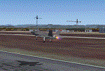
| RNAS Yeovilton - HMS Heron |
|
Images related to this file:
File Description:
FS2004 scenery for RNAS Yeovilton (HMS Heron) as it is today. Yeovilton is the current home to various helicopter squadrons flying the Sea King, Commando, Lynx and the new Wildcat. It is also home to fix wing flying with the likes of Hawks of the Naval Flying Standards Flight with the Hawk, 727 Sqn with Grob Tutors and not forgetting the Royal Navy Historic Aircraft Flight, flying the Swordfish, Sea Fury, Sea Hawk and Chipmunk.
This scenery is made up from objects obtained from various MAIW scenery libraries, which are all available to download, and will be needed in order to get the fullest benefit of this station. Full details in the enclosed documentation.
| Filename: | RNAS_Yeovilton__HMS_Heron.zip |
| License: | Freeware, limited distribution |
| Added: | 11th November 2013, 21:19:33 |
| Downloads: | 1,404 |
| Author: | Brian Clarke, Daryl Payne |
| Size: | 943.61 KB |
© 2001-2026 AVSIM Online
All Rights Reserved
Privacy Policy |