
Where Flight Simulation Enthusiasts Gather from Around the World!
AVSIM Library - Search Results

| Category: Flight Simulator 2004 - Scenery | |
| Quebec sceneries Enhancements Update |

|
File Description:
Enhanced sceneries and mesh update of the province of Quebec, Canada. Must be used with
Scenes_du_Quebec_2k4.zip and qc09_2K4a.zip, qc09_2K4b.zip, qc09_2K4c.zip,
qc09_2K4d.zip files (AVSIM files library).Installation procedure in INSTALLATION_SETUP.txt.
Mise � jour et nouvelles sc�¨nes de la province de Qu�©bec. Pour utiliser cette mise � jour, il faut obligatoirement avoir d�©j� install�© les sc�¨nes du Qu�©bec contenues dans Scenes_du_Quebec_2k4.zip (sur AVSIM). Inclus aussi une mise � jour des �©l�©vations de terrain (mesh - lod09) de la province de Qu�©bec (qc09_2K4a.zip, qc09_2K4b.zip, qc09_2K4c.zip, qc09_2K4d.zip sur AVSIM). L'installation des fichiers est d�©crite dans INSTALLATION_SETUP.txt.
| Filename: | Quebec_sceneries_Enhancements_Update.zip |
| License: | Freeware, limited distribution |
| Added: | 1st November 2009, 06:49:03 |
| Downloads: | 4,759 |
| Author: | Gilles Gauthier |
| Size: | 6.81 MB |
| Category: Flight Simulator 2004 - Scenery | |
| New Terrain Mesh of the Province of Quebec in LOD09 (1/4) |
|
File Description:
The files in this package contain terrain mesh files of the province of Quebec (N45 to N53) to be used with my Quebec enhanced sceneries for FS2004 (Scenes_du_Quebec_2k4.zip). The public data sources are the Shuttle Radar Topography Mission (SRTM-3, 90m) and the Canadian Digital Elevation Data (CDED - 0.75s/arc - 23m). (QC09_2k4a.zip to QC09_2k4d.zip - 4 parts)
***********************
Les fichiers de ces archives contiennent les donnees d'elevation de terrain (mesh files - lod09), pour FS2004, du territoire de la province de Quebec sous le 53ieme degre de latitude nord. Ils ont ete crees pour etre utilises avec mes nouvelles scenes du Quebec contenues dans Scenes_du_Quebec_2k4.zip. Les donnees sources sont du domaine public et proviennent de la Shuttle Radar Topography Mission (SRTM-3, 90m) et des donnees numerique d'elevation du Canada (DNEC - 0.75s/arc -23 m). (QC09_2k4a.zip to QC09_2k4d.zip - 4 parties)
| Filename: | New_Terrain_Mesh_of_the_Province_of_Quebec_in_LOD09_14.zip |
| License: | Freeware, limited distribution |
| Added: | 27th January 2010, 18:10:18 |
| Downloads: | 8,915 |
| Author: | Gilles Gauthier |
| Size: | 23.76 MB |
| Category: Flight Simulator 2004 - Scenery | |
| New Terrain Mesh of the Province of Quebec in LOD09 (2/4) |
|
File Description:
The files in this package contain terrain mesh files of the province of Quebec (N45 to N53) to be used with my Quebec enhanced sceneries for FS2004 (Scenes_du_Quebec_2k4.zip). The public data sources are the Shuttle Radar Topography Mission (SRTM-3, 90m) and the Canadian Digital Elevation Data (CDED - 0.75s/arc - 23m). (QC09_2k4a.zip to QC09_2k4d.zip - 4 parts)
***********************
Les fichiers de ces archives contiennent les donnees d'elevation de terrain (mesh files - lod09), pour FS2004, du territoire de la province de Quebec sous le 53ieme degre de latitude nord. Ils ont ete crees pour etre utilises avec mes nouvelles scenes du Quebec contenues dans Scenes_du_Quebec_2k4.zip. Les donnees sources sont du domaine public et proviennent de la Shuttle Radar Topography Mission (SRTM-3, 90m) et des donnees numerique d'elevation du Canada (DNEC - 0.75s/arc -23 m). (QC09_2k4a.zip to QC09_2k4d.zip - 4 parties)
| Filename: | New_Terrain_Mesh_of_the_Province_of_Quebec_in_LOD0.zip |
| License: | Freeware, limited distribution |
| Added: | 1st November 2009, 06:47:09 |
| Downloads: | 4,627 |
| Author: | Gilles Gauthier |
| Size: | 27.78 MB |
| Category: Flight Simulator 2004 - Scenery | |
| New Terrain Mesh of the Province of Quebec in LOD09 (3/4) |
|
File Description:
The files in this package contain terrain mesh files of the province of Quebec (N45 to N53) to be used with my Quebec enhanced sceneries for FS2004 (Scenes_du_Quebec_2k4.zip). The public data sources are the Shuttle Radar Topography Mission (SRTM-3, 90m) and the Canadian Digital Elevation Data (CDED - 0.75s/arc - 23m). (QC09_2k4a.zip to QC09_2k4d.zip - 4 parts)
***********************
Les fichiers de ces archives contiennent les donnees d'elevation de terrain (mesh files - lod09), pour FS2004, du territoire de la province de Quebec sous le 53ieme degre de latitude nord. Ils ont ete crees pour etre utilises avec mes nouvelles scenes du Quebec contenues dans Scenes_du_Quebec_2k4.zip. Les donnees sources sont du domaine public et proviennent de la Shuttle Radar Topography Mission (SRTM-3, 90m) et des donnees numerique d'elevation du Canada (DNEC - 0.75s/arc -23 m). (QC09_2k4a.zip to QC09_2k4d.zip - 4 parties)
| Filename: | New_Terrain_Mesh_of_the_Province_of_Quebec_in_LOD0.zip |
| License: | Freeware, limited distribution |
| Added: | 27th January 2010, 18:15:12 |
| Downloads: | 7,495 |
| Author: | Gilles Gauthier |
| Size: | 29.35 MB |
| Category: Flight Simulator 2004 - Scenery | |
| New Terrain Mesh of the Province of Quebec in LOD09 (4/4) |
|
File Description:
The files in this package contain terrain mesh files of the province of Quebec (N45 to N53) to be used with my Quebec enhanced sceneries for FS2004 (Scenes_du_Quebec_2k4.zip). The public data sources are the Shuttle Radar Topography Mission (SRTM-3, 90m) and the Canadian Digital Elevation Data (CDED - 0.75s/arc - 23m). (QC09_2k4a.zip to QC09_2k4d.zip - 4 parts)
***********************
Les fichiers de ces archives contiennent les donnees d'elevation de terrain (mesh files - lod09), pour FS2004, du territoire de la province de Quebec sous le 53ieme degre de latitude nord. Ils ont ete crees pour etre utilises avec mes nouvelles scenes du Quebec contenues dans Scenes_du_Quebec_2k4.zip. Les donnees sources sont du domaine public et proviennent de la Shuttle Radar Topography Mission (SRTM-3, 90m) et des donnees numerique d'elevation du Canada (DNEC - 0.75s/arc -23 m). (QC09_2k4a.zip to QC09_2k4d.zip - 4 parties)
| Filename: | New_Terrain_Mesh_of_the_Province_of_Quebec_in_LOD0.zip |
| License: | Freeware, limited distribution |
| Added: | 27th January 2010, 18:17:08 |
| Downloads: | 7,854 |
| Author: | Gilles Gauthier |
| Size: | 20.94 MB |
| Category: Flight Simulator 2004 - Scenery | |
| Tibet Scenery v9.0 |
|
File Description:
Addon scenery for Microsoft Flight Simulators FS2004 both missing airports in Tibet
- ZULS LXA Lhasa Gongkar Airport (other names: Gonggar, Gonga)
- ZUBD BPX Changdu International Airport (other names: Bangda, Bamda, Pomda, Qamdo)
Includes now Potala Palace, seasonal textures and new terminal at Lhasa, corrected river and mesh and 3 detailed flightplans. AFCAD files available later after the release of the new AFCAD program.
By UranusJay - Jan Martin
| Filename: | Tibet_Scenery_v90.zip |
| License: | Freeware |
| Added: | 19th August 2003, 01:09:08 |
| Downloads: | 4,020 |
| Author: | Jan Martin |
| Size: | 863.35 KB |
| Category: Flight Simulator 2004 - Scenery | |
| Hauraki Gulf v4 |
|
File Description:
This replaces all my previous Pakatoa Island and Hauraki Gulf sceneries.You must have Christian Stock's NZ mesh in the form of "Mountains of New Zealand" and topo in the form of "Lakes and Rivers of New Zealand". Includes all previous scenery candy. New in this pack...RANGITOTO ISLAND: Rangitoto Lighthouse; Rangitoto Wharf, public conveniences and baches; Islington Bay Wharf with toilets, telephone and information stand.
| Filename: | Hauraki_Gulf_v4.zip |
| License: | Freeware |
| Added: | 9th November 2008, 08:12:31 |
| Downloads: | 298 |
| Author: | Godfrey Tier |
| Size: | 6 MB |
| Category: Flight Simulator 2004 - Scenery | |
| Fertiliser Works - Awatoto, Napier |
|
File Description:
Situated on the coast, just south of Napier - a familiar sight to pilots around Hawke's Bay, New Zealand.
An updated version from my original scenery object - textures also updated.
Smoke from chimneys affected by wind.
This scenery is located for Christian Stock's NZ mesh in the form of "Mountains of New Zealand" and topo in the form of "Lakes and Rivers of New Zealand".
| Filename: | Fertiliser_Works__Awatoto_Napier.zip |
| License: | Freeware |
| Added: | 28th October 2008, 14:20:16 |
| Downloads: | 376 |
| Author: | Godfrey Tier |
| Size: | 134.6 KB |
| Category: Flight Simulator 2004 - Scenery | |
| Hauraki Gulf v5 |
|
File Description:
This replaces all my previous Pakatoa Island and Hauraki Gulf sceneries.You must have Christian Stock's NZ mesh in the form of "Mountains of New Zealand" and topo in the form of "Lakes and Rivers of New Zealand". Includes all previous scenery candy. New in this version: MOTUTAPU ISLAND: Home Bay Wharf; WW2 Observation Hut, Billy Goat Point; Motutapu Outdoor Education Camp Trust, Administration Bay.
| Filename: | Hauraki_Gulf_v5.zip |
| License: | Freeware |
| Added: | 13th November 2008, 02:24:13 |
| Downloads: | 510 |
| Author: | Godfrey Tier |
| Size: | 6.4 MB |
| Category: Flight Simulator 2004 - Scenery | |
| Vance W. Amory International Airport, St Kitss and Nevis (TKPN), Update to version 1.1 |
|
Images related to this file:
File Description:
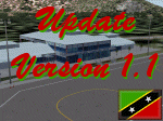
This zip-file contains a update to version 1.1 of my scenery for the Vance W. Amory International Airport in St. Kitts and Nevis. Original version 1.0 is required. Update contains:
- Removed flatten-area which conflicted with default FS9 mesh terrain settings.
- Corrected AFCAD file
- Fixed some small bugs
- New displaced threshold markings
- Modified windsocks
- Added working marshalers on parking spot 1 & 2 (front of the terminal)
| Filename: | Vance_W_Amory_International_Airport_St_Kitss_and_N.zip |
| License: | Freeware, limited distribution |
| Added: | 2nd April 2010, 01:24:50 |
| Downloads: | 1,828 |
| Author: | Marcel Ritzema |
| Size: | 57.77 KB |
© 2001-2026 AVSIM Online
All Rights Reserved
Privacy Policy |