
Where Flight Simulation Enthusiasts Gather from Around the World!
AVSIM Library - Search Results

| Category: Flight Simulator 2004 - Scenery | |
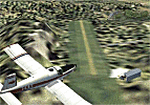
| Ilhas BR (Atol das Rocas, Sao Vicente, Sao Pedro) v3 |

|
Images related to this file:
File Description:

v3 ==> || Atol das Rocas (SNRC) | Sao Vicente & Sao Pedro (SNVP/SNPV) || FS2004 AFCAD and mesh files for three fictious airport-islands in Brazilian Atlantic Coast (the idea is not to represent nothing in real, but to provide a way for flight sim pilots to reach these islands). || Arquivos AFCAD e mesh para tres ilhas brasileiras, criando aeroportos ficticios para elas (a ideia nao eh representar nada real, mas apenas possibilitar que pilotos virtuais possam visitar essas ilhas). ==> v3 corrects MAG deviation at SNVP/SNPV reference VOR & adds news buildings to SNRC, SNVP and SNPV.
| Filename: | Ilhas_BR_Atol_das_Rocas_Sao_Vicente_Sao_Pedro_v3.zip |
| License: | Freeware |
| Added: | 13th December 2009, 03:34:41 |
| Downloads: | 707 |
| Author: | Rui Mesquita |
| Size: | 335.67 KB |
| Category: Flight Simulator 2004 - Scenery | |
| RealScene 2004 Terrain and Landclass Preview |
|
File Description:
This is a preview of the upcoming release of RealScene 2004 Addon Terrain and Landclass Scenery for Microsoft Flight Simulator 2004 and 2002. The terrain mesh and landclass scenery covers Yellowstone Park and the Grand Tetons area.
| Filename: | RealScene_2004_Terrain_and_Landclass_Preview.zip |
| License: | Freeware |
| Added: | 23rd December 2003, 22:08:38 |
| Downloads: | 2,273 |
| Author: | Eddie Denney |
| Size: | 39.43 MB |
| Category: Flight Simulator 2004 - Scenery | |
| South Africa (Johannesburg(Transvaal)/Swasiland/Lesotho/Orange Freestate- 76M SRTM TERRAIN MESH) Part 2 |
|
File Description:
This mesh of South Africa includes beautiful areas of Transvaal(Johannesburg), Swasiland, Orange Freestate and Lesotho.It comes in 3 files. Part 2 of 3.
All the 3 files cover the area from S25 E26(!) to S30 E31.
| Filename: | South_Africa_JohannesburgTransvaalSwasilandLesotho.zip |
| License: | Freeware, limited distribution |
| Added: | 24th April 2004, 02:25:21 |
| Downloads: | 4,208 |
| Author: | Michael Speck |
| Size: | 15.87 MB |
| Category: Flight Simulator 2004 - Scenery | |
| South Africa (Johannesburg(Transvaal)/Swasiland/Lesotho/Orange Freestate- 76M SRTM TERRAIN MESH) Part 1 |
|
File Description:
This mesh of South Africa includes beautiful areas of Transvaal(Johannesburg), Swasiland, Orange Freestate and Lesotho.It comes in 3 files. Part 1 of 3.
All the 3 files cover the area from S25 E31 to S30 E31.
| Filename: | South_Africa_JohannesburgTransvaalSwasilandLesotho.zip |
| License: | Freeware, limited distribution |
| Added: | 24th April 2004, 02:06:43 |
| Downloads: | 5,022 |
| Author: | Michael Speck |
| Size: | 4.84 MB |
| Category: Flight Simulator 2004 - Scenery | |
| NZ Rural Airstrips, v3 |
|
Images related to this file:
File Description:
Replaces my previous versions. 9 more strips included. Gisborne area. Requires Christian Stock's payware NZ mesh in the form of "Mountains of New Zealand" and topo in the form of "Lakes and Rivers of New Zealand".
| Filename: | NZ_Rural_Airstrips_v3.zip |
| License: | Freeware |
| Added: | 17th April 2010, 16:18:18 |
| Downloads: | 147 |
| Author: | Godfrey Tier |
| Size: | 2.37 MB |
| Category: Flight Simulator 2004 - Scenery | |
| La Tortuga Island - SyDesigns |
|
File Description:
La Tortuga Island Scenery for Flight Simulator 2004: It is an accurate depiction of this paradise located near Margarita Island in Venezuela. It includes two airfields, new coastlines, mesh, landclass, visual details for VFR flying, and animated scenery.
| Filename: | La_Tortuga_Island__SyDesigns.zip |
| License: | Freeware, limited distribution |
| Added: | 3rd August 2006, 03:52:22 |
| Downloads: | 4,324 |
| Author: | Sabino Yacobone & Arnoldo Perdomo |
| Size: | 6.72 MB |
| Category: Flight Simulator 2004 - Scenery | |
| RANGITAIKI - NZRK |
|
Images related to this file:
File Description:
Simple rendition of this aerodrome, 16nm south-east of Taupo, (NAZP), New Zealand. Made for Christian Stock's NZ mesh in the form of "Mountains of New Zealand"
and topo in the form of "Lakes and Rivers of New Zealand".
| Filename: | RANGITAIKI__NZRK.zip |
| License: | Freeware |
| Added: | 6th February 2011, 03:46:28 |
| Downloads: | 205 |
| Author: | Godfrey Tier |
| Size: | 183.53 KB |
| Category: Flight Simulator 2004 - Scenery | |
| FYKT, J. G. H. Van Der Wath airport, Keetmanshoop, Namibia for FS9 |
|
File Description:
Based on googleEarth picture. Ez-scenery and rwy12 objects included. Compatible with Holger Sandmann's Namibia LOD9 Terrain mesh (namibia_ne.zip, namibia_nw.zip, namibia_se.zip, namibia_sw.zip, namibia_cp.zip) as well as his namibia_scenery_updates.zip, all found at avsim.com. (re-upload, originally uploaded 23rd November 2008)
| Filename: | FYKT_J_G_H_Van_Der_Wath_airport_Keetmanshoop_Namib.zip |
| License: | Freeware |
| Added: | 16th May 2010, 23:59:11 |
| Downloads: | 1,080 |
| Author: | Detlev J. Rohmer |
| Size: | 5.88 MB |
| Category: Flight Simulator 2004 - Scenery | |
| Glen Canyon / Lake Powell, Utah 38m Terrain Mesh |
|
File Description:
USGS SRTM30 1 arc-second, resampled to LOD10 (38.2 meters).
This high-resolution terrain mesh is centered at Glen Canyon
National Recreation Area in south-eastern Utah. Coverage area:
From West -111.6° to West -110.2° and North 36.8° to North 38.0°.
It includes the National Recreation Area with Lake Powell,
Navajo Mountain, the Henry Mountains, parts of Capitol Reef
National Park / Grand Staircase Escalante National Monument,
the town of Page in northern Arizona and surrounding areas.
| Filename: | Glen_Canyon__Lake_Powell_Utah_38m_Terrain_Mesh.zip |
| License: | Freeware, limited distribution |
| Added: | 25th January 2004, 20:30:45 |
| Downloads: | 5,417 |
| Author: | Andreas Trawny |
| Size: | 8.31 MB |
| Category: Flight Simulator 2004 - Scenery | |
| Bella Coola Valley Terrain Mesh and Scenery Enhancements |
|
File Description:
One of the most spectacular watersheds of British Columbia's Midcoast, the Bella Coola Valley looks pretty boring in its default FS rendition. These files provide a LOD10 (38-m) mesh made from CDED1 0.75-arcsec data, a new landclass file, and accurate placements of lakes, rivers, streams, and roads. Also includes the glaciers of the Monarch Mt. Icefield and several forestry roads and clearcuts along the side valleys. Made with Ground2K4 based on Landsat 7 ETM+ satellite imagery.
| Filename: | Bella_Coola_Valley_Terrain_Mesh_and_Scenery_Enhanc.zip |
| License: | Freeware, limited distribution |
| Added: | 1st April 2004, 20:49:32 |
| Downloads: | 8,867 |
| Author: | Holger Sandmann |
| Size: | 20.74 MB |
© 2001-2026 AVSIM Online
All Rights Reserved
Privacy Policy |