
Where Flight Simulation Enthusiasts Gather from Around the World!
AVSIM Library - Search Results

| Category: Flight Simulator 2004 - Scenery | |
| Peninsular Malaysia Mesh Terrain: AREA 2/6 |

|
File Description:
Scenery based on SRTM-30 digital elevation model (DEM). Interpolation process done using Blackart and MicroDEM, all scenery files compiled at LOD9. Airport Coverage: Sultan Azlan Shah.
| Filename: | Peninsular_Malaysia_Mesh_Terrain_AREA_26.zip |
| License: | Freeware |
| Added: | 17th July 2005, 17:26:00 |
| Downloads: | 2,570 |
| Author: | Mohammad Omar |
| Size: | 4.11 MB |
| Category: Flight Simulator 2004 - Scenery | |
| Cape Farvel, Greenland 76m SRTM Terrain Mesh |
|
File Description:
USGS SRTM 3 arc-second, resampled to LOD9 (76 meters). This is a terrain mesh scenery of Cape Farvel in southern Greenland. Coverage area: From West 45.6° to West 42.8° and North 59.6° to North 60.4°. (Cape Farvel is the only part of Greenland available as SRTM elevation model)
| Filename: | Cape_Farvel_Greenland_76m_SRTM_Terrain_Mesh.zip |
| License: | Freeware, limited distribution |
| Added: | 17th April 2004, 23:35:14 |
| Downloads: | 4,183 |
| Author: | Andreas Trawny |
| Size: | 1.55 MB |
| Category: Flight Simulator 2004 - Scenery | |
| Europe SRTM mesh part 10: Lower Danube |
|
File Description:
Europe SRTM LOD9 mesh part 10 of 13: Covers a wide area centered over the Danube valley from Novi Sad to the Black Sea (42°N-46°N, 19°E-30°E). Includes Balkans & Transylvanian moutain ranges, and parts of the following countries: Romania, Bulgaria, Serbia and Albania.
This Europe SRTM project was optimized for the lowest HDD space use: Each part macthing exactly the boundaries of its neighbors, you'll have a complete corevage of Europe without gap or overlapping scenery. Based on SRTM Data v1 and v2 (3 arcsec, 90m) and sampled to LOD9 resolution (76m). Each SRTM tile was carefully checked and repaired with Blackart v4.02: water areas are now flattened (lighter mesh), and SRTM voids were treated taking advantage of Blackart's sophisticated interpolation algorithm. When required, biggest voids were patched with oversampled SRTM 30 arcsec data and/or manual input.
| Filename: | Europe_SRTM_mesh_part_10_Lower_Danube.zip |
| License: | Freeware, limited distribution |
| Added: | 19th October 2005, 17:55:10 |
| Downloads: | 11,732 |
| Author: | Yohann Baptiste |
| Size: | 39.14 MB |
| Category: Flight Simulator 2004 - Scenery | |
| Europe SRTM mesh Part 02: UK & Ireland |
|
File Description:
Europe SRTM LOD9 mesh part 2 of 13: Covers all of UK & Ireland except the Shetlands, and a tiny part of France (from Calais to Abbeville).
This Europe SRTM project was optimized for the lowest HDD space use: Each part macthing exactly the boundaries of its neighbors, you'll have a complete corevage of Europe without gap or overlapping scenery. Based on SRTM Data v1 and v2 (3 arcsec, 90m) and sampled to LOD9 resolution (90m). Each SRTM tile was carefully checked and repaired with Blackart v4.02: water areas are now flattened (lighter mesh), and SRTM voids were treated taking advantage of Blackart's sophisticated interpolation algorithm. When required, biggest voids were patched with oversampled SRTM 30 arcsec data and/or manual input.
| Filename: | Europe_SRTM_mesh_Part_02_UK__Ireland.zip |
| License: | Freeware, limited distribution |
| Added: | 19th October 2005, 16:11:56 |
| Downloads: | 17,955 |
| Author: | Yohann Baptiste |
| Size: | 36.17 MB |
| Category: Flight Simulator 2004 - Scenery | |
| Europe SRTM mesh Part 11: Southern Italy |
|
File Description:
Europe SRTM LOD9 mesh part 11 of 13: Covers southern Italy, Sardinia, Corsica and parts of Croatia and Bosnia.
This Europe SRTM project was optimized for the lowest HDD space use: Each part macthing exactly the boundaries of its neighbors, you'll have a complete corevage of Europe without gap or overlapping scenery. Based on SRTM Data v1 and v2 (3 arcsec, 90m) and sampled to LOD9 resolution (76m). Each SRTM tile was carefully checked and repaired with Blackart v4.02: water areas are now flattened (lighter mesh), and SRTM voids were treated taking advantage of Blackart's sophisticated interpolation algorithm. When required, biggest voids were patched with oversampled SRTM 30 arcsec data and/or manual input.
| Filename: | Europe_SRTM_mesh_Part_11_Southern_Italy.zip |
| License: | Freeware, limited distribution |
| Added: | 20th October 2005, 11:17:43 |
| Downloads: | 14,227 |
| Author: | Yohann Baptiste |
| Size: | 27.86 MB |
| Category: Flight Simulator 2004 - Scenery | |
| Ultimate Malta - Landclass, Mesh, Roads and Towns |
|
File Description:
With this file you will get one of the best freeware sceneries for the island of Malta, including:
----- a more realistical landclass mixed with green grounds and southern dry grounds ----- Important roads around the airport ----- a more realistical mesh with small mountain, cliffs and beaches ----- Important towns that do not exist in FS2004 inlc. the capital of Malta, villages around the airport as well as the harbor town in the very south of Malta and some important ones more -----
| Filename: | Ultimate_Malta__Landclass_Mesh_Roads_and_Towns.zip |
| License: | Freeware |
| Added: | 7th September 2008, 22:59:31 |
| Downloads: | 4,539 |
| Author: | Dave Sheffield |
| Size: | 38.14 KB |
| Category: Flight Simulator 2004 - Scenery | |
| Atlas Mountains, Morocco 76m SRTM Terrain Mesh |
|
File Description:
USGS SRTM 3 arc-second, resampled to LOD9 (76 meters). This is a terrain mesh scenery of the Atlas Mountains in Morocco, Africa. It includes the High Atlas, the cities of Agadir & Marrakech and northwestern parts of the Sahara Desert.
| Filename: | Atlas_Mountains_Morocco_76m_SRTM_Terrain_Mesh.zip |
| License: | Freeware |
| Added: | 4th April 2004, 19:46:58 |
| Downloads: | 15,259 |
| Author: | Andreas Trawny |
| Size: | 15.95 MB |
| Category: Flight Simulator 2004 - Scenery | |
| New Zealand Coastal Airstrips |
|
Images related to this file:
File Description:

7 coastal airstrips around New Zealand. Made to fit Christian Stock's NZ mesh in the form of "Mountains of New Zealand" and topo in the form of "Lakes and Rivers of New Zealand".
| Filename: | New_Zealand_Coastal_Airstrips.zip |
| License: | Freeware |
| Added: | 7th September 2011, 22:15:53 |
| Downloads: | 517 |
| Author: | Godfrey Tier |
| Size: | 2.32 MB |
| Category: Flight Simulator 2004 - Scenery | |
| FYSM Swakopmund, Namibia for FS9 |
|
File Description:
Based on googleEarth and fotos. Ez-scenery and rwy12 objects included. Compatible with Holger Sandmann's Namibia LOD9 Terrain mesh (namibia_ne.zip, namibia_nw.zip, namibia_se.zip, namibia_sw.zip, namibia_cp.zip) as well as his namibia_scenery_updates.zip, all found at avsim.com.
| Filename: | FYSM_Swakopmund_Namibia_for_FS9.zip |
| License: | Freeware |
| Added: | 12th December 2008, 23:26:45 |
| Downloads: | 1,030 |
| Author: | Detlev J. Rohmer |
| Size: | 10.92 MB |
| Category: Flight Simulator 2004 - Scenery | |
| NZMJ Martins Bay, New Zealand |
|
Images related to this file:
File Description:
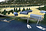
Fiordland, New Zealand. 19nm from Milford Sound. You must have Christian Stock's NZ mesh in the form of "Mountains of New Zealand"
and topo in the form of "Lakes and Rivers of New Zealand".
| Filename: | NZMJ_Martins_Bay_New_Zealand.zip |
| License: | Freeware |
| Added: | 13th July 2010, 09:19:02 |
| Downloads: | 358 |
| Author: | Godfrey Tier |
| Size: | 855.99 KB |
© 2001-2026 AVSIM Online
All Rights Reserved
Privacy Policy |