
Where Flight Simulation Enthusiasts Gather from Around the World!
AVSIM Library - Search Results

| Category: Flight Simulator 2004 - Scenery | |
| Project Mexico Real LOD10 File 9 of 11 |

|
Images related to this file:
File Description:
File 9th of 11 of a Terrain Mesh that covers the entirety of Mexican Territory and related bordering U.S., Guatemala and Belice areas, part of the "Proyecto Mexico Real" project, compiled at LOD10 (1.24 arcseconds in latitude and 1.65 arcseconds in longitude) resolution from INEGI data. Intended to enhance the virtual flying experience complementing the LOD8 and LOD9 versions compiled from the same data. Compatible backwards with Flight Simulator 2000, Flight Simulator 2002 and Combat Flight Simulator 2. Refer to the file contents about the cover area to this compressed file. (Re-upload due to AVSIM hack)
| Filename: | Project_Mexico_Real_LOD10_File_9_of_11.zip |
| License: | Check within download |
| Added: | 29th August 2010, 23:24:57 |
| Downloads: | 1,195 |
| Author: | Juan Jose Galvan Bautista |
| Size: | 76.35 MB |
| Category: Flight Simulator 2004 - Scenery | |
| Private Strips - revisited |
|
File Description:
Herewith my previously uploaded collections of various Private/Extra/Grass/Microlight/Miscellaneous etc. airfields from around England and Wales, all now in one place and re-edited with parking and taxiways for the facilitation of ai aircraft.
Please note :- these sceneries have been designed for use in FS2004 with the original UK VFR Photographic scenery and mesh. They rely for details on the "usual" collections of library objects, specifically EZ-Scenery, UKVFR and Rwy12 libraries. Whilst other configurations will probably work, to a degree, you'll have to try them and see if they suit you.
See the enclosed ReadMe for further details.
| Filename: | Private_Strips__revisited.zip |
| License: | Freeware |
| Added: | 6th March 2021, 16:15:32 |
| Downloads: | 156 |
| Author: | Chris Eve |
| Size: | 2 MB |
| Category: Flight Simulator 2004 - Scenery | |
| Sydney, Australia |
|
File Description:
This scenery is meant as an enhancement
to the already detailed photo-realistic Sydney
scenery provided by Microsoft in this version
of their Simulator.
THIS SCENERY FEATURES North Sydney Buildings
Chatswood buildings, TV Antena's, Fort Denision
Harbour traffic, including ferry boats and
other water traffic, Stadium Australia (Now Telstra Stadium)
Sydney Football Stadium (Now Aussie Stadium.)
Gladesville Bridge, Iron Cove Bridge.
In addition two heliports have been added, one
at the Opera House one at Telstra Stadium.
For use with or without SATPAC mesh scenery.
Textures required are Airport 2.6, VOD, Nova and Nova Gold.
& ASD.
| Filename: | Sydney_Australia.zip |
| License: | Freeware |
| Added: | 12th November 2003, 16:05:51 |
| Downloads: | 10,999 |
| Author: | Clive Marriott |
| Size: | 1.37 MB |
| Category: Flight Simulator 2004 - Scenery | |
| Old Rhinebeck Aerodrome |
|
File Description:
Old Rhinebeck, the living museum of antique aviation, located at NY94 in Rhinebeck NY. Included are all the buildings and hangars at the field. Photoreal ground textures for the Rock City area surrounding ORA. All lakes streams, and rivers were hand edited for accuracy. Hand placed autogen and trees to match the ground textures. Special effects that make crowds of people appear during show times, and a few easter eggs as well. Mesh compliled from clean 1 arc sec SRTM data. Afcad is AI ready for your flightplans. All Gmax 3d models, and optimized textures for smooth performance.
happy flyin.
| Filename: | Old_Rhinebeck_Aerodrome.zip |
| License: | Freeware, limited distribution |
| Added: | 4th December 2005, 03:32:41 |
| Downloads: | 4,617 |
| Author: | Joe Binka |
| Size: | 38.57 MB |
| Category: Flight Simulator 2004 - Scenery | |
| World's Highest Airfield @ 16600 feet - Daulat Beg Oldie |
|
File Description:
Located at an altitude of 16600 feet in North Eastern Ladakh near the strategic Karakoram Pass, DBO is an important Indian Army post which links with the ancient Silk Route to China. The Indian army maintains a helipad and an airstrip here, which is highest in the world. It is just 8 km south the Chinese border and 9 km northwest of the Aksai Chin & line of actual control between China and India. The scenery is truly fictional as no information is available on internet regarding the orientation of airstrip. Works best with Himalayan Peaks LOD10 Mesh, Volume 6 - Jammu and Kashmir avaiable at avsim: (fs_him_06.zip)
| Filename: | Worlds_Highest_Airfield__16600_feet__Daulat_Beg_Ol.zip |
| License: | Freeware |
| Added: | 26th June 2008, 10:57:26 |
| Downloads: | 964 |
| Author: | Deepak Blassi |
| Size: | 1.3 MB |
| Category: Flight Simulator 2004 - Scenery | |
| Hauraki Gulf v2 |
|
File Description:
This replaces all my previous Pakatoa Island and Hauraki Gulf sceneries.You must have Christian Stock's NZ mesh in the form of "Mountains of New Zealand" and topo in the form of "Lakes and Rivers of New Zealand."
TIRITIRI MATANGI ISLAND:
Tiritiri Wharf.
Lighthouse Area - including souvenir shop.
PAKATOA ISLAND:
A few houses plus a jetty with parking for float planes.
WAIHEKE ISLAND:
Floatplane parking and a ferry terminal at Matiatia Beach.
Jetty at Orapiu.
KAWAU ISLAND:
More accurate location of Mansion House and jetty in this version.South Cove Wharf.Old Coppermine ruins near South Cove.
Kawau Yacht Club and jetty - Bon Accord Harbour.
AUCKLAND:
Ferry Terminal.
| Filename: | Hauraki_Gulf_v2.zip |
| License: | Freeware |
| Added: | 31st October 2008, 08:51:23 |
| Downloads: | 345 |
| Author: | Godfrey Tier |
| Size: | 5.66 MB |
| Category: Flight Simulator 2004 - Scenery | |
| Canadian Mountain Parks Pack |
|
File Description:
FS2004 Scenery - This file creates 12 new airports in six of Canada's National Parks (Banff, Jasper, Kootenay, Yoho, Glacier and Mt Revelstoke). Required is Holger Sandmann's excellent BC mesh, which is the reason for this file in the first place, and Lago's FSE demo file. Pack designed for low level visual 30 mile scenic flights with some tourist attraction additions (Takakkaw Falls, Emerald Lake, Lake Louise, Morainne Lake, Spiral Tunnel etc). The strips are ficticious, but the names and places are real. There is parking for you to add your own AI traffic as well. There are also improvements to other area strips (mainly lights and taxiways). Six flights included.
| Filename: | Canadian_Mountain_Parks_Pack.zip |
| License: | Freeware |
| Added: | 11th April 2004, 23:15:31 |
| Downloads: | 5,262 |
| Author: | Peter Vibe |
| Size: | 1.68 MB |
| Category: Flight Simulator 2004 - Scenery | |
| Project Mexico Real LOD9 File 4 of 4 |
|
Images related to this file:
File Description:
File 4th of 4 of a Terrain Mesh that covers the entirety of Mexican Territory and related bordering U.S., Guatemala and Belice areas, part of the "Proyecto M�©xico Real" project, compiled at LOD9 (2.48 arcseconds in latitude and 3.3 arcseconds in longitude) resolution from INEGI data. Intended to enhance the virtual flying experience with the more detailed LOD10 version and complement the LOD8 version compiled from the same data. Compatible backwards with Flight Simulator 2000, Flight Simulator 2002 and Combat Flight Simulator 2. Refer to the file contents about the cover area to this compressed file. (Re-upload due to AVSIM hack)
| Filename: | Project_Mexico_Real_LOD9_File_4_of_4.zip |
| License: | Check within download |
| Added: | 6th June 2010, 08:50:44 |
| Downloads: | 2,726 |
| Author: | Juan Jose Galvan Bautista |
| Size: | 54.82 MB |
| Category: Flight Simulator 2004 - Scenery | |
| Project México Real LOD9 File 3 of 4 |
|
Images related to this file:
File Description:
Re-upload. File 3rd of 4 of a Terrain Mesh that covers the entirety of Mexican Territory and related bordering U.S., Guatemala and Belice areas, part of the "Proyecto México Real" project, compiled at LOD9 (2.48 arcseconds in latitude and 3.3 arcseconds in longitude) resolution from INEGI data. Intended to enhance the virtual flying experience with the more detailed LOD10 version and complement the LOD8 version compiled from the same data. Compatible backwards with Flight Simulator 2000, Flight Simulator 2002 and Combat Flight Simulator 2. Refer to the file contents about the cover area to this compressed file. (Re-upload due to AVSIM hack)
| Filename: | Project_Mxico_Real_LOD9_File_3_of_4.zip |
| License: | Check within download |
| Added: | 6th June 2010, 03:15:08 |
| Downloads: | 2,595 |
| Author: | Juan José Galvén Bautista |
| Size: | 53.8 MB |
| Category: Flight Simulator 2004 - Scenery | |
| Hellas Scenery Project (HSP) - All in One scenery package 2 of 2 |
|
Images related to this file:
File Description:
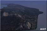
Second of the two files needed. The package includes all freeware scenery created by the HSP team for Greece in FS9 up to June 2009. The package bundles all HSP released scenery in one pack which was necessary following the loss of several files after avsim's file library crash.
By using this scenery you do not need to download anything else from HSP.
Included are detailed airport sceneries of LGAL Alexandroupolis, LGAV Athens Venizelos, LGIR Iraklion, LGKO Kos, LGMK Mikonos, LGSA Chania, LGSO Syros, LGSR Santorini as well as HSP base scenery with essential improvements to other airports and finally the detailed mesh terrain for all Hellenic territory.
| Filename: | Hellas_Scenery_Project_HSP__All_in_One_scenery_pac.zip |
| License: | Freeware, limited distribution |
| Added: | 20th May 2010, 13:14:10 |
| Downloads: | 155,852 |
| Author: | Hellas Scenery Team (HST) |
| Size: | 47.54 MB |


© 2001-2026 AVSIM Online
All Rights Reserved
Privacy Policy |