
Where Flight Simulation Enthusiasts Gather from Around the World!
AVSIM Library - Search Results

| Category: Flight Simulator 2004 - Scenery | |
| Armenia And Surrounding Area |

|
File Description:
Discover Armenia! This mesh includes the whole territory of Armenia, and also small parts at the borders, Georgia and Aserbaidschan. Also included is Büyük Agri, a 5197 meters high mountain in Turkey to the border to Armenia. SRTM 3 arc-second, resampled to LOD9 (76 meters).
| Filename: | Armenia_And_Surrounding_Area.zip |
| License: | Freeware |
| Added: | 13th April 2004, 03:18:39 |
| Downloads: | 4,682 |
| Author: | Michael Speck |
| Size: | 6.6 MB |
| Category: Flight Simulator 2004 - Scenery | |
| Tui Brewery |
|
Images related to this file:
File Description:

Tui Brewery, Mangatainoka, New Zealand. This replaces my previous Tui Brewery scenery. Made to fit Christian Stock's NZ mesh in the form of "Mountains of New Zealand" and topo in the form of "Lakes and Rivers of New Zealand". Most buildings are custom-made for this project.
| Filename: | Tui_Brewery.zip |
| License: | Freeware |
| Added: | 31st January 2012, 09:33:40 |
| Downloads: | 272 |
| Author: | Godfrey Tier |
| Size: | 2.36 MB |
| Category: Flight Simulator 2004 - Scenery | |
| Pudding Hill - NZPH |
|
Images related to this file:
File Description:
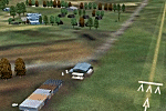
44nm east from Christchurch, New Zealand. 22nm from Ashburton.
Pudding Hill Lodge and Holiday Park. Skydiving area. Choice of 2 runways. Made for Christian Stock's NZ mesh in the form of "Mountains of New Zealand" and topo in the form of "Lakes and Rivers of New Zealand".
| Filename: | Pudding_Hill__NZPH.zip |
| License: | Freeware |
| Added: | 2nd January 2011, 21:56:28 |
| Downloads: | 287 |
| Author: | Godfrey Tier |
| Size: | 1.15 MB |
| Category: Flight Simulator 2004 - Scenery | |
| RJTT - Tokyo Haneda International Airport, Japan (2012) |
|
Images related to this file:
File Description:
Simple scenery of Tokyo(Haneda) intl airport 2012. ADE file and gmax objects only, but better than default airport.
| Filename: | RJTT__Tokyo_Haneda_International_Airport_Japan_201.zip |
| License: | Freeware |
| Added: | 12th March 2013, 07:06:35 |
| Downloads: | 4,735 |
| Author: | Ken Yonezawa |
| Size: | 5.28 MB |
| Category: Flight Simulator 2004 - Scenery | |
| RJTT - Tokyo (Haneda) International Airport - Tokyo, Japan |
|
Images related to this file:
File Description:
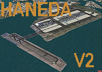
This is a reload of my recent Haneda scenery (RJTT_JS.zip) and contains all fixes and missing files. Haneda International (RJTT) is one of the oldest (1931) civil airports in Japan. Over 80% of its traffic is domestic and, with the opening of the new Terminal 2, is a major hub for both JAL and ANA airlines. This scenery I did for myself because I've always preferred Haneda to Narita. This scenery includes photo-ground cover for the airport with custom objects including the new runway 5 island and harbor Aqualine structures. Certainly not a patch on the many fine commercial sceneries available but it's free and an improvement over the default.
| Filename: | RJTT__Tokyo_Haneda_International_Airport__Tokyo_Ja.zip |
| License: | Freeware, limited distribution |
| Added: | 20th March 2015, 14:07:00 |
| Downloads: | 6,687 |
| Author: | John Stinstrom |
| Size: | 7.32 MB |
| Category: Flight Simulator 2004 - Scenery | |
| Guadalupe Mountains National Park (Version 2) SRTM30_1ArcSec Terrain Mesh |
|
File Description:
This 38m terrain mesh is centered in the 'Panhandle' region of Western Texas.
Coverage area: From West 104.5° to West 105° and North 31.7° to North 32.2°.
It includes Guadalupe Mountains National Park and the surrounding mountains
of Lincoln National Forest. Version 2 replaces my former release of 'Guadalupe_Mountains_SRTM30.zip' which covered a too large area and had some scenery anomalies (craters). The new version now fixes these errors.
| Filename: | Guadalupe_Mountains_National_Park_Version_2_SRTM30.zip |
| License: | Freeware, limited distribution |
| Added: | 28th December 2003, 18:33:52 |
| Downloads: | 2,062 |
| Author: | Andreas Trawny |
| Size: | 1.27 MB |
| Category: Flight Simulator 2004 - Scenery | |
| Backcountry USFS fields for 19m terrain mesh in Idaho |
|
Images related to this file:
File Description:
These backcountry airfields are for use with the FSGenesis 19m mesh of Idaho; they almost certainly do not work without it. I also have Ultimate Terrain installed, with the settings as noted. The 15 airfields included here are almost all United States Forestry Service fields: 1U1 Moose Creek, 2ID7 Cayuse Creek, 2U5 Shearer, 3U1 Warren, 12ID Flying B Ranch, 24K Krassel, 75c Orogrande, I08 Cabin Creek, ID67 Lower Loon Creek, ID76 Wilson Bar, S81 Indian Creek, S92 Fish Lake, U54 Bernard, U79 Chamberlain, U81 Cold Meadows. There is also a 85U bgl included to remove the remnants of Soldier Bar which is impossible to make into a scenery with the terrain mesh, and spoiled the surroundings if left untouched and intact. The screenshots are typical examples giving a good impression of the terrain.
| Filename: | Backcountry_USFS_fields_for_19m_terrain_mesh_in_Id.zip |
| License: | Freeware, limited distribution |
| Added: | 22nd July 2019, 16:38:48 |
| Downloads: | 100 |
| Author: | Roger Wensley |
| Size: | 22.2 MB |
| Category: Flight Simulator 2004 - Scenery | |
| Azores Islands, North Atlantic Ocean 76m SRTM Terrain Mesh |
|
File Description:
USGS SRTM 3 arc-second, resampled to LOD9 (76 meters). This is a terrain mesh scenery of the Azores Islands in the North Atlantic Ocean. It includes the following islands: Flores, Corvo, Faial, Pico with 7,711 feet (2,351m) high Pico Volcano, Sao Jorge, Graciosa, Terceira, Sao Miguel and Santa Maria.
| Filename: | Azores_Islands_North_Atlantic_Ocean_76m_SRTM_Terra.zip |
| License: | Freeware, limited distribution |
| Added: | 8th April 2004, 03:20:23 |
| Downloads: | 7,986 |
| Author: | Andreas Trawny |
| Size: | 1.81 MB |
| Category: Flight Simulator 2004 - Scenery | |
| Central Volcanic Belt, Mexico 76m SRTM Terrain Mesh & Landclass |
|
File Description:
USGS SRTM 3 arc-second, resampled to LOD9 (76 meters). This is a terrain mesh & landclass scenery of the Central Volcanic Belt in Mexico. The following volcanoes can be found in this area: Popocatepetl, Iztaccihuatl, La Malinche, Pico de Orizaba and Cofre de Perote. Also included are some volcanic eruption effects.
| Filename: | Central_Volcanic_Belt_Mexico_76m_SRTM_Terrain_Mesh.zip |
| License: | Freeware, limited distribution |
| Added: | 11th April 2004, 06:32:55 |
| Downloads: | 7,629 |
| Author: | Andreas Trawny |
| Size: | 2.9 MB |
| Category: Flight Simulator 2004 - Scenery | |
| Joshua Tree + San Bernardino Mountains, California 38m Terrain Mesh |
|
File Description:
USGS SRTM30 1 arc-second, resampled to LOD10 (38.2 meters). This terrain mesh is centered at Joshua Tree National Park in southern California. Coverage area: From West 115.1° to West 117.4° and North 33.7° to North 34.3°. It includes the National Park, the Palm Springs area with Mount San Jacinto and the San Bernardino Mountains.
| Filename: | Joshua_Tree__San_Bernardino_Mountains_California_3.zip |
| License: | Freeware, limited distribution |
| Added: | 4th January 2004, 21:05:58 |
| Downloads: | 3,715 |
| Author: | Andreas Trawny |
| Size: | 4.57 MB |


© 2001-2026 AVSIM Online
All Rights Reserved
Privacy Policy |