
Where Flight Simulation Enthusiasts Gather from Around the World!
AVSIM Library - Search Results

| Category: Flight Simulator 2004 - Scenery | |
| Matelica 2012 - Rel. 002 |

|
File Description:
FS2004 scenery of the Italian City Matelica. Located in Central Italy, near Camerino and Fabriano, Matelica is a little city sorrounded by hills and mountains. Hope you enjoy it. KIA ORA All!!! Requires Central European Vegetation Library 1.0 Created by Laszlo Varju. You can find it in the unzipped Folder.
This is the second version of my scenery Matelica. I correct some texture and positioning errors in the prior release. If You have installed first release you have to deactivate it from Scenery Library and delete it so you can install this release.
In this download i include the original European Vegetation packet by Laszlo Varju so You don't have to find it on the web.
The installation is extremely simple. Just Unzip the downloaded file, place both folder (Matelica and Vegetation) in the Scenery Folder of FS9 and activate it via the Scenery Library. Hope You Enjoy it. Best regards. Andrea, I-SNAK
| Filename: | Matelica_2012__Rel_002.zip |
| License: | Freeware |
| Added: | 19th April 2012, 14:20:29 |
| Downloads: | 496 |
| Author: | Andrea Reani, I-SNAK |
| Size: | 46.15 MB |
| Category: Flight Simulator 2004 - Scenery | |
| Airstrips east of the Alps |
|
File Description:
A collection of over 70 small airfields in Hungary, Slovakia, Slovenia and Croatia, many of which aren't featured in FS2004, each enhanced with taxiways, parking spaces, buildings etc. and aprons as appropriate, to fill in a few gaps to the north-east of Italy and to allow the generation of lightweight GA AI traffic in this area and into the adjacent countries.Again, there's no photo-realism here, just a selection of basic 'generic' buildings, more or less accurately sized and placed to reflect the airfield layout as seen on on-line satellite imagery and aerial photography. These buildings have minimal effect on frame-rates, so are ideal for this kind of job. The airfields are aligned as well as possible with the roads etc. in UT Europe, where applicable, and the Genesis Europe mesh, but should mostly be fine in a default installation or other configuration.
| Filename: | Airstrips_east_of_the_Alps.zip |
| License: | Freeware |
| Added: | 12th September 2025, 13:29:14 |
| Downloads: | 60 |
| Author: | Chris Eve |
| Size: | 785.49 KB |
| Category: Flight Simulator 2004 - Scenery | |
| Rome Fiumicino Area 2013 |
|
Images related to this file:
File Description:
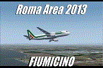
Dear Friends simmer, as always taking advantage of the beautiful objects bgl Gianluca Giovannini, I tried to improve with a symmetric pairing of autogen trees / towns / industrial buildings and grass in 3-D, the urban area near the Intercontinental Airport in Rome Fiumicino in the amazing scenery by the ISD project. "With the current integration I have created the town of Fiumicino located on the south west of the airport.The scenery is based videos of real landing and satellite photos availables on the web.
The purpose of visualization tasks is an overall improvement of the work of Leonardo da Vinci airport . The scenery is designed only for ISD project (even better with UTE by Flight one software), but i dont exclude that (which you should remove the file from the folder scenery the bgl Groups houses) or the more recent Payware published by Aerosoft. Most information inside the read me file. Best regards from Italy, Fafo !
| Filename: | Rome_Fiumicino_Area_2013.zip |
| License: | Freeware |
| Added: | 24th February 2013, 01:02:07 |
| Downloads: | 3,490 |
| Author: | Fabio Ferrari "fafo air" |
| Size: | 4.28 MB |
| Category: Flight Simulator 2004 - Scenery | |
| Milan Malpensa Airport (LIMC - MXP) |
|
Images related to this file:
File Description:
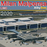
This FS2004 scenery reproduce the second-busiest italian airport "Milan Malpensa" (Iata: MXP, Icao: LIMC) located in the northwest area of Italy. The airport is used by over 100 airlines (passenger and cargo) that fly to Milan from all over the world, so this scenery is a “must have†for every simmer!
In the scenery you'll find almost all airport buldings exsisting at the real airport, hundred of custom made detailed objects, static and animated vehicles and a photoreal airport background with night lighting and hard winter textures. Each scenery part and object (frame-rate friendly thanks to the hi-performance design) has day and night photoreal textures and everything is placed in the right position which has been seen on autumn 2020 at the real airport.English extendet handbook is included and AES support is working too. Watch the screenshot inside this zip package or on the Albysim Website and enjoy all scenery features (in this free/demo edition some features are limited).
| Filename: | Milan_Malpensa_Airport_LIMC__MXP.zip |
| License: | Shareware, limited functionality |
| Added: | 15th January 2021, 20:25:12 |
| Downloads: | 2,053 |
| Author: | Alberto Di Bolzano (Albysim Scenery Design) |
| Size: | 48.72 MB |
| Category: Flight Simulator 2004 - Scenery | |
| AVIOSUPERFICI ITALIANE 2026 (The Methuselah Project) - Aviosuperficie di Le Chatelair |
|
Images related to this file:
File Description:
2nd upload and step of ITALIAN AIRSTRIPS 2026 (The Methuselah Project)
Aviosuperficie di Le Chatelair (città NUS, provincia Aosta, regione Valle d’Aosta - Italia)
This airfield is home to the Corrado Gex Aeroclub and the International Mountain Flying School; it is just over 4 km (east) from the Aosta Valley Airport and about 8 km (northeast) from the Chamois Altiporto, the first in Italy at an altitude of 1,820 m. Radio frequency 130.00 active; hangar facilities are available, but not mechanics or refueling.
Pay attention when maneuvering to the nearby power lines, parallel to runway 28; railway line on the opposite side of the power line; hangar opening with Com2 radio freq. 115.
This scenery was created using A.D.E. v1.65 and integrated libraries.
The third and final airfield in the Region is Aereoporto Valle di Aosta, which is already available for FS9 (see the details in the project summary table... https://drive.google.com/file/d/1qT7ZCUhE6ZqCzfjZe9kJM_Y0qhBNNnnN/view?usp=sharing
| Filename: | AVIOSUPERFICI_ITALIANE_2026_The_Methuselah_Project.zip |
| License: | Freeware |
| Added: | 2nd November 2026, 14:51:37 |
| Downloads: | 35 |
| Author: | Aldo Della Vedova and Gian Mario Verga |
| Size: | 3.26 MB |
| Category: Flight Simulator 2004 - Scenery | |
| LFBT Tarbes/Lourdes-Pyrenees, France |
|
Images related to this file:
File Description:
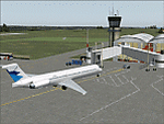
Googly scenery for LFBT Tarbes - a normally quiet airport that just sees a few
domestic flights a day but bursts into life for those of the the Catholic faith to
participate in the pilgrimage to Lourdes. At these times it is served by a
regular stream of charter flights and the airport can handle aircraft as large
as the Boeing 747. The only scheduled flights are between here and Paris, normally operated by Canadair CRJ700 craft worked by Brittany Air International on behalf of Air France, but a huge range of charter operators - mostly from Italy, Ireland, Belgium, the
United Kingdom and Germany - may be seen here at times and although seasonal this
traffic represents 80% of the airport's entire annual activity.
The scenery does not purport to be ultra-accurate. Based on less-than-perfect
satellite imagery from Google Earth, the layout is proportionally correct but the
added airport features, such as buildings, are built from default Microsoft objects
and add-on libraries so will not look exactly like the real thing. You are not obliged to download and install any additional scenery libraries, but to enjoy this scenery in its entirety, you may wish to. It will work fine, with or without.
[File re-uploaded at the request of AVSIM]
| Filename: | LFBT_TarbesLourdesPyrenees_France.zip |
| License: | Freeware |
| Added: | 4th May 2010, 15:02:30 |
| Downloads: | 7,821 |
| Author: | John Hinson |
| Size: | 73 KB |
| Category: Flight Simulator 2004 - Scenery | |
| Airstrips East of the Adriatic |
|
Images related to this file:
File Description:
A collection of about 60 small airfields in Albania, Bosnia & Herzegovina, Kosovo, North Macedonia and Serbia & Montenegro, many of which aren't featured in FS2004, each enhanced with taxiways, parking spaces, buildings etc. and aprons as appropriate, to fill in a few gaps to the east of Italy. Most of these airfields are relatively "rural", often little more than a shed and a grass runway in a field, but they allow the generation of lightweight GA AI traffic in this area and into the adjacent countries.Again, there's no photo-realism here, just a selection of basic 'generic' buildings, more or less accurately sized and placed to reflect the airfield layout as seen on on-line satellite imagery and aerial photography. These buildings have minimal effect on frame-rates, so are ideal for this kind of job. The airfields are aligned as well as possible with the default roads etc. and the Genesis Europe mesh, but should mostly be fine in a default installation or other configuration.As before, the files for each airfield can be easily identified by the ICAO code, even if the airfield names vary slightly, so you can pick and choose and mix and match to suit any sceneries you already have, should you so wish. There is no requirement for any other download. Each airfield will exist as a stand-alone entity should you only want a few of them. A few default airfields have had new ICAO codes allocated, in these instances I've provided files to remove the default scenery from the landscape, though the original airfield will still appear on the maps and menu.
| Filename: | Airstrips_East_of_the_Adriatic.zip |
| License: | Freeware |
| Added: | 20th October 2025, 11:48:25 |
| Downloads: | 62 |
| Author: | Chris Eve |
| Size: | 525.71 KB |


© 2001-2026 AVSIM Online
All Rights Reserved
Privacy Policy |