
Where Flight Simulation Enthusiasts Gather from Around the World!
AVSIM Library - Search Results

| Category: Flight Simulator 2004 - Scenery | |
| La Macaza Airfield with Northern Lights === Québec Bush Scenery |

|
File Description:
La Macaza is in the Québec Bush region in the Laurentian mountains just North of Mont Tremblant. In this scenery, I have added northern lights and as usual, lots of candies. Sounds are included for those who have the Lago program.
| Filename: | La_Macaza_Airfield__with_Northern_Lights__Qubec_Bu.zip |
| License: | Freeware |
| Added: | 17th April 2004, 07:26:04 |
| Downloads: | 1,877 |
| Author: | Leon Louis |
| Size: | 3.91 MB |
| Category: Flight Simulator 2004 - Scenery | |
| Bush Flying Unlimited Quebec Scenery Missing Texture Patch 2 |
|
File Description:
I forgot to include the textures for the BFU Quebec sign and the Blue hangar. My apologys. This supercedes the previous patch
I have also included another AFCAD file for the airport as some people have had a problem with the first one.
| Filename: | Bush_Flying_Unlimited_Quebec_Scenery_Missing_Textu.zip |
| License: | Freeware, limited distribution |
| Added: | 22nd July 2004, 16:46:35 |
| Downloads: | 3,258 |
| Author: | Brian Gladden |
| Size: | 131.77 KB |
| Category: Flight Simulator 2004 - Scenery | |
| Saint-Michel-des-Saints Airfield, Québec Bush Scenery Series |
|
File Description:
Saint-Michel-des-Saints is situated at the entrance to the Québec Bush region. This field is very important to bush pilots and operators. You will therefore find the airfield and hangars very busy, view the pictures. Sounds included for those who have the Lago program.
| Filename: | SaintMicheldesSaints_Airfield_Qubec_Bush_Scenery_S.zip |
| License: | Freeware |
| Added: | 29th March 2004, 13:51:53 |
| Downloads: | 1,083 |
| Author: | Leron Louis |
| Size: | 4.19 MB |
| Category: Flight Simulator 2004 - Scenery | |
| Etimesgut AB/Ankara(Turkey) Airport (LTAD/ANK) scenery (2016) |
|
Images related to this file:
File Description:
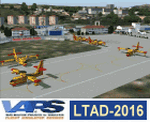
Etimesgut AB/Ankara(Turkey) Airport (LTAD/ANK) scenery (2016) for Flight Simulator 2004 (Fs9). This military airport is in Ankara, the capital of Turkey. Esenboga (LTAC) is very close to the airport. Flight training is given here. The pilot is raised. There are two large and long aprons on either side of the runway. This aprons has a very large number of flight training buildings and hospitals. Bombardier, Gulfstream, Cessna 560XL Excel, Businesss Jet, CL215-Fire fighter, Dash8, Saab-340, CN235, etc. GA airplanes have been configured for parking. Thanks for using. Scenery design by VAPS (vaps.hooxs.com)
| Filename: | Etimesgut_ABAnkaraTurkey_Airport_LTADANK_scenery_2.zip |
| License: | Freeware |
| Added: | 14th April 2017, 07:18:47 |
| Downloads: | 979 |
| Author: | Pilot Hoca (VAPS) |
| Size: | 8.88 MB |
| Category: Flight Simulator 2004 - Scenery | |
| LOD 10 mesh terrain scenery of Slovenia, final version |
|
File Description:
Sampled to LOD10, this is a standard version of
mesh terrain covering N45E13 - N47E17.
It is perfectly compatible with Austria professional and mesh
of Italy by Pietro Mauri.All incompatibilities with flattens around
airports were corrected.
| Filename: | LOD_10_mesh_terrain_scenery_of_Slovenia_final_vers.zip |
| License: | Freeware |
| Added: | 13th November 2005, 23:09:48 |
| Downloads: | 6,281 |
| Author: | Mirko Ternik/FSSlovenia Team |
| Size: | 25.79 MB |
| Category: Flight Simulator 2004 - Scenery | |
| Branson Airport KBBG--New Airport, Scenery, and Flight Plans |
|
Images related to this file:
File Description:

This project adds a new Branson Airport KBBG (Missouri) to FS 2004, which opened in May 2009, and is a privately developed commercial airport. The construction of the airport, which involved the flattening of several Ozark Mountains, is claimed to be the largest earthmoving project in Missouri history. As a result, the airport actually sits on a manmade plateau, surrounded by rolling hills. The airport uses the ICAO identifier BBG, however, the airlines use the IATA code BKG. The airport is served by AirTran, Frontier, and ExpressJet (Branson AirExpress), and is located in hilly terrain. Aircraft equipped with a terrain avoidance warning system may experience system activation on final approach. AFCAD created using Airport Design Editor 9 v1.47.07, and the hilltops were cleared and flattened and roads were added using SBuilder 2.05 revision 06. The terminal and hangar were added and modified from within Airport Design Editor 9. This airport is based on my more detailed FSX version, Branson_Airport_Project.zip.
| Filename: | Branson_Airport_KBBGNew_Airport_Scenery_and_Flight.zip |
| License: | Freeware |
| Added: | 16th August 2010, 20:50:16 |
| Downloads: | 1,733 |
| Author: | Carlyle Sharpe |
| Size: | 3.23 MB |
| Category: Flight Simulator 2004 - Scenery | |
| Scenery Objects: Military Hangars and Buildings Library vol 2 |
|
Images related to this file:
File Description:
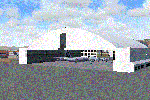
This library contains the original 48 custom made FS9 military style hangars, buildings, and objects in vol 1 and adds some extra hazard lights and hangars used in upcoming projects. Original GUIDs are preserved. These should work in FSX too.
By Dan French.
| Filename: | Scenery_Objects_Military_Hangars_and_Buildings_Lib.zip |
| License: | Freeware, limited distribution |
| Added: | 1st July 2014, 22:58:48 |
| Downloads: | 1,186 |
| Author: | Dan French |
| Size: | 3 MB |
| Category: Flight Simulator 2004 - Scenery | |
| Martin Garcia and Timoteo Dominguez Islands Photo-Real Scenery |
|
Images related to this file:
File Description:
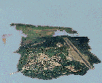
Photo-real scenery of the Martin Garcia and Timoteo Dominguez Islands on the River Plate, between Uruguay and Argentina. This package includes photo-real textures for the islands. Also included are Autogen vegetation and houses, together with a corrected airport location.
Scenery also works in FSX.
| Filename: | Martin_Garcia_and_Timoteo_Dominguez_Islands_PhotoR.zip |
| License: | Freeware, limited distribution |
| Added: | 20th February 2010, 02:08:20 |
| Downloads: | 861 |
| Author: | "As the Bird Flies / A Vuelo de Pajaro" group member Alan Pereira-Pierce |
| Size: | 396.4 KB |
| Category: Flight Simulator 2004 - Scenery | |
| Kish Island 2004 |
|
File Description:
Kish Island 2004 (OIBK)/
Finally after 7 months of developing and in the following of producing succssecfull sceneries for Iran and after one of the most succssecfull sceneries, "Tehran Scenery 2003", Kish Island 2004 is ready. It is new add-on scenery for Microsoft Flight Simulator 2004 with many new features Include: Complete scenery of the Kish Island, Kish Island Landclass, Waterclass, Very detailed objects, Frequency controlled animation, distance controlled animation, Dynamic scenery, Static Scenery, New and more realistic AFCAD, New roads and night lighting, Corrected navigational data, corrected runways data, Corrected apron and runways lighting system, All in Gmax for better performance, Apron Marshaller, certain number of objects in different scenery complexity setting and ….The scenery replaces the Default scenery of Kish Island which is really terrible. This add-on was developed according to the satellite images of the island provided by the "Kish Free Zone" company and contains 3 packages, the complete scenery of Kish Island, New and More realistic Landclass and Waterclass of the island and New Afcad file which is provided according to jeppesen airport chart. By Touradg Morassaei (www.touradg.tk)
| Filename: | Kish_Island_2004.zip |
| License: | Freeware |
| Added: | 15th December 2003, 05:42:57 |
| Downloads: | 10,075 |
| Author: | Touradg Morassaei |
| Size: | 5.34 MB |
| Category: Flight Simulator 2004 - Scenery | |
| Panama City - Bay Cty 2 |
|
File Description:
FS2004 Scenery-Panama City-Bay Co Intl Airport (KPFN) serves Panama City and Bay County and is owned by Panama City-Bay Co Arpt Dist. The airport has more than one runway. The longest is a paved runway extending 6304 feet. The facility is at an elevation of 21 feet at a distance of about 3 miles from Panama City. Version 2 includes dynamic scenery, Totally redone static scenery taken from Google Earth Satellite Images. All Runways in use. Created with FSDS2.10, Rwy12, EZ Scenery, with a new AFCAD2 file and Traffic Tools. FSDS2 scenery textures included. (Previous version had 1186 downloads)
| Filename: | Panama_City__Bay_Cty_2.zip |
| License: | Freeware |
| Added: | 27th February 2006, 00:48:28 |
| Downloads: | 3,313 |
| Author: | John B. Loney, Jr. |
| Size: | 1000.19 KB |


© 2001-2026 AVSIM Online
All Rights Reserved
Privacy Policy |