
Where Flight Simulation Enthusiasts Gather from Around the World!
AVSIM Library - Search Results

| Category: Flight Simulator 2004 - Scenery | |
| Nenana Municipal Airport PANN in Alaska |

|
Images related to this file:
File Description:
Nenana is a village on the river of the same name around 40 miles west of Fairbanks, which is the second largest urban area in Alaska after Anchorage. Nenana, as a result of this proximity, is served by road and railway and unlike other Alaskan villages is not reliant on air cargo for necessities. The current population is just under 400, which is way down from its peak of 5,000 in the 1920's when gold was being mined and the railroad being built. Nenana's main claim to fame is as the starting point for the 1925 mushing delivery to Nome of the serum to combat an outbreak of diphtheria. Any Nenana Municipal Airport history is difficult to find, even the date of construction. It has two runways 3L-21R and 3R-21L, the first being asphalt and just under 5,000 feet with PAPI at both ends, the second grass and 1,800 feet. Both are lit. It also has a further water runway similarly aligned and 3,000 feet long. Maintenance is available and there is also fuel at the end of the northern apron, close to the crashed and stripped DC4 that sits among other unwanted items that are too large to make it worth the cost of moving them off the site. There are no regular scheduled flights to the airport, with air taxi or owner operated being in the majority. The scenery, in addition to the terrain, town, bridges, and airport items also modifies the terrain in an area further south where FS9 depicted as a city an Air Force base that is mainly concerned with radar and communications and in fact has very few buildings. The AI includes some Beavers on floats that were used in previous BC scenery with the kind permission of FSAddon. As I have already posted them I have not included them again here. The float plane AI uses the same radio frequency as the land based planes, but they fly to PANX and not to PANN as FS9 has problems with getting floats and wheels separated. Or maybe I just haven't worked out how to cope with FS9. A note here about my scenery making. There will not be many more to follow this as I am almost at the end of the photos I either took or found for scenery purposes, plus I expect to move on from FS9 at some point during next year.
| Filename: | Nenana_Municipal_Airport_PANN_in_Alaska.zip |
| License: | Freeware, limited distribution |
| Added: | 2nd December 2019, 18:12:42 |
| Downloads: | 156 |
| Author: | Roger Wensley |
| Size: | 7.36 MB |
| Category: Flight Simulator 2004 - Scenery | |
| Puntzi Mountain CYPU in British Columbia Canada |
|
Images related to this file:
File Description:
Puntzi Mountain is near a village called Chilanko Forks, approximately midway between Bella Coola and Williams Lake and just north of the Chilcotin to Bella Coola Highway. It is what remains of a military base and which currently shows in FS9 as a town, reduced in my scenery version to what remains after the base was closed and cleared. All that remains of the base is now the runway, over 6,000 feet of asphalt aligned 04-22, unlit, at 2,985 feet above sea level, and with centre line markings that are almost invisible. The runway is used in the summer for whatever local fire-fighting operations are needed by ConAir and there are some buildings and fuel tanks for this. It is also used for local flights such as those for a lodge on Puntzi Lake to the north. I have added three AT-802 textures with additional tail numbers for use in the AI. These are to be added to an aircraft that you very likely already have and which was included in Don Grovestine's posting of Abbotsford CYXX. I have also included the revised config file that adds the planes to Don's original; save the original config under another name and replace it with mine. Put the three new texture folders in with the original, which is called "CYXX-AI_Air Tractor AT-802 (Wheels)". If you do not have Don's scenery I suggest you get it, as his work is worth having and like Greg Putz he puts in a lot more effort than I do. The L188 Electra should already be with you if you downloaded my Smithers CYYD scenery. If you find a defect, email me.
| Filename: | Puntzi_Mountain_CYPU_in_British_Columbia_Canada.zip |
| License: | Freeware, limited distribution |
| Added: | 20th November 2020, 05:33:01 |
| Downloads: | 174 |
| Author: | Roger Wensley |
| Size: | 10.33 MB |
| Category: Flight Simulator 2004 - Scenery | |
| Polish Airports VOL. 1 DEMO |
|
Images related to this file:
File Description:

POLISH AIRPORTS VOL. 1 DEMO is a package of detailed sceneries of EPGD Gdansk, EPKT Katowice, EPRZ Rzeszow (including EPRJ) and EPLB Lublin (including EPSW) airports in Poland, fully compatible with FS2004.
This product is a fully functional DEMO version of the commercial payware product. It features same airports layout as in the full version but with limited 3D objects and low resolution textures. Using this free demo ensures no problems with online (VATSIM, IVAO, multiplayer etc.) flying in case some users use the payware scenery and some don't.
Gdansk Lech Walesa Airport (GDN/EPGD) is an international airport, the 3rd largest airport in Poland, often used as a diversionary airport for Warsaw Frederic Chopin Airport in the event of poor weather or emergencies. Katowice International Airport (KTW/EPKT) is an international airport, which service both passenger flow and cargo flights. Its concrete runway is 2,800 m * 60 m (9,186 ft * 197 ft) and can accommodate even heavy transports such as Antonov An-124 or An-225. Rzeszow-Jasionka Airport (RZE/EPRZ) is an international airport located in southeastern Poland. It is the seventh-busiest airport in Poland. Near to EPRZ there is located a smaller Rzeszow Jasionka Airport (EPRJ) used by Rzeszow Aeroclub (900x30m lighted asphalt runway (090/270), 700x100m grass strip). Lublin Airport (Port Lotniczy Lublin) (LUZ/EPLB) has a 2520m runway, and the terminal facilities are capable of handling 4 x B738/A320.
The product is equipped with an automatic installer, which means that the scenery will be automatically added to the Flight Simulator Scenery Library. Please uninstall all previous versions of this airport you may have installed before. Please make also sure that no duplicate AFCAD files are installed.
Enjoy your virtual flying with Drzewiecki Design!
| Filename: | Polish_Airports_VOL_1_DEMO.zip |
| License: | Commercial demo |
| Added: | 2nd September 2015, 22:18:50 |
| Downloads: | 1,055 |
| Author: | Drzewiecki Design |
| Size: | 35.47 MB |
| Category: Flight Simulator 2004 - Scenery | |
| FS2004 Scenery--Goose Bay Canadian Forces Base and US Air Base. Goose Bay Canadian Forces Base and US Air Base (CYYR), Newfoundland and Labrador, Canada, 1955-62. |
|
File Description:
Goose Bay Canadian Forces Base and US Air Base (CYYR), Newfoundland and Labrador, Canada, 1955-62. Originally built to facilitate the transport of US aircraft to Europe during the Second World War, during the Cold War Goose Bay was a base of major importance. Like nearby Gander it was a vital refuelling point for transatlantic crossings, but also along with the recently released Ernest Harmon Air Base (CYJT) an important part of the defences against the threat of Soviet bombers carrying muclear weapons attacking the USA via the North Pole. F-89 Scorpions and then F-102 Delta Daggers were based there, and this download includes F-89s especially made for this scenery by David Wooster. Flight plans are provided for 1955, 1957, 1959 and 1962, doing much to recreate this significant Cold War base as it really was; many of the aircraft which passed through Goose at that time are provided for.
This file is an update to the scenery issued in October 2021, made necessary by the discovery of new information as a result of further historical research. There have also been changes to the ADE and traffic files intended to improve the performance of both, and to the navaids too. Instructions are included for those installing from scratch and those updating our previous version, and there have been improvements to the clarity of the instructions for the downloading and installation of the ai aircraft.
There will be no further updates.
| Filename: | FS2004_SceneryGoose_Bay_Canadian_Forces_Base_and_U.zip |
| License: | Freeware |
| Added: | 25th December 2021, 19:00:49 |
| Downloads: | 289 |
| Author: | Al Von Pingel, Dan French, Bill Douglas, Ken Lawson |
| Size: | 50.25 MB |
| Category: Flight Simulator 2004 - Scenery | |
| Moncton, New Brunswick, CYQM, 1955-1957 |
|
File Description:
In the period after 1945 Moncton was an important alternate airport for commercial aircraft flying the North Atlantic route between Europe and the U.S.A and Canada. Like Sydney and Goose Bay, it was in a sense a satellite of the much better known Gander, which was however sometimes rendered unusable by adverse weather conditions and especially fog. This scenery is primarily intended for use in the California Classic retro environment created by Tom Gibson and the CalClassic Community, and awaits your Stratocruisers, Douglases and Constellations.
| Filename: | Moncton_New_Brunswick_CYQM_19551957.zip |
| License: | Freeware |
| Added: | 7th January 2023, 01:28:38 |
| Downloads: | 108 |
| Author: | Ken Lawson |
| Size: | 7.34 MB |
| Category: Flight Simulator 2004 - Scenery | |
| VFR of Lario, Area B4 - Como lake, Italy |
|
Images related to this file:
File Description:
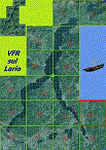
This 14th scenery covers approximately an area of 7.5x6 kmt, from Grignetta mountain (NW) to Culmine S. Pietro (NE), from S. Michele/Barro mountain (SW) to Fuipiano Imagna valley (SE); some of specific buildings are included (Lecco), as the Meridiana shopping center, the Azzone Visconti old bridge, the Alessandro Manzoni monument, some italian trains in the railway station and several sections of the highway SS36 with overpasses and tunnels.
Check video available here: http://youtu.be/8QPz6E7NS-U
| Filename: | VFR_of_Lario_Area_B4__Como_lake_Italy.zip |
| License: | Freeware |
| Added: | 6th September 2013, 15:27:31 |
| Downloads: | 659 |
| Author: | Aldo Della Vedova, Daniele Lanfranchi, Gian Mario Verga |
| Size: | 18.56 MB |
| Category: Flight Simulator 2004 - Scenery | |
| Official Water Aerodromes located in Province of Quebec. SUPPLEMENT. |
|
File Description:
These are AFCAD2 Scenery files for most popular and visited waterbases located in the
province of Quebec, Canada. Your Ai floatplanes will come alive with these "invisible"
waterbases airports installed (AI traffic flightplans required.) and your flyable
floatplanes will be allowed to take-off directly into water, at official water
aerodromes, using FS9 airports menu. Thanks to Holger Sandmann who has developped this
technique. Must be used with Gilles Gauthier's "Terrain Mesh Province of Quebec" for FS2004
and his excellent "Quebec Sceneries Enchancements". READ the TXT files.
| Filename: | Official_Water_Aerodromes_located_in_Province_of_Q.zip |
| License: | Freeware |
| Added: | 10th May 2010, 23:33:54 |
| Downloads: | 1,739 |
| Author: | Jean Morissette |
| Size: | 1.12 MB |
| Category: Flight Simulator 2004 - Scenery | |
| Cross Country Short Hops |
|
Images related to this file:
File Description:
Cross Country Short Hops. This scenery package contains 13 airports from the east coast to the west coast of the USA. The longest leg is 229 nm and the shortest leg is 136 nm. Start from either the east coast (Montauk Airport, KMTP) or the west coast (Little River Airport, O48 (now known as KLLR)). Eleven of the 13 airports are new designs. Two airports are previous releases and are included here. Tested in default FS9 and with Ultimate Terrain. By John B. Loney, Jr.
| Filename: | Cross_Country_Short_Hops.zip |
| License: | Freeware, limited distribution |
| Added: | 9th February 2011, 20:45:27 |
| Downloads: | 580 |
| Author: | John B. Loney, Jr. |
| Size: | 2.69 MB |
| Category: Flight Simulator 2004 - Scenery | |
| Pocono Mountains Municipal Airport |
|
Images related to this file:
File Description:
FS2004 Scenery - Pocono Mountains Municipal Airport (KMPO) serves Mount Pocono and Monroe County, PA and is owned by Pocono Mtns Muni Arpt Auth. The airport has more than one runway. The longest is a paved runway extending 5001 feet. The facility is at an elevation of 1916 feet at a distance of about 2 miles from Mount Pocono. Includes the runway 13/31 which was extended to 5,001 ft x 75 ft. Tested in Ultimate Terrain and Default FS. By John B. Loney, Jr.
| Filename: | Pocono_Mountains_Municipal_Airport.zip |
| License: | Freeware, limited distribution |
| Added: | 22nd February 2011, 23:02:23 |
| Downloads: | 388 |
| Author: | John B. Loney, Jr. |
| Size: | 813.69 KB |
| Category: Flight Simulator 2004 - Scenery | |
| Red-Brown Night Texture Fix |
|
File Description:
This package replaces 99 of the "LM" night ground textures found in the "Flight Simulator 9/Scenery/World/texture" folder with ones that have been "slightly" darkened. These files retain the correct "street" lighting while losing the red/brown "ground glow" found particularly in the farm textures. The result is a nighttime texture that blends seamlessly with the rest of the FS textures and provides a more realistic night environment. This package also works very well in combination with the FSGenesis US National Landclass Project.
| Filename: | RedBrown_Night_Texture_Fix.zip |
| License: | Freeware |
| Added: | 26th October 2003, 01:55:25 |
| Downloads: | 4,405 |
| Author: | Carlyle Sharpe |
| Size: | 328.41 KB |


© 2001-2026 AVSIM Online
All Rights Reserved
Privacy Policy |