
Where Flight Simulation Enthusiasts Gather from Around the World!
AVSIM Library - Search Results

| Category: Flight Simulator 2004 - Scenery | |
| Hana Heli-Obstacle Course v2.0 |

|
Images related to this file:
File Description:
Hana Airport is a regional airport of the State of Hawaii on the east shore of the island of Maui, 3 NM northwest of the unincorporated town of Hana. The airport covers 119 acres and has one runway. It is primarily a commuter facility used by unscheduled air taxis and general aviation. This scenery is intended as a single/multiplayer helicopter obstacle course where heli pilots can meet to compete, show off, and share their helo skills. Since birdseye (Timm Turner) already did a neat scenery called Hana_Scenery_PHHN (search for "hana" in the HoverControl Downloads), we decided to convert PHHN to a full helicopter training area. Makes a great place for helo pilots to gather to practice and perfect their skills, and challenge other pilots! And keep an eye-out for that Hot Air Balloon, cruising around an altitude of 3000 feet (don't forget to wave at them!). Another unique thing about this scenery is the neighboring islands (Honolulu Intl/Hickam AFB, Bellows AFB, Lanai City, Kahului, Molokai, etc). If you get frustrated during your heli obstacle course training, just take a heading of 275 degrees, and relax at one of the neighboring islands. We also added an Easter Egg - If you set your FS calendar to July 21st, you'll see a large ridge fire up in the hills. Load Jordan Moore's Erickson S64E (http://www.hovercontrol.com/) & try your skills at water bombing!
| Filename: | Hana_HeliObstacle_Course_v20.zip |
| License: | Freeware |
| Added: | 7th December 2010, 03:28:47 |
| Downloads: | 476 |
| Author: | Greg Spellmen & Bob Ferguson |
| Size: | 58.56 MB |
| Category: Flight Simulator 2004 - Scenery | |
| VFR of Lario - Como lake, Italy |
|
Images related to this file:
File Description:
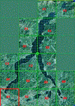
This is the first of the expected seventeen sceneries in the "VFR of Lario" project, that will include the full view of the Como Lake, made with photorealistic terrain (multiseason & night) and with 3D GMax realistic objects, including some motions. Further the Como seaplane airport, the project will include some other virtual ones, and all the piers of NLC (Navigation Lake Como). The project will be completed with a related AI seaplane traffic.
The "VFR of Lario" project REQUEST the installation of the scenery "Itcoast2.zip" & the related "ITAC2_P1.zip", both available for free download from different libraries.
Information: Como is the main and beautifull city on the namesake lake (called Lario), placed in the north of Italy, closed to the Helvetic border. It includes the AeroClub Como seaplanes international airport, with his own flight school. Como has the headseat of NLC, the fleet management for connection of forty Lario's piers. This first scenery covers approximately an area of 7.5x6 kmt.
Contents: airport water track with hangar and static seaplanes; breackwater and stadium lake front, war memorial monument, Volta's temple and lighthouse, main Cathedral, Social theater, city old towers and wall, villa Olmo, square Cavour's buildings, NLC main pier and some minor others, Como-Brunate's funicolar connection (animated), lake fountain, Tavernola shipyard, Baradello's castle, Valduce hospital; motor ships (animated), steamer, hydrofoils and other minor boats; several other buildings (GenericBuilding system), trees and lights widespread all over the scenery.
| Filename: | VFR_of_Lario__Como_lake_Italy.zip |
| License: | Freeware |
| Added: | 22nd December 2011, 23:30:47 |
| Downloads: | 3,551 |
| Author: | Aldo Della Vedova, Daniele Lanfranchi, Diego Caligiuri |
| Size: | 25.33 MB |
| Category: Flight Simulator 2004 - Scenery | |
| EDCP Peenemunde Military Airfield, Germany |
|
Images related to this file:
File Description:
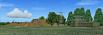
Peenemünde Airfield, Germany. The airfield Peenemunede is the one field of a row of military airfield sceneries of the former NVA. In the scenery are included the airfield and the technical supplies. The airfield was put into operation in 1961 in duty of the NVA. He accommodated the 9th fighter wing with Mig-21 and MiG-23. It is located along the Baltic Sea north of Peenemünde, Germany.
| Filename: | EDCP_Peenemunde_Military_Airfield_Germany.zip |
| License: | Freeware |
| Added: | 8th August 2011, 16:45:21 |
| Downloads: | 1,016 |
| Author: | Volker Loew, Rolf-Uwe Hochmuth, Frithjof Koch |
| Size: | 6.43 MB |
| Category: Flight Simulator 2004 - Scenery | |
| ZGCJ - Huaihua Zhijiang Airport |
|
Images related to this file:
File Description:
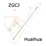
A scenery for Huaihua airport which is missing in FS9 stock version, with basic default buildings, tower, and taxisigns.
Based on december 2004 sat imagery, at a time when construction works were still going on. Navaids valid as AIRAC 1110.
Fictionnal ILS04 approach coded for UI & AI. A basic landclass is also provided, which covers only vicinity of the airport & Zhijiang town.
Current scheduled operators at ZGCJ: China Southern, Spring Airlines.
| Filename: | ZGCJ__Huaihua_Zhijiang_Airport.zip |
| License: | Freeware, limited distribution |
| Added: | 30th January 2012, 14:52:02 |
| Downloads: | 600 |
| Author: | Yohann Baptiste |
| Size: | 377.88 KB |
| Category: Flight Simulator 2004 - Scenery | |
| Moffett Federal Airfield - *FIX* |
|
Images related to this file:
File Description:
Some users of my Moffett Federal Airfield scenery (KNUQ_JS3.zip) may find that the P-3 Orions do not appear. This is due to a typographical error in the aircraft.cfg file. Just drop the attached file into your "JKAI_P-3C Moffett" folder and overwrite the extisting file. Sorry for the trouble and thanks to Voorink for letting me know of the error and again to Michael Pearson for some awesome reapints.
| Filename: | Moffett_Federal_Airfield__FIX.zip |
| License: | Freeware, limited distribution |
| Added: | 23rd August 2014, 11:13:39 |
| Downloads: | 795 |
| Author: | John Stinstrom |
| Size: | 4.65 KB |
| Category: Flight Simulator 2004 - Scenery | |
| Eastern West Virginia Regional Airport *UPDATE* |
|
Images related to this file:
File Description:

Scenery UPDATE for Shephard Field Virginia, home to both the Eastern West Virginia Regional Airport and the 167th Airlift Wing of the Air National Guard. Package contains missing traffic file for Civil Air Patrol and General Aviation Aircraft, updated ILS placement file, and new (tweaked)airport file to correct minor parking and taxi errors. My sincere thanks to the anonymous gentleman who found and helped me resolve these errors.
| Filename: | Eastern_West_Virginia_Regional_Airport_UPDATE.zip |
| License: | Freeware, limited distribution |
| Added: | 8th June 2012, 22:59:00 |
| Downloads: | 988 |
| Author: | John Stinstrom |
| Size: | 19.89 KB |
| Category: Flight Simulator 2004 - Scenery | |
| Charlevoix & Rivière Ouelle - Québec Short Hops |
|
File Description:
These sceneries, part of my Québec Short Hops are situated a few miles downstream from my Ile-aux-Coudres CTA3 scenery already uploaded to this site. Charlevoix is on the North shore and Rivière Ouelle on the South shore. As you leave Ile-aux-Coudres in other then daylight, you will soon see the lighthouse beacon of Charlevoix and those of Ile-aux-Coudres on your way back.
| Filename: | Charlevoix__Rivire_Ouelle__Qubec_Short_Hops.zip |
| License: | Freeware |
| Added: | 6th November 2003, 23:02:59 |
| Downloads: | 2,638 |
| Author: | Léon Louis |
| Size: | 6.8 MB |
| Category: Flight Simulator 2004 - Scenery | |
| Wombat Bend |
|
File Description:
Wombat_Bend, a fictional scenery set in Lake Eildon, Victoria, Australia, a short Dirt Bush Strip on the side of one of the lakes with buildings and wharf for those that choose to fly in via Sea Plane. Night lighting and buildings. Location provided with attached map.jpg .
Has a nice approach from either direction with plenty of trees to avoid on the way in.
Uses Default textures with Custom textures where required.
| Filename: | Wombat_Bend.zip |
| License: | Freeware |
| Added: | 11th October 2003, 05:30:59 |
| Downloads: | 848 |
| Author: | Jeffrey Stanyer |
| Size: | 272.7 KB |
| Category: Flight Simulator 2004 - Scenery | |
| Guadalupe Mountains National Park (Version 2) SRTM30_1ArcSec Terrain Mesh |
|
File Description:
This 38m terrain mesh is centered in the 'Panhandle' region of Western Texas.
Coverage area: From West 104.5° to West 105° and North 31.7° to North 32.2°.
It includes Guadalupe Mountains National Park and the surrounding mountains
of Lincoln National Forest. Version 2 replaces my former release of 'Guadalupe_Mountains_SRTM30.zip' which covered a too large area and had some scenery anomalies (craters). The new version now fixes these errors.
| Filename: | Guadalupe_Mountains_National_Park_Version_2_SRTM30.zip |
| License: | Freeware, limited distribution |
| Added: | 28th December 2003, 18:33:52 |
| Downloads: | 2,062 |
| Author: | Andreas Trawny |
| Size: | 1.27 MB |
| Category: Flight Simulator 2004 - Scenery | |
| Columbia Metropolitan Airport (KCAE) |
|
File Description:
This file replaces the inaccurate and drab rendition of the KCAE terminal with a more realistic version of the new terminal and parking deck. AFCAD2 file included for proper placement and assignment of gates and for addition of the airport roads. LAGO FSE file also included for some 'extras' such as UPS planes at the UPS hub and others.
Scenery will work in FS2002, but AFCAD2 and LAGO files will not.
| Filename: | Columbia_Metropolitan_Airport_KCAE.zip |
| License: | Freeware |
| Added: | 27th February 2004, 21:48:52 |
| Downloads: | 1,773 |
| Author: | Todd Lucas |
| Size: | 1.69 MB |


© 2001-2026 AVSIM Online
All Rights Reserved
Privacy Policy |