
Where Flight Simulation Enthusiasts Gather from Around the World!
AVSIM Library - Search Results

| Category: Flight Simulator 2004 - Scenery | |
| Ford Project - Stag Lane Aerodrome - home of de Havilland's first factory |

|
Images related to this file:
File Description:
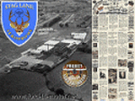
Ford-de-Havilland is a scenery pack created by the Ford
Project Team that contains a historical rendition of
the Stag Lane Aerodrome.
Stag Lane Aerodrome was the home of the first de Havilland Aircraft
Manufacturer's factories located at Stag Lane, Edgware, London, UK.
Stag Lane became the main base of The de Havilland Aircraft Company Limited
in 1920. Former wartime aircraft were refurbished in the early years, and
the company designed and built large numbers of aircraft at Stag Lane in
the 1920s and early 1930s.
Created by the Ford Project Team to support their recently
released large suite of liveries for the Milton Shupe
DH80 aircraft. This package is just one of nearly 30 other
scenery packs available for FREE at the Ford Tri-Motor site -
http://www.ford-tri-motor.net
| Filename: | Ford_Project__Stag_Lane_Aerodrome__home_of_de_Havi.zip |
| License: | Freeware, limited distribution |
| Added: | 21st May 2013, 15:45:03 |
| Downloads: | 374 |
| Author: | Garry J. Smith |
| Size: | 4.63 MB |
| Category: Flight Simulator 2004 - Scenery | |
| Kaltag KAL in Alaska |
|
Images related to this file:
File Description:
Kaltag is a small village on the west bank of the Yukon River, around 65 miles east of the coast at Unalakleet and about 40 miles south of where the river turns from north-south to east-west, east being upstream towards the distant Fairbanks. The population is just under 200 and living from fishing and the land. The airfield is close by and has a gravel runway aligned 21-3 and just under 5,000 feet long. Apart from the airfield itself, and it's buildings, this scenery modifies the local land class, adds village buildings while reducing the village size to reality, and creates a new airfield background. Kaltag is located on the edge of three different airlines coverage areas, and is served by Bering Air from the northwest, ERA from the southwest, and also by Wright Air from Fairbanks in the east. These are included in the AI.
A note here about my scenery making. This is post number 507 and there will not be many more to follow this as I am almost at the end of the photos I either took or found for scenery purposes. There is a limit to what can be located online and I have already been making use of the little there is; eg Unalakleet. So, if you are near an airport (preferably Canadian or Alaskan) and have a camera..... Let me know.
| Filename: | Kaltag_KAL_in_Alaska.zip |
| License: | Freeware, limited distribution |
| Added: | 20th August 2019, 19:04:35 |
| Downloads: | 102 |
| Author: | Roger Wensley |
| Size: | 3.57 MB |
| Category: Flight Simulator 2004 - Scenery | |
| Aklavik CYKD in the Northwest Territories, Canada Revised |
|
Images related to this file:
File Description:
This version of Aklavik replaces the previous version so delete all previous installation elements. There is also for Inuvik replacement AI, additional texture, and replacement scenery bgl; this presumes you have already installed my revised post of Inuvik. There is also for Tuktoyuktak additional textures, and replacement scenery bgl's; this presumes you have already installed my 2012 post of Tuktoyakyuk.
Aklavik is a town of 650 or so inhabitants 120 miles inside the Arctic Circle and on the West Channel of the Mackenzie River delta. It is 40 miles west of Inuvik. There are two airlines serving the town on a regular basis and one is Aklak Air, operated by Kenn Borek. Aklavik village has not been changed since my previous post, but the airfield now has the correct terminal building.
The Inuvik replacement AI involves flights to Aklavik and Tuktoyaktuk and the texture and replacement bgl's are for gates that I forgot to include before.
The Tuktoyaktuk scenery now has a barge carrying the prefabricated new terminal for Grise Fiord, plus other items for the installation work. Northern terminals are prefabricated and delivered either complete or in flat-pack form to reduce construction time on site to a minimum. There is a note explaining why the terminal building is on a barge instead of being installed at its destination!
| Filename: | Aklavik_CYKD_in_the_Northwest_Territories_Canada_R.zip |
| License: | Freeware |
| Added: | 14th May 2012, 17:20:39 |
| Downloads: | 539 |
| Author: | Roger Wensley |
| Size: | 8.6 MB |
| Category: Flight Simulator 2004 - Scenery | |
| VFR of Lario, Area C2A - Como lake, Italy |
|
Images related to this file:
File Description:
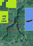
*** REPLACEMENT OF PREVIOUS ISSUE, due to a bug of an High Winter texture ***
This is the fifth scenery of the "VFR of Lario" project, made with photorealistic terrain (multiseason & night) and with some 3D GMax realistic objects.
Information: Como's lake is in the north of Italy, closed to the Helvetic border; this scenery covers approximately an area of 7.5x6 kmt, from la "Zoca de l'Oli" and mountains over Ossuccio (NW) to Tremezzo (NE), and from Colonno (SW) to Magreglio (SE) and includes the NLC piers of Sala Comacina, Comacina island, Campo, Lenno, Tremezzo, Bellagio (2), S. Giovanni, Lezzeno; it includes several dedicated buildings as Taverna Bleu hotel (Sala Comacina), S. Maria e S.Giacomo churches and villa Balbiano (Ossuccio), church and pier of S. Michele (Colonno), villa del Balbianello (Lenno), hotel Villa Marie, S. Lorenzo Church, villa La Quiete, Grand Hotel, villa Carlotta, hotel La Darsena, Pub motor ship Bisbino (Tremezzo), villa Melzi, villa Giulia, buildings Carillon e lungolago Manzoni, hotels Excelsior, Du Lac, Metropole (Bellagio). Two NLC ferry (moted on the way Bellagio-Cadenabbia) are placed together with other minor boats and docks placed alongside the coast, including platforms for seaplanes arrival.
Contents: GMax objects as above and other buildings, minor piers and boats together with autogen buildings and trees are fully spreaded on the scenery.
| Filename: | VFR_of_Lario_Area_C2A__Como_lake_Italy.zip |
| License: | Freeware |
| Added: | 22nd May 2012, 18:12:41 |
| Downloads: | 1,671 |
| Author: | Aldo Della Vedova, Daniele Lanfranchi, Gian Mario Verga, Diego Caligiuri |
| Size: | 28.49 MB |
| Category: Flight Simulator 2004 - Scenery | |
| Chennai International Airport , India ( VOMM ) |
|
Images related to this file:
File Description:
Chennai scenery has been in demand for long time and here it is ,the file also includes " the ACTIVE RNAV�1 (GNSS or DME/DME/IRU) SIDs and STARs. It also has the extended runway and the extended taxiway M3. Definitely the screen shots will help you decide if its worth downloading.T his will also work in FSX. Inside you will find a zip file that reads-"Asia.zip" if you are FSX user you will have to add this addition folder to database (FSX) 2-3 buildings used are default FS2004 object which are not in FSX . This additional will enable that thing previously if you have downloaded Chatrapatti shivaji International Scenery that I uploaded for everyone made the FSX users unhappy , because they must have found few objects hanging in air or something's missing. This asia folder included in the scenery will solve the trouble. Airport Features include- NEW models of taxiway edge fixtures, Parkable Hanger for General aviation light aircrafts. Just roll in and out sticking to the ctr guide line. You can even begin simulation parked inside the hanger .Don't worry , you won't be disappointed .. check out the pics. Oh! you'll also find surfaces painted " paraphernalia " kind of stuff at all taxiway- runway intersection and surface painting for stands numbers at one of the apron. stands 1-7 .
| Filename: | Chennai_International_Airport__India__VOMM_.zip |
| License: | Freeware |
| Added: | 10th July 2010, 02:54:43 |
| Downloads: | 6,696 |
| Author: | Ashish Singh |
| Size: | 70.84 MB |
| Category: Flight Simulator 2004 - Scenery | |
| Hazyview Airfield, Hazyview, South Africa |
|
Images related to this file:
File Description:
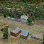
Hazyview is one of the gateway towns to the Kruger National Park and is located just to the West of Phabeni Gate, one of the main gates to use if you are travelling to Skukuza. The airfield in Hazyview is also called Numbi Airfield due to the location of the Numbi Hotel right next to the airfield.
Hazyview airfield is not included in the default scenery of FS2004. With this package, it has been faithfully produced in Gmax with photoreal textures on all the buildings and a photoreal ground as well. Even the Lowveld mall to the North of the airfield and right on the approach to Rwy 19 as well as the Building supplies store to the south and on approach to Rwy 01 is inlcuded with custom models and textures. Likewise, the buildings to the West of the runway (right at the edge of the runway) and the brickyard at the Northern end is modeled with custom models and textures. The two large cellphone antennas are also present in the airport scenery and custom made.
In real life, the runway is quite sloped and this was also recreated in the scenery under the limitations FS2004 presents with regards to non-flat airports.
The grass runway is aligned 01/19 and only 820m long. Take-off is on Rwy 01, with landings on Rwy 19.
| Filename: | Hazyview_Airfield_Hazyview_South_Africa.zip |
| License: | Freeware, limited distribution |
| Added: | 4th February 2022, 14:57:40 |
| Downloads: | 141 |
| Author: | Kobus van Wyk |
| Size: | 17.07 MB |
| Category: Flight Simulator 2004 - Scenery | |
| FS2004 EFKT_KITTILA (FINLAND) |
|
Images related to this file:
File Description:
FS2004 EFKT_KITTILA (FINLAND)
This scene was developed in order to perform Flight Crew Experience Tour 2019: TUI fly Belgium Boeing 737
This scenery was built from the official maps for the runway and taxiways with Google Maps as a background image as support. The different signs were positioned without any documentation or references. Only use with IVAO or VATSIM; no AI possible. By Serge Libon.
| Filename: | FS2004_EFKT_KITTILA_FINLAND.zip |
| License: | Freeware |
| Added: | 7th January 2019, 00:42:40 |
| Downloads: | 343 |
| Author: | Serge Libon |
| Size: | 7.76 MB |
| Category: Flight Simulator 2004 - Scenery | |
| Vandenberg Airport (KVDF) |
|
Images related to this file:
File Description:
FS2004 Scenery - Vandenberg Airport (KVDF) serves Tampa and Hillsborough County and is owned by Hillsborough Co Avia Auth. The paved runway extends for 3260 feet. The facility is at an elevation of 20 feet at a distance of about 6 miles from Tampa. Requires Nova, NovaGold and NovaSim Textures. Created with FSDS2, Rwy12 and Lago's FSE. AFCAD2 and Traffic Tools a must. By John B. Loney, Jr.
| Filename: | Vandenberg_Airport_KVDF.zip |
| License: | Freeware, limited distribution |
| Added: | 17th May 2010, 22:23:20 |
| Downloads: | 1,357 |
| Author: | John B. Loney, Jr. |
| Size: | 1.15 MB |
| Category: Flight Simulator 2004 - Scenery | |
| Indianapolis Executive KTYQ |
|
Images related to this file:
File Description:
FS2004 Scenery - Indianapolis Executive Airport (Formally known as Indianapolis Terry Airport) KTYQ, serves Indianapolis and Boone County and is owned by R. Vansickle. The paved runway extends for 5500 feet. The facility is at an elevation of 922 feet at a distance of about 14 miles from Indianapolis. Created with FSDS2, Rwy12 and Lago's FSE. AFCAD2 and Traffic Tools required. By John B. Loney, Jr.
| Filename: | Indianapolis_Executive_KTYQ.zip |
| License: | Freeware, limited distribution |
| Added: | 17th May 2010, 22:30:47 |
| Downloads: | 786 |
| Author: | John B. Loney, Jr. |
| Size: | 984.06 KB |
| Category: Flight Simulator 2004 - Scenery | |
| NC Lakes |
|
File Description:
Re-upload. NC Lakes This is the first of a series for North Carolina
which will put some boats and marinas on the
empty NC lakes. This download includes
lakes around Greensboro and High Point.
Simply unzip inclosed zip into your
addon scenery folder and then activate the
"North Carolina" folder. I would sugget
putting all NC sceneries into this folder.
jimmy R martin
| Filename: | NC_Lakes.zip |
| License: | Freeware |
| Added: | 26th May 2010, 04:09:38 |
| Downloads: | 1,440 |
| Author: | jimmy R martin |
| Size: | 1001.98 KB |


© 2001-2026 AVSIM Online
All Rights Reserved
Privacy Policy |