
Where Flight Simulation Enthusiasts Gather from Around the World!
AVSIM Library - Search Results

| Category: Flight Simulator 2004 - Scenery | |
| KCVS - Cannon AFB, New Mexico |

|
Images related to this file:
File Description:

The 27th Special Operations Group located at Cannon Air Force Base New Mexico is one of four groups assigned to the 27th Special Operations Wing. The group accomplishes global special operations taskingsas an Air Force component member of the United States Special Operations Command. It conducts infiltration/exfiltration, combat support, tilt-rotor operations, helicopter aerial refueling, close air support, unmanned aerial vehicle operations, non-standard aviation, and other special missions. It directs the deployment, employment, training, and planning for squadrons that operate the AC-130H, AC-130W, PC-12, Do-328, M-28, CV-22, MC-130J, MQ-1, MQ-9 and provides operational support to flying operations. Although this scenery is intended for use with the Cannon AI package available at MilitaryAIWorks.com, it is a fully functional scenery and will work fine without it.
| Filename: | KCVS__Cannon_AFB_New_Mexico.zip |
| License: | Freeware, limited distribution |
| Added: | 6th April 2014, 11:02:29 |
| Downloads: | 1,101 |
| Author: | John Stinstrom |
| Size: | 5.55 MB |
| Category: Flight Simulator 2004 - Scenery | |
| SSJA Joaçaba, Brazil |
|
Images related to this file:
File Description:
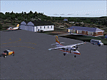
Googly scenery for SSJA Joaçaba - a small domestic airport
in the state of Santa Caterina, Brazil, that is poorly provided for in Flight
Simulator 2004. These scenery files add taxiways, aprons, buildings and other
airport features, so that you and your "AI" traffic can land, taxi, park and
take off in a realistic manner.
The small but prosperous city of Joaçaba was originally established in 1917 as
Cruzeiro and later known as Limeira and Cruzeiro do Sol, but in 1943 adopted
the current name following the introduction of legislation prohibiting cities
in Brazil using the same name - not a bad idea really. Joaçaba has a high
quality medical centre serving the state of Santa Caterina and a renowned
university which both bring traffic to the airport which is served by mainly
by LET410 aircraft of local airline NHT Linhas Aéreas.
The scenery does not purport to be ultra-accurate. Based on high-detail satellite
imagery from Google Earth, the layout is proportionally correct but the added
airport features, such as buildings, are built from default Microsoft objects
and add-on libraries so will not look exactly like the real thing.
[File re-uploaded at request of AVSIM]
| Filename: | SSJA_Joaccedilaba_Brazil.zip |
| License: | Freeware |
| Added: | 14th May 2010, 04:47:22 |
| Downloads: | 1,263 |
| Author: | John Hinson |
| Size: | 65.83 KB |
| Category: Flight Simulator 2004 - Scenery | |
| Polish Airports VOL. 2 DEMO |
|
Images related to this file:
File Description:

POLISH AIRPORTS VOL. 2 DEMO is a package of detailed sceneries of EPSC Szczecin, EPLL Lodz and EPZG Zielona Gora airports in Poland, fully compatible with FS2004.
This product is a fully functional DEMO version of the commercial payware product. It features same airports layout as in the full version but with limited 3D objects and low resolution textures. Using this free demo ensures no problems with online (VATSIM, IVAO, multiplayer etc.) flying in case some users use the payware scenery and some don't.
Szczecin-Goleniow "Solidarnosc" (SZZ/EPSC) is the main domestic and international airport serving the city of Szczecin in Poland. Lodz Wladyslaw Reymont (LCJ/EPLL), formerly known as Lodz-Lublinek Airport, is a regional airport in central Poland. Zielona Gora-Babimost (IEG/EPZG) is a regional post-military airport located within the greater Zielona Gora agglomeration and is the 11th busiest airport in Poland.
The product is equipped with an automatic installer, which means that the scenery will be automatically added to the Flight Simulator Scenery Library. Please uninstall all previous versions of this airport you may have installed before. Please make also sure that no duplicate AFCAD files are installed.
Enjoy your virtual flying with Drzewiecki Design!
| Filename: | Polish_Airports_VOL_2_DEMO.zip |
| License: | Commercial demo |
| Added: | 2nd September 2015, 22:19:48 |
| Downloads: | 583 |
| Author: | Drzewiecki Design |
| Size: | 9.11 MB |
| Category: Flight Simulator 2004 - Scenery | |
| Iloilo Airport ,Iloilo City, Philippines |
|
File Description:
Iloilo Airport is located in Iloilo City, Panay Island, Philippines. This local visayan airport is served by the following major domestic airlines: Philippine Airlines, Cebu Pacific and Air Philippines. This scenery features the most realistic replica of buildings located in the airport area such as the Main Terminal buildings, Control Tower, Crash and Fire Rescue Station, Philippine Air Force building, private hangars, shops, and commercial buildings including the SM City-Iloilo right in front of the airport area. SM City's parking area is generally filled with vehicles everyday that they are very visible at the ramp area of the airport at daytime and most especially visible glittering at nighttime.
This scenery also features the different commercial vessels serving Iloilo City such as WG&A Superferry, Sulpicio Lines, Negros Navigation, and Philippine Fastferry Corporation's Supercat and SeaAngels. These vessels are visible when flying from Iloilo to Bacolod City passing through the Guimaras Channel.
This scenery is designed with the combined efforts of Ver Walter Gulfan of Cebu City, Philippines and Manny Aquino of Surabaya, Indonesia. For suggestions or comments, please visit our Philippine Flightsimmers Group website at www.philskies.net or you may join our forum at www.philskies.net/forum.
RPVI AFCAD file included with aircrafts taking off at the middle of the runway!
| Filename: | Iloilo_Airport_Iloilo_City_Philippines.zip |
| License: | Freeware |
| Added: | 29th August 2003, 21:38:49 |
| Downloads: | 5,813 |
| Author: | Ver Walter Gulfan/Manny Aquino,Jr. |
| Size: | 5.83 MB |
| Category: Flight Simulator 2004 - Scenery | |
| Montana Unleashed! - Part One |
|
Images related to this file:
File Description:
Montana Unleashed! Part 1 is the first in a two part series of a collection of airports in Montana. The majority of airports covered in Part 1 are located in the western half of the state. THIS IS A RE-UPLOAD OF A PREVIOUS UPLOADED SCENERY THAT WAS LOST DURING THE AVSIM HACK! NOTHING HAS CHANGED!
Montana Unleashed! is a collection of 14 highly detailed airports, created using Abacus' EZ-Scenery, scattered about the state of Montana and one in Washington. Do a ZipDive and check out some of the screenshots! The state of Montana, from what I've seen, seems to have been very neglected by scenery makers over the years which is surprising considering the beautiful and varied landscapes the state has to offer. There's some very cool approaches at many of these airports. The size of the airports vary from large all the way down to small county airports meaning you can fly just about any kind and size of aircraft with these sceneries. Fly your Delta 737 from Salt Lake to Bozeman. Fly your shiny new Skywest EMB-120 from Missoula to Billings. Or fly your Piper Cub from Havre City to Choteau and on to Dillon. It's all here!
| Filename: | Montana_Unleashed__Part_One.zip |
| License: | Freeware, limited distribution |
| Added: | 18th April 2010, 09:48:54 |
| Downloads: | 7,074 |
| Author: | Lauren Robison |
| Size: | 3.81 MB |
| Category: Flight Simulator 2004 - Scenery | |
| EGVL - RAF Little Rissington - Gloucestershire, England |
|
Images related to this file:
File Description:

Representative scenery of RAF Little Rissington in Gloucestershire.
RAF Little Rissington (ICAO: EGVL) is an RAF aerodrome and former RAF station in Gloucestershire, England. It was once home to the Central Flying School, the Vintage Pair and the Red Arrows.
Built during the 1930s, the station was opened in 1938 and closed in 1994. The married-quarters and main technical site were sold in 1996 (the former becoming the village of Upper Rissington), but the aerodrome has been retained by the Ministry of Defence and remains active along with the southern technical sites, under the operational control of No.2 Flying Training School at RAFC Cranwell.
It is now home to 637 Volunteer Gliding Squadron as the primary military unit, who provide elementary flying training for Combined Cadet Force and Air Training Corps cadets. The airfield is also used by the forces as a relief landing ground, training area and parachute dropping area. In previous years, the Royal Air Force estate has been used as a film set, including The Avengers, part of the ice chase in Die Another Day, and the Thunderbirds film.
This scenery has been made using various scenery libraries, mainly from MAIW. Full listing in the docs.
| Filename: | EGVL__RAF_Little_Rissington__Gloucestershire_Engla.zip |
| License: | Freeware, limited distribution |
| Added: | 28th July 2014, 09:17:31 |
| Downloads: | 1,062 |
| Author: | Brian Clarke, Daryl Payne, Stewart Pearson |
| Size: | 448.92 KB |
| Category: Flight Simulator 2004 - Scenery | |
| RAF Middleton St. George |
|
Images related to this file:
File Description:
Representative scenery of RAF Middleton St. George in County Durham.
The airfield began its life as Royal Air Force Station Goosepool, and in 1941 became RAF Middleton St. George. The aerodrome opened as a Bomber Command station in 1941. In 1943 it was allocated to No. 6 Group, Royal Canadian Air Force. A sub-station was located at RAF Croft, Yorkshire. Squadrons based here include: 76 Squadron, which flew Halifaxes, 78 Squadron, which flew Whitleys, 419 Squadron RCAF, which flew Wellingtons, Halifaxes, and Lancasters, 420 Squadron RCAF, which flew Wellingtons, and 428 Squadron RCAF, which flew Wellingtons, Halifaxes, and Lancasters.
After the war, the aerodrome served various squadrons and units including No. 13 Operational Training Unit (OTU), No. 2 Air Navigation School, No. 4 Flight Training School, 226 OCU and squadrons that used Meteors, Hunters, Javelins and Lightnings.
The RAF left the station in 1964, but the aerodrome was reopened in 1966 as a civil airport. The airfield was named Teesside International Airport in the 1960s, and was renamed Durham Tees Valley Airport in 2004.
This scenery has been made using various scenery libraries, mainly from MAIW. Full listing in the docs.
| Filename: | RAF_Middleton_St_George.zip |
| License: | Freeware, limited distribution |
| Added: | 22nd June 2014, 18:31:59 |
| Downloads: | 1,183 |
| Author: | Brian Clarke; Daryl Payne |
| Size: | 3.84 MB |
| Category: Flight Simulator 2004 - Scenery | |
| FS2004 Charleston Air Force Base 1957-1962 |
|
File Description:
Charleston AFB/Municipal Airport Scenery, 1957-1962. With Custom Hangars by Dan French, David Wooster's F-86L ai and repaints of the C-121C by Ken Lawson and Frank Gonzalez. Separate Military Traffic files for 1957, 1959 and 1962. Intended primarily for use in the California Classics world created by Tom Gibson and the CalClassics Community. By Al Von Pingel & Ken Lawson.
| Filename: | FS2004_Charleston_Air_Force_Base_19571962.zip |
| License: | Freeware |
| Added: | 25th April 2021, 15:14:20 |
| Downloads: | 150 |
| Author: | Al Von Pingel and Ken Lawson |
| Size: | 17.82 MB |
| Category: Flight Simulator 2004 - Scenery | |
| Nordhorn & Siegenburg Air to Ground Ranges |
|
Images related to this file:
File Description:
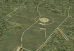
Scenery for the German air to ground ranges ED-R37 Nordhorn (ETUN) and ED-R138 Siegenburg (ETAV). Both are used by NATO air forces to practice ground attacks. Nordhorn located close to Hopsten AB in Nordrhein-Westfalen. Siegenburg is located near Ingolstadt/Manching AB in Bayern. Version 2.1 contains updates for both ranges and more accurate target information. By Marcel Ritzema
| Filename: | Nordhorn__Siegenburg_Air_to_Ground_Ranges.zip |
| License: | Freeware, limited distribution |
| Added: | 13th May 2010, 21:06:28 |
| Downloads: | 1,195 |
| Author: | Marcel Ritzema |
| Size: | 2.08 MB |
| Category: Flight Simulator 2004 - Scenery | |
| Atouguia da Baleia (Peniche) ULM Airfield v1 |
|
Images related to this file:
File Description:
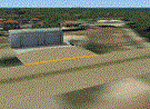
Atouguia da Baleia airfield, near Peniche.
This scenery is ONLY compatible with freeware Portugal Terrain from PTSIM (http://www.ptsim.com) and is based on digital pictures taken at the place, accurate real measures by Aerodromos de Portugal (http://www.pelicano.com.pt/zmapa.html). Although certified for ULM, this airfield have no ICAO so I gave it the fake LPAB. Freeware. For Microsoft FS2004. NOT tested for FSX.
| Filename: | Atouguia_da_Baleia_Peniche_ULM_Airfield_v1.zip |
| License: | Freeware |
| Added: | 20th September 2011, 23:29:36 |
| Downloads: | 331 |
| Author: | Joao A. Graca Ferreira |
| Size: | 1.33 MB |


© 2001-2026 AVSIM Online
All Rights Reserved
Privacy Policy |