
Where Flight Simulation Enthusiasts Gather from Around the World!
AVSIM Library - Search Results

| Category: Flight Simulator 2004 - Scenery | |
| Central Volcanic Belt, Mexico 76m SRTM Terrain Mesh & Landclass |

|
File Description:
USGS SRTM 3 arc-second, resampled to LOD9 (76 meters). This is a terrain mesh & landclass scenery of the Central Volcanic Belt in Mexico. The following volcanoes can be found in this area: Popocatepetl, Iztaccihuatl, La Malinche, Pico de Orizaba and Cofre de Perote. Also included are some volcanic eruption effects.
| Filename: | Central_Volcanic_Belt_Mexico_76m_SRTM_Terrain_Mesh.zip |
| License: | Freeware, limited distribution |
| Added: | 11th April 2004, 06:32:55 |
| Downloads: | 7,631 |
| Author: | Andreas Trawny |
| Size: | 2.9 MB |
| Category: Flight Simulator 2004 - Scenery | |
| Les Eplatures (LSGC) for Suisse 2004 |
|
File Description:
Second bigger airport of West Switzerland, Les Eplatures is also the highest one at 3360 feet. This scenery needed 60 hours and over 100 pictures. It includes all usual features of Suisse 2004 : animation, seasonal changes, photoreal textures, VAC chart. A AFCAD file for FS9 and for FS2002 is also included.
| Filename: | Les_Eplatures_LSGC_for_Suisse_2004.zip |
| License: | Freeware |
| Added: | 7th January 2004, 17:21:58 |
| Downloads: | 7,792 |
| Author: | Daniel Gauthier |
| Size: | 3.64 MB |
| Category: Flight Simulator 2004 - Scenery | |
| Mitilini 2004 |
|
File Description:
Mitilini 2004 scenery for Flight Simulator 2004 (not tested in 2002). This time, I did something different: I've designed many objects by myself.
Mitilini is the capital of the island Lesbos in Greece, very close to the Turkish border.
Read readme carefully before touching any other files in here.
Have fun! :)
| Filename: | Mitilini_2004.zip |
| License: | Freeware |
| Added: | 20th June 2004, 20:11:48 |
| Downloads: | 4,209 |
| Author: | Nils Lips (BWAirlines) |
| Size: | 5.17 MB |
| Category: Flight Simulator 2004 - Scenery | |
| Norway Airports 2004 |
|
File Description:
Norway Airports 2004 ver.1 includes 53 Norwegian airports. In addition it includes AFCAD-files for all of the included airports. This scenery is the newest version of the Norway Airports scenries and supersedes all other verions. Merry Christmas and a Happy New Year to all flight simmers around the world.
| Filename: | Norway_Airports_2004.zip |
| License: | Freeware, limited distribution |
| Added: | 5th December 2003, 01:29:39 |
| Downloads: | 14,121 |
| Author: | Arne Sundsbo/Kjell Aril Bersaas/Jan Roar Rod |
| Size: | 30.75 MB |
| Category: Flight Simulator 2004 - Scenery | |
| Russia & Middle Asia Airports |
|
File Description:
These files supplement those included in file
rap2004u.zip to enable the FS2002 scenery
collection of Russia & Middle Asia Republic
Airports Part 1 by Vladimir Svoboda -
rusnew.zip - to work with FS2004. The
additional files here allow the implementation
of Cholpon-Ata airport and also include an
additional sound file for Mary airport.
| Filename: | Russia__Middle_Asia_Airports.zip |
| License: | Freeware |
| Added: | 16th May 2004, 23:35:02 |
| Downloads: | 1,526 |
| Author: | John Hinson & Vladimir Svoboda |
| Size: | 43.84 KB |
| Category: Flight Simulator 2004 - Scenery | |
| Granada (Spain), Version 2 Fix-Patch |
|
File Description:
Patch for the 3D scenery part, with improvements in framerate and design of textures and objects. It includes some new objects and eliminates unnecessary others (for example
a simple design of Armilla´s heliport base: LEGA) It also includes an updated and retouched surface of Granada city. By Valentin Casares.
| Filename: | Granada_Spain_Version_2_FixPatch.zip |
| License: | Freeware |
| Added: | 23rd June 2006, 00:24:36 |
| Downloads: | 3,742 |
| Author: | Valentin Casares |
| Size: | 3.88 MB |
| Category: Flight Simulator 2004 - Scenery | |
| OSM World: South America |
|
Images related to this file:
File Description:
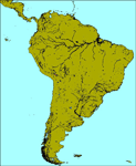
OSM World is a community project! If you wish to help, check the documentation and contact the author!
Welcome to OSM Wold: South America! This is a vector data scenery package covering the South American area. Coastlines, Rivers, lakes, roads, railways, and power lines with detail never before seen! All in an autogen-compatible density! You can see roundabouts, train terminals, harbor areas in a resolution of a point every 10 meters. At this same resolution a vectorial city class places residential (in small and big building variations, depending on surface area) and industrial areas exactly where they are supposed to be. This gives the city areas a resolution far superior to the capacity of FS-2004 default landclass bitmaps, limited to approximately 1 Km x 1 Km squares. OSM World: South America will even give you small roads leading to small towns (even a few houses across)! From big highway intersections, including ramps, to the tiniest rural pathways covering the entire South american area! Wherever in South America you fly, there is something to see!
You can enjoy this scenery near coastlines too! harbor areas and extremely detailed coastal topology (try the southern Chile). This scenery makes sure that the ocean is always flat, you can forget about the climbing water often found around photo-sceneries! This scenery is best paired with a good set of terrain meshes (like the freeware global SRTM mesh by Stephen Rothlisberger , available here: http://simviation.com/1/fs2004terrainmesh).
| Filename: | OSM_World_South_America.zip |
| License: | Freeware |
| Added: | 5th August 2015, 02:31:08 |
| Downloads: | 3,105 |
| Author: | Mario Noriega, Luis Miguel Hernandez |
| Size: | 64.37 MB |
| Category: Flight Simulator 2004 - Scenery | |
| Buckland PABL in Alaska |
|
Images related to this file:
File Description:
Buckland is a village on a small river, around 45 miles east of Deering and 15 miles inland from the river mouth. Like Deering, the population of 420 live from fishing and the land. The airfield is close by and has a gravel runway aligned 10-24 and 3,300 feet long with VASI at both ends. Apart from the airfield itself, and it's buildings, this scenery modifies the local (mostly treeless) land class, adds village buildings while reducing the village size to reality, and creates a new airfield background. Bering Air flies into Buckland from Kotzebue and is included in the AI. A note here about my scenery making. This is post number 505 and there will not be many more to follow this as I am almost at the end of the photos I either took or found for scenery purposes. There is a limit to what can be located online and I have already been making use of the little there is; eg Unalakleet. So, if you are near an airport (preferably Canadian or Alaskan) and have a camera..... Let me know.
| Filename: | Buckland_PABL_in_Alaska.zip |
| License: | Freeware, limited distribution |
| Added: | 10th August 2019, 18:51:45 |
| Downloads: | 145 |
| Author: | Roger Wensley |
| Size: | 4.11 MB |
| Category: Flight Simulator 2004 - Scenery | |
| Colville Lake CEB3 in Northwest Territories Canada |
|
Images related to this file:
File Description:
Colville Lake is a small village of around 150 Dene, located to the northwest of the Great Bear Lake and east of the Mackenzie River, 120 miles north of Norman Wells. The village and the airfield are next to each other and to the lake shore. I recently discovered which of the standard terminal buildings had been used there and this, along with information I already had, enabled me to now make the scenery, which is based on an approximate 2010 date. The gravel runway is lit and around 2,800 feet long, aligned 10-28. North Wright Air serves the village from it's headquarters at Norman Wells with daily flights by de Havilland Twin Otters, or "twotters" as they were quickly named among the northern Canadian airline personnel when they were first produced. The approximate time of this scenery is 2010. While testing this scenery I discovered that Tulita (previously called Fort Norman) which is another Mackenzie River airfield to the south of Norman Wells, needs to be reposted due to a terrain fault. If you find an error here then email me please, and note that my email address has been changed to rogwens at Gmail dot com.
| Filename: | Colville_Lake_CEB3_in_Northwest_Territories_Canada.zip |
| License: | Freeware, limited distribution |
| Added: | 31st July 2021, 18:23:48 |
| Downloads: | 69 |
| Author: | Roger Wensley |
| Size: | 4.51 MB |
| Category: Flight Simulator 2004 - Scenery | |
| Hana Heli-Playground v1.0 |
|
Images related to this file:
File Description:
Hana Airport is a regional airport of the State of Hawaii on the east shore of the island of Maui, 3 NM northwest of the unincorporated town of Hana. The airport covers 119 acres and has one runway. It is primarily a commuter facility used by unscheduled air taxis and general aviation. This scenery is intended as a single/multiplayer helicopter obstacle course where heli pilots can meet to compete, show off, and share their helo skills. Since birdseye (Timm Turner) already did a neat scenery called Hana_Scenery_PHHN (search for "hana" in the HoverControl Downloads), we decided to convert PHHN to a full helicopter training area. Makes a great place for helo pilots to gather to practice and perfect their skills, and challenge other pilots! And keep an eye-out for that Hot Air Balloon, cruising around an altitude of 3000 feet (don't forget to wave at them!).
Another unique thing about this scenery is the neighboring islands (Honolulu Intl/Hickam AFB, Bellows AFB, Lanai City, Kahului, Molokai, etc). If you get frustrated during your heli obstacle course training, just take a heading of 275°, and relax at one of the neighboring islands.
| Filename: | Hana_HeliPlayground_v10.zip |
| License: | Freeware |
| Added: | 9th May 2010, 11:29:39 |
| Downloads: | 524 |
| Author: | Bob Ferguson |
| Size: | 27.79 MB |


© 2001-2026 AVSIM Online
All Rights Reserved
Privacy Policy |