
Where Flight Simulation Enthusiasts Gather from Around the World!
AVSIM Library - Search Results

| Category: Flight Simulator 2004 - Scenery | |
| EPWA - Warsaw Chopin Airport - Warsaw, Poland ** UPDATED VERSION `` |

|
Images related to this file:
File Description:
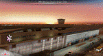
EPWA WARSAW CHOPIN AIRPORT 2015 DEMO features an extremely detailed scenery of EPWA Chopin airport in Warsaw, Poland, fully compatible with FS2004.
This product is a fully functional DEMO version of the commercial payware product. It features same airport layout as in the full version but with limited 3D objects and low resolution textures. Using this free demo ensures no problems with online (VATSIM, IVAO, multiplayer etc.) flying in case some users use the payware scenery and some don't.
Warsaw Chopin Airport (WAW / EPWA) is is an international airport located in Warsaw, Poland's capital, which handles just under 40% of the country's air passenger traffic. There are two crossing runways (2800m and 3690m), a number of hangars, a cargo terminal and a passenger terminal, completely rebuilt in 2008-2015.
The product is equipped with an automatic installer, which means that the scenery will be automatically added to the Flight Simulator Scenery Library. Please uninstall all previous versions of this airport you may have installed before. Please make also sure that no duplicated AFCAD files are installed.
Enjoy your virtual flying with Drzewiecki Design!
| Filename: | EPWA__Warsaw_Chopin_Airport__Warsaw_Poland___UPDAT.zip |
| License: | Freeware, limited distribution |
| Added: | 4th March 2016, 15:54:50 |
| Downloads: | 1,038 |
| Author: | Drzewiecki Design |
| Size: | 15.67 MB |
| Category: Flight Simulator 2004 - Scenery | |
| CYQR Regina (Regina International Airport and Roland Groome Field) Version 2 |
|
Images related to this file:
File Description:

Regina International Airport can trace its history back to 1919, when Regina airport became the first registered air harbour in Canada. This virtual model of CYQR represents the airport as it was in spring of 2007. CYQR airport is the gateway to southern Saskatchewan, Canada and is situationed in Regina, which is the provincial capital. The airport is served by Air Canada, Air Canada JAZZ, Westjet, West Wind, Express Air, Northwest Airlines and United Airlines. The airport is named for Roland Groome, who was the first registered pilot in Canada.
This scenery is a re-upload of version 2 of the scenery, which was lost in the AVSIM hack. Nothing has changed.
This scenery was constructed using GMAX and includes nearly every airport and commercial building on the airport property. Beyond the airport itself this scenery also includes, as an option, the major landmark buildings in the city of Regina proper and those on the runway approaches. Regina City buildings are meant to enhance the realism of virtual flying in the Regina area.
| Filename: | CYQR_Regina_Regina_International_Airport_and_Rolan.zip |
| License: | Freeware |
| Added: | 7th May 2010, 12:49:25 |
| Downloads: | 6,908 |
| Author: | Gregory Putz |
| Size: | 10.99 MB |
| Category: Flight Simulator 2004 - Scenery | |
| FHSH - St. Helena Island & Airport - St. Helena, South Atlantic |
|
Images related to this file:
File Description:
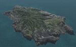
This project is a port of my FSX release of the the new airport (FHSH) on St. Helena Island. This scenery provides more accurate coastlines and roads, as well as corrected landclass based on the latest available satellite imagery. Flight plans are provided for the proposed commercial service to St. Helena, and some additional GA and military flights to the island are added as well.
The FS2004 St. Helena (FHSH) airport was created by aligning master plans for the airport with current satellite data and by studying many of the pictures that have been posted as the airport has taken shape. The official opening of the real airport on May 21, 2016, has been pushed back for more field tests due to challenging crosswinds. Updates were created or rebuilt in a manner which carefully aligns airport data with current satellite imagery. Scenery was created using Airport Design Editor 9 v1.67.5684 and SBuilder. Scenery objects were added and modified from stock FS9 scenery to resemble as closely as possible the actual airports.
| Filename: | FHSH__St_Helena_Island__Airport__St_Helena_South_A.zip |
| License: | Freeware |
| Added: | 5th May 2016, 07:44:38 |
| Downloads: | 2,235 |
| Author: | Carlyle Sharpe |
| Size: | 1.62 MB |
| Category: Flight Simulator 2004 - Scenery | |
| The Greater Toronto Area Part 1 |
|
File Description:
Part 1 of Flight Ontario's scenery for the Greater Toronto Area and Southern Ontario.
Over a year in the making, this scenery for Fs 2002 and Fs 2004 is bounded by Detroit in the west, Kingston in the east, Huntsville in the north and Buffalo in the south and features:
* all-season scenery
* custom water textures
* completely modelled Toronto Airports...CYTZ (Toronto Island) and CYZD
(Downsview-home to Bombardier Aerospace and the Canadair Regional Jet
and Dash-8, and the Toronto Aerospace Museum)
* custom autogen for the GTA
* Custom landclass for southern Ontario
* custom shorelines (western Lake Ontario, Kingston area, Lake
Couchiching...Severn River...Sparrow Lake area, and the Muskoka Lake
area)
* prominent features around Hamilton include the Burlington Skyway and
Lift Bridge and steel mills
* the Welland Canal is featured with lift bridges, bascule bridge and
fixed link bridge from Pt Weller to Pt Colborne
* the Niagara area includes the Minolta Tower, and 3 hydro generating
plants with reservoirs
* compatibility with SimFlyers CYYZ
This scenery is downloadable in two parts and both parts are essential
| Filename: | The_Greater_Toronto_Area__Part_1.zip |
| License: | Freeware |
| Added: | 9th April 2004, 12:40:02 |
| Downloads: | 37,178 |
| Author: | Flight Ontario |
| Size: | 62.09 MB |
| Category: Flight Simulator 2004 - Scenery | |
| Colombian Airports - Update |
|
File Description:
This is an update to my previous Colombian Airports upload colapts1.zip.
The update contains mainly some navaid corrections to SKFL, SKIB, and SKVP, and adds the airport SKSJ Jorge E. Gonzales of San Jose del Guaviare; this is now at the correct location and altitude and has buildings, objects, and landclass added. It is for FS9 default scenery and the Colombia freeware mesh by Raimondo Taburet. However, the scenery should also work with the default or any other mesh but I have not tested it.
However, please NOTE:
that in the default scenery without mesh the airport SKSJ will be below the rest of the surface whereas with the mesh, the airport will be at the same altitude as the rest of the scenery with the exception of the river which now runs at a higher (the default) altitude (see screenshots). For me flying without the mesh does not make any sense, so I live with that restriction. If you don't like it, you can always delete or deactivate the files starting with "SKSJ".
| Filename: | Colombian_Airports__Update.zip |
| License: | Freeware |
| Added: | 10th September 2014, 14:50:05 |
| Downloads: | 1,438 |
| Author: | Detlev J. Rohmer |
| Size: | 5.4 MB |
| Category: Flight Simulator 2004 - Scenery | |
| ETUO - RAF Gutersloh AB |
|
Images related to this file:
File Description:
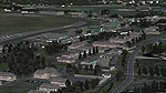
FS 2004 scenery - RAF Gutersloh AB (ICAO: ETUO)
The scenery represents the former airbase of RAF Gutersloh, one of the most populated military bases in West Germany during the Cold War, due to its location near the former East/West border. This scenery reflects the era at the end of the 1980s/beginning of the 90s, when the Harrier GR3 was in operation there, along with Chinook helicopters.
The airfield was built in 1935 and was used by the German Air Force during WW2, flying the Junkers JU-86 and Heinkel H-111. The first British squadrons were stationed there from 1947, with Mosquitos, Vampires and then Canberras.
The first Harrier arrived at Gutersloh in January 1977 and 3 and 4 Squadrons became resident until their farewell in 1993, after the cold war had ended. The airfield is currently used by the British army, but they will leave in 2014 to relinquish the area to the Government of Gutersloh for civil usage.
High detailed scenery by Manfred Schyma and Pete Beeby, supported by the Airfield Construction Group.
| Filename: | ETUO__RAF_Gutersloh_AB.zip |
| License: | Freeware |
| Added: | 10th October 2013, 20:30:01 |
| Downloads: | 1,926 |
| Author: | Manfred Schyma / Pete Beeby |
| Size: | 173.25 MB |
| Category: Flight Simulator 2004 - Scenery | |
| Bornholm Island 2011 DEMO |
|
Images related to this file:
File Description:

BORNHOLM ISLAND 2011 DEMO features an extremely detailed scenery of Bornholm Island and EKRN Ronne airport in Denmark, fully compatible with FS2004.
It's a fully functional DEMO version of the commercial payware product. It features same airport layout as in the full version but with limited 3D objects and low resolution textures. Using this free demo ensures no problems with online (VATSIM, IVAO, multiplayer etc.) flying in case some users use the payware scenery and some don't.
Bornholm is an island located in the Baltic Sea 37 km south of Sweden and the north of Poland. Bornholm Airport (RNN / EKRN) is a Danish airport located 2.7 nautical miles (5 km) southeast of Ronne.
It's equipped with an automatic installer, which means that the scenery will be automatically added to the Flight Simulator Scenery Library.
Please uninstall all previous versions of this airport you may have installed before. Please make also sure that no duplicated AFCAD files are installed.
Enjoy your virtual flying with Drzewiecki Design!
| Filename: | Bornholm_Island_2011_DEMO.zip |
| License: | Commercial demo |
| Added: | 5th September 2015, 01:09:19 |
| Downloads: | 3,607 |
| Author: | Drzewiecki Design |
| Size: | 12.75 MB |
| Category: Flight Simulator 2004 - Scenery | |
| VFR of Lario, Area E1 - Como Lake, Italy |
|
Images related to this file:
File Description:
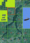
This 11th scenery of the project covers approximately an area of 7.5x6 kmt, from Stabiello mountain (NW) to Germasino (NE), from Mel (SW) to Santa Maria (SE); one dedicated building is included, as the San Bernardo little church (mountain ridge over Musso); GMax object as above and other buildings, with autogen/libraries buildings and trees are fully spreaded on the scenery.
Check video available here: http://youtu.be/5Q7KeoSljPc
| Filename: | VFR_of_Lario_Area_E1__Como_Lake_Italy.zip |
| License: | Freeware |
| Added: | 9th February 2013, 16:21:58 |
| Downloads: | 882 |
| Author: | Aldo Della Vedova, Daniele Lanfranchi, Gian Mario Verga |
| Size: | 11.53 MB |
| Category: Flight Simulator 2004 - Scenery | |
| LPFA - Ferreira do Alentejo, Portugal |
|
Images related to this file:
File Description: LPFA - Ferreira do Alentejo prived certified general and ULM aviation
airfield. This freeware scenery was created using pictures from internet as well
as real measures by Google Earth and official information at http://www.nav.pt/ais/VFRs/ferreira%20do%20alentejo.pdf
(it is supposed you download the file and read it carefully).
This scenery is to be used EXCLUSIVELY with Portugal Terrain from PTSIM
(http://www.ptsim.com). Freeware. For Microsoft FS2004. NOT tested for FSX.
| Filename: | LPFA__Ferreira_do_Alentejo_Portugal.zip |
| License: | Freeware |
| Added: | 13th June 2013, 13:38:05 |
| Downloads: | 291 |
| Author: | Joao A. Graca Ferreira |
| Size: | 5.02 MB |
| Category: Flight Simulator 2004 - Scenery | |
| W29 - Bay Bridge Airport - Stevensville, Maryland - USA |
|
Images related to this file:
File Description:
FS2004 Scenery - Bay Bridge Airport (FAA LID: W29) is a county-owned public-use airport located in Stevensville, Maryland.The airport is named for the nearby Chesapeake Bay Bridge and is mostly used for general aviation. Bay Bridge Airport covers an area of 72 acres (29 ha) and contains one asphalt runway (11/29) measuring 2,903 x 60 ft (885 x 18 m). Non-default AI repaints/traffic available by John Burford. Scenery created by John B. Loney, Jr.
| Filename: | W29__Bay_Bridge_Airport__Stevensville_Maryland__USA.zip |
| License: | Freeware, limited distribution |
| Added: | 18th November 2014, 14:58:27 |
| Downloads: | 294 |
| Author: | John B. Loney, Jr. |
| Size: | 8.02 MB |


© 2001-2026 AVSIM Online
All Rights Reserved
Privacy Policy |