
Where Flight Simulation Enthusiasts Gather from Around the World!
AVSIM Library - Search Results

| Category: Flight Simulator 2004 - Scenery | |
| Arpt Luis R. Magalhaes (SBSV) Default Airport Improvement |

|
File Description:
Default Airport Improvement scenery for Arpt Luis R. Magalhaes Airport (SBSV) Salvador, Brazil. Simple default airport improvement to make it more realistic. It also includes AFCAD modifications.
| Filename: | Arpt_Luis_R_Magalhaes_SBSV_Default_Airport_Improve.zip |
| License: | Freeware |
| Added: | 8th February 2006, 00:57:54 |
| Downloads: | 1,782 |
| Author: | Roberto Zanolli |
| Size: | 267.56 KB |
| Category: Flight Simulator 2004 - Scenery | |
| Elba - Marina di campo |
|
File Description:
Here is a scenery improvement for the airport of Elba, Marina di Campo, LIRJ, a little Italian island located between the Italian coast of Tuscany and Corsica.
| Filename: | Elba__Marina_di_campo.zip |
| License: | Freeware |
| Added: | 12th January 2010, 19:25:56 |
| Downloads: | 11,174 |
| Author: | Johan Thiers |
| Size: | 3.56 MB |
| Category: Flight Simulator 2004 - Scenery | |
| Stanton Drew Standing Stone Circle, Village Church & Toll House SOMERSET UK - FS2004 |
|
File Description:
Updated files from FS2002 Version. Fully tested in FS2004 and texture error amended.
Designed to work with VFR Photo Scenery & VFR Terrain by Get Mapping / Visual Flight
| Filename: | Stanton_Drew_Standing_Stone_Circle_Village_Church_.zip |
| License: | Freeware |
| Added: | 13th October 2005, 03:02:53 |
| Downloads: | 771 |
| Author: | Justin Wilmott |
| Size: | 232.28 KB |
| Category: Flight Simulator 2004 - Scenery | |
| North Netherlands |
|
File Description:
This is extra addon scenery for the default FS2004 in the northern part of Holland: Dokkum,Eernewoude,Oostwold,Giethoorn,Leek,Groningen and other spots for VFR flying.
| Filename: | North_Netherlands.zip |
| License: | Freeware |
| Added: | 12th August 2003, 16:32:54 |
| Downloads: | 5,622 |
| Author: | Joop Mak |
| Size: | 1.34 MB |
| Category: Flight Simulator 2004 - Scenery | |
| Yverdon-Les-Bains, Neuchatel, and Motiers, Switzerland Airports |
|
File Description:
I found one airport of Yverdon-Les-Bains does not have FS2004 in data. 2 others are not connected node links. I created scenery with more details.
| Filename: | YverdonLesBains_Neuchatel_and_Motiers_Switzerland_.zip |
| License: | Freeware |
| Added: | 19th December 2020, 20:18:50 |
| Downloads: | 160 |
| Author: | Stuart John Gilbert II |
| Size: | 4.41 MB |
| Category: Flight Simulator 2004 - Scenery | |
| South Georgia VFR (Southern Atlantic Ocean). |
|
File Description:
South Georgia (Southern Atlantic Ocean) - Enhanced Terrain Mesh SRTM and replace coastline. This scenery area is a terrain mesh SRTM 3 arc/sec (LOD 9) 76 mt.
| Filename: | South_Georgia_VFR_Southern_Atlantic_Ocean.zip |
| License: | Freeware |
| Added: | 9th March 2006, 03:57:26 |
| Downloads: | 1,174 |
| Author: | Giovanni Miduri |
| Size: | 3.01 MB |
| Category: Flight Simulator 2004 - Scenery | |
| HCMI Berbera, Somalia |
|
Images related to this file:
File Description:
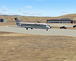
Googly scenery for HCMI Berbera, Somalia - an airport largely overlooked in
Flight Simulator 2004 with just a runway and tower provided at what is actually
the country's largest airport. At one time it had two active runways and a
strong military presence but today activity is limited to occasional
civilian flights. These scenery files add taxiways, aprons, buildings and
other airport features (and remove the non-existent tower that Microsoft
put there) so that you and your "AI" traffic can land, taxi, park and take
off in a realistic manner. This desert-surrounded airport is served three times per week by Douglas DC-9 jets of Kenyan airline African Express Airways.
The scenery does not purport to be ultra-accurate. Based on high-detail satellite
imagery from Google Earth, the layout is proportionally correct but the added
airport features, such as buildings, are built from default Microsoft objects
and add-on libraries so will not look like the real thing.
You are not obliged to download and install any additional scenery libraries,
but to enjoy this scenery in its entirety, you may wish to. It will work fine,
with or without. [File re-uploaded at request of AVSIM]
| Filename: | HCMI_Berbera_Somalia.zip |
| License: | Freeware |
| Added: | 29th May 2010, 09:26:33 |
| Downloads: | 1,317 |
| Author: | John Hinson |
| Size: | 62.07 KB |
| Category: Flight Simulator 2004 - Scenery | |
| WIKD/WIOD Tanjung Pandan/Buluh Tumbang/H.A.S. Hanandjoeddin, Indonesia |
|
File Description:
Googly scenery for WIKD/WIOD Tanjung Pandan/Buluh Tumbang/H.A.S. Hanandjoeddin,
Indonesia, based on Google Earth satellite data. It is a small domestic airport
serving the island of Belitung, located about 17 miles from the main town of the
island - Tandjungpandan. The island produces mainly tin and pepper but there are
some beaches that are generating tourist traffic too.
Flight Simulator 2004 has made no provision for any traffic at this airport and
this scenery seeks to redress the situation. The airport sees daily scheduled
traffic operated by Batavia Air and Sriwijaya Air.
The scenery does not purport to be ultra-accurate. Based on poor quality
satellite imagery from Google Earth, the layout is proportionally correct but the
added airport features, such as buildings, are built from default Microsoft objects
and add-on libraries so will not look exactly like the real thing.
You are not obliged to download and install any additional scenery libraries,
but to enjoy this scenery in its entirety, you may wish to. It will work fine,
with or without.
The ICAO code for this airport has recently changed from WIKD to WIOD. The included
files allow you to either retain the old code or optionally change the airport to
use the new one.
| Filename: | WIKDWIOD_Tanjung_PandanBuluh_TumbangHAS_Hanandjoed.zip |
| License: | Freeware |
| Added: | 22nd February 2008, 09:19:27 |
| Downloads: | 1,774 |
| Author: | John Hinson |
| Size: | 64.96 KB |
| Category: Flight Simulator 2004 - Scenery | |
| VGCB Cox's Bazar, Bangladesh |
|
File Description:
Googly scenery for VGCB Cox's Bazar, Bangladesh, a small domestic airport
serving the fishing town of the same name in the Bay of Bengal, to the
south of Chittagong. It boasts extensive sandy beaches which has allowed
tourism development. The unusual name comes from Captain Hiram Cox of the
British East India Company who was appointed Superintendent of the outpost
in the late 1700s. The airport, which was originally a Pakistan Air Force
base, sees domestic flights (mostly to/from Dhaka) operated by Hawker
Siddeley 748s, de Havilland Dash 8s and Fokker Fellowship aircraft of Biman
Bangladesh Airlines, GMG Airlines, United Airways and Zoom Airlines.
Flight Simulator 2004 has made no provision for traffic with only a runway
provided and this scenery seeks to redress the situation.
The scenery does not purport to be ultra-accurate. Based on high quality
satellite imagery from Google Earth, the layout is proportionally correct but the
added airport features, such as buildings, are built from default Microsoft objects
and add-on libraries so will not look exactly like the real thing.
You are not obliged to download and install any additional scenery libraries,
but to enjoy this scenery in its entirety, you may wish to. It will work fine,
with or without.
| Filename: | VGCB_Coxs_Bazar_Bangladesh.zip |
| License: | Freeware |
| Added: | 14th April 2008, 21:13:08 |
| Downloads: | 1,353 |
| Author: | John Hinson |
| Size: | 67.71 KB |
| Category: Flight Simulator 2004 - Scenery | |
| Cape Verde Islands Domestic Airports |
|
Images related to this file:
File Description:
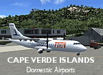
Googlyafcads and simple scenery for five airports in the Cape Verde Islands, all
of which are served by regular domestic flights of TACV - Transportes Aereos de
Cabo Verde. Each of these has been "overlooked" by Microsoft in Flight Simulator
2004 and are provided with nothing other than a runway. These scenery files add
aprons, taxiways, buildings and other airport features to Flight Simulator's bland
representation and allow you and "AI" traffic to land, taxi, park and take off
in a realistic manner.
The airports represented are: GVBA Rabil, GVMA Maio, GVSF Sao Filipe, GVSN Preguica and GVSV Sao Pedro.
The scenery does not purport to be ultra-accurate. Based on high-detail satellite
imagery from Google Earth (except Sao Filipe), the layout is proportianally correct
but the added airport features, such as buildings, are built from default Microsoft
objects and add-on libraries so will not look like the real thing. Sao Filipe is
largely imaginary owing to poor quality of the satellite image, but has been created
to be similar to other airports of like size.
You are not obliged to download and install any additional scenery libraries,
but to enjoy this scenery in its entirety, you may wish to. It will work fine,
with or without.
[File re-uploaded at request of AVSIM]
| Filename: | Cape_Verde_Islands_Domestic_Airports.zip |
| License: | Freeware |
| Added: | 15th June 2010, 01:00:46 |
| Downloads: | 7,001 |
| Author: | John Hinson |
| Size: | 84.1 KB |


© 2001-2026 AVSIM Online
All Rights Reserved
Privacy Policy |