
Where Flight Simulation Enthusiasts Gather from Around the World!
AVSIM Library - Search Results

| Category: Flight Simulator 2004 - Scenery | |
| Comoro Islands Mesh |

|
File Description:
this mesh, based on africa srtm data, covert mayotte, grande comore, anjouan and moheli islands.
enjoy.
| Filename: | Comoro_Islands_Mesh.zip |
| License: | Freeware, limited distribution |
| Added: | 1st April 2004, 16:50:25 |
| Downloads: | 2,812 |
| Author: | Jean Gabriel Laurent |
| Size: | 604.33 KB |
| Category: Flight Simulator 2004 - Scenery | |
| Seychelles Islands Mesh |
|
File Description:
this mesh, based on africa srtm data, covert mahe, silouhette, ile du nord, la digue and praslin islands.
enjoy.
| Filename: | Seychelles_Islands_Mesh.zip |
| License: | Freeware, limited distribution |
| Added: | 1st April 2004, 16:56:10 |
| Downloads: | 3,125 |
| Author: | Jean Gabriel Laurent |
| Size: | 154.14 KB |
| Category: Flight Simulator 2004 - Scenery | |
| Sicily Scenery Mesh |
|
File Description:
This terrain mesh scenery covers whole Sicily with Eolie archipelago, Pantelleria, Lampedusa, Malta and Gozo Islands. Based on SRTM Data (3 arcsec, 90m), generated with Matthew Styles's program "SRTM To BGL v1.04", sampled to LOD9 resolution (76m) with 10 interpolation passes.
| Filename: | Sicily_Scenery_Mesh.zip |
| License: | Freeware |
| Added: | 5th November 2003, 16:39:10 |
| Downloads: | 10,422 |
| Author: | Giovanni Miduri |
| Size: | 8.97 MB |
| Category: Flight Simulator 2004 - Scenery | |
| France SRTM Mesh |
|
File Description:
Based on SRTM 3 arc.sec data.
Unfortunately SRTM DATA have many holes and data loss, so I made a resampling and an oversampling with other data with lower resolution, but with better coverege (like data from swiss topographic federal istitute or from italian IGM, and finally with DTED Level 0.) with geo cad software like Grass and GlobalMapper for projection convertion.
Compression and conversion to bgl with MS Flight simulator SDK at LOD 9
This scenery cover the part of France territories not included in my Italian and Spanish sceneries;thus these sceneries are required to cover entire France country. Parts of Belgium and Netherlands are included too (Till E005)
| Filename: | France_SRTM_Mesh.zip |
| License: | Freeware |
| Added: | 23rd November 2003, 11:48:22 |
| Downloads: | 25,755 |
| Author: | Pietro Mauri |
| Size: | 46.44 MB |
| Category: Flight Simulator 2004 - Scenery | |
| Java SRTM Mesh |
|
File Description:
This terrain mesh scenery covers Java, Madura and Bali islands, Indonesia. Some Minor neighboring islands have been included too.
Based on SRTM Data (3 arcsec, 90m), generated with Matthew Styles's program "SRTM To BGL v1.04", sampled to LOD9 resolution (76m). While only tested with Fs2004, this mesh should also run with FS2002.
| Filename: | Java_SRTM_Mesh.zip |
| License: | Freeware |
| Added: | 14th November 2003, 03:58:44 |
| Downloads: | 6,714 |
| Author: | Yohann Baptiste |
| Size: | 20.88 MB |
| Category: Flight Simulator 2004 - Scenery | |
| Croatia Terrain Mesh Update |
|
File Description:
Terrain mesh correction for Croatia. Replaces some bad LOD9 data from my previously released Croatia mesh, "croatia_76m.zip". Made at LOD9 or 76.4 m resolution and covers between N46 - N46.25 and E15 - E20.
| Filename: | Croatia_Terrain_Mesh_Update.zip |
| License: | Freeware |
| Added: | 29th November 2003, 01:57:38 |
| Downloads: | 4,013 |
| Author: | Hrvoje Kruhek |
| Size: | 1.92 MB |
| Category: Flight Simulator 2004 - Scenery | |
| Middle East SRTM Mesh - Lebanon, Israel and Egypt Part2 |
|
File Description:
Middle East SRTM Mesh - Lebanon, Israel and most of Egypt LOD9 Terrain Mesh in 3 parts, created from SRTM 3arc sec spatial data - this is Part 2. Mesh covers area from N25 - N34 and E29 - E36. It gives You possibility to fly above continuous terrain of Lebanon, Israel and Egypt. Holes were cleared using SRTM/DTED0 merger by Martin Domig, MICRODEM and SRTMFill.
| Filename: | Middle_East_SRTM_Mesh__Lebanon_Israel_and_Egypt_Pa.zip |
| License: | Freeware, limited distribution |
| Added: | 23rd April 2004, 12:55:58 |
| Downloads: | 6,646 |
| Author: | Ryszard Winawer |
| Size: | 21.07 MB |
| Category: Flight Simulator 2004 - Scenery | |
| New Caledonia (Landclass and Terrain Mesh) |
|
Images related to this file:
File Description:
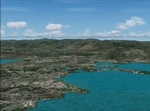
FS2004 Landclass and Terrain Mesh--New Caledonia. This is a complete Landclass and Terrain Mesh makeover for New Caledonia and its outlying islands. Andy Weir and Ian Thatcher have graciously allowed me to integrate their Terrain Mesh into this scenery. All known airports have now been added to New Caledonia and the local islands are designed for AI aircraft operation.
| Filename: | New_Caledonia_Landclass_and_Terrain_Mesh.zip |
| License: | Freeware |
| Added: | 18th April 2010, 09:59:48 |
| Downloads: | 1,110 |
| Author: | Charles Reid |
| Size: | 24.88 MB |
| Category: Flight Simulator 2004 - Scenery | |
| LOD 10 mesh terrain scenery of Slovenia, final version |
|
File Description:
Sampled to LOD10, this is a standard version of
mesh terrain covering N45E13 - N47E17.
It is perfectly compatible with Austria professional and mesh
of Italy by Pietro Mauri.All incompatibilities with flattens around
airports were corrected.
| Filename: | LOD_10_mesh_terrain_scenery_of_Slovenia_final_vers.zip |
| License: | Freeware |
| Added: | 13th November 2005, 23:09:48 |
| Downloads: | 6,281 |
| Author: | Mirko Ternik/FSSlovenia Team |
| Size: | 25.79 MB |
| Category: Flight Simulator 2004 - Scenery | |
| Greece SRTM Mesh Part 1 |
|
File Description:
This terrain mesh scenery covers Greece, including all Aegean sea islands, plus most parts of Albania and Macedonia up to 41°50'N. Some parts of Bulgaria and Turkey are also included in northern and eastern boundaries of the mesh. The greek island of Crete isn't part of this mesh because SRTM data isn't yet released for the whole island.
Based on SRTM Data (3 arcsec, 90m), generated with Matthew Styles's program "SRTM To BGL v1.04", sampled to LOD9 resolution (76m). While only tested with Fs2004, this mesh should also run with FS2002.
This part contains northern parts of the mesh: Greece-N.bgl, Greece-NE1.bgl and Greece-NE2.bgl. See Greece_Mesh_Part1-1.jpg for exact bgl coverage.
| Filename: | Greece_SRTM_Mesh_Part_1.zip |
| License: | Freeware |
| Added: | 10th November 2003, 02:08:20 |
| Downloads: | 10,988 |
| Author: | Yohann Baptiste |
| Size: | 17.75 MB |


© 2001-2026 AVSIM Online
All Rights Reserved
Privacy Policy |