
Where Flight Simulation Enthusiasts Gather from Around the World!
AVSIM Library - Search Results

| Category: Flight Simulator 2004 - Scenery | |
| UK Farm Strips Vol 3 |

|
File Description:
UK Farm Strips Scenery containing a further 20 private landing strips, all located within, and compatible with, the VFR GM Photoscenery coverage and prepared using the VFR Terrain Mesh. All strips reflect the topographical nature of the fields, so that users may experience the challenge of taking ofF from, and landing on, sloping runways. This scenery is not compatible with FS2002, or earlier versions. This third volume requires the presence of Vol 1 and Vol 2, since it uses objects provided with these initial versions, as well as a few additional objects.
Farms in this volume are spread across the counties of Beds, Cheshire, Gloucs, Hamps, Herts, Herts, Kent, etc. Statics now include a number of Microlights.
| Filename: | UK_Farm_Strips_Vol_3.zip |
| License: | Freeware |
| Added: | 11th September 2005, 22:50:07 |
| Downloads: | 1,596 |
| Author: | Gerry Winskill |
| Size: | 1.93 MB |
| Category: Flight Simulator 2004 - Scenery | |
| Alaska/BC Bush Scenery: Edgecombe Lodge, Johnny Mountain Mine, & Bob Quinn Lake |
|
File Description:
My fourth bush scenery in Alaska/British Columbia. This package includes three airstrips: the first runway at Edgecombe Lodge has an unusual inclined profile, located precariously across a ridgeline on Annette Island near Ketchikan. I've also put together a tailor-made NDB Instrument Approach plate for it. The other two, Johnny Mountain Mine and Bob Quinn Lake, are hazardous real-life airstrips along the Iskut River in BC (about 50 miles north of Ketchikan). Includes AFCAD files for FS2004 and FS2002. Although I have modified the terrain to create the runways, Eddie Denney's FS2002 mesh of Alaska is still required as a foundation for this scenery to work. Also requires Gerrish Gray's Tree Library (release 3).
| Filename: | AlaskaBC_Bush_Scenery_Edgecombe_Lodge_Johnny_Mount.zip |
| License: | Freeware, limited distribution |
| Added: | 26th January 2004, 15:42:49 |
| Downloads: | 4,434 |
| Author: | James Belk |
| Size: | 5.64 MB |
| Category: Flight Simulator 2004 - Scenery | |
| O12 - Grand Lake St. Marys Seaplane Base - Ohio, USA |
|
Images related to this file:
File Description:
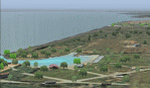
Grand Lake St. Marys Seaport O12 rests in Ohio's largest inland lake at Celina, Ohio. Float and soar plane enthusiasts will find thermals (several are placed within about a 60 mile radius) and plenty of docks or moors around the lake for your Amphib and afcads. Grand Lake St. Marys Seaport O12 scenery is made to blend with autogen scenery and default mesh. I used custom made objects & default objects. Grand_thermals.BGL is the troublesome file with winds aloft for sail planning thermals. Some people may want to remove it for smoother landing at one of the airports. Airports: Lakefield KCQA - Mulholland OI99 - Fortman 1OH4 and Grand Lake St Marys O12. I pulled this from my old archives.
| Filename: | O12__Grand_Lake_St_Marys_Seaplane_Base__Ohio_USA.zip |
| License: | Freeware |
| Added: | 11th July 2015, 11:22:45 |
| Downloads: | 242 |
| Author: | Rick Connolly |
| Size: | 13.53 MB |
| Category: Flight Simulator 2004 - Scenery | |
| Hong Kong Kai Tak 1963 |
|
File Description:
This is Kai Tak airport as it was in 1963. Kowloon Bay has yet to be filled in, and the runway is only 8405 ft long. Includes mesh files by Holger Sandmann and charts of the era scanned by Chic Eather. Navaids backdated to the early 60's, except the IGS for runway 13 is included although not actually installed until 1974. Curving approach lights will help you find the runway. Chek Lap Kok airport has been removed. The IGS and other approaches created by Jim Vile. The AI aircraft will follow the curved approach to runway 13 in good weather or bad. Please note that Jim Vile has produced a modern version of this airport (kaitak98.zip).
| Filename: | Hong_Kong_Kai_Tak_1963.zip |
| License: | Freeware, limited distribution |
| Added: | 27th April 2006, 02:02:13 |
| Downloads: | 15,228 |
| Author: | Tom Gibson and Jim Vile |
| Size: | 5.74 MB |
| Category: Flight Simulator 2004 - Scenery | |
| UK Hospitals (Vol 1) |
|
File Description:
This scenery collection contains airfield data for 54 Helipad landing sites in Wales, Lancashire, Merseyside, Cheshire and Cumbria based on the information provided by the Confederation of Helicopter Ambulance Services. Information here http://www.chasuk.co.uk/Documentation/HospitalLandingSites/tabid/69/Default.aspx.
The scenery is intended to be used in FS2004 Century of Flight with Just Flight's VFR photographic VFR scenery installed. The height data from CHASUK has been ignored in favour of that obtained from the Just Flight default mesh.
I have started to add autogen trees etc. around some of the landing sites - but this takes a lot longer and so I'm issuing vol 1 first with autogen only added to a few of the sites in the Chester/Merseyside area.
| Filename: | UK_Hospitals_Vol_1.zip |
| License: | Freeware |
| Added: | 2nd April 2009, 16:44:10 |
| Downloads: | 1,101 |
| Author: | Russ McGinn |
| Size: | 231.54 KB |
| Category: Flight Simulator 2004 - Scenery | |
| Exploring Our World - Part 3 - The Wine Country of Chile. |
|
Images related to this file:
File Description:

Exploring Our World - Part 3 - The Wine Country of Chile. Here is your opportunity to explore the Wine Country of Northern Chile with stopovers at four delightful GA airfields (SCAD-SCMI-SCOV-SCVN) enhanced by Cesar Carrasco. Along the way you will enjoy some very beautiful scenery. This package includes revised Afcads for the airports and a small Traffic file using default aircraft plus a challenge to find an observatory which I have added. Please read the documentation for further details. Designed to work with the default FS2004 scenery, no additional mesh is required. Please unzip (using folders option) to a temporary folder and follow the simple installation instructions which are in .doc and .pdf formats. Compiled for your flying enjoyment by David "Opa" Marshall.
| Filename: | Exploring_Our_World__Part_3__The_Wine_Country_of_C.zip |
| License: | Freeware |
| Added: | 3rd February 2010, 02:08:43 |
| Downloads: | 1,472 |
| Author: | David "Opa" Marshall |
| Size: | 1.19 MB |
| Category: Flight Simulator 2004 - Scenery | |
| Raiatea Airport, Uturoa, French Polynesia, NTTR |
|
File Description:
This is a total update of the airport at Raiatea in French Polynesia. It is the largest airport in the Society Islands outside of Tahiti. This scenery contains a new realistic terminal, the rustic hangar area, and the tower, along with tropical landscaping, and an afcad by Ray Smith. This island along with all of the Society Islands of French Polynesia are among the most beautiful paradises on Earth. They can all be greatly enhanced by using the terrain mesh by John Applegate, and Rolf Keibel, updated for FS2004 under the name of fpsimesh.zip. There are also some new landclass files for this area which will also greatly enhance this forgotten area in FS, and their location is available in the read me file of this scenery.
| Filename: | Raiatea_Airport_Uturoa_French_Polynesia_NTTR.zip |
| License: | Freeware |
| Added: | 21st May 2004, 15:24:33 |
| Downloads: | 10,657 |
| Author: | Bill Melichar |
| Size: | 3.15 MB |
| Category: Flight Simulator 2004 - Scenery | |
| Ko Samui, Thailand (VTSM) v4.0 |
|
File Description:
Samui is a small, but busy airport on the island of Ko Samui. It is located in Southern Thailand, and is an exotic resort destination. In 1989 Bangkok Airways opened their own airport on the island, which decreased the travel time from Bangkok considerably. The airport is currently served by Bangkok Airways, although an occasional private aircraft will land here. This scenery is a detailed and accurate representation of this airport as it looks today. I consulted with several visitors to the airport, as well as the AIP for Thailand. Landsat imagery was used to modify the shoreline, and a custom landclass is included. Taxiway and parking areas were modified by using AFCAD2. This scenery is compatible with 3rd-party mesh scenery for Thailand.
| Filename: | Ko_Samui_Thailand_VTSM_v40.zip |
| License: | Freeware, limited distribution |
| Added: | 25th April 2004, 21:10:31 |
| Downloads: | 11,747 |
| Author: | Martin Strong |
| Size: | 5.34 MB |
| Category: Flight Simulator 2004 - Scenery | |
| Bardenas Reales Firing Range Version 1.0 |
|
File Description:
Photorealistic scenery of the Firing Range of Bardenas Reales, in Navarra, Spain, close to LEZG ( N42º10.6',W1º28.0'). Created on 1951, this range was the practice area for air to surface weapons for the spanish air force pilots of EF18M, F1M, F5M and AV8 harriers. Usually is used for other allied forces like USAF F16. Actually the use of the firing range is decreasing @ 20% of the full capacity of 100 operations by day. Only textures 4.75 m/pixel, we recomend mesh EVA4,(http://www.airhispania.com/eva/eva.htm) or similar containing detailed topo of spain. Created By Jose Ramon Rodriguez ( this a present to all my friends of Virtual ZAragoza Airbase - www.basezaragozavirtual.tk -, specially to Diego Novillo by his support and illusion in this, and other projects, thx.
| Filename: | Bardenas_Reales_Firing_Range_Version_10.zip |
| License: | Freeware |
| Added: | 18th July 2006, 19:31:31 |
| Downloads: | 3,877 |
| Author: | Jose Ramon Rodriguez |
| Size: | 13.71 MB |
| Category: Flight Simulator 2004 - Scenery | |
| San Francisco Int. (SFO) High Res Ground Scenery |
|
File Description:
This scenery contains high resolution ground scenery for the airport of San Francisco Intl. (SFO). It makes me kind of nostalgic, because that's the area where I first successfully tried my hi-res mesh technique for FS2004. The scenery has a resolution of 1.2m/pix (4.7m/pix is FS2004-standard). Coverage is the area around SFO containing the San Bruno Mountain Park and the San Adreas Res. So it's quiet a sight! And don't forget to bring some flowers :-) The scenery gives best results when combined with with my "San Francisco" standard resolution ground scenery, which covers a much larger area at 4.7m/pix and matches perfectly in color and everything...
Won't work in FSX. For FSX please wait for the upcoming FSX-version of this scenery.
| Filename: | San__Francisco_Int_SFO_High_Res_Ground_Scenery.zip |
| License: | Freeware, limited distribution |
| Added: | 27th November 2006, 10:58:19 |
| Downloads: | 16,822 |
| Author: | Gottfried Razek |
| Size: | 41.8 MB |


© 2001-2026 AVSIM Online
All Rights Reserved
Privacy Policy |